
Mexico - Sierra Negra 4,650m and Izaccihuatl 5,350m
June 14, 2021
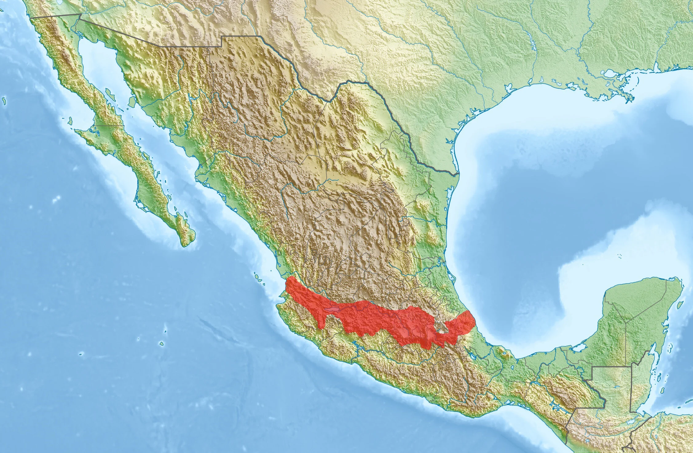
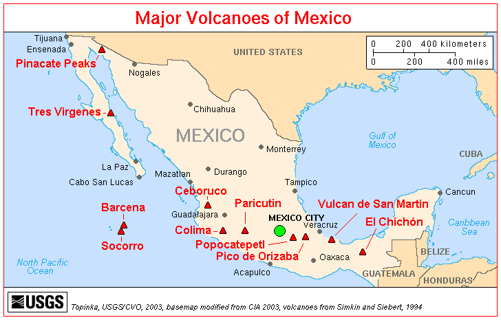
The Trans-Mexican Volcanic Belt or Sierra Nevada stretches 1000km across Mexico with the highest peak being Pico de Orizaba. In order to acclimatize and prepare for the altitude of Pico de Orizaba, I climbed two lower (although not easer) mountains: Sierra Negra and the companion of Popocatopetl, Iztaccihuatl. In addition to hiking and climbing, the region offers superb cultural and culinary attractions. The city of Puebla, a de facto base camp, is a UNESCO World Heritage site because of its historical center.
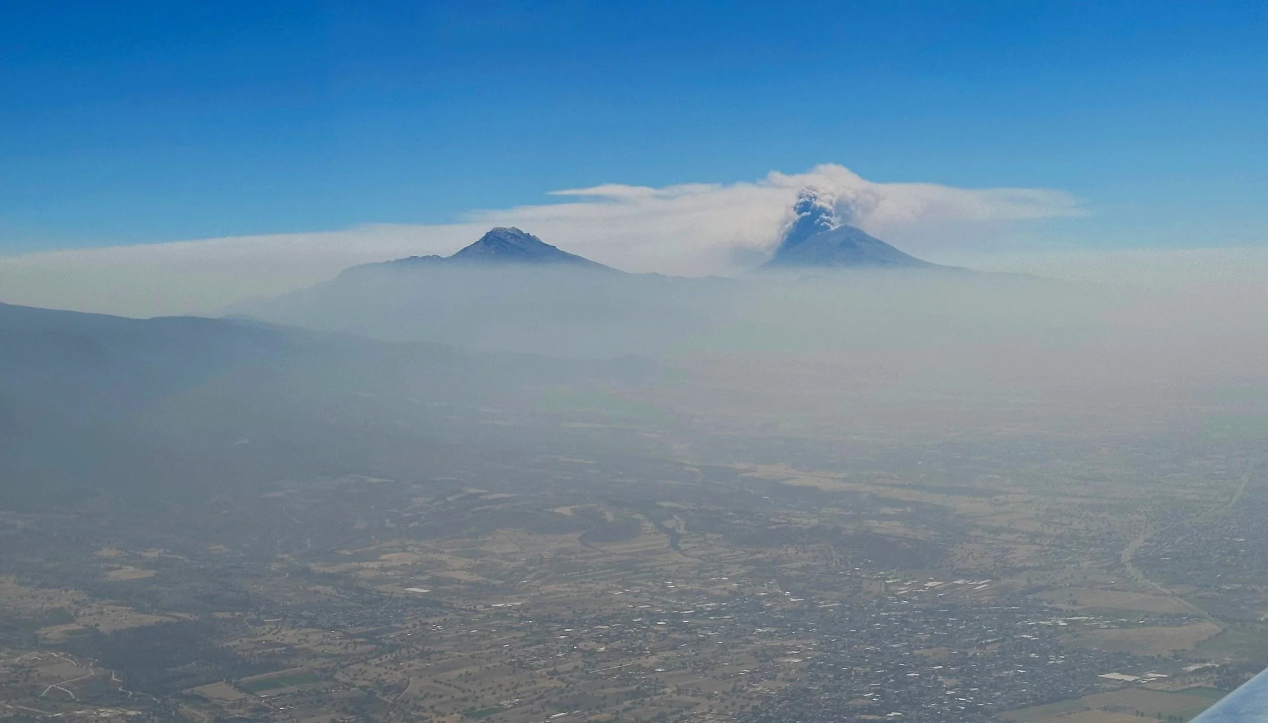
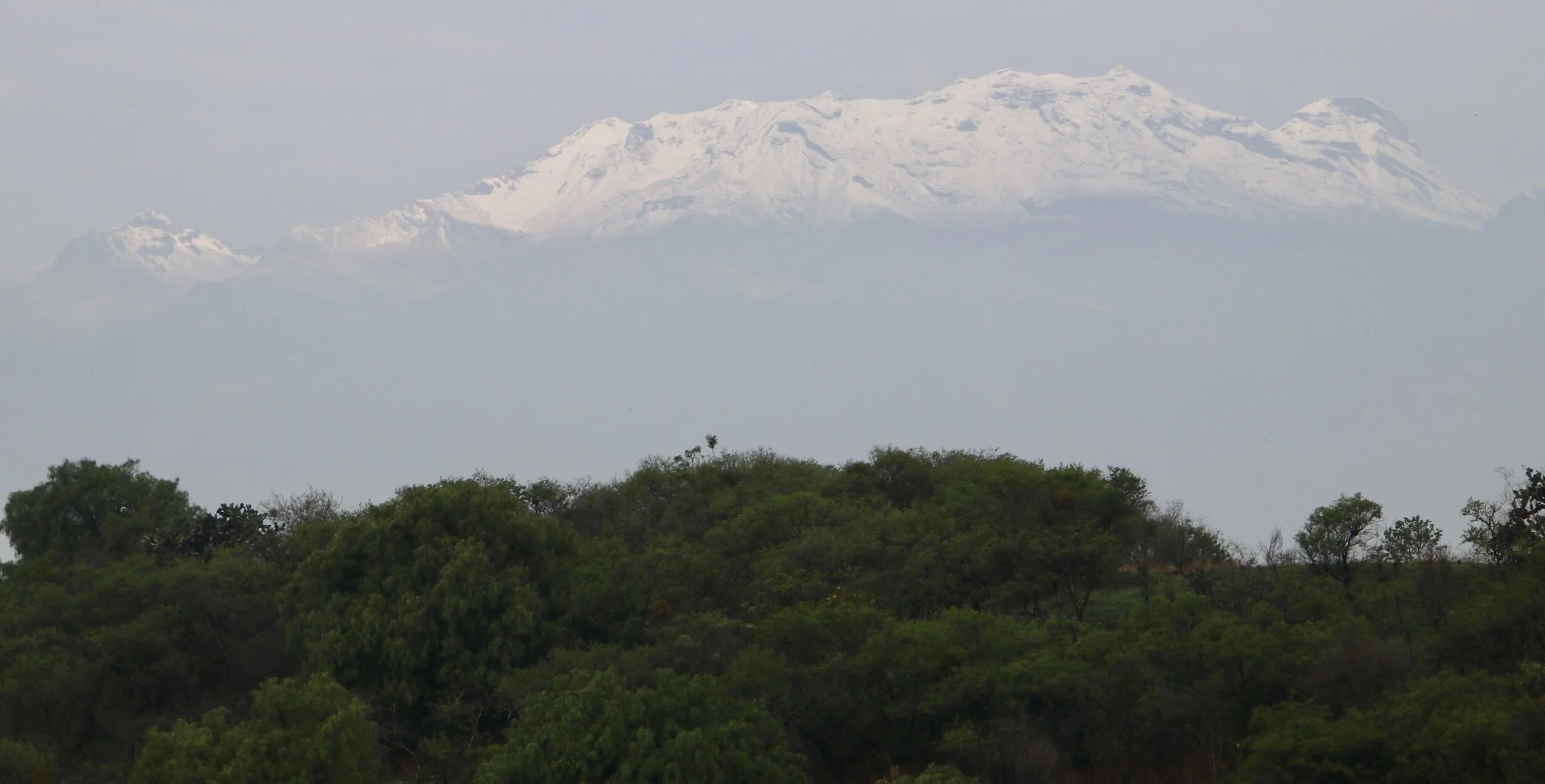
Izta and Popo from the airplane tower over smoggy Mexico City Valley
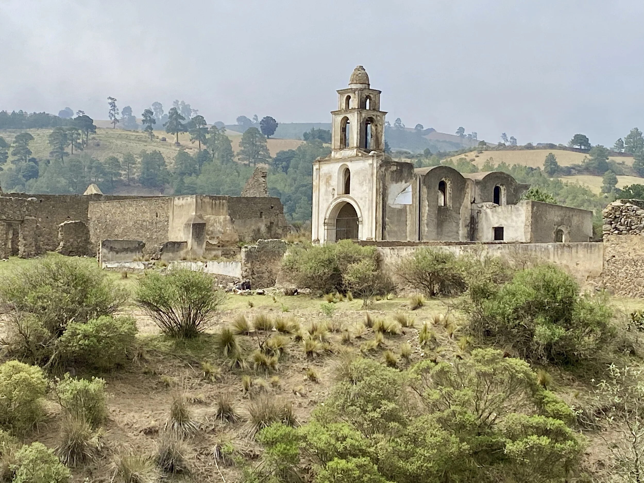
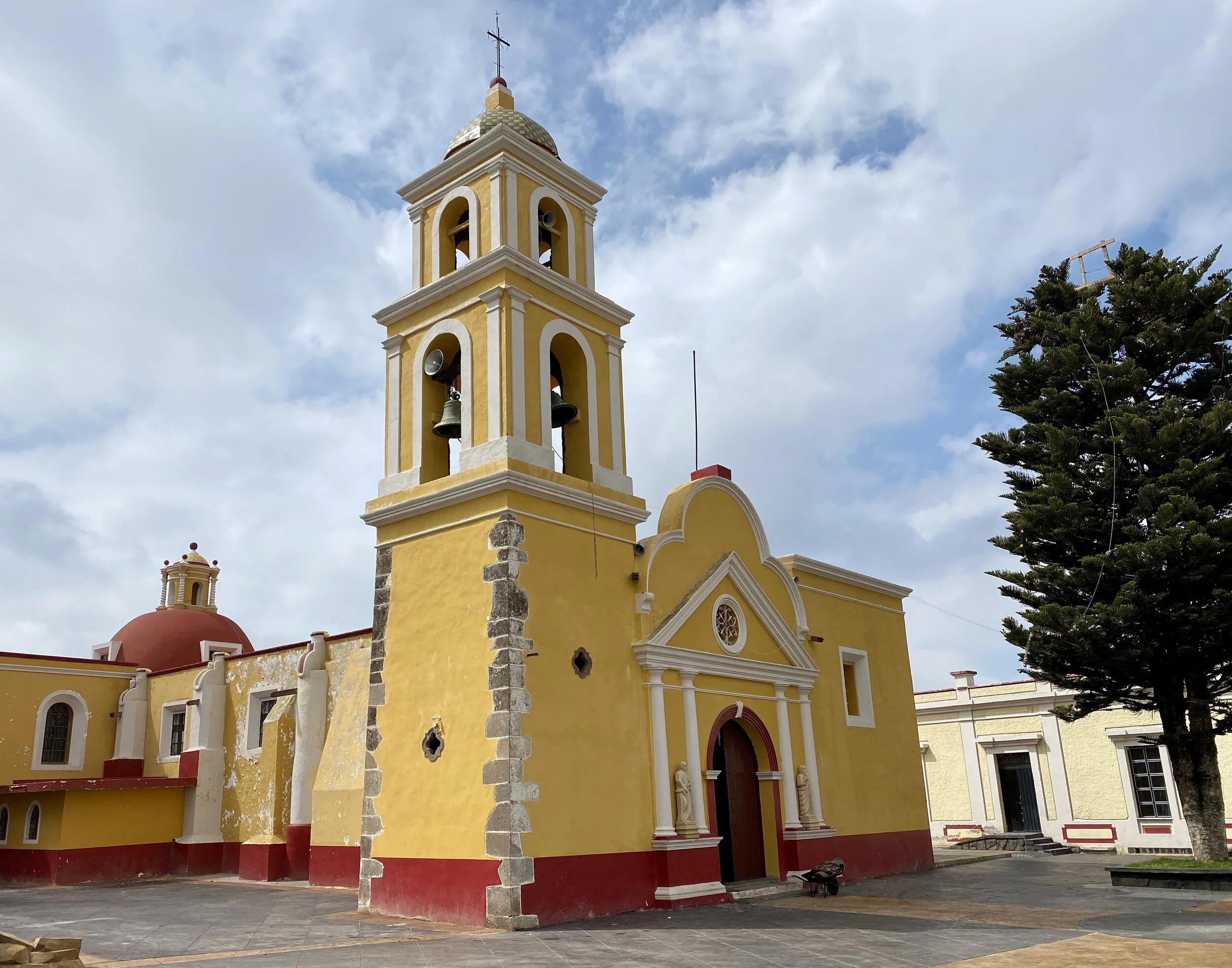
An atmospheric old church on the way to Sierra Negra
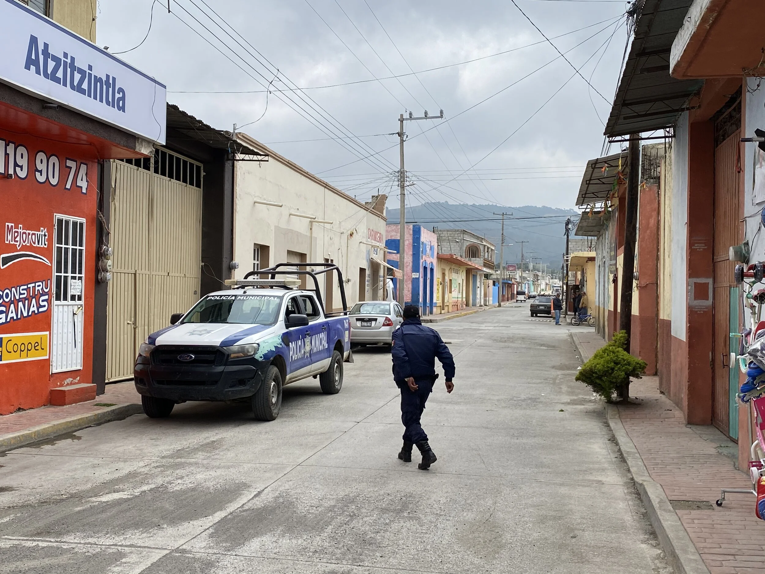
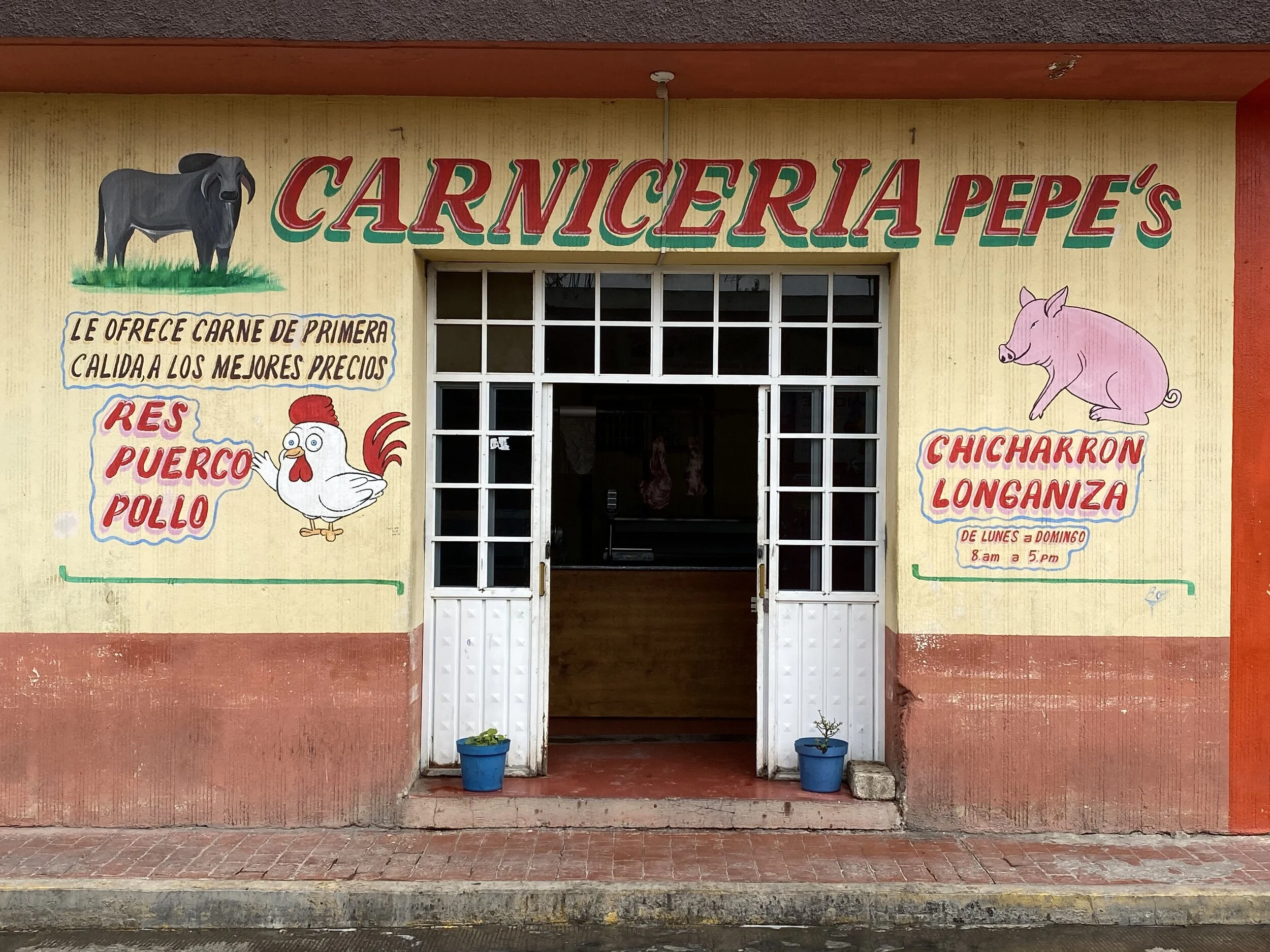
The small town of Atzitzintla at the base of the Sierra Negra Volcano
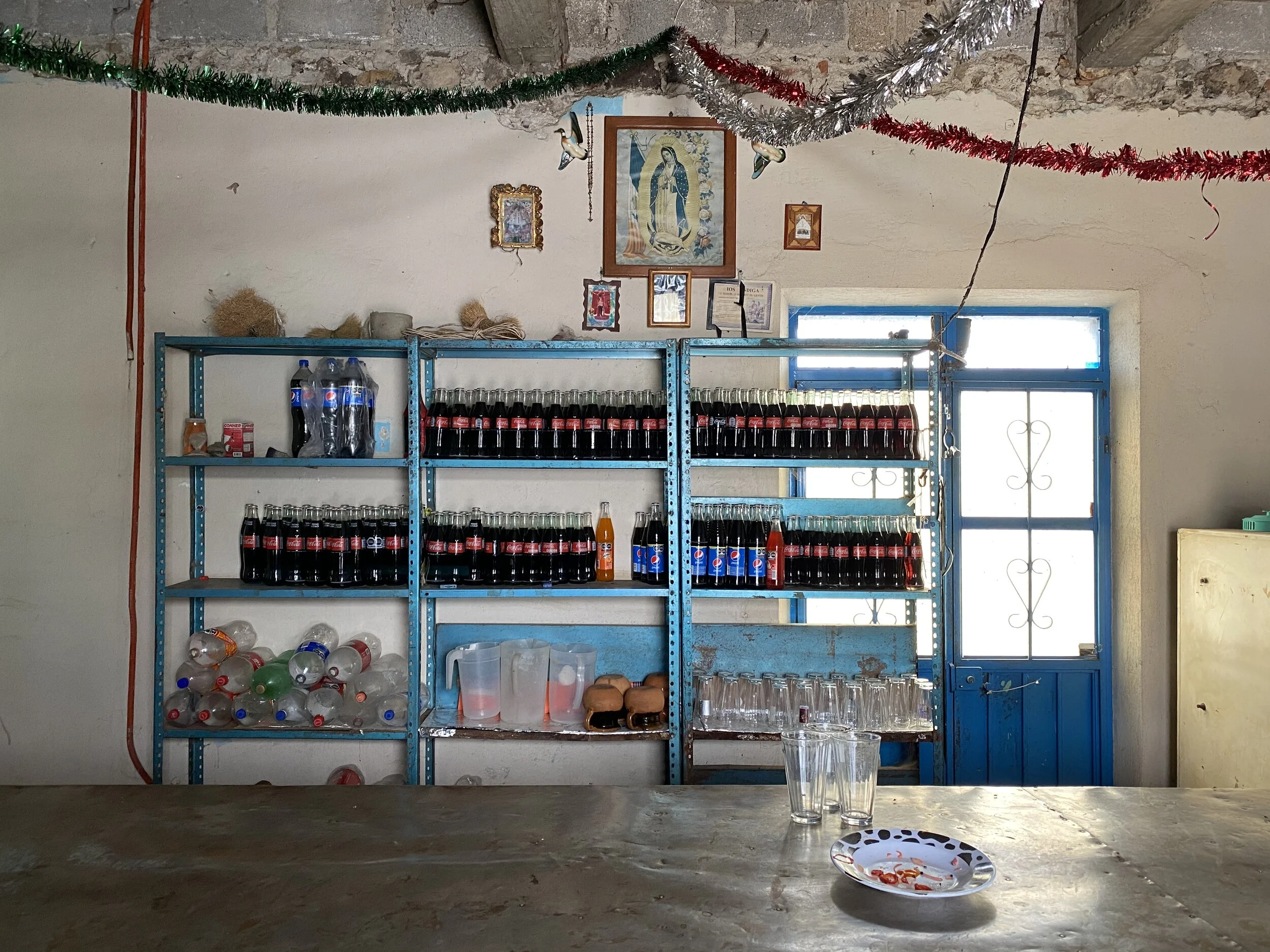
At a local bar
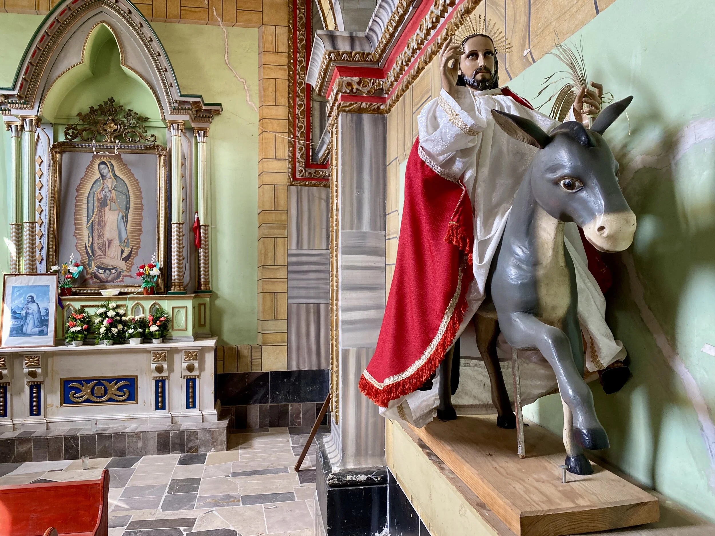
Small local church in Atzitzintla
The trailhead
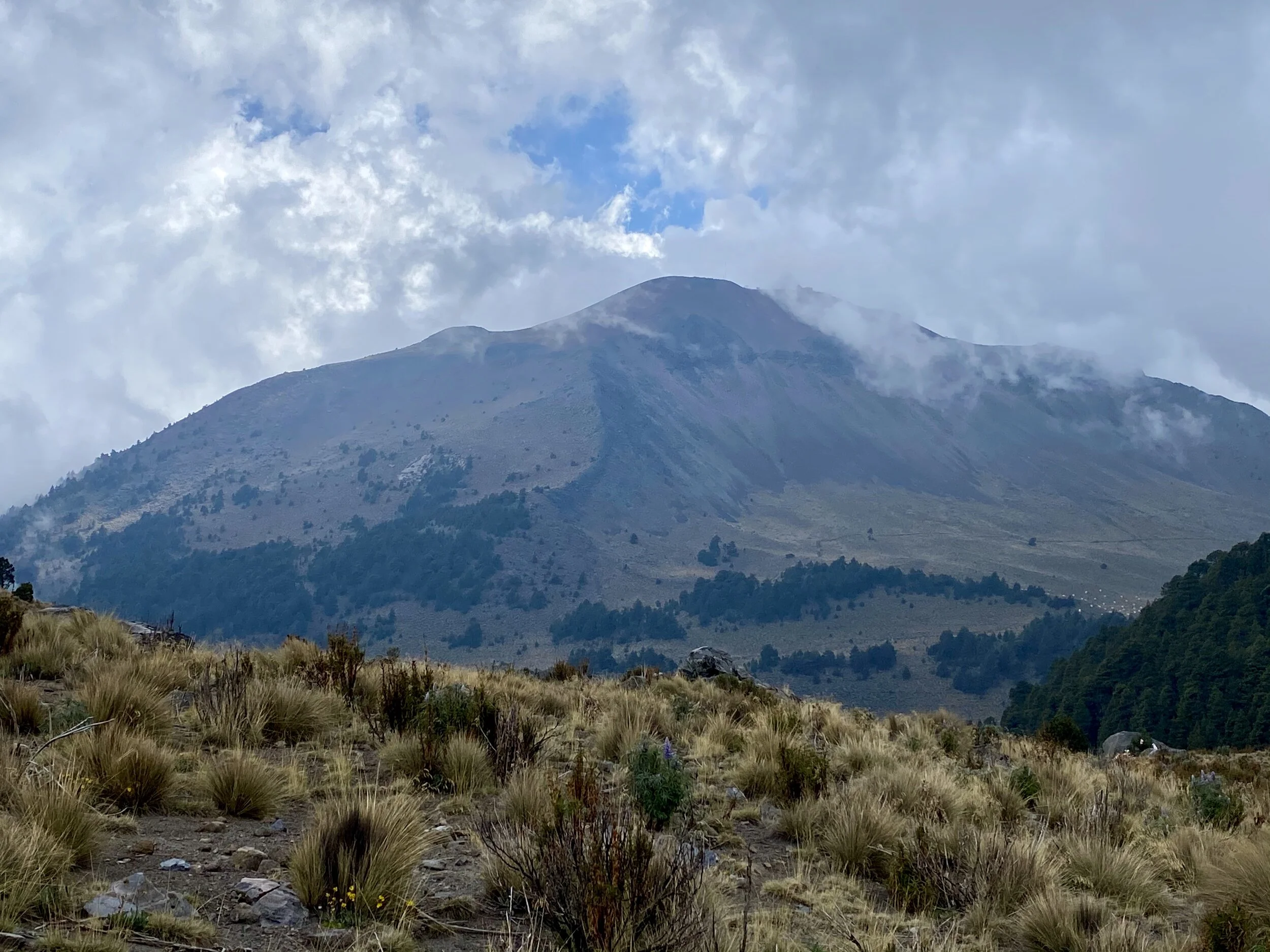
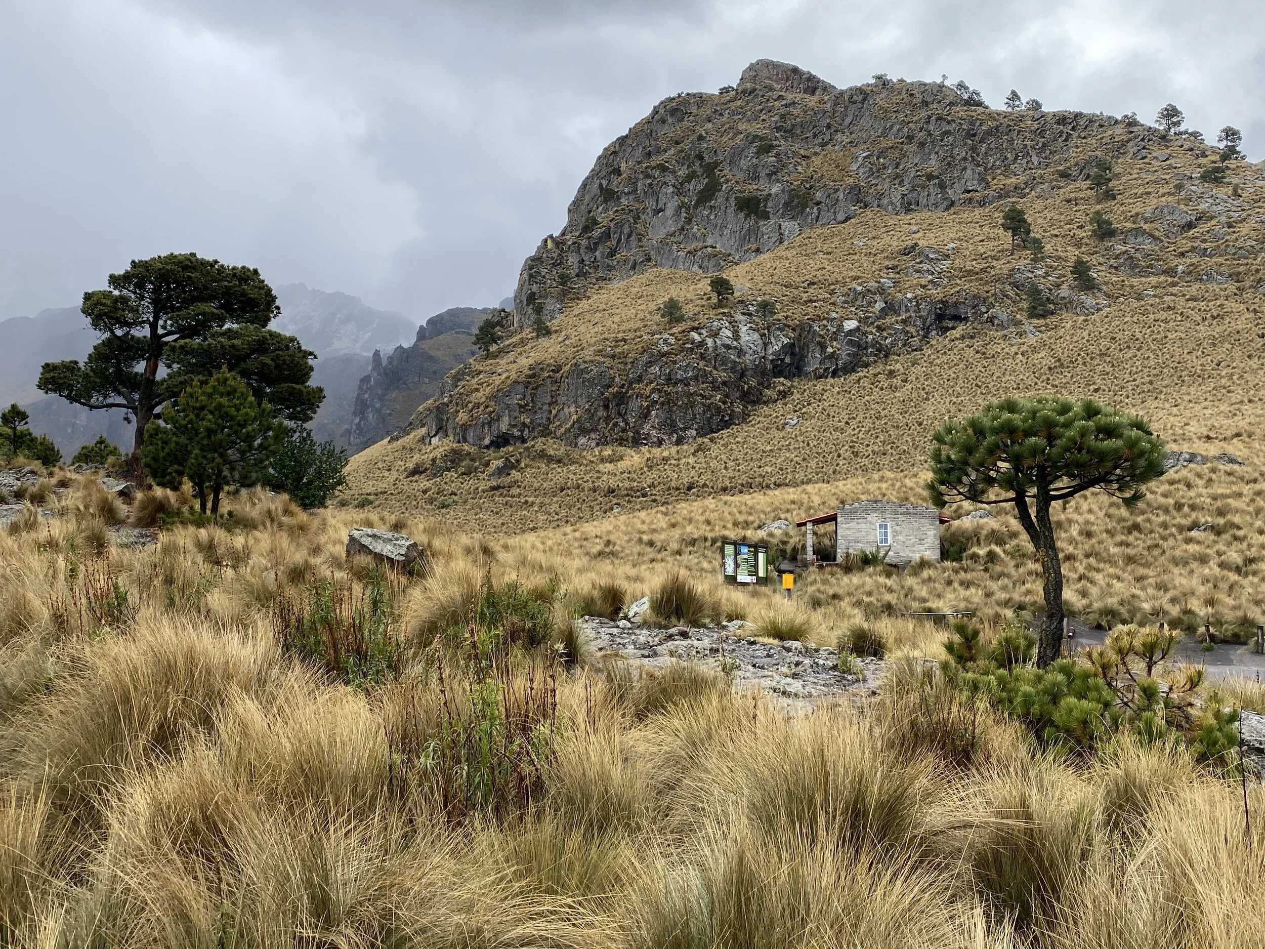
The dormant volcano of Sierra Negra. It is a short hike really but at a high elevation. We were checking the weather forecast often and adjusting our plans because early June is not an ideal period for climbing. The mornings are usually clear but the clouds roll in before noon and massive thunderstorms rage all around in the evenings and nights.
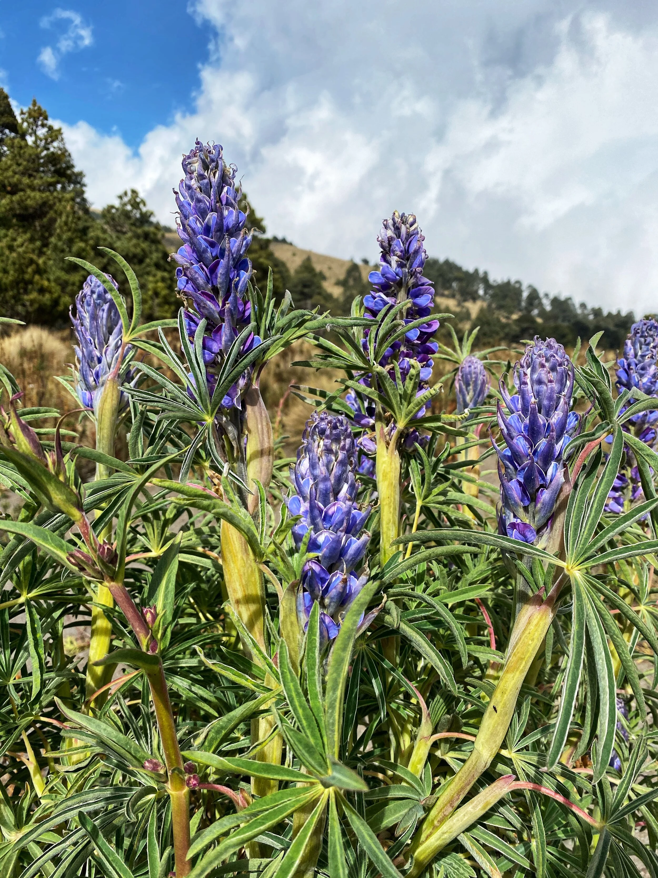
Beautiful flowers in the Pico de Orizaba National Park. We had the place to ourselves.
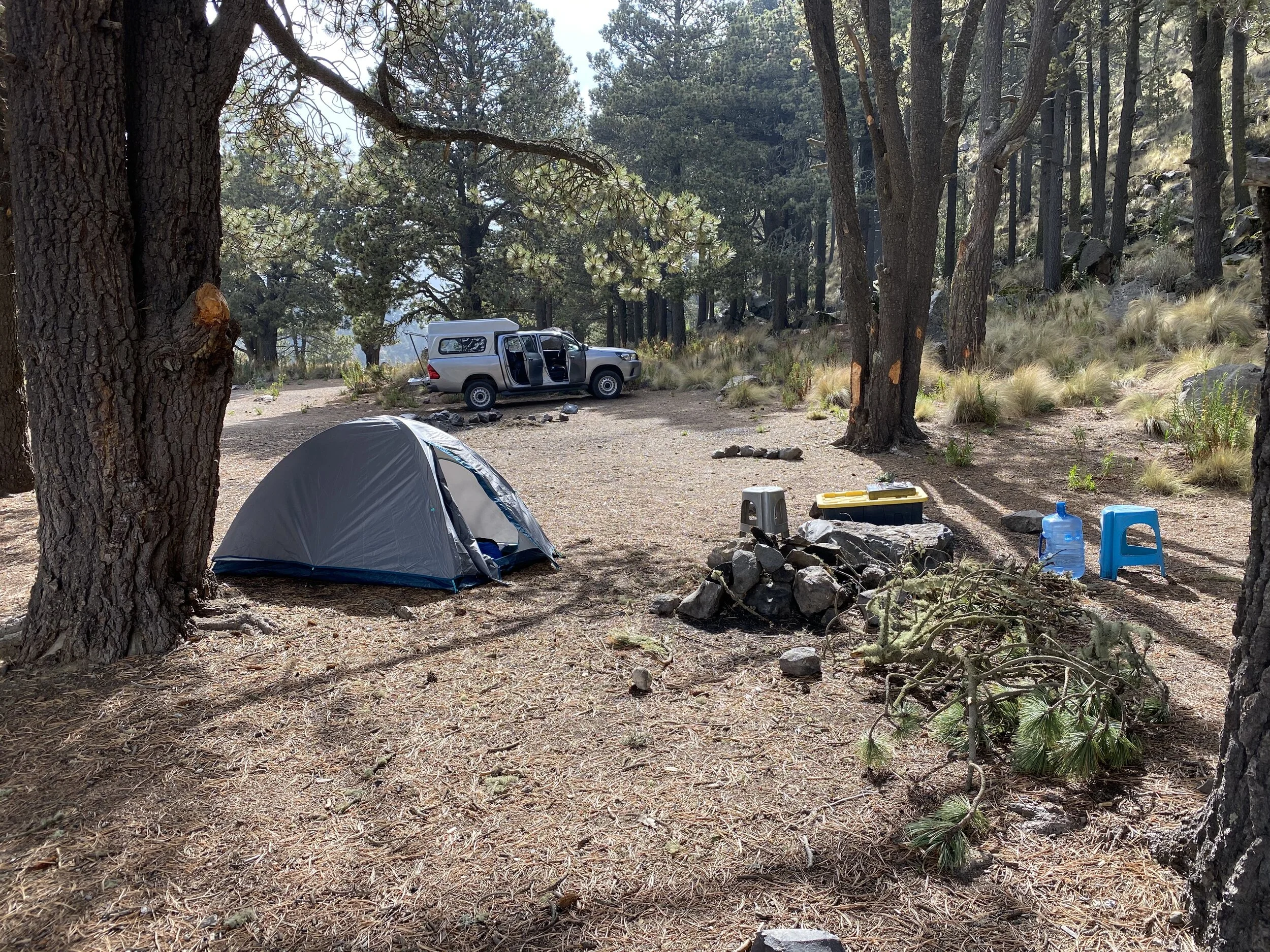
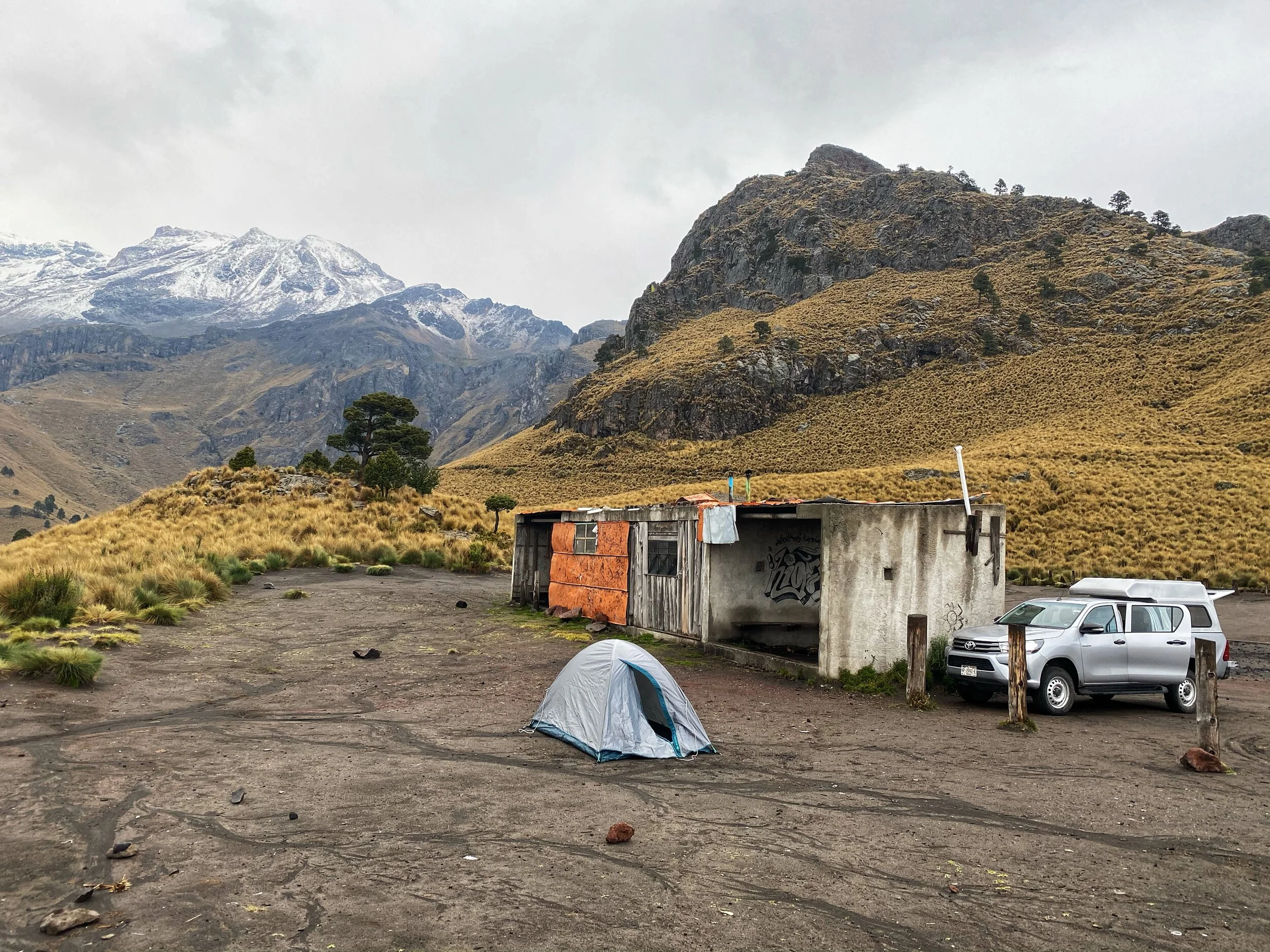
This was our camping site at the foot of Sierra Negra. Nice place for a camp fire.
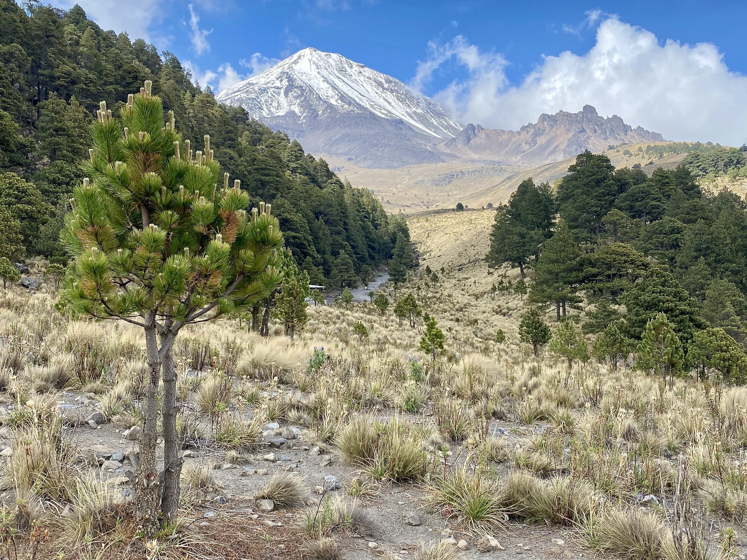
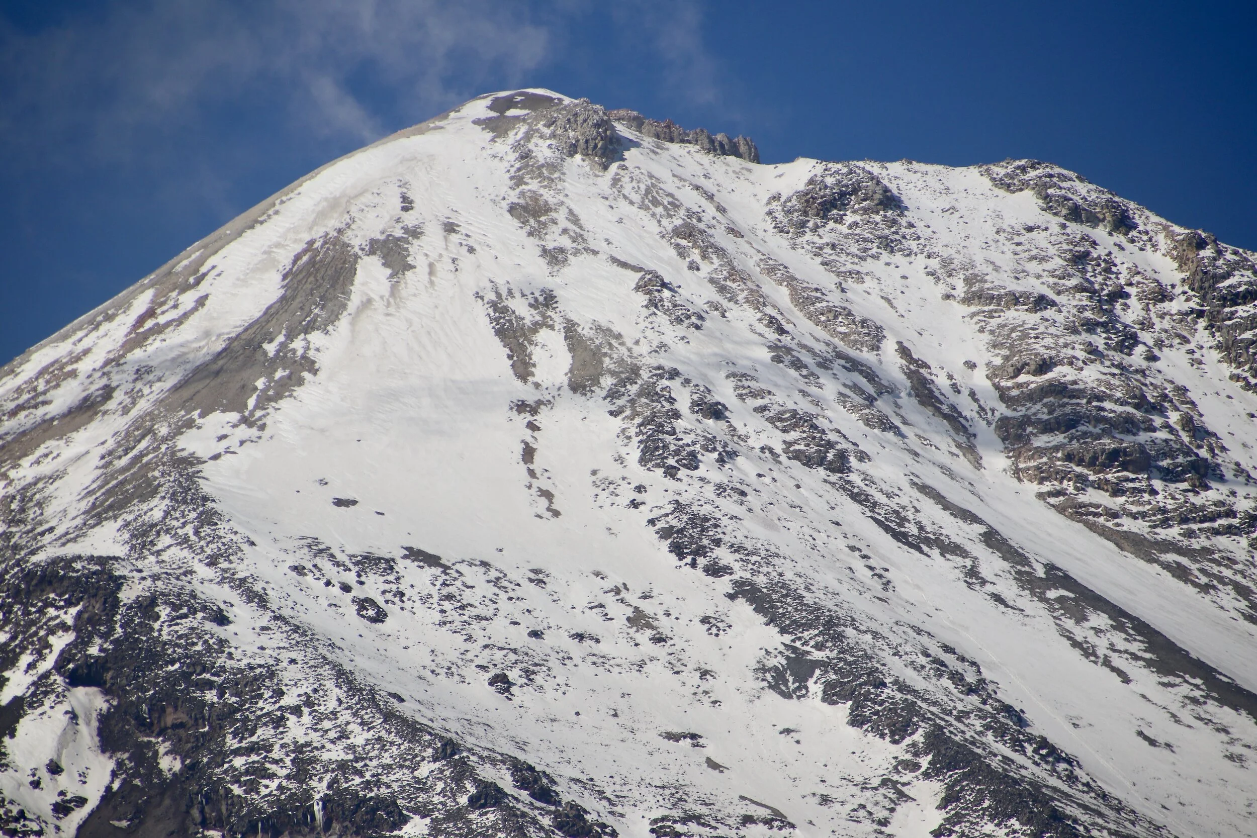
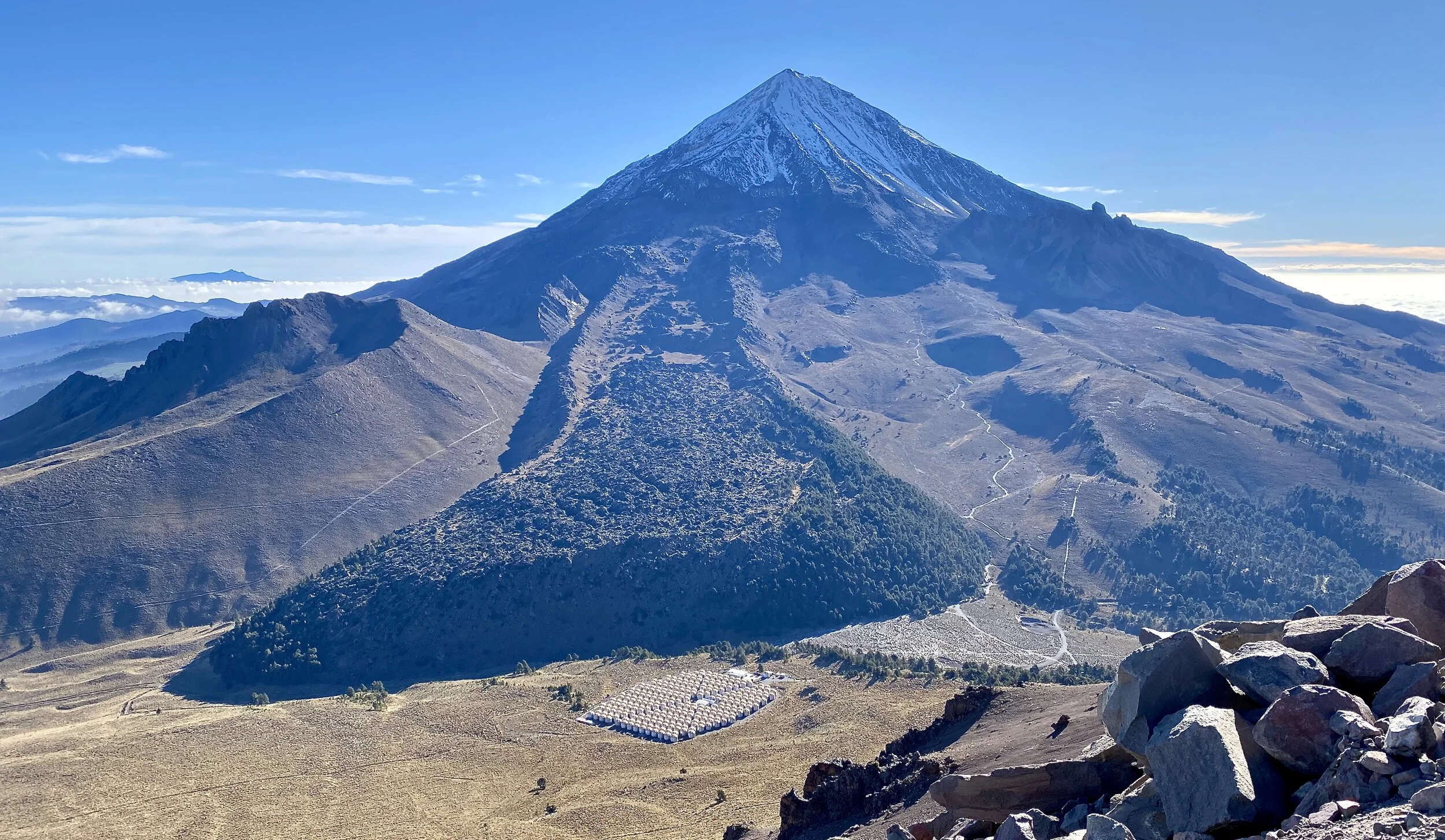
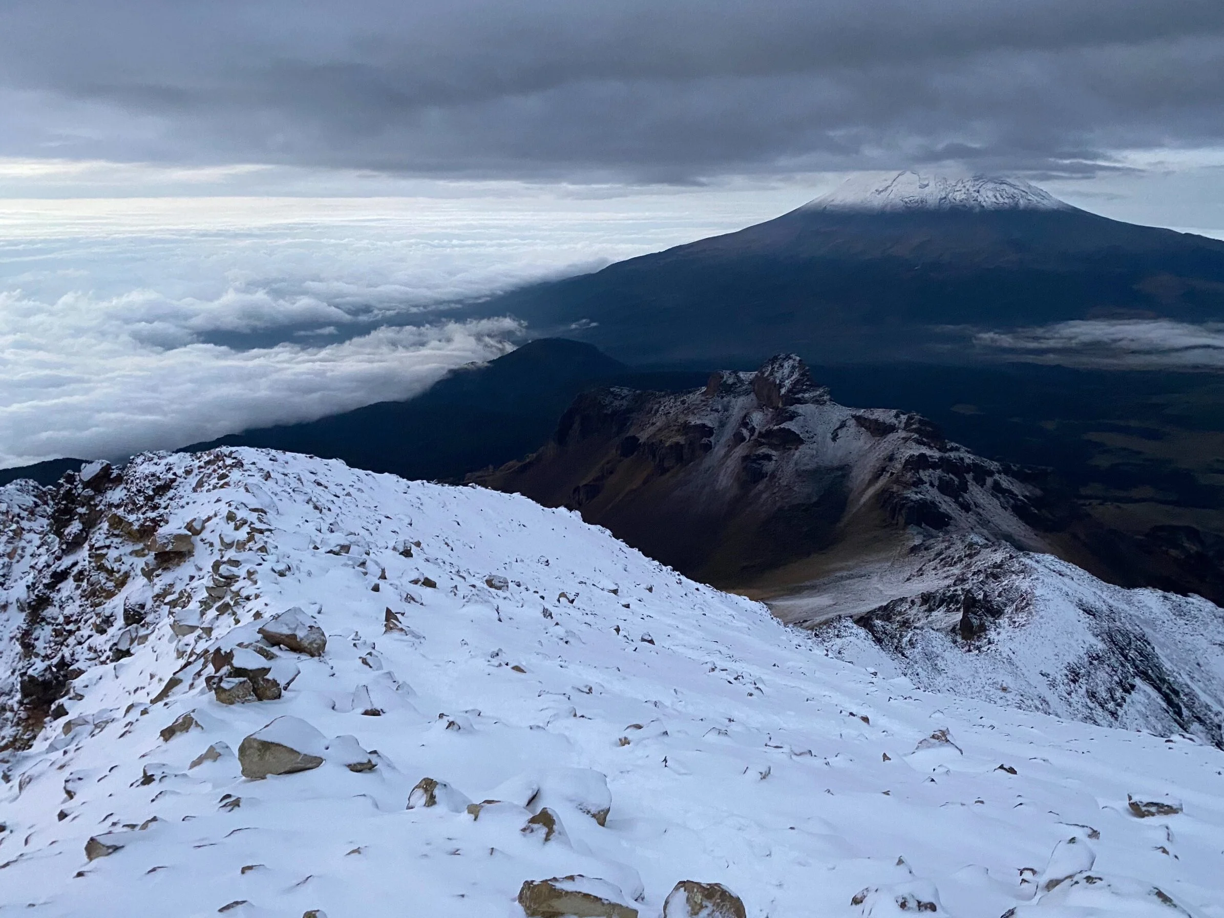
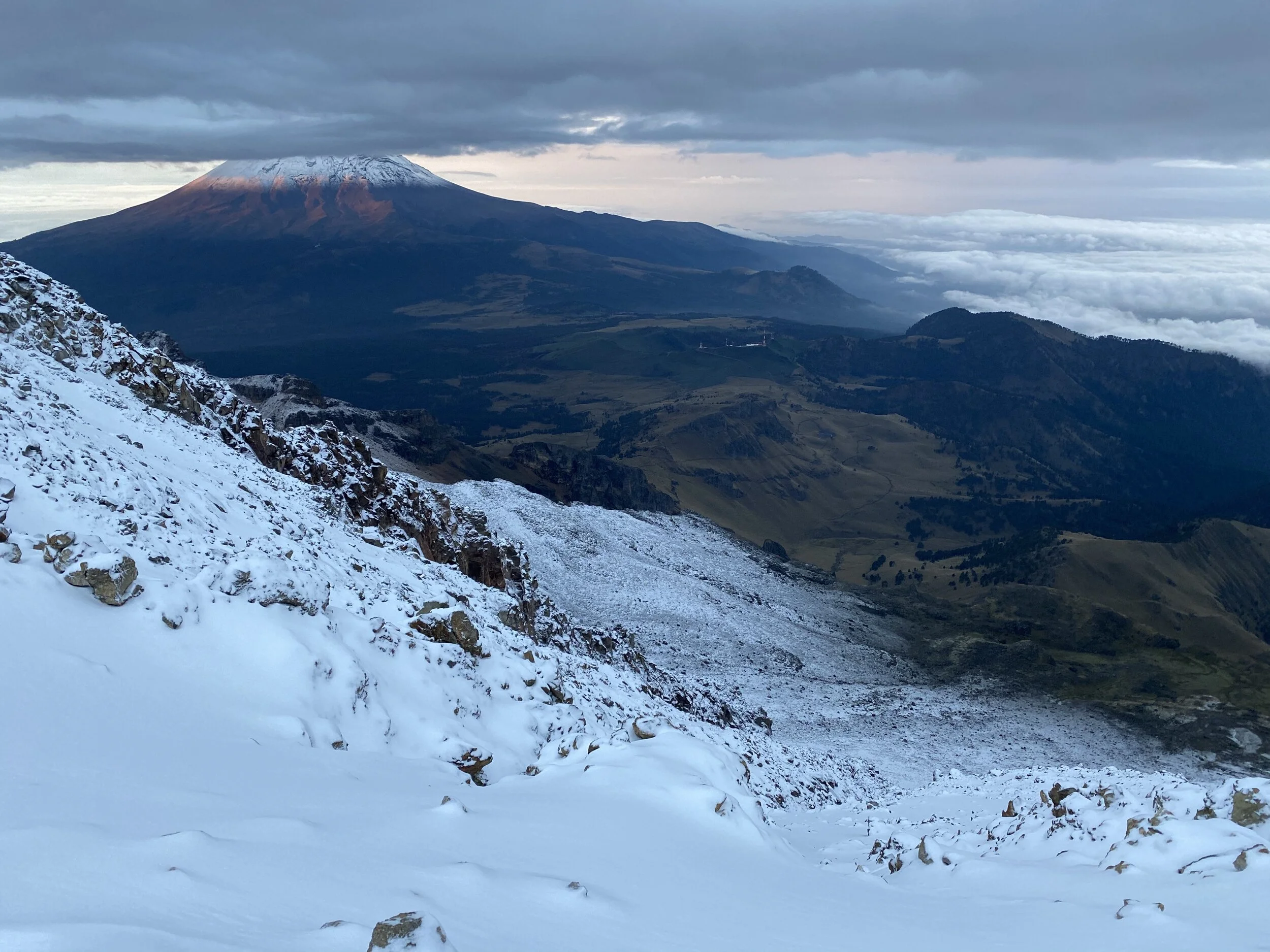
From our camp site, we could see the south face of Pico de Orizaba. The south face is usually scree and free of snow. Being the beginning of the rainy season though, the snow starts to accumulate. The climbing route up the south face starts from the snow line in the center of the photo. It is shorter than the north side but steeper. It does not involve glacier travel though.
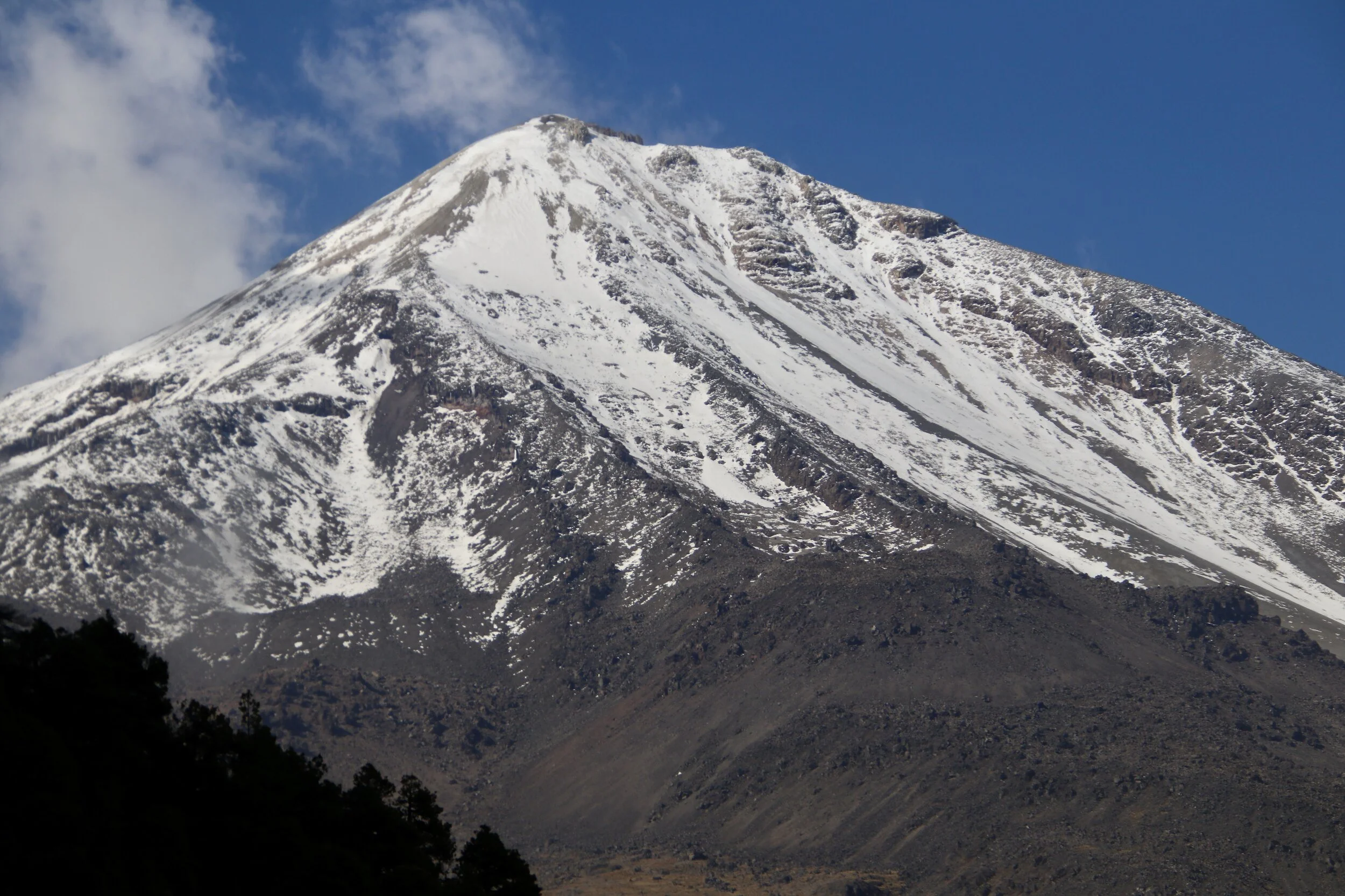
The closeup of the summit and the top part of the Pico de Orizaba’s south face
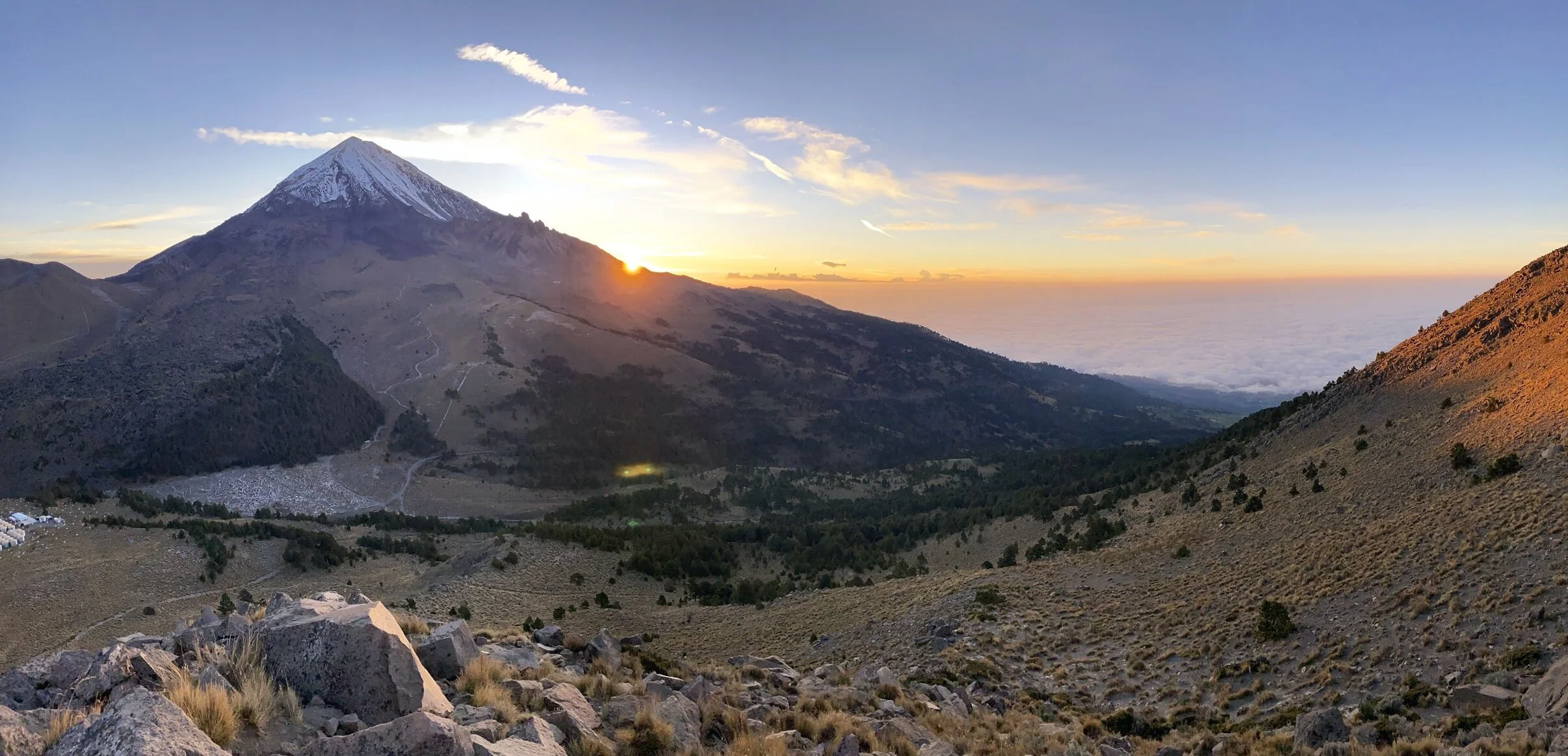
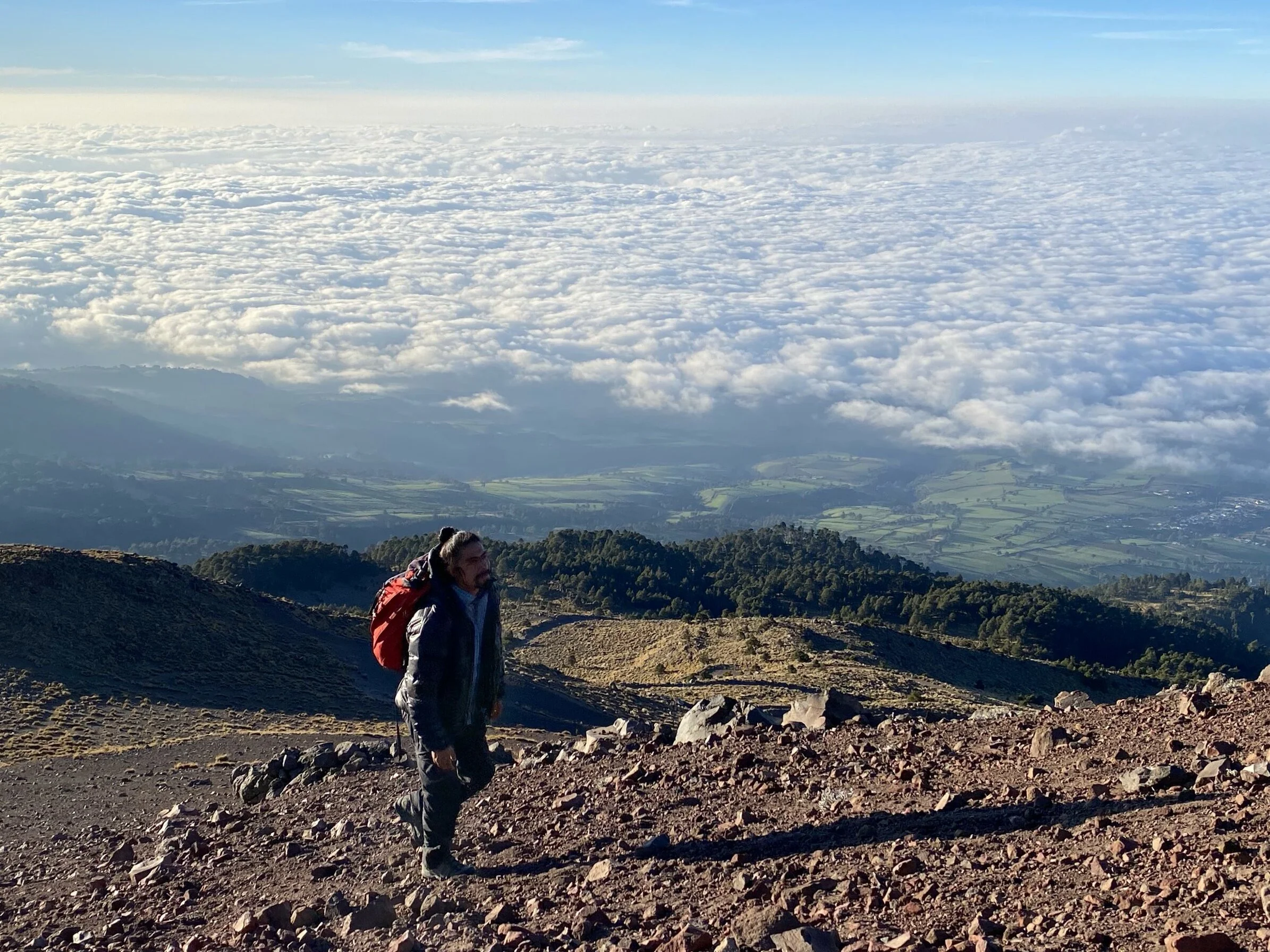
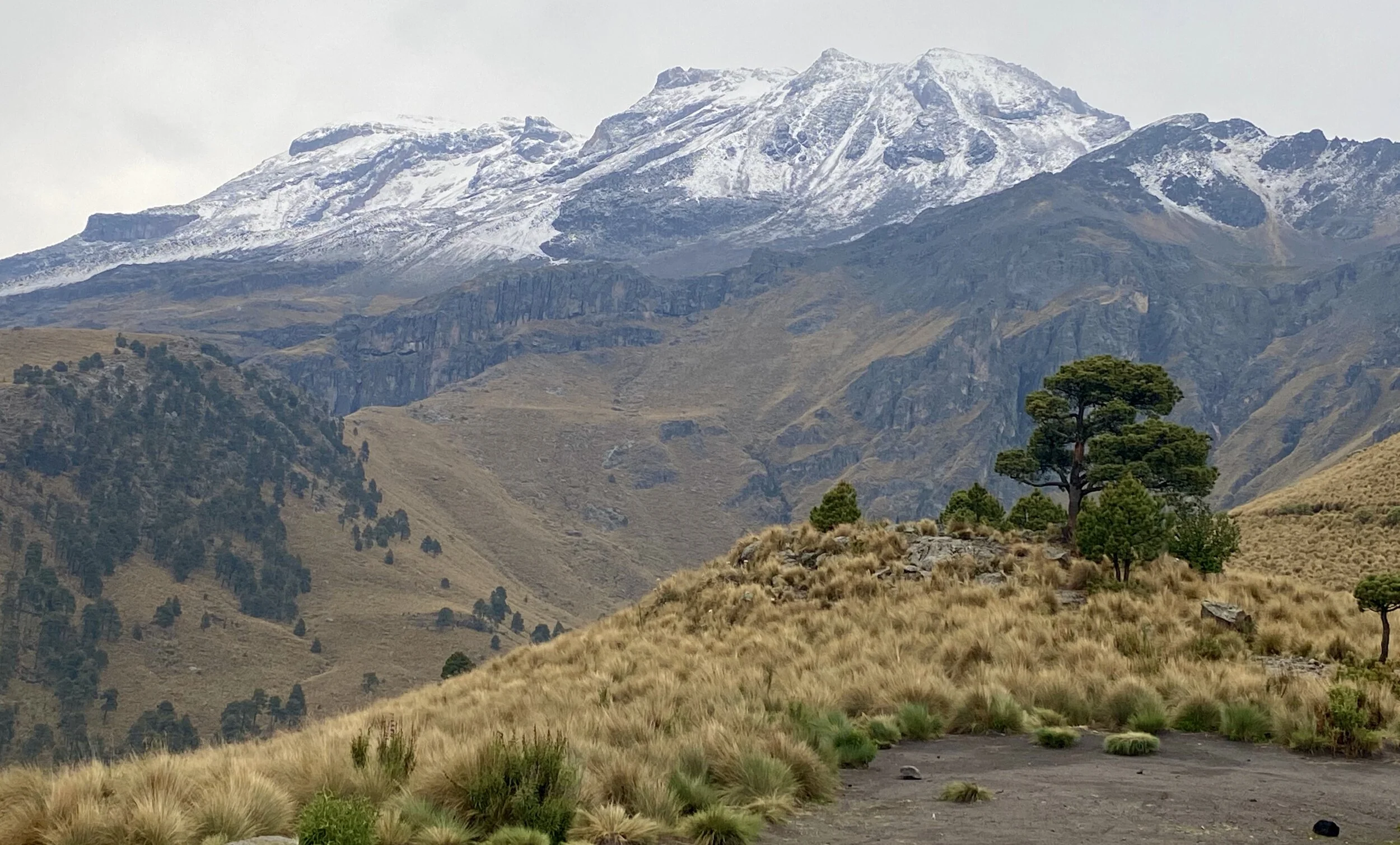
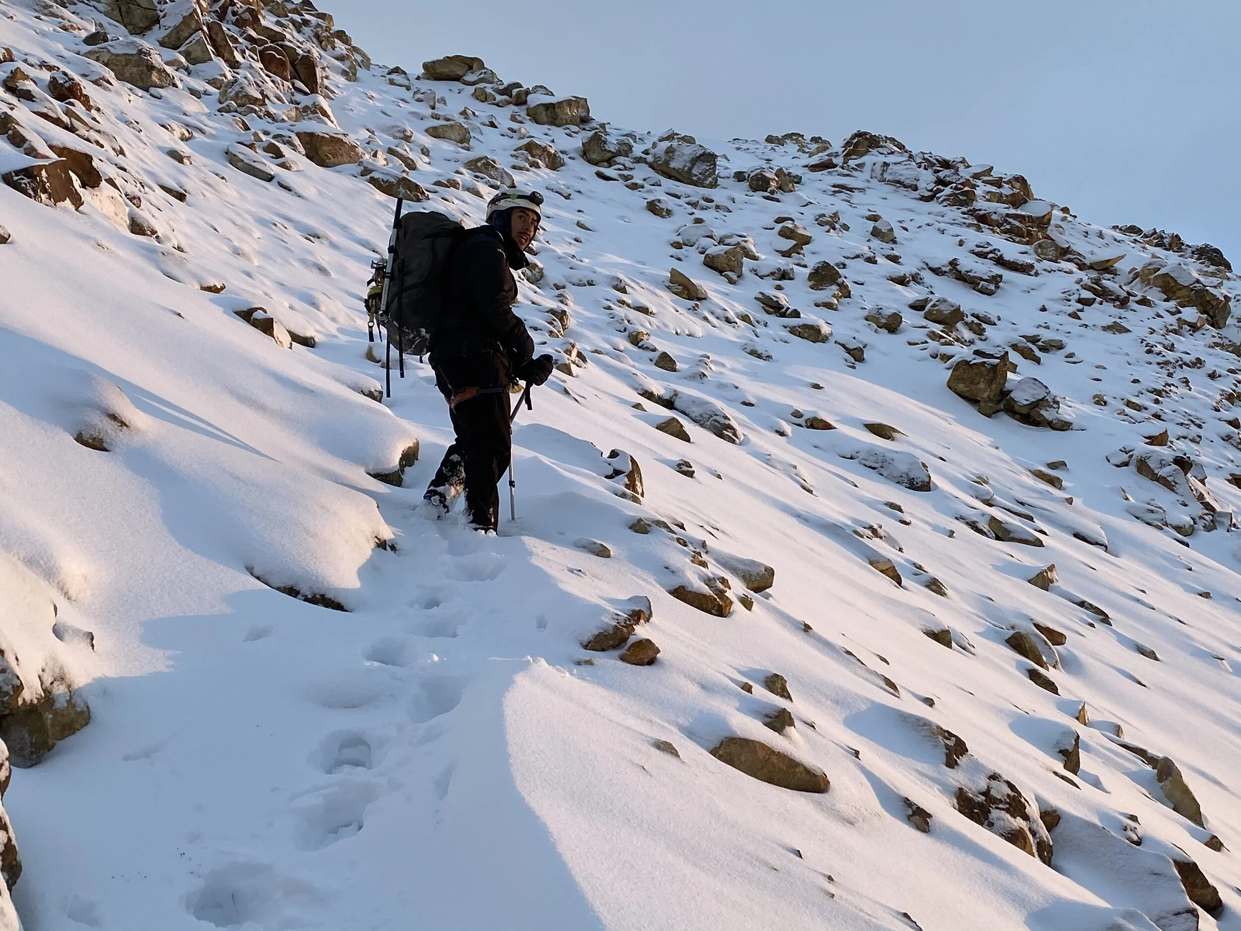
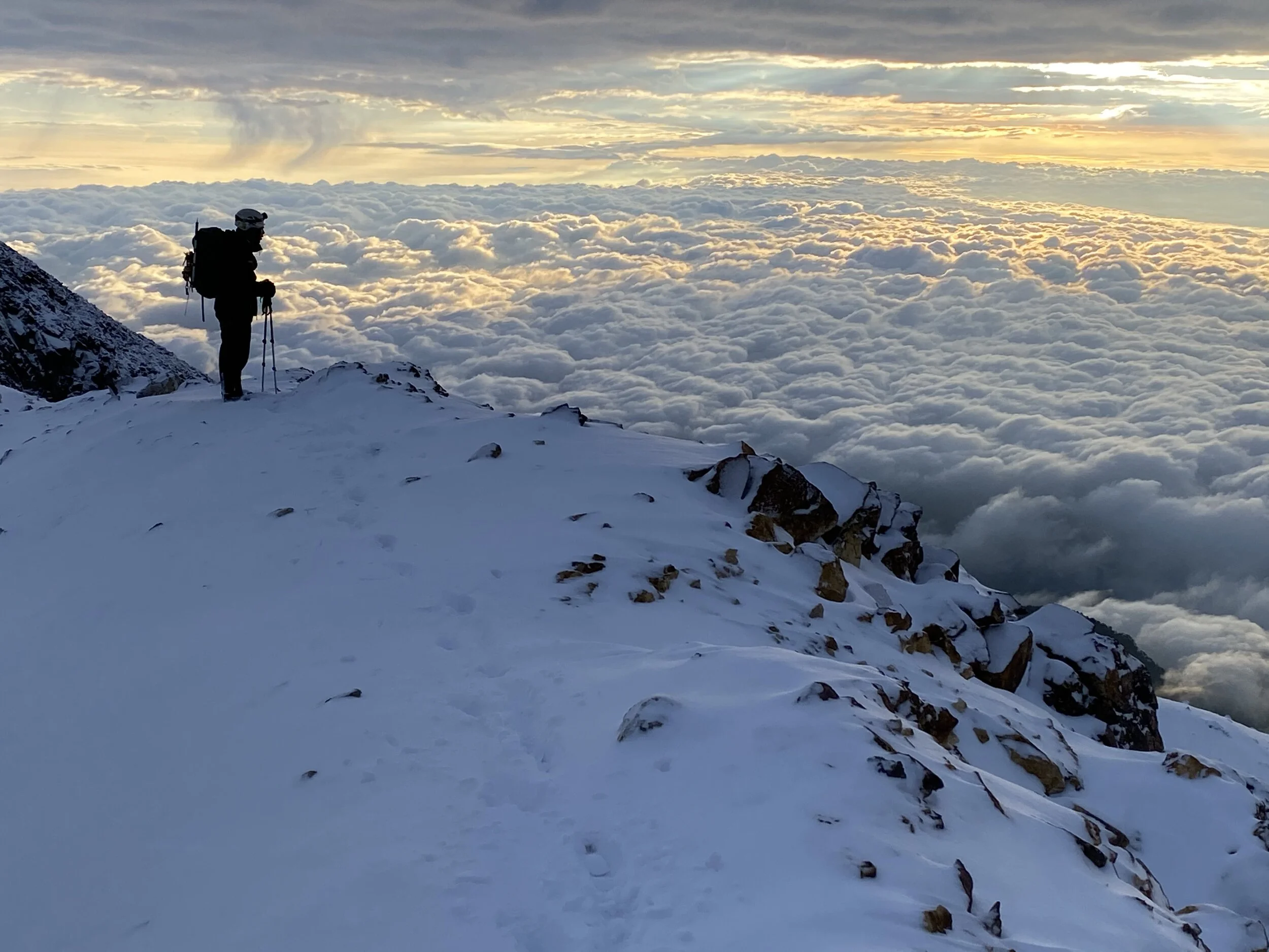
The sunrise mid way up Sierra Negra. It is a pleasant hike and it is excellent for acclimatization. The views from the summit are definitely worth the effort. The view of the entire south-east aspect of Pico de Orizaba is spectacular.
We are now high above the surrounding valleys.
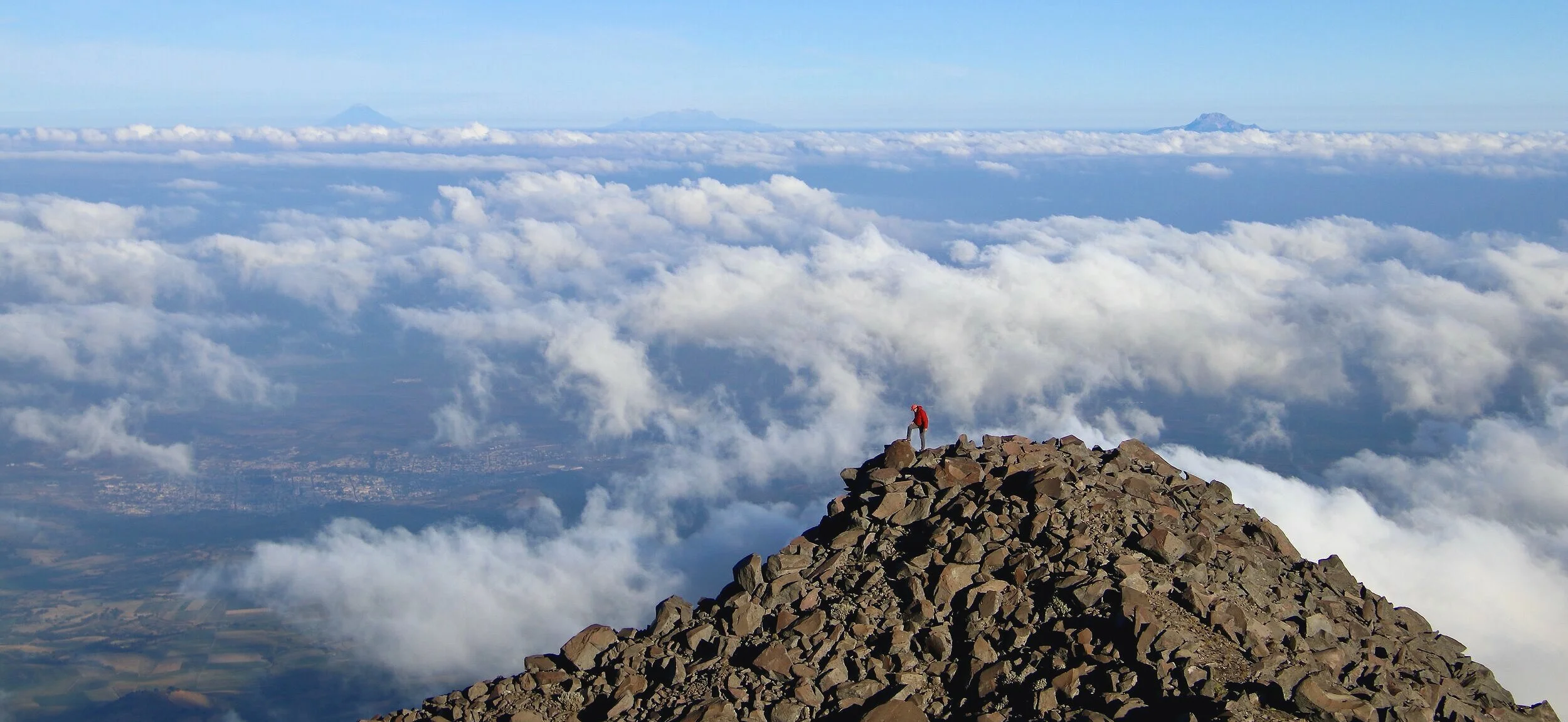
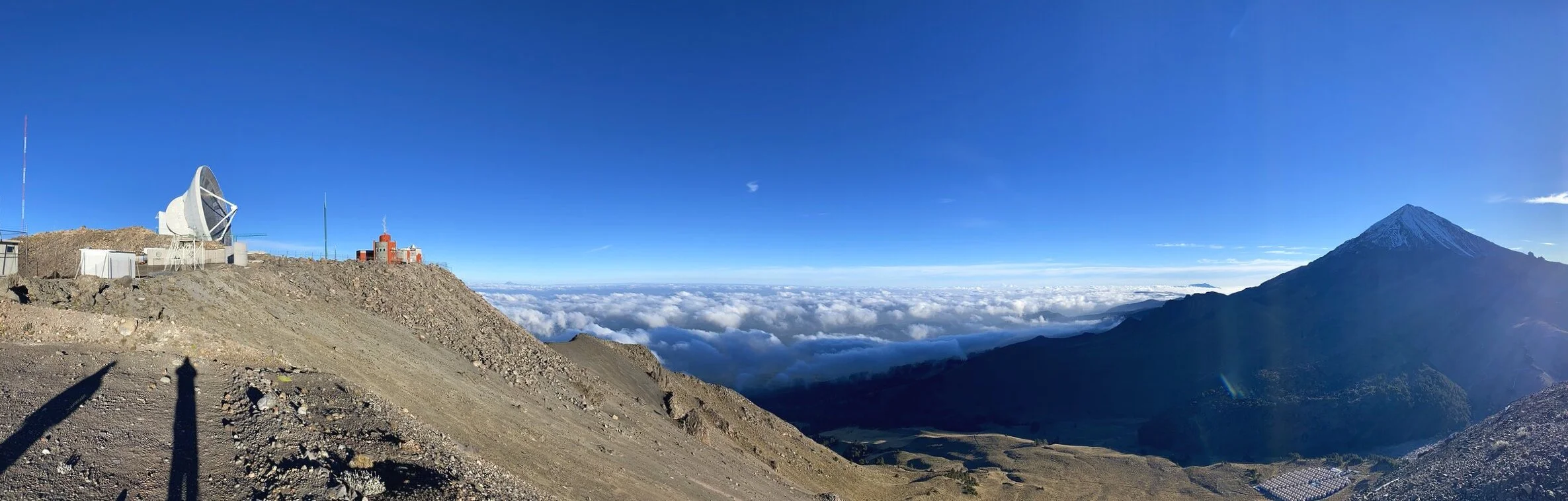
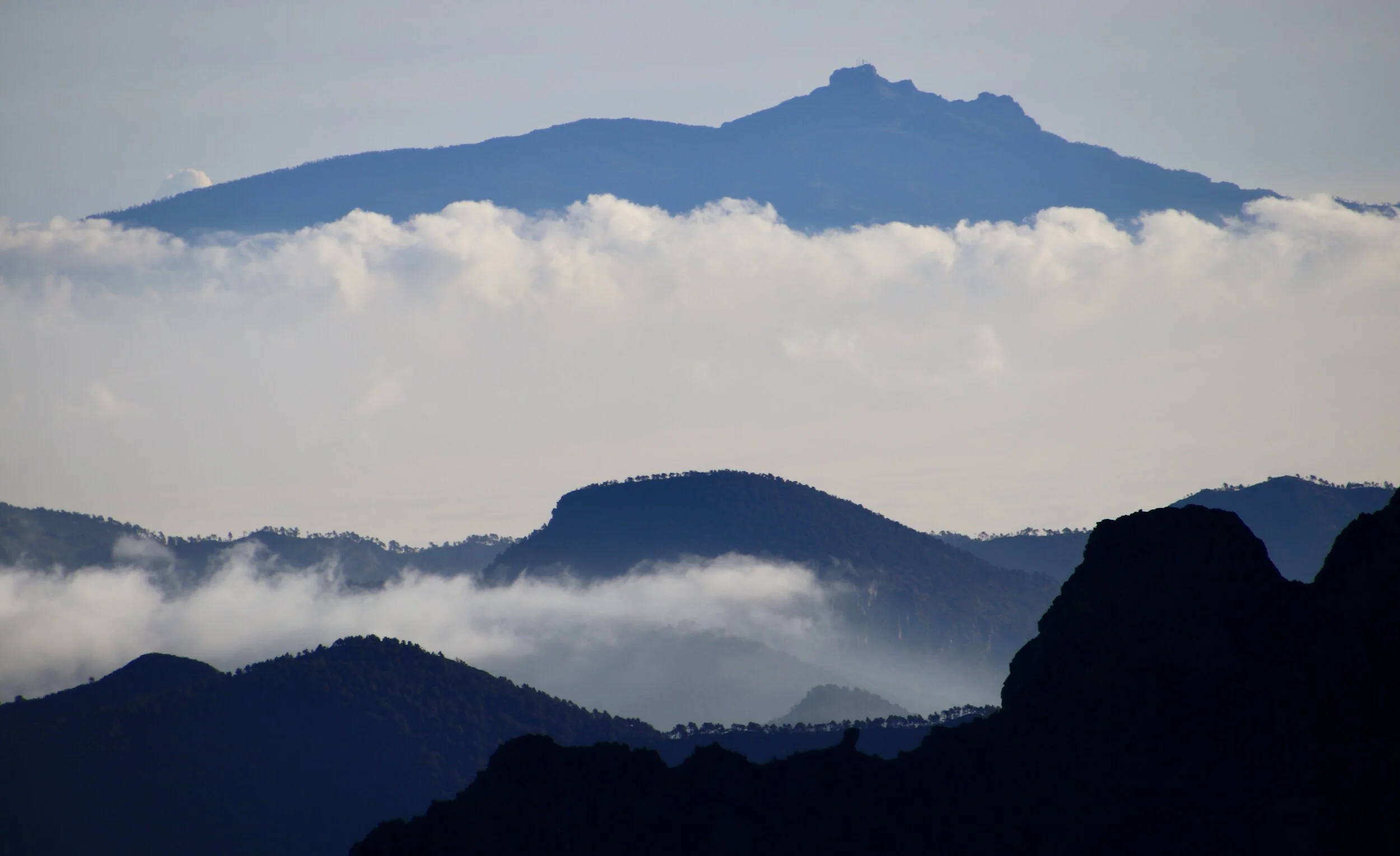
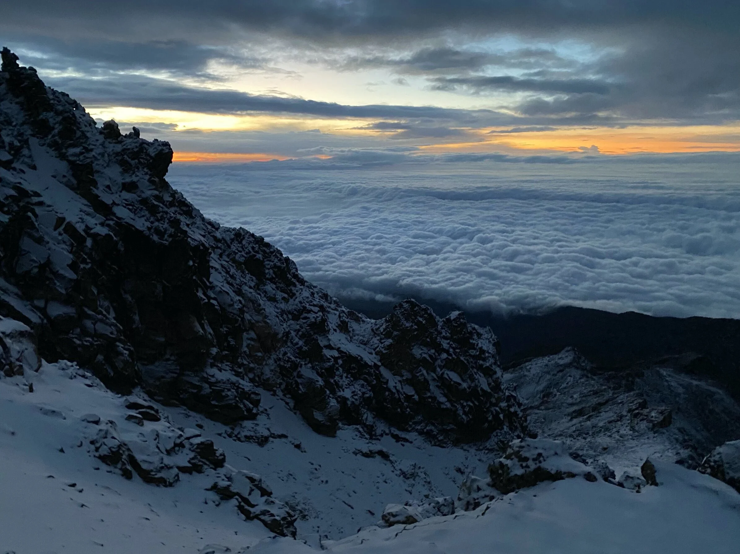
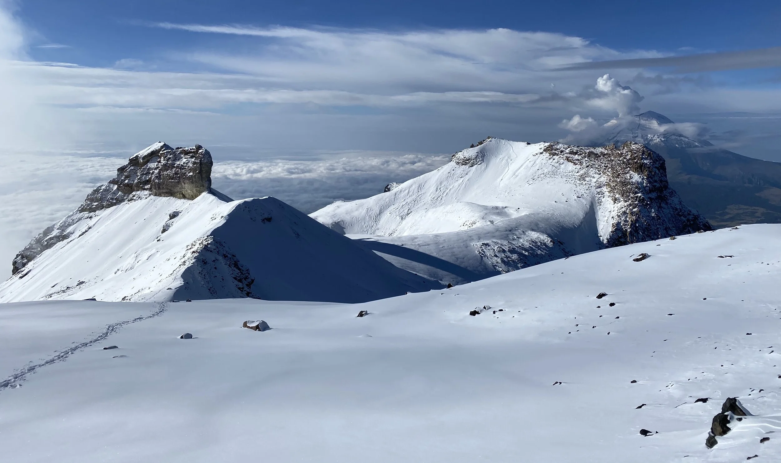
From the summit of Sierra Negra the 3 volcanoes are visible: on the left is Popocatépetl, in the middle Izta and on the right is Malinche (very close to Puebla City).
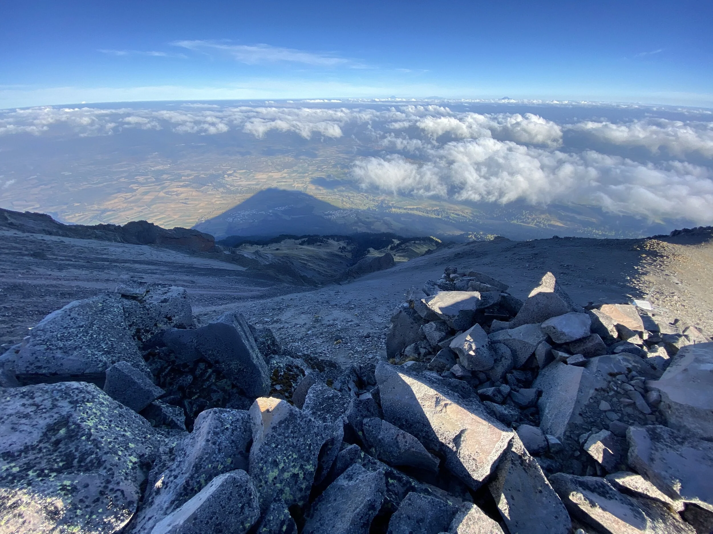
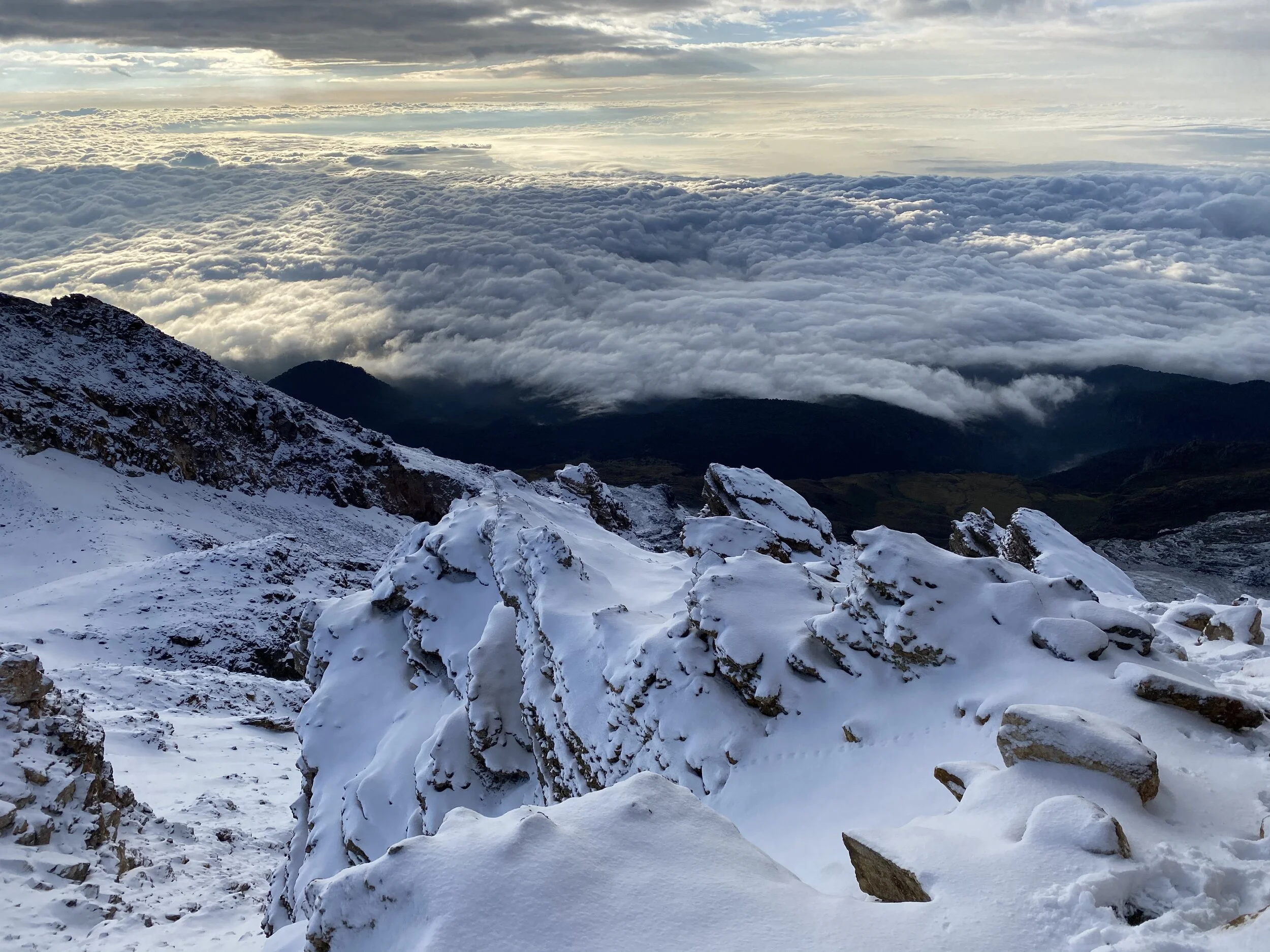
The shadow of the mountain is projected onto the surrounding plane.
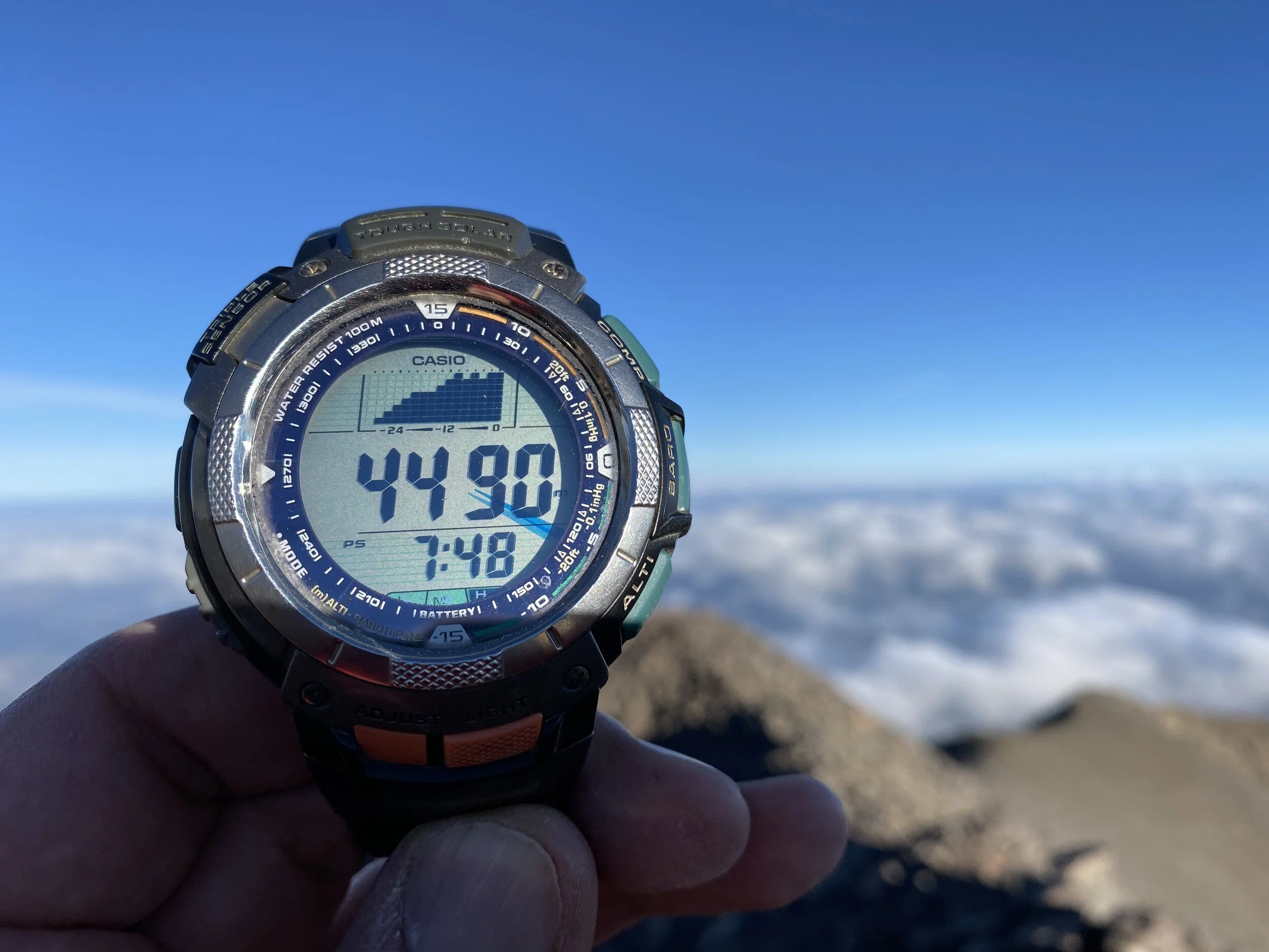
The summit altitude (add another 90m (my device is faulty :-)). The summit is 4580m or 15,030ft.
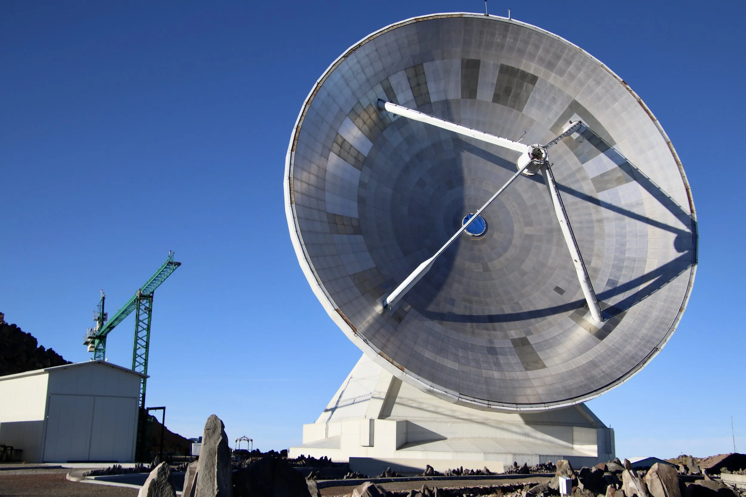
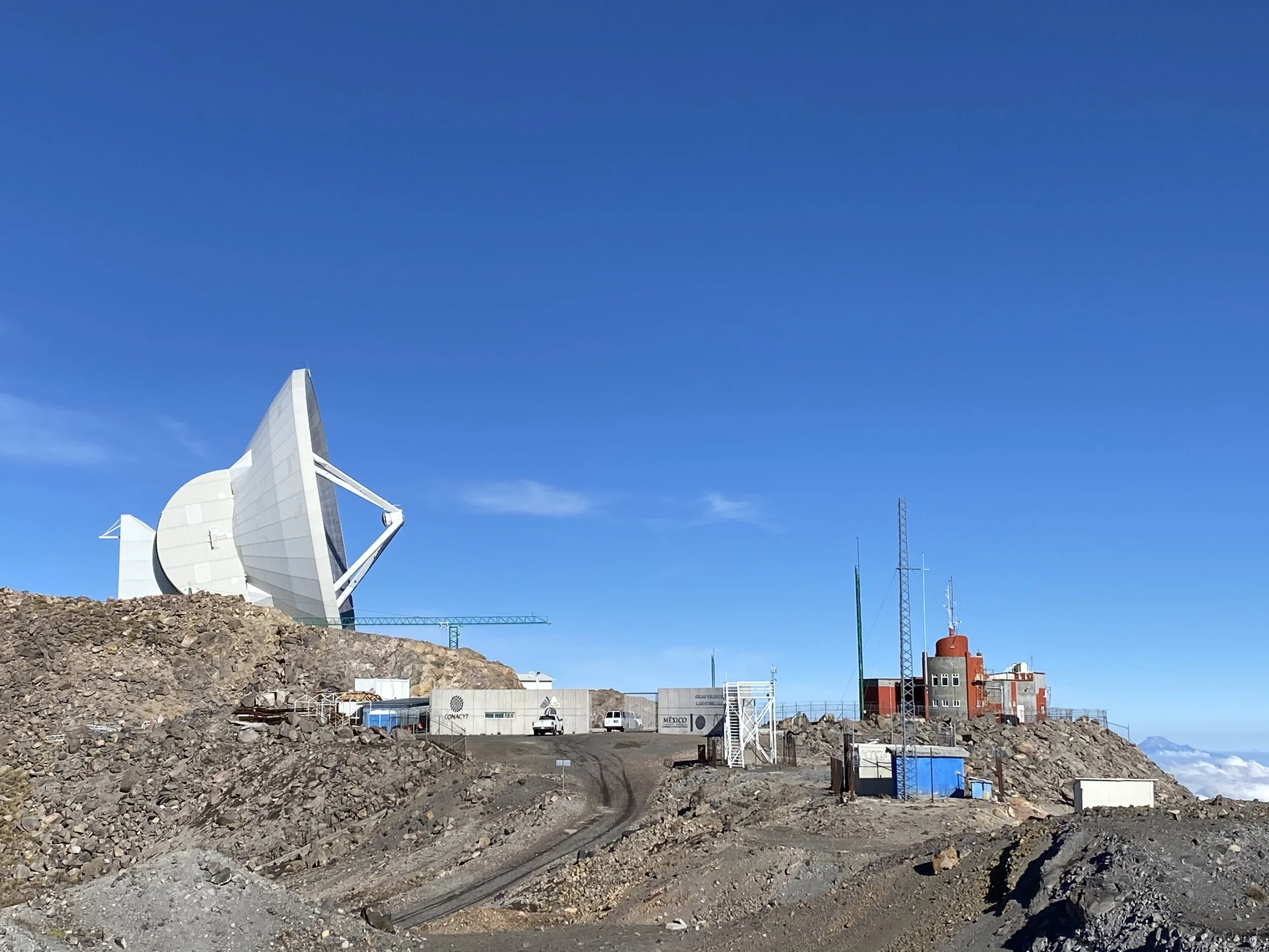
There is a massive astronomical observatory on the summit of Sierra Negra. It is run by the Government of Mexico and the University of Maryland in the USA.
You can get a sense of the size of the antenna vis-à-vis the cars. Although there is a road to the summit to service the observatory, the hiking route comes from the opposite side.
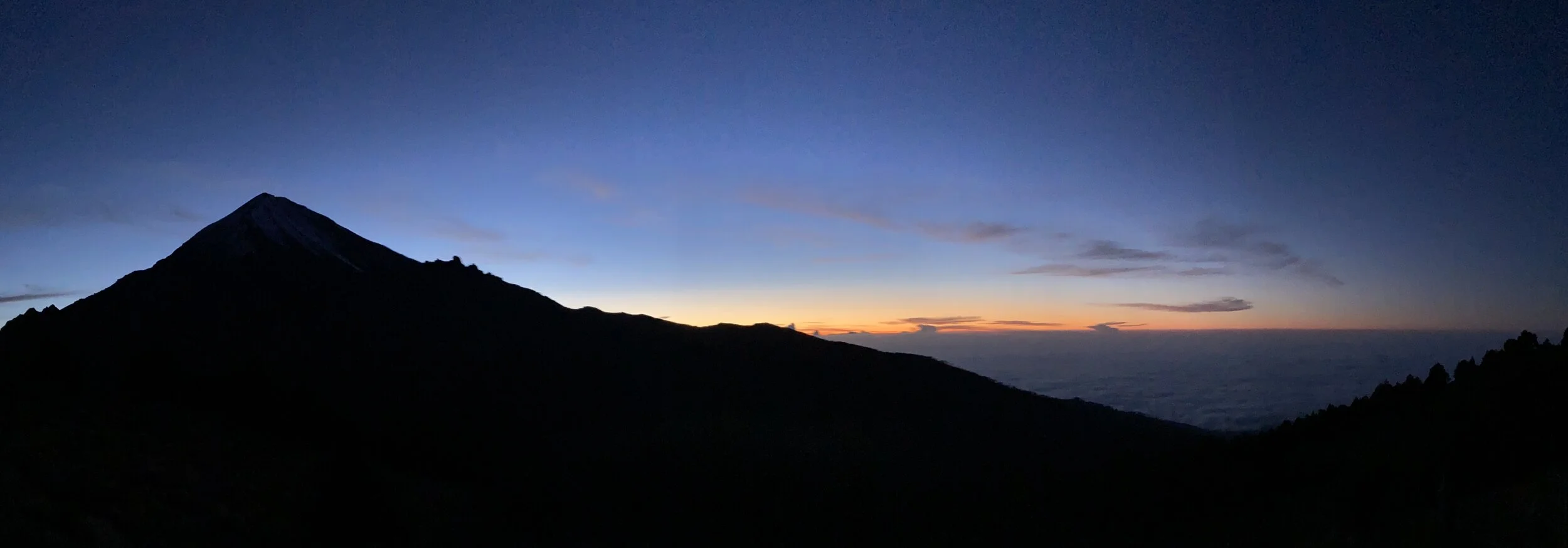
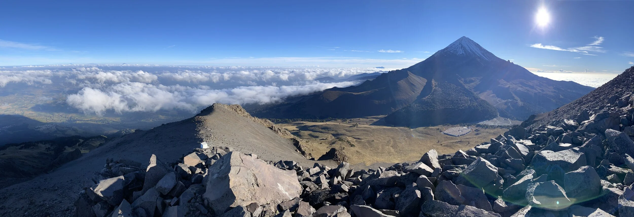
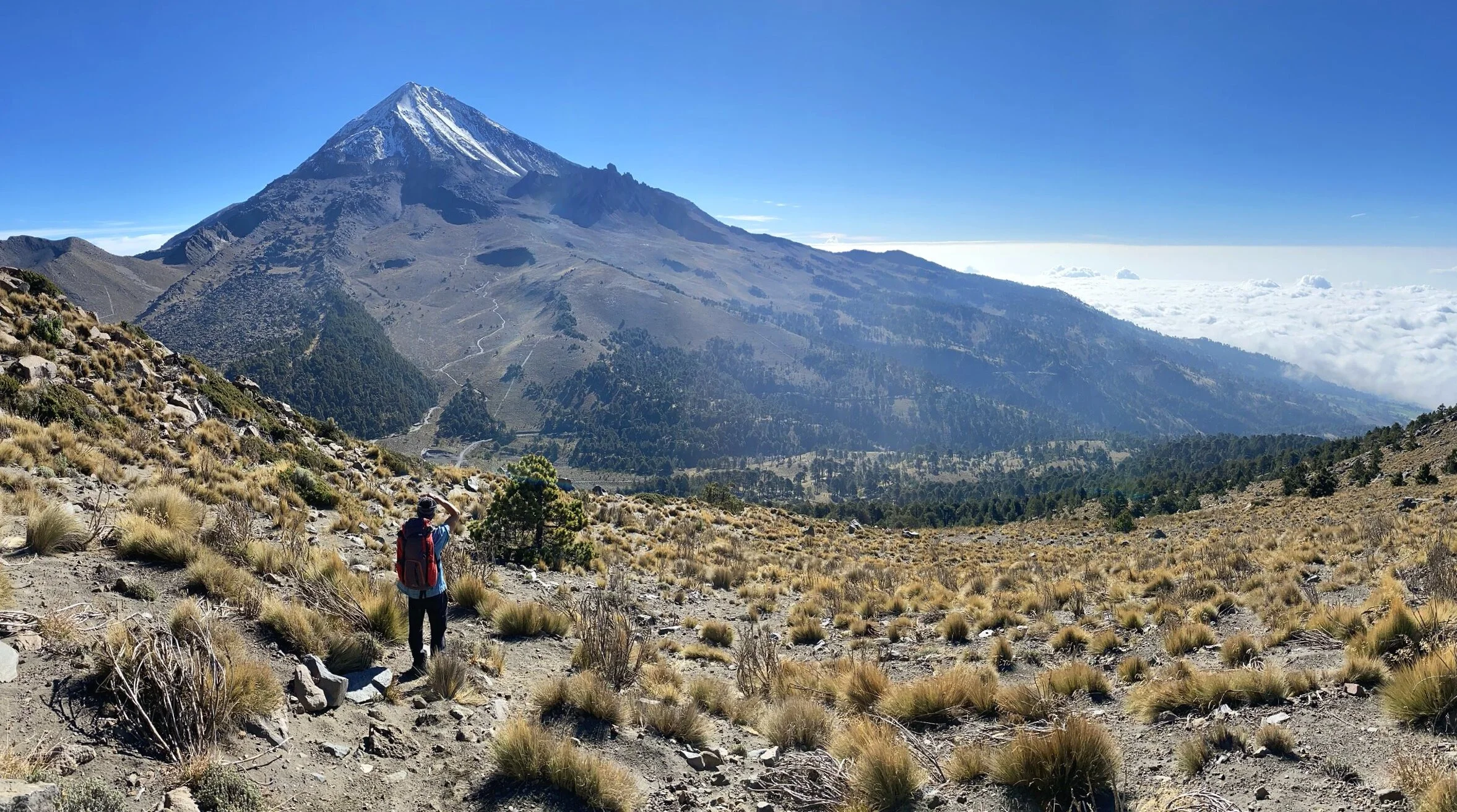
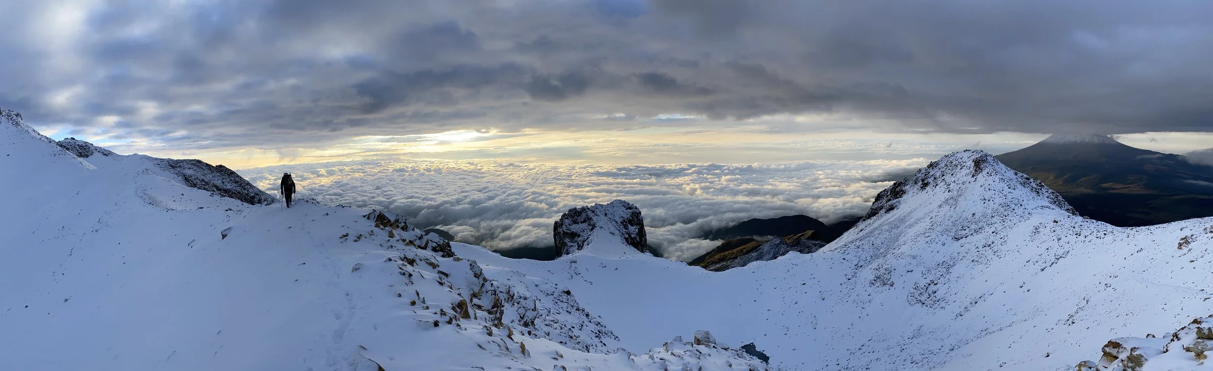
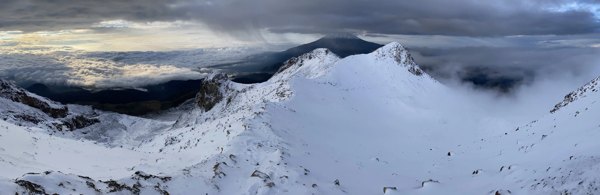
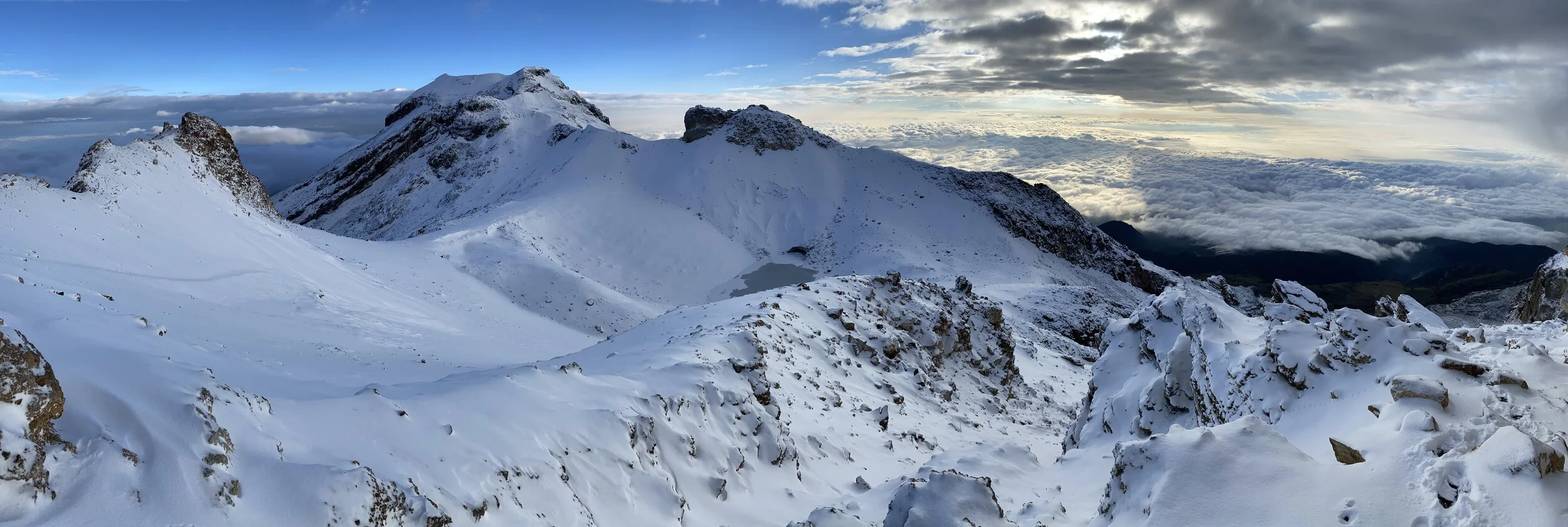
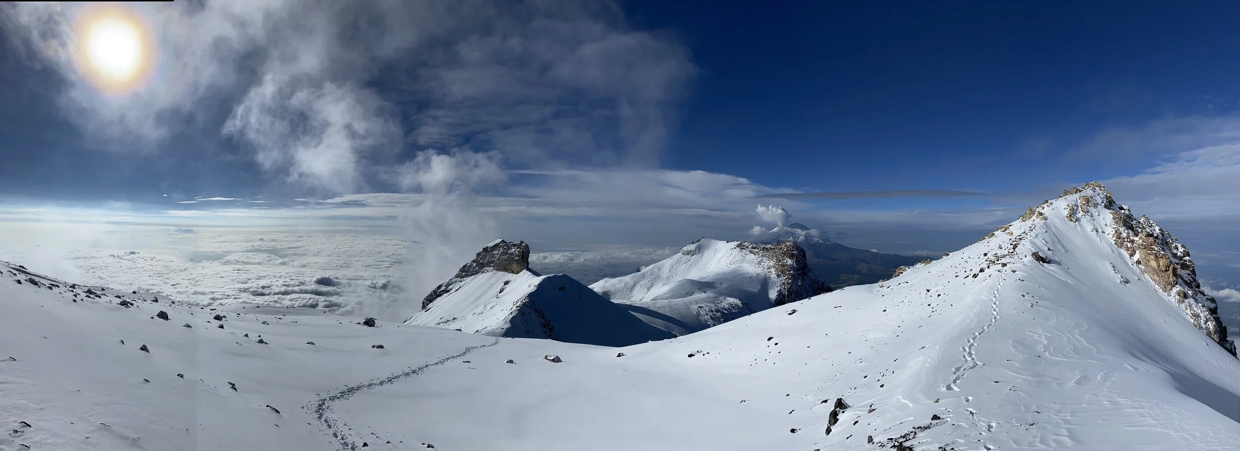
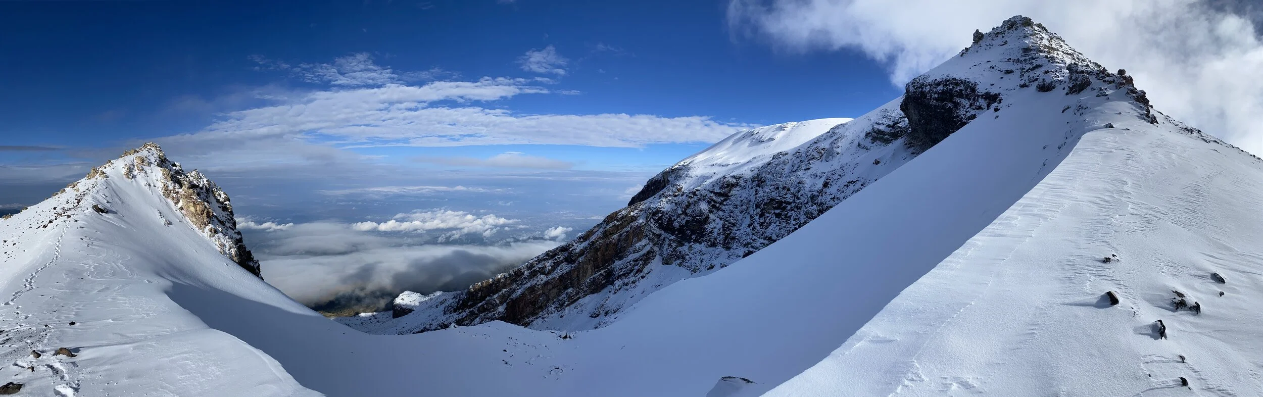
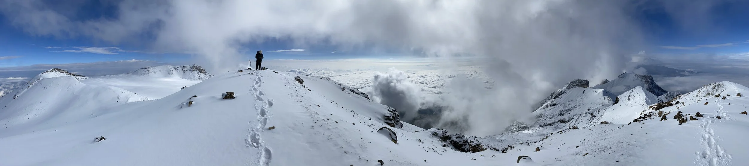
Panoramas from the summit. Pico de Orizaba is 1km higher than Sierra Negra.
An old lava flow on the Pico de Orizaba
A closeup of the hills surrounding Pico de Orizaba
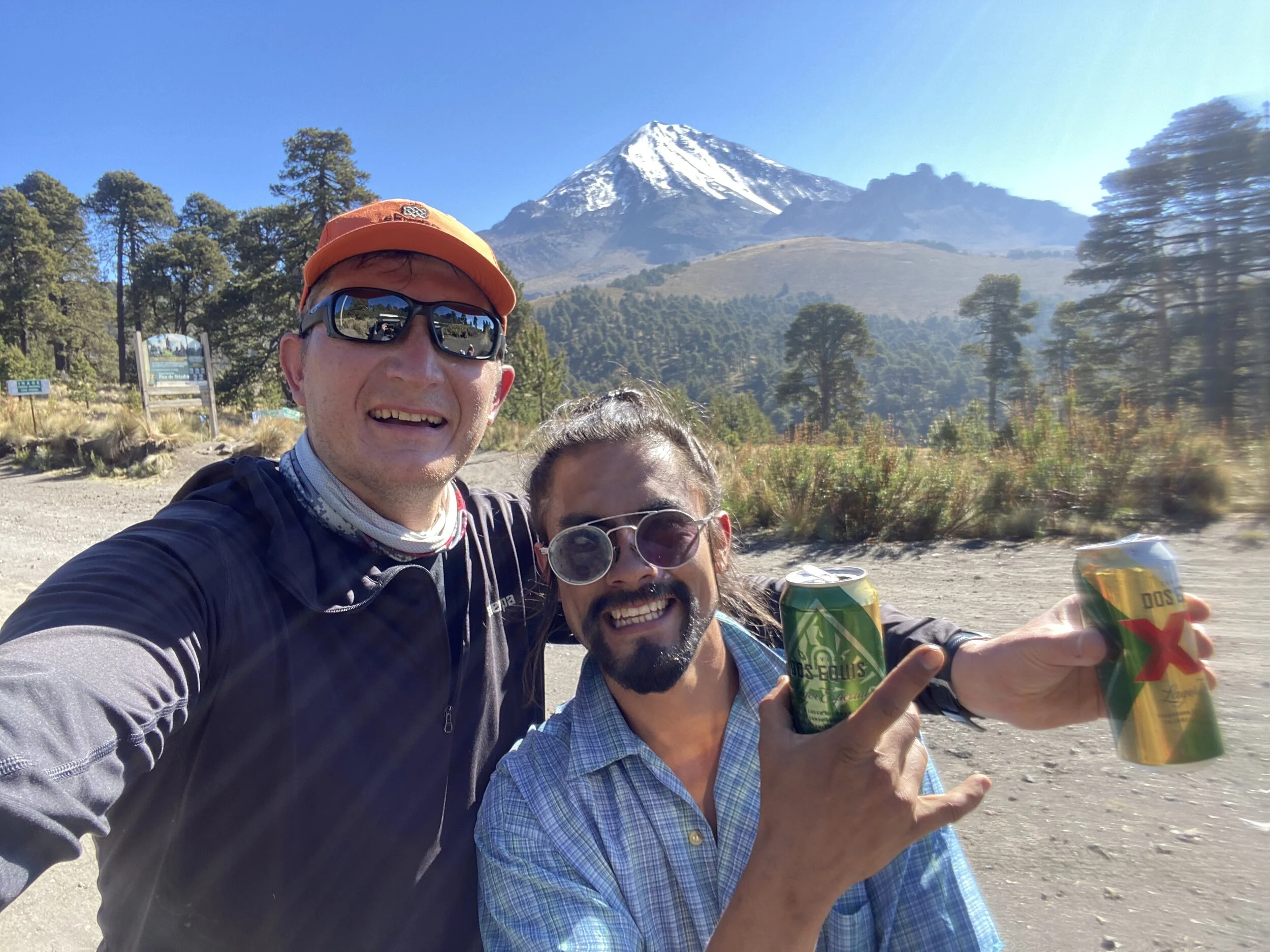
Celebratory beers at 10am.
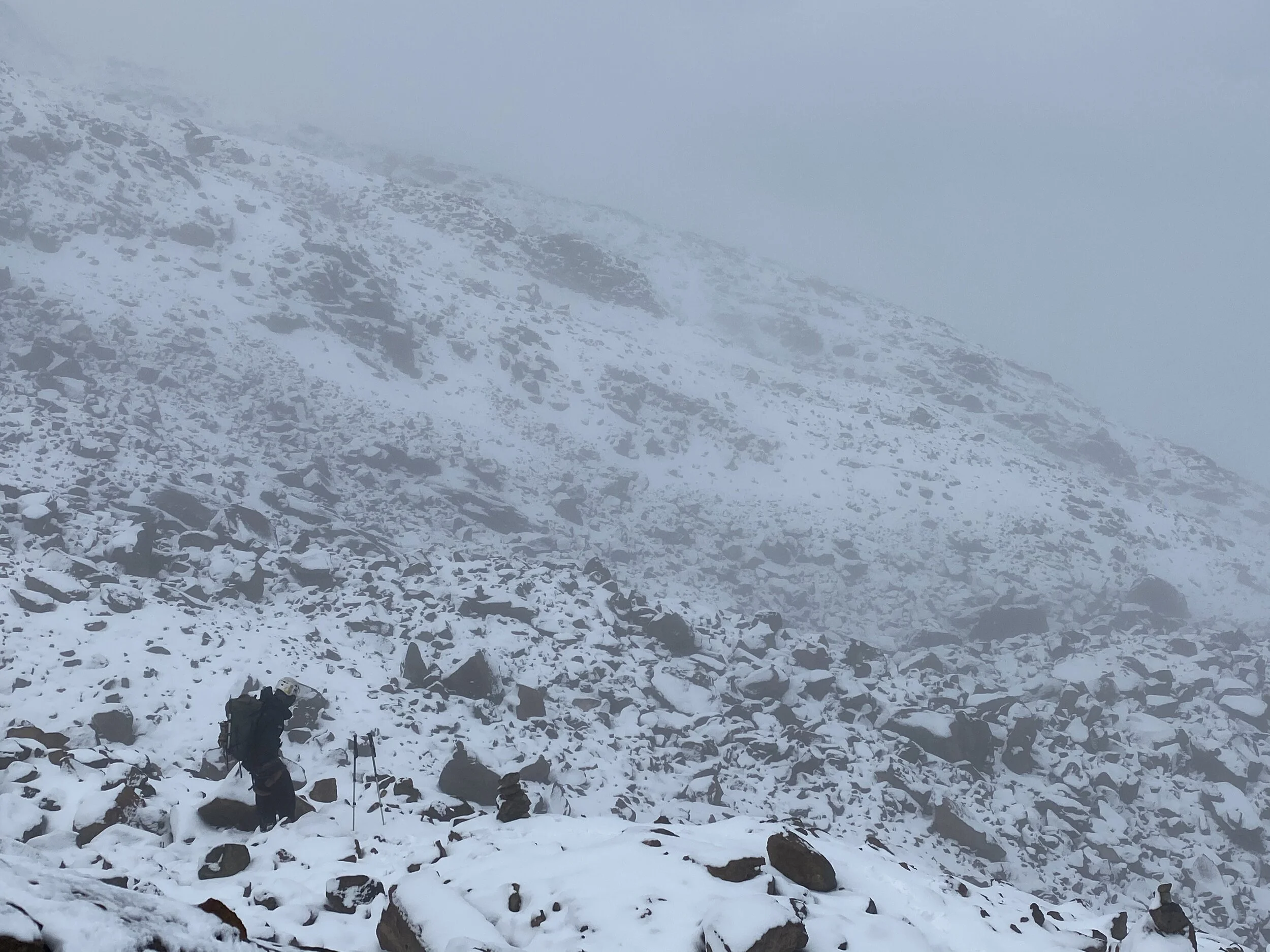
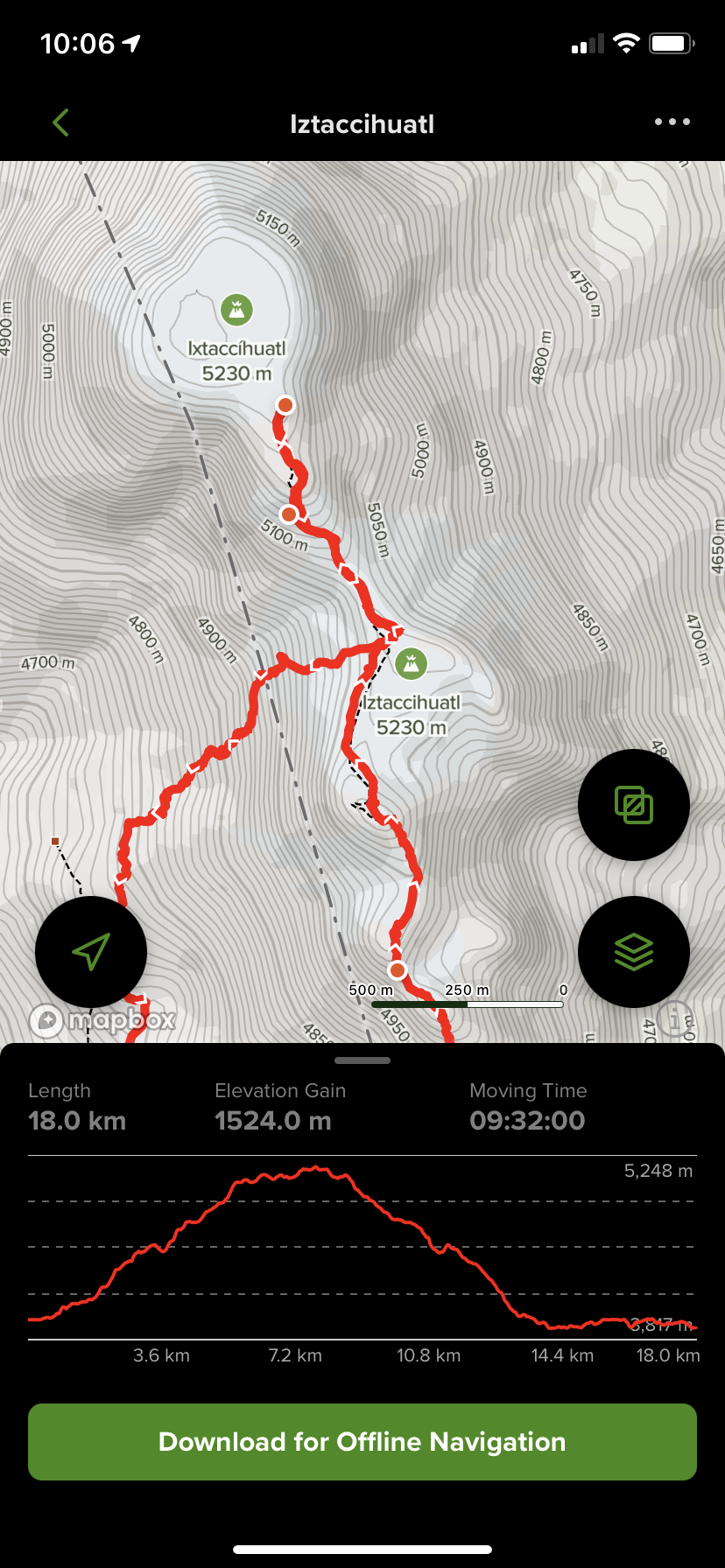
Our next objective was the volcano Iztaccihuatl. This is the base camp and the trail head called La Joya close to the Paso de Cortes. The route we followed is called La Arista del Sol (The Ridge of the Sun). We had an intense rain in the evening and the weather forecast called for a small window of clear weather in the early morning hours (at sunrise). We started at 1am and climbed all night to end up on the Knee at sunrise. We started out in the drizzle which morphed into blowing snow at 4500m. We took an hour break in the hut at 4800m to warm up although there was not much heat there but at least we were sheltered from the wind. We run into two other guys who decided not to proceed due to the amount snow accumulating on the higher slopes. While climbing in the dark, we were surrounded by intense lightning all around and then below us.
The basecamp
The Volcano of Iztaccihuatl. We traversed all the summits from right to left in order to get to the highest point.
In Aztec mythology, the volcanoes were once humans who were deeply in love. This legend features two star-crossed lovers, the young brave warrior Popocatepetl and the beautiful princess Iztaccihuatl. The father of Iztaccihuatl, a mighty ruler, placed a demanding condition upon Popocatepetl before he could take Iztaccihuatl as his bride. His mandate required that Popocatepetl first engage in battle against the tribe's enemy and return victorious. Variations of the legend include the added stipulation that Popocatepetl needed to return with the vanquished enemy's head as proof of his success.
The story continues with Popocatepetl setting off for battle with Iztaccihuatl waiting for her beloved's return. Treacherously, a rival of Popocatepetl's sends a false message back to the ruler that the warrior has been slain when in fact, Popocatepetl has won the battle and is ready to return to his Iztaccihuatl. However, the princess upon hearing the false news, falls ill and succumbs to her deep sorrow, dying of a broken heart. When Popocatepetl returns triumphant to his people only to encounter his beloved's death, his heartbreak is inconsolable.
He carries Iztaccihuatl's body to the mountains whereupon he has a funeral pyre built for both himself and his princess. Grief-stricken beyond measure, Popocatepetl dies next to his beloved. The Gods, touched by the lover's plight, turn the humans into mountains, so that they may finally be together. They remain so to this day with Popocatepetl residing over his princess Iztaccihuatl, while she lay asleep. On occasion, Popo will spew ash, reminding those watching that he is always in attendance, that he will never leave the side of his beloved Izta.
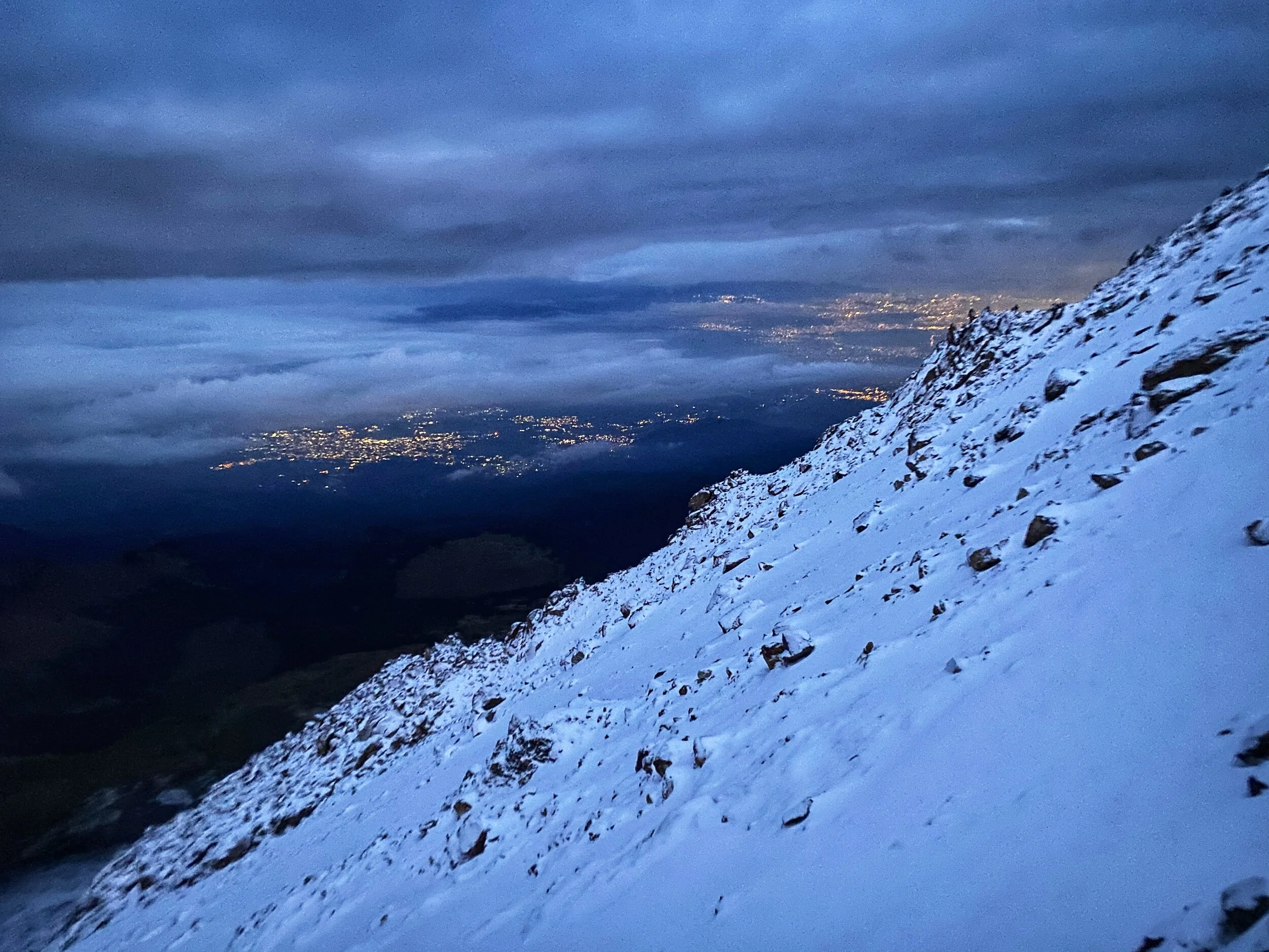
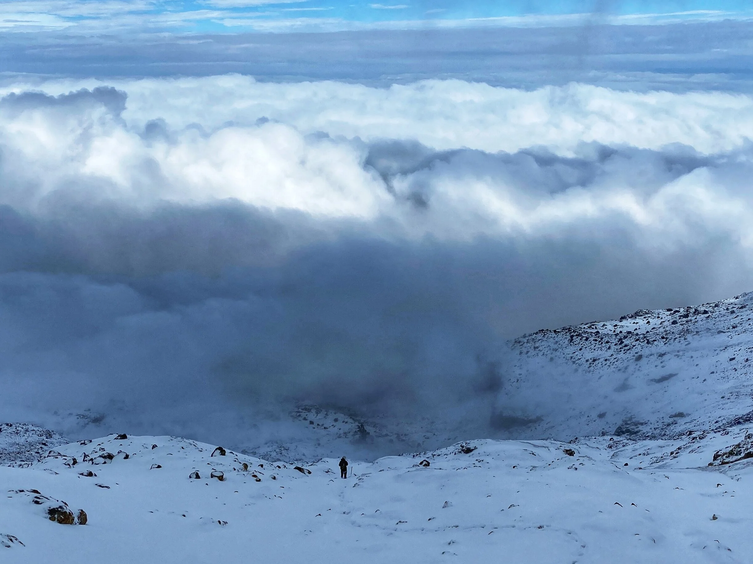
As we climbed higher, the lights of Mexico City spread below us. We had some heavy clouds and it did not look like we would get much of a view from the summit.
Approaching the knee at dawn. By now the cold of the night pushed the cloud cover down.
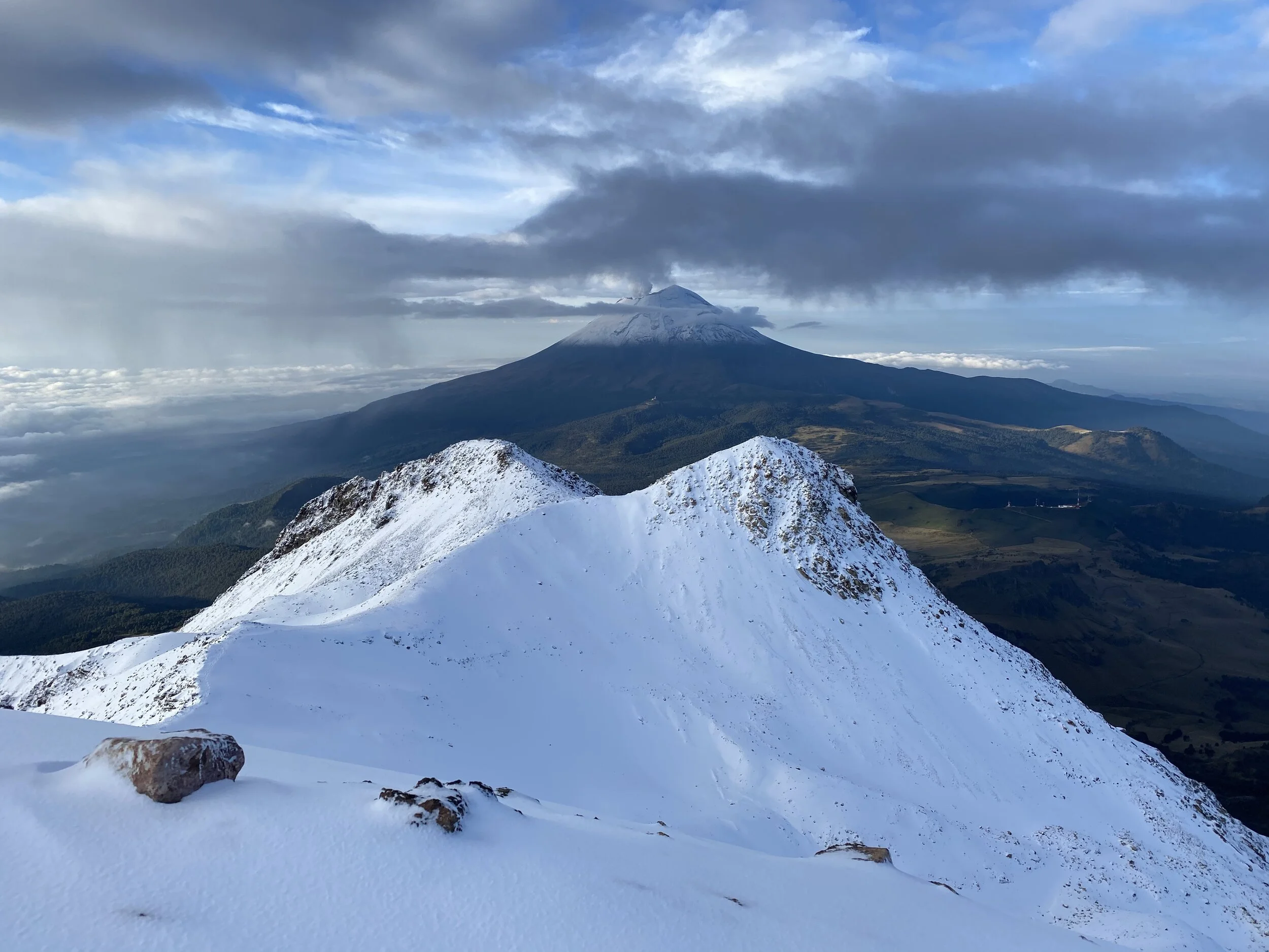
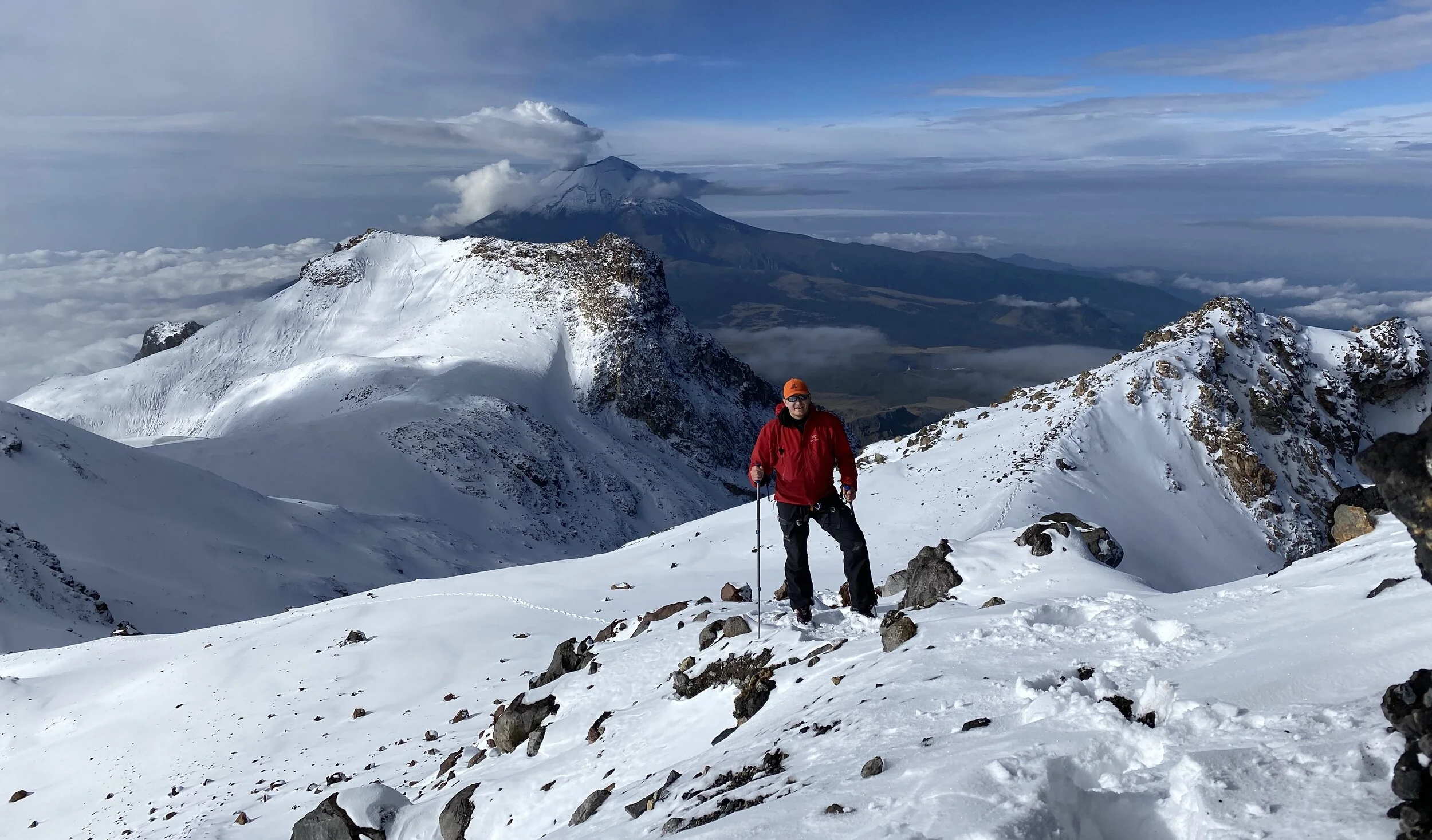
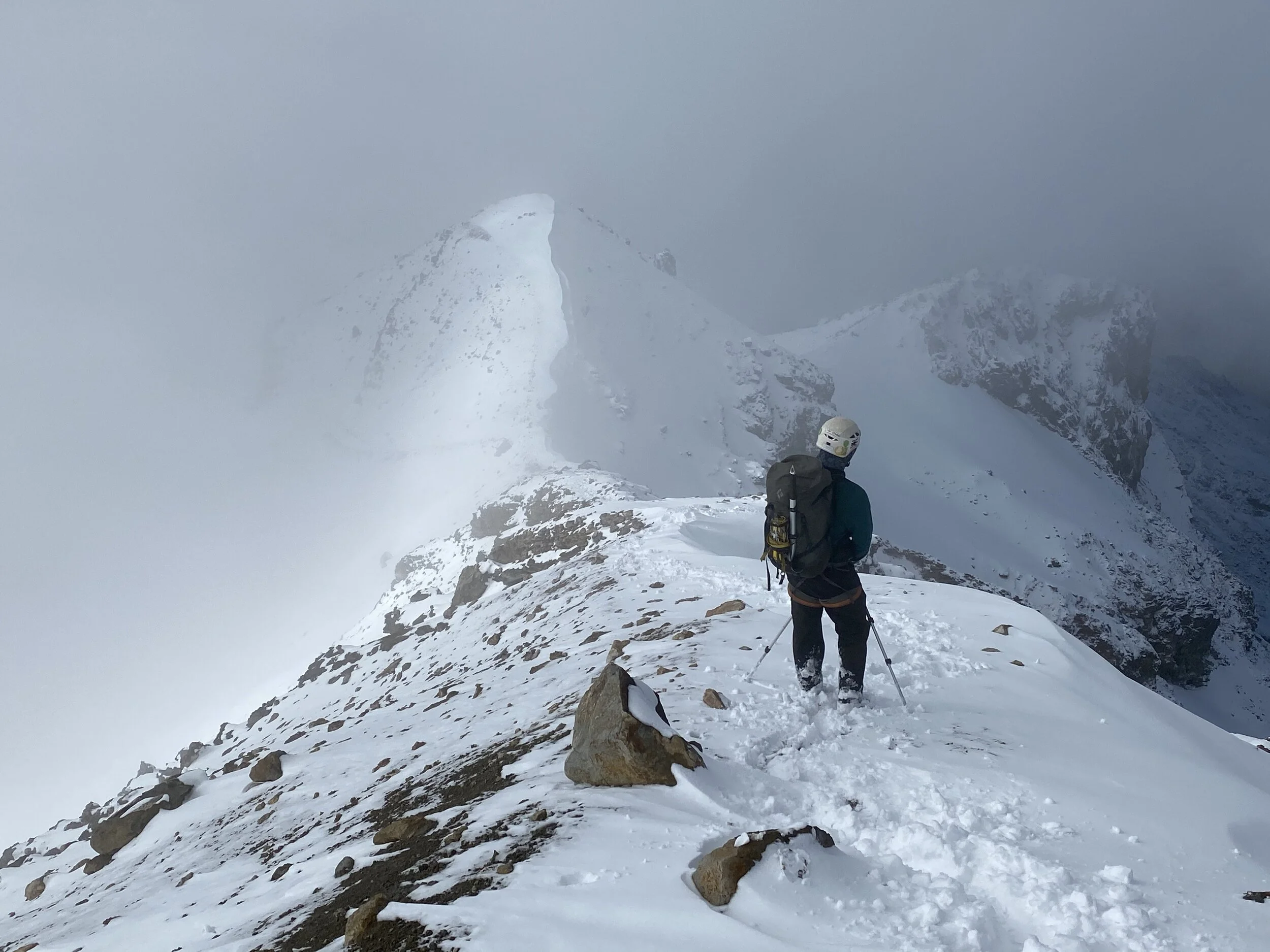
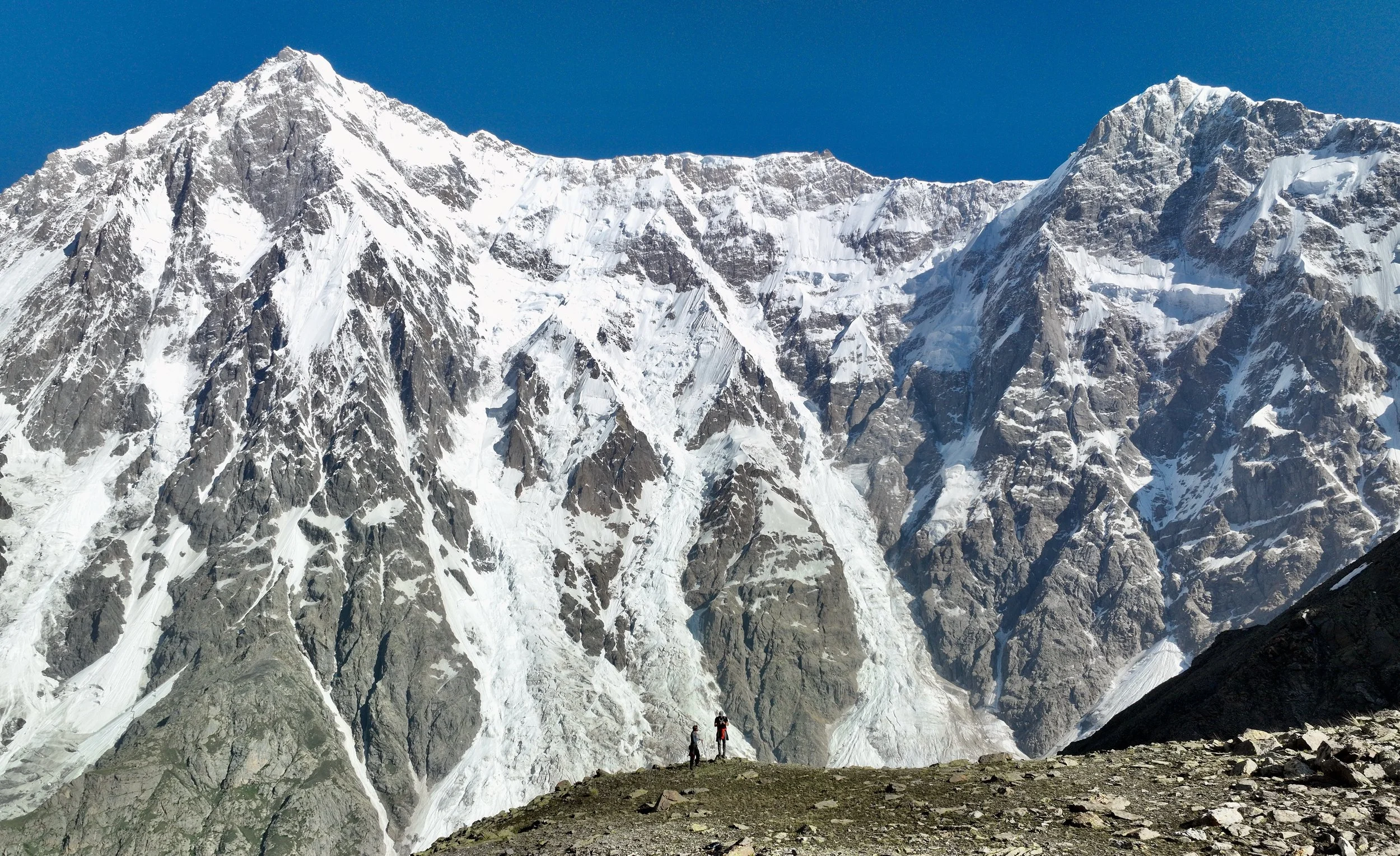
We finally reached the “Knee”, the first false summit of Izta, and the Popocatopetl Volcano appeared in all the glory. It is an active volcano and off limits for climbing or hiking.
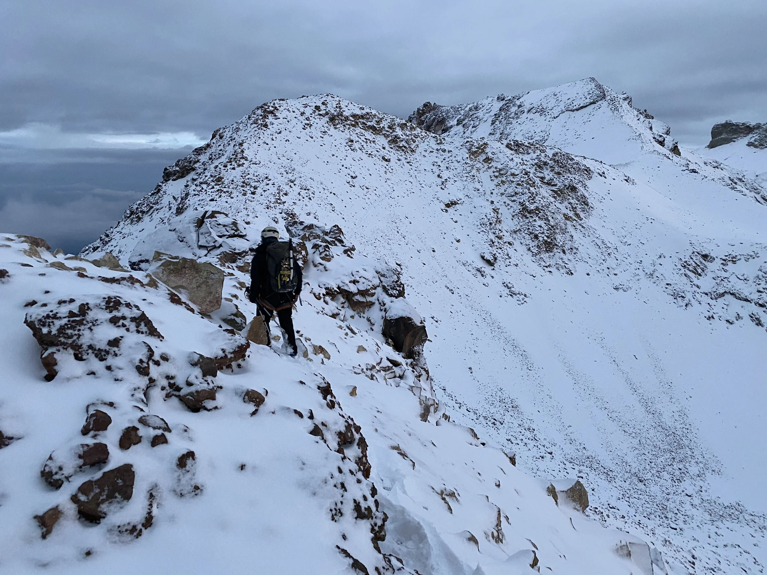
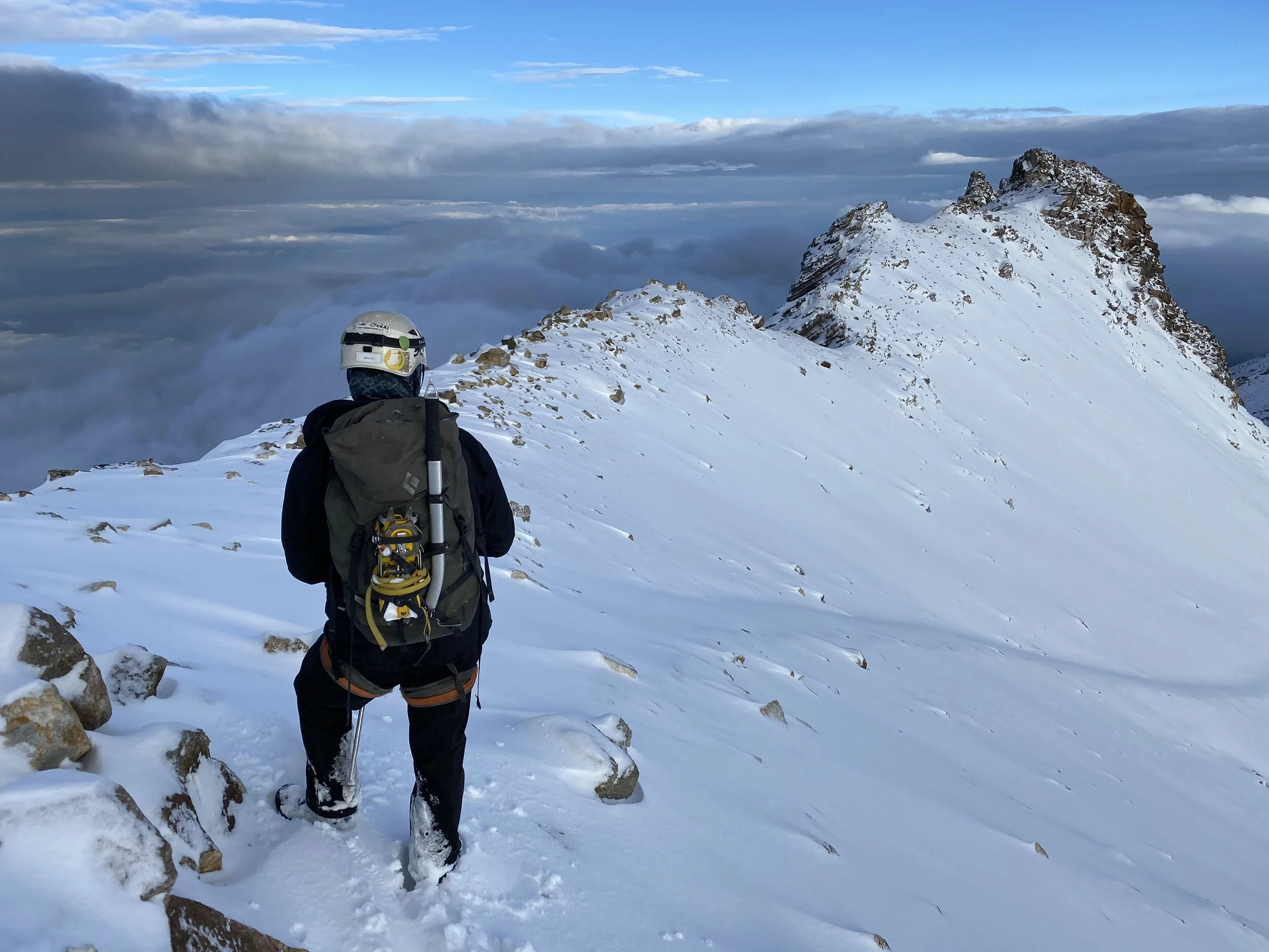
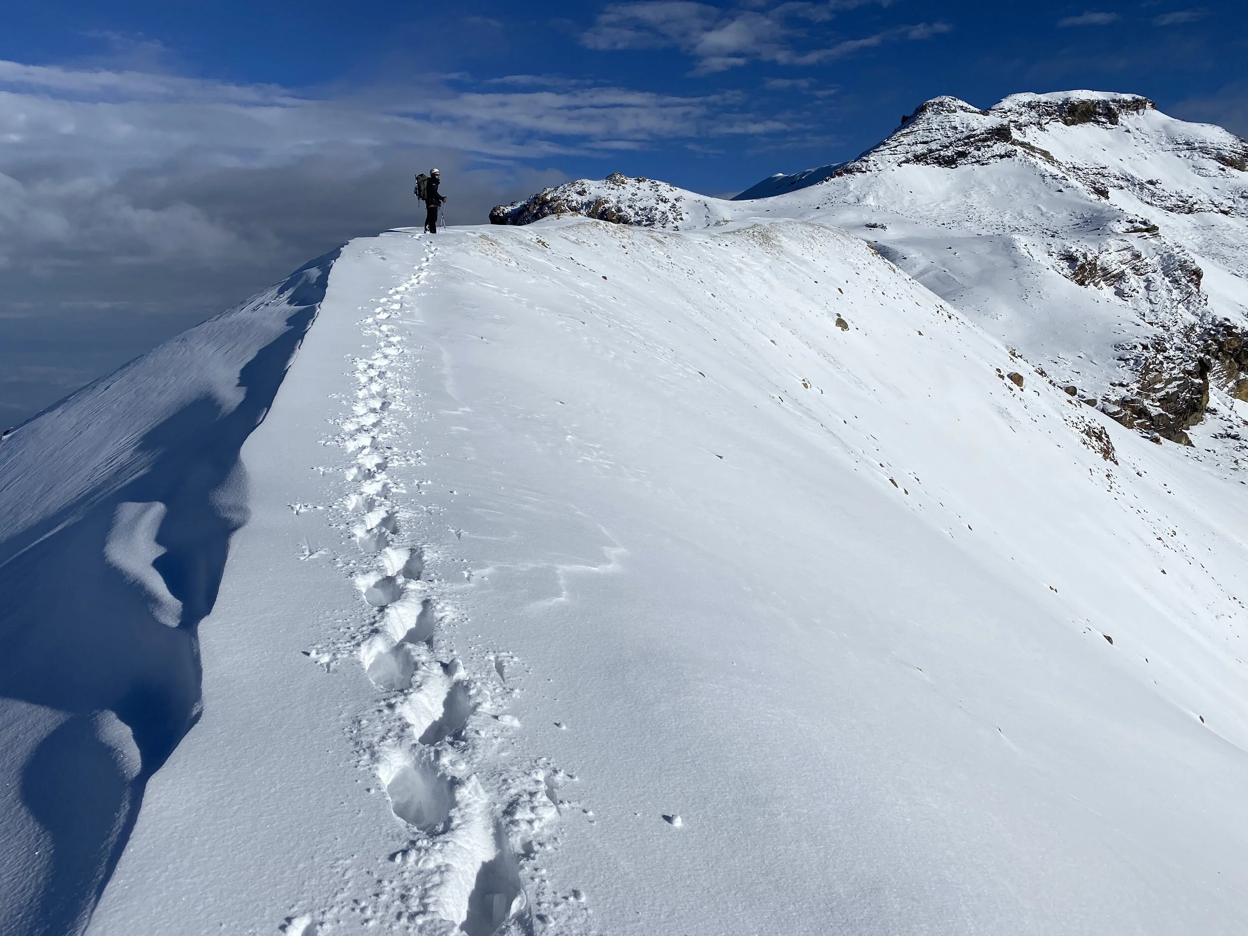
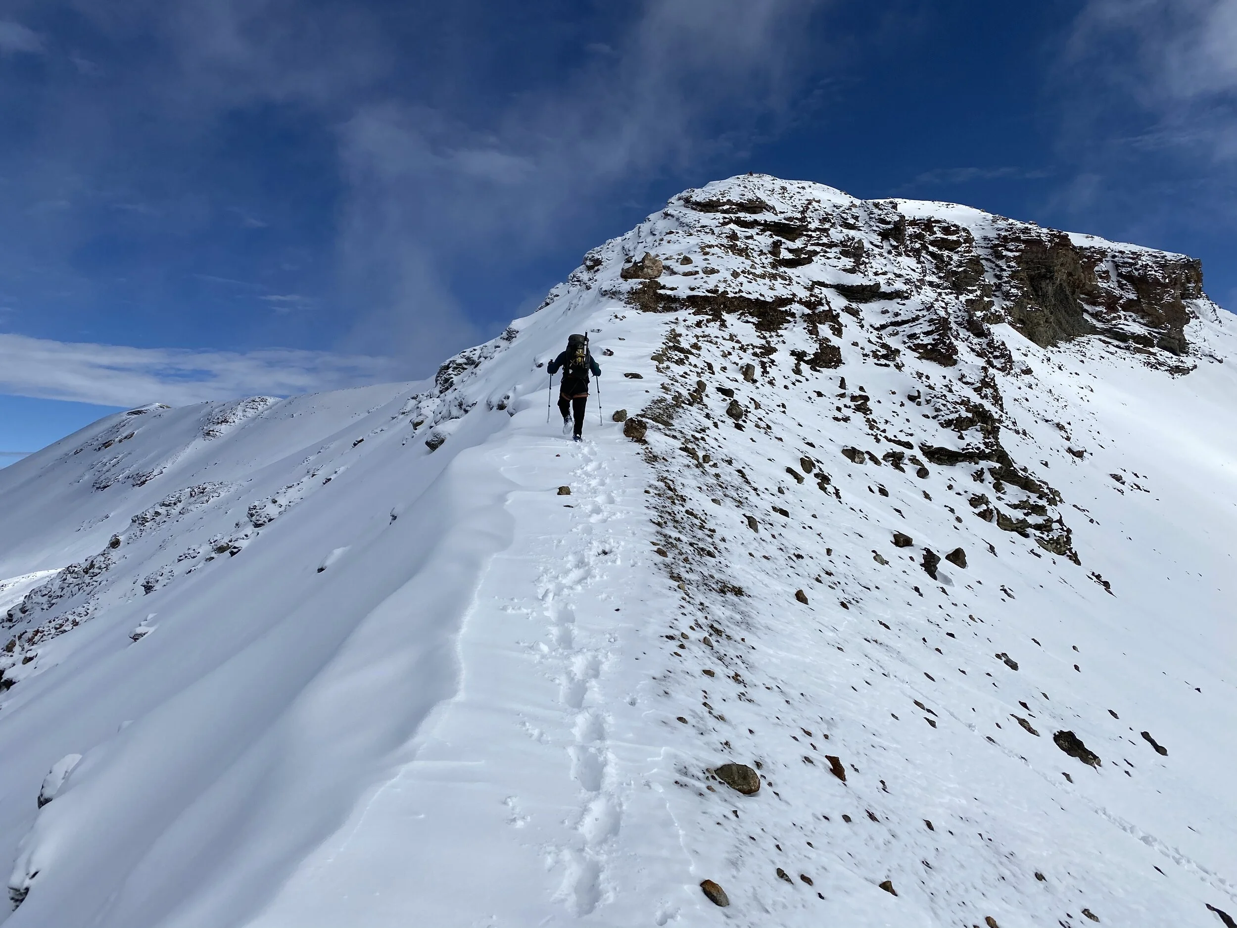
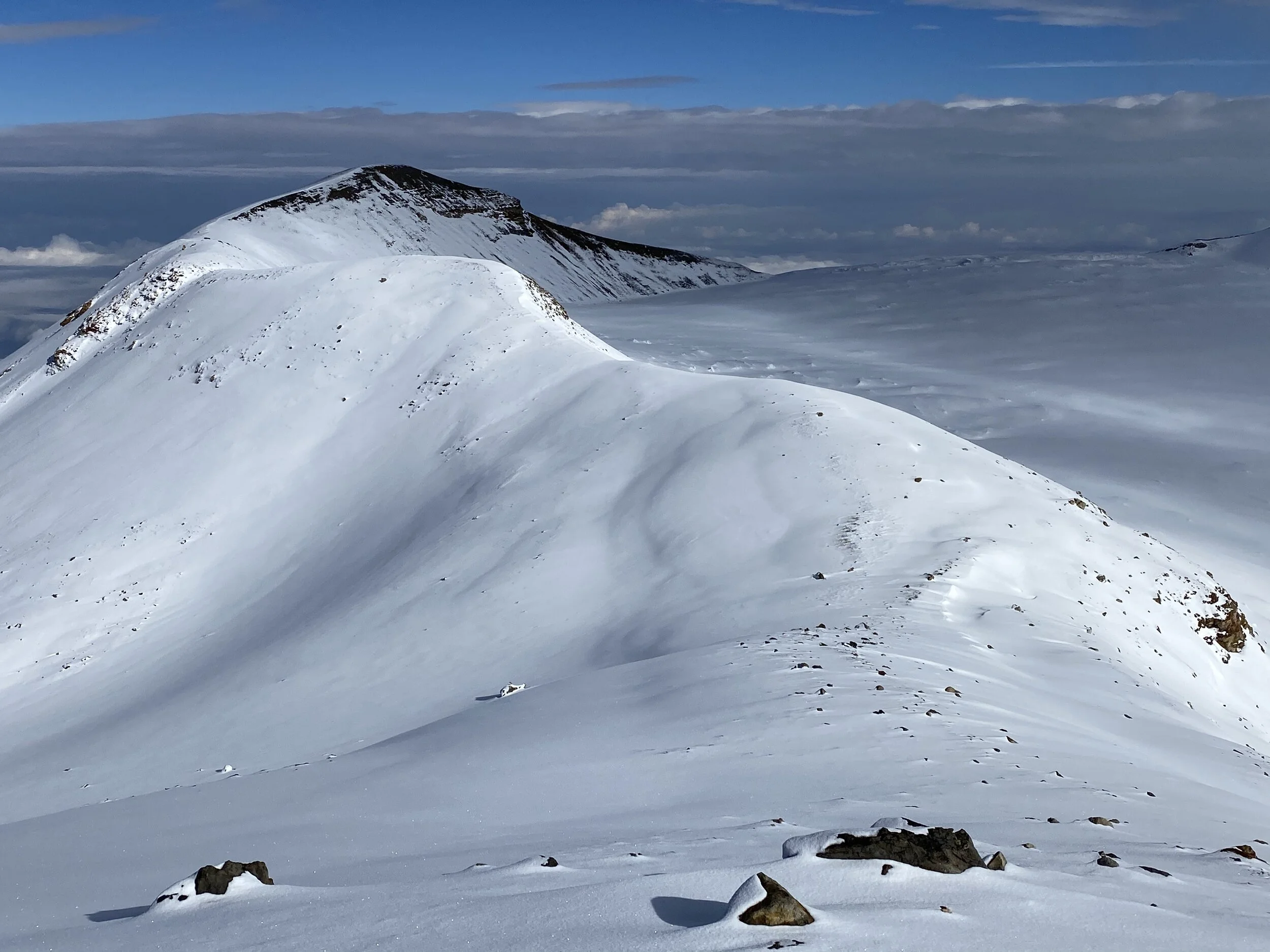
From the Knee, there are three more false summits to traverse before the true summit is reached. I underestimated the length of the summit ridge. It is all above 5000m and involves down climbing and reclaiming the false summits. The ridge is long and tiring.
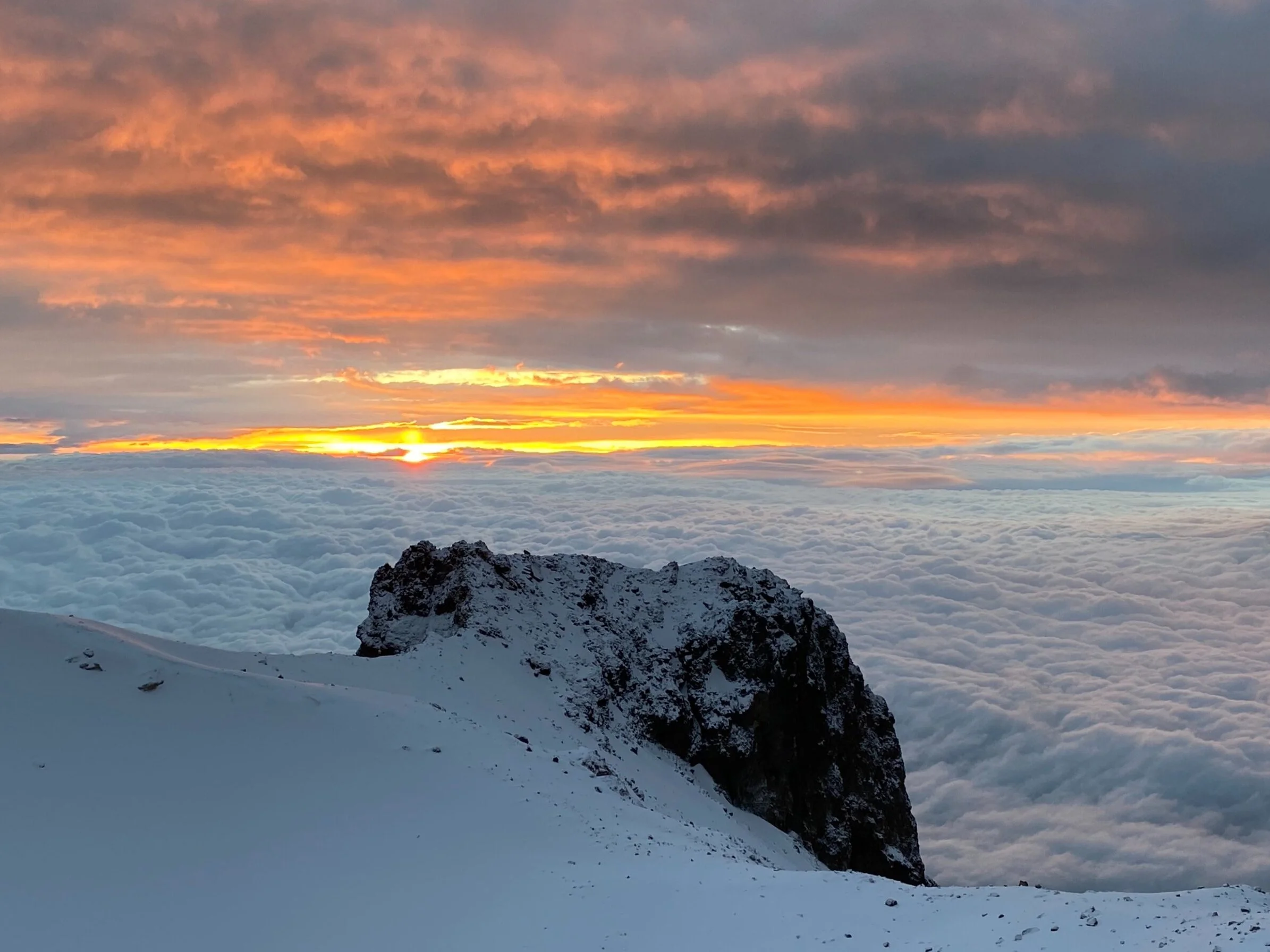
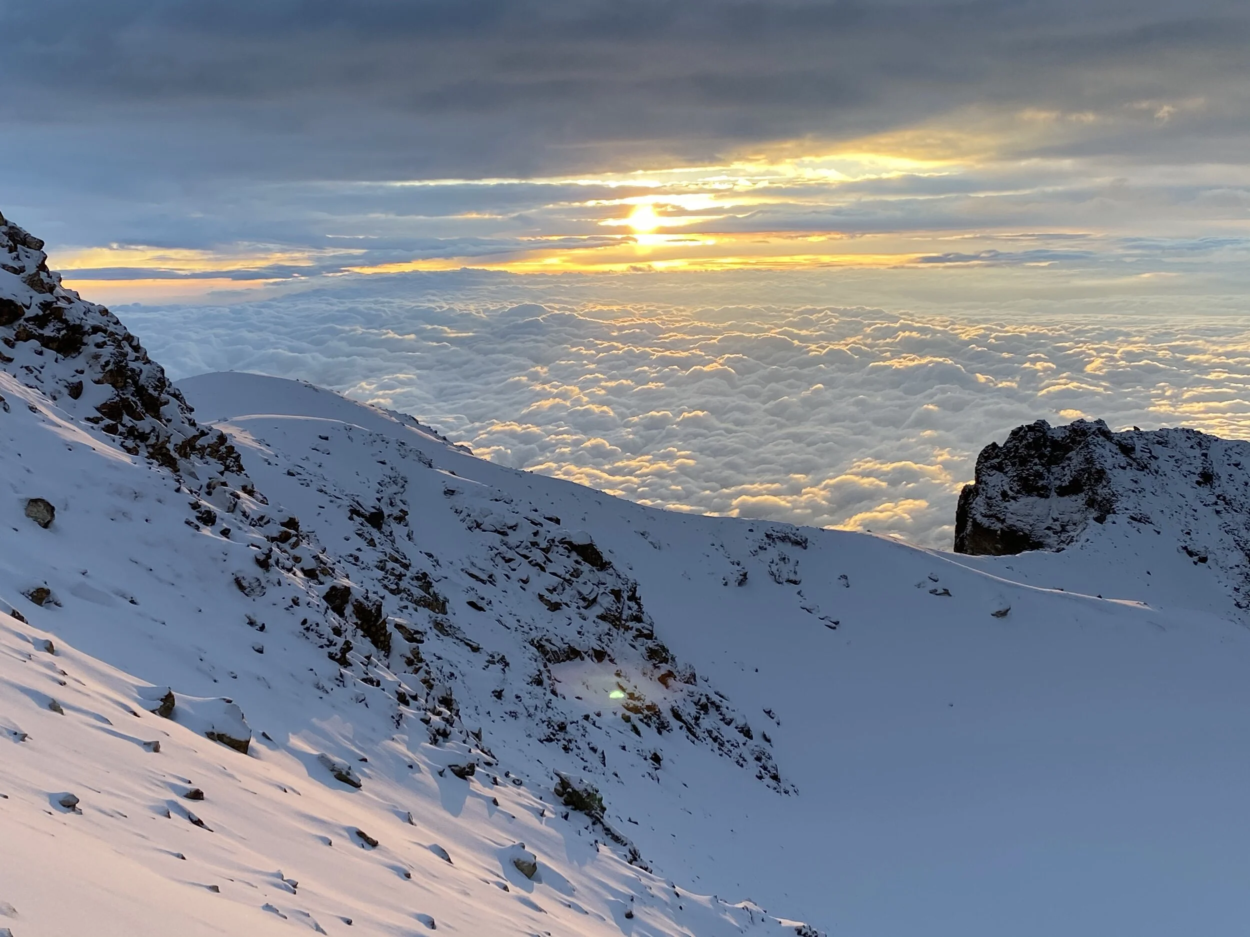
A spectacular sunrise from the Knee summit. It makes you forget the tiredness and the lack of O2.
El Popo and el Paso de Cortes at 3400m
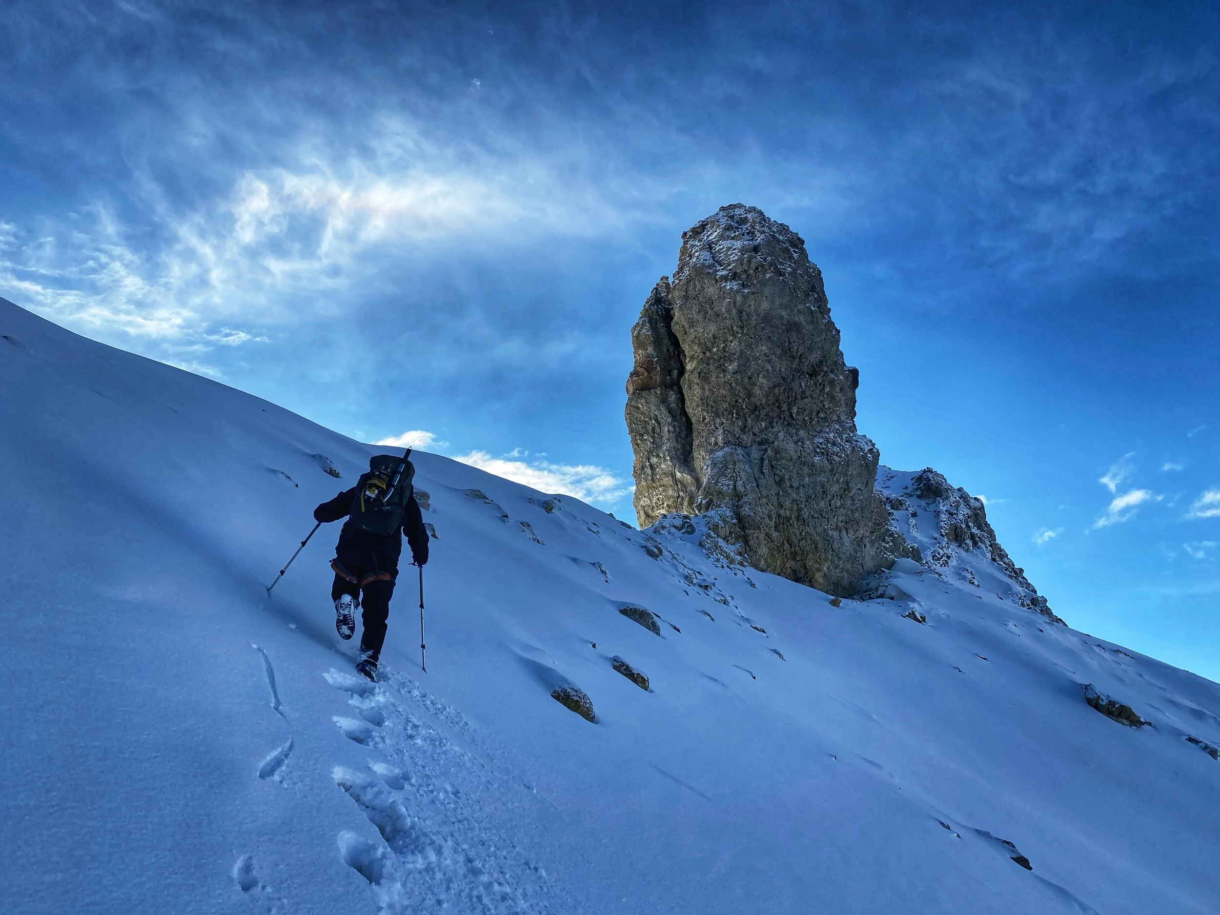
The beginning of the long traverse of the ridge to the summit
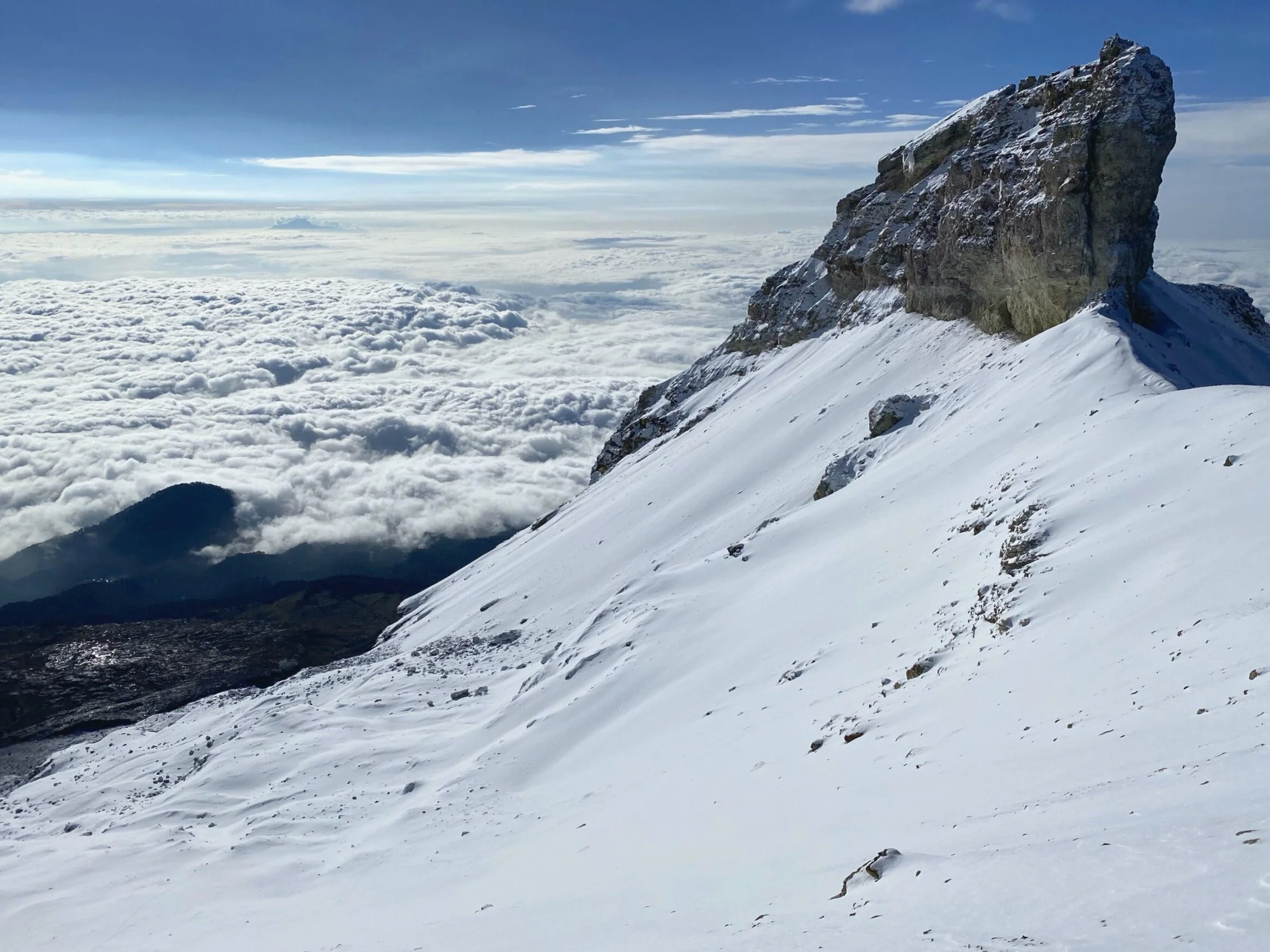
Views like this make it all worthwhile!
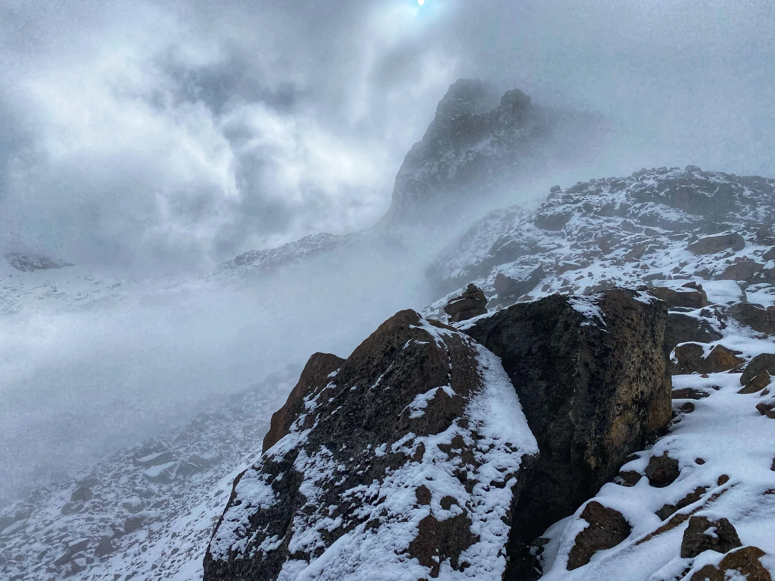
The true summit is not even visible from this point. We have to get behind the highest bulky summit on the left.
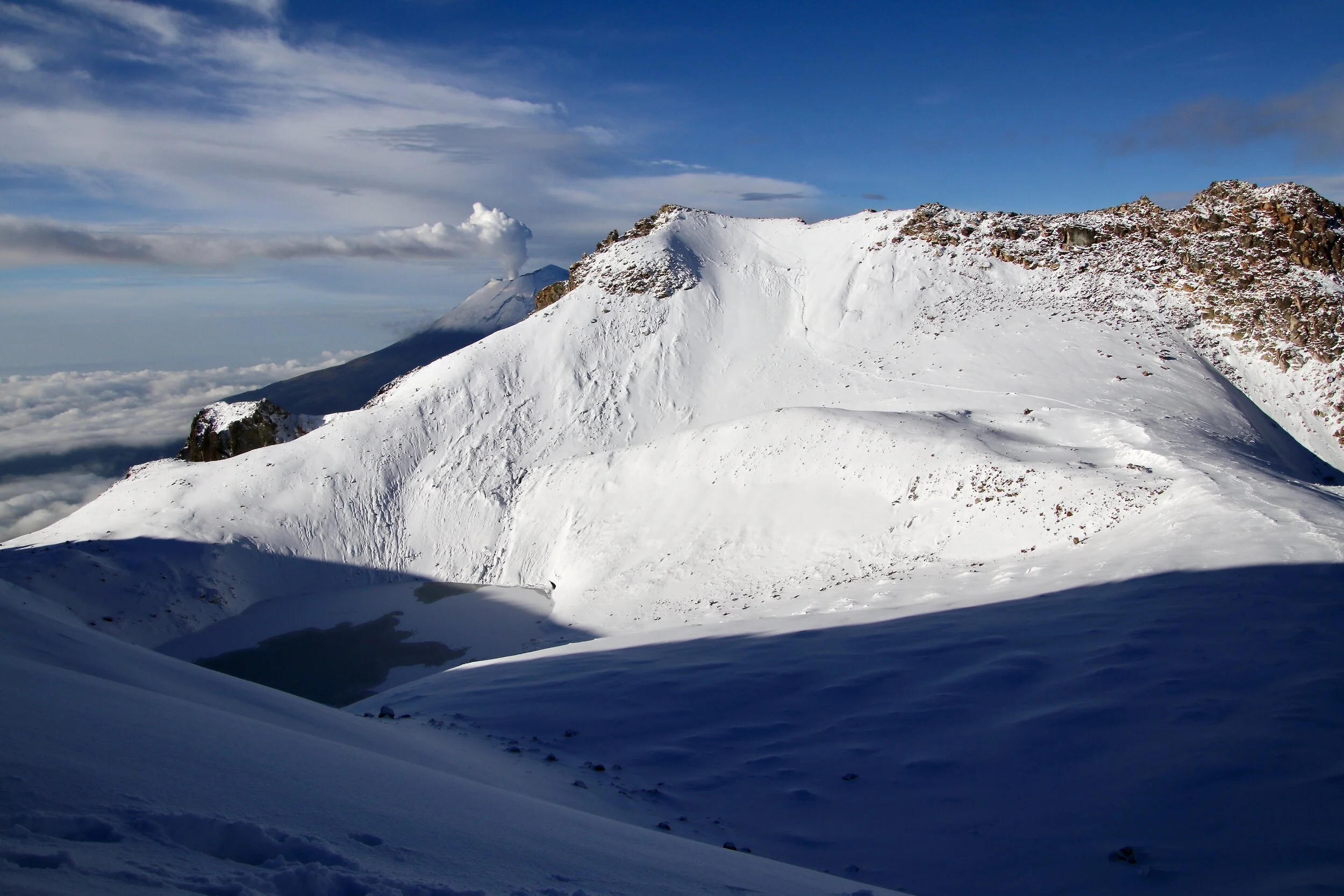
The clouds started to part and we could see the crater of the Popocatopetl Volcano.
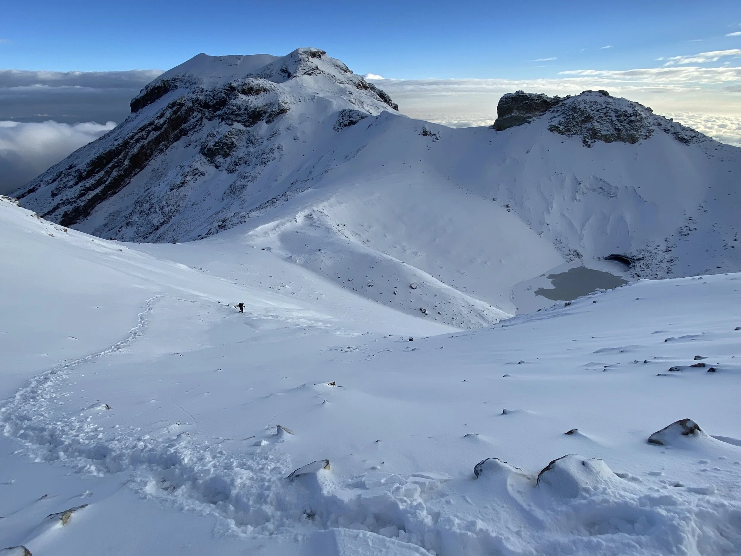
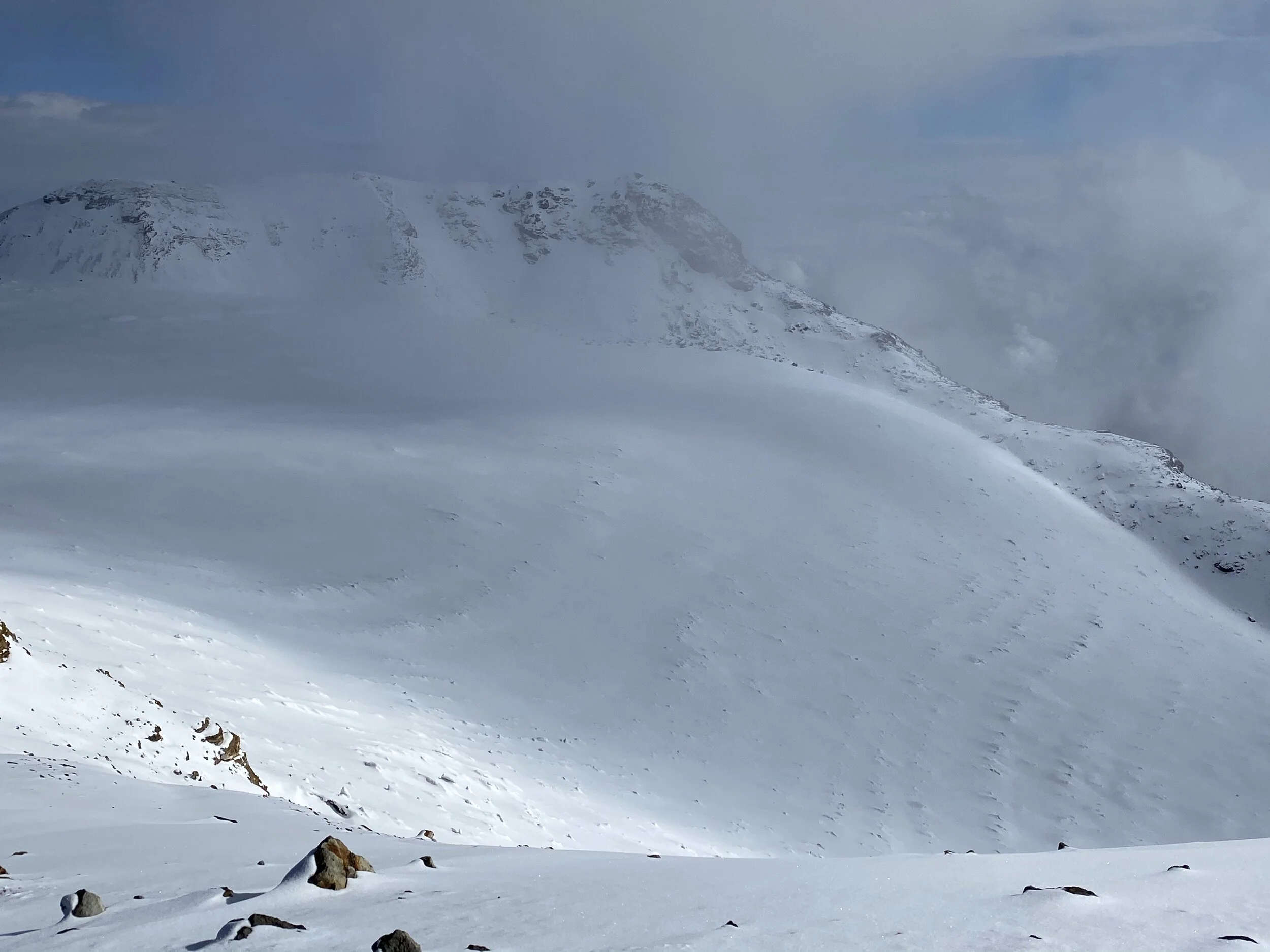
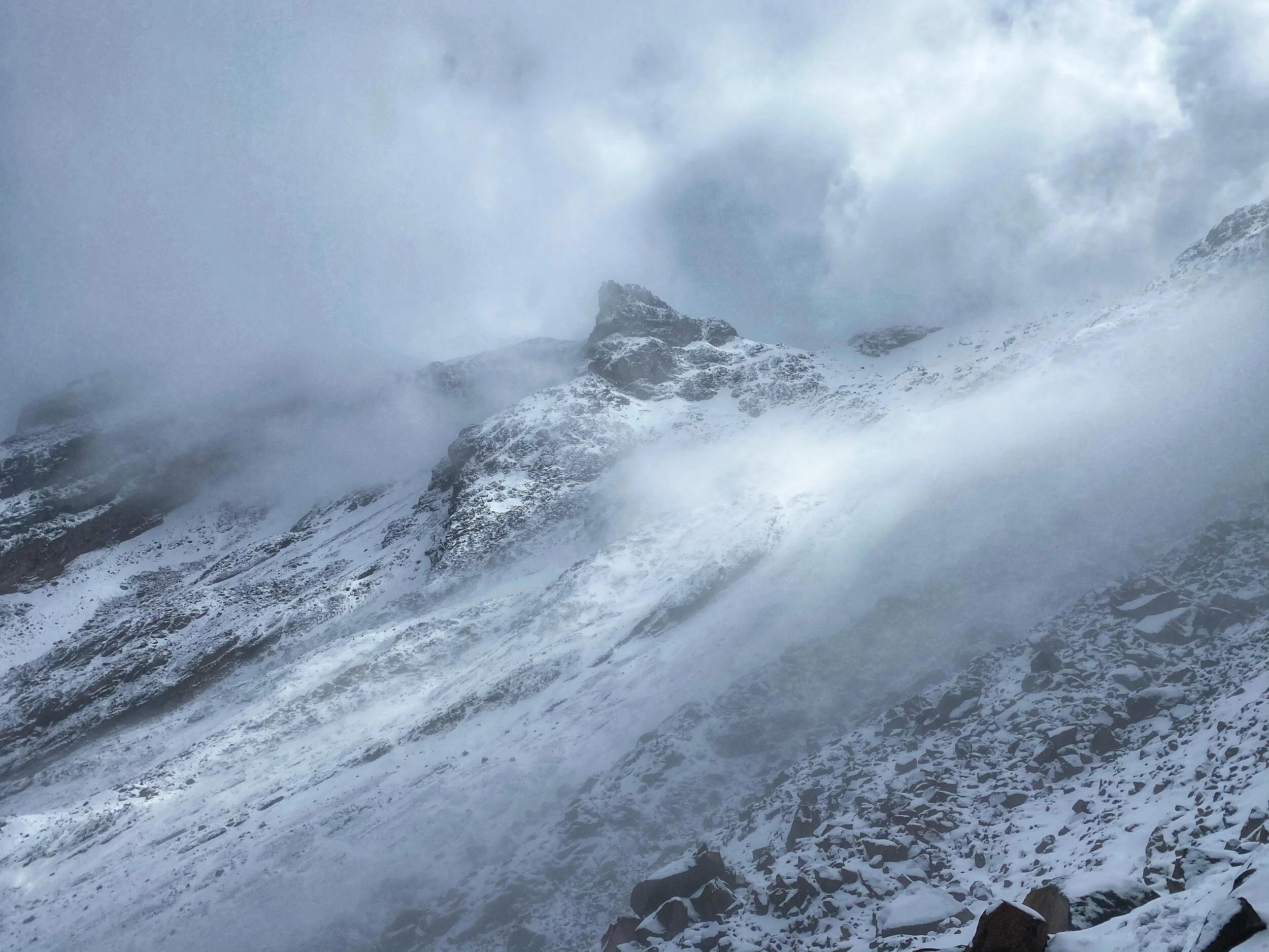
We have to traverse this basin that contains a glacier under the new snow. Then we have to re-climb the ridge on the horizon and traverse again to the main summit still not visible.
Looking back on the down climb and el Popo in the distance.
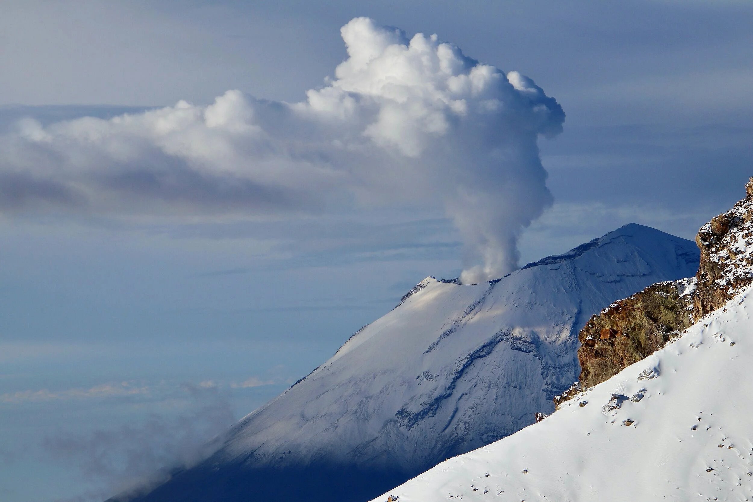
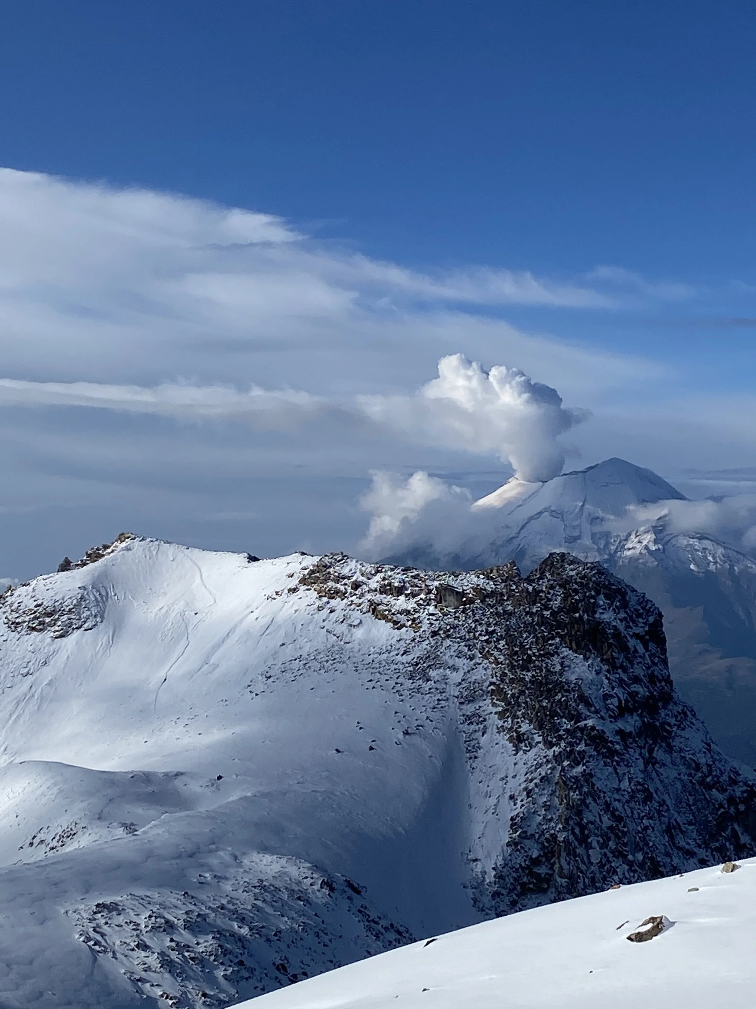
We were lucky to see the Popo in action. The volcano is very active and it had a large eruption in 2020.
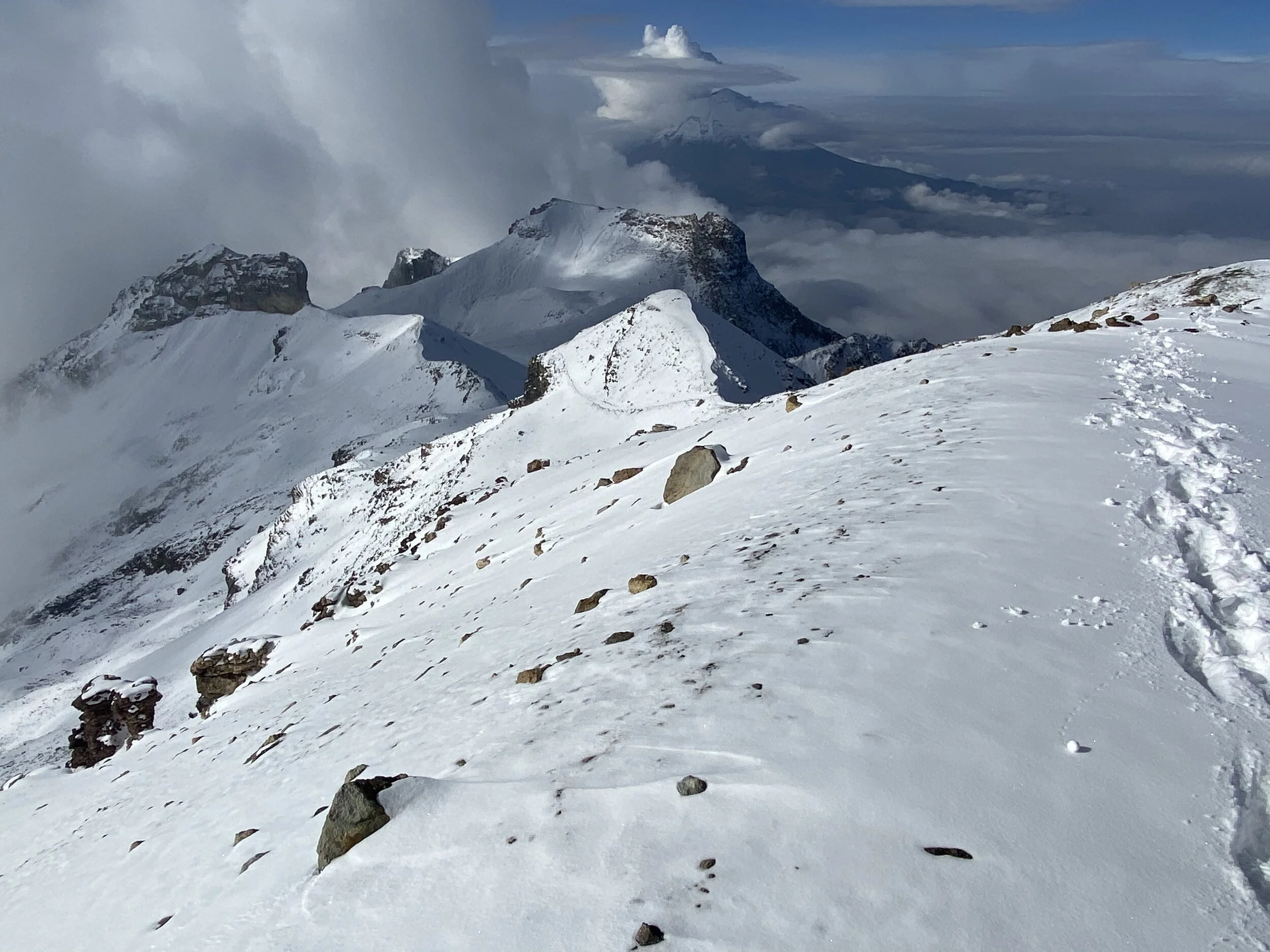
Pico de Orizaba can be seen on the horizon
Looking back to our route. Our descent route is down from the saddle between the two false summits in the middle of the photo.
Finally we are close to the summit. I dropped my pack for the final stretch.
You can see our trail in the snow.
The false summits are now below us. Nearing the true summit.
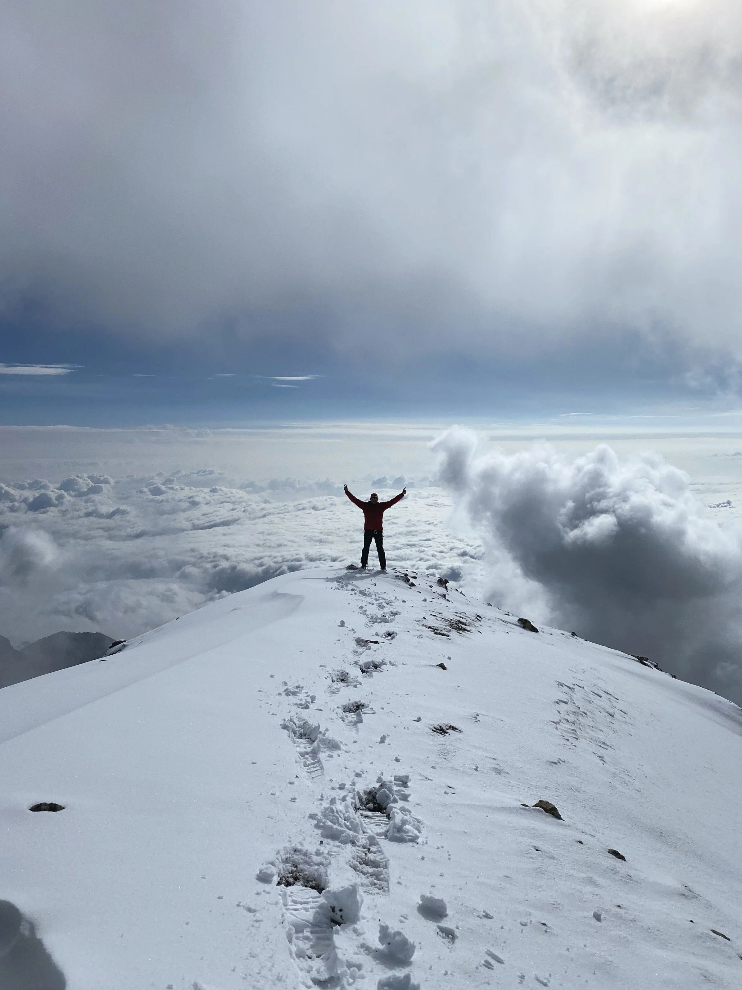
Finally the true summit of the mountain! I was happy to be there and we were rewarded with a spectacular view for about 30min. Then the clouds rolled in and obscured the view completely. We descended in a fog. The twin of the main summit can be seen on the left. It has the same elevation.
Our entire route from the summit. The “Knee” is now the lowest pointy rock far below. We traversed the entire ridge and it was long! I guess once you know how long it is you can mentally prepare. No knowing, it seemed as the ridge would never end!
The summit of Izta. We were very lucky with the weather window and the views.
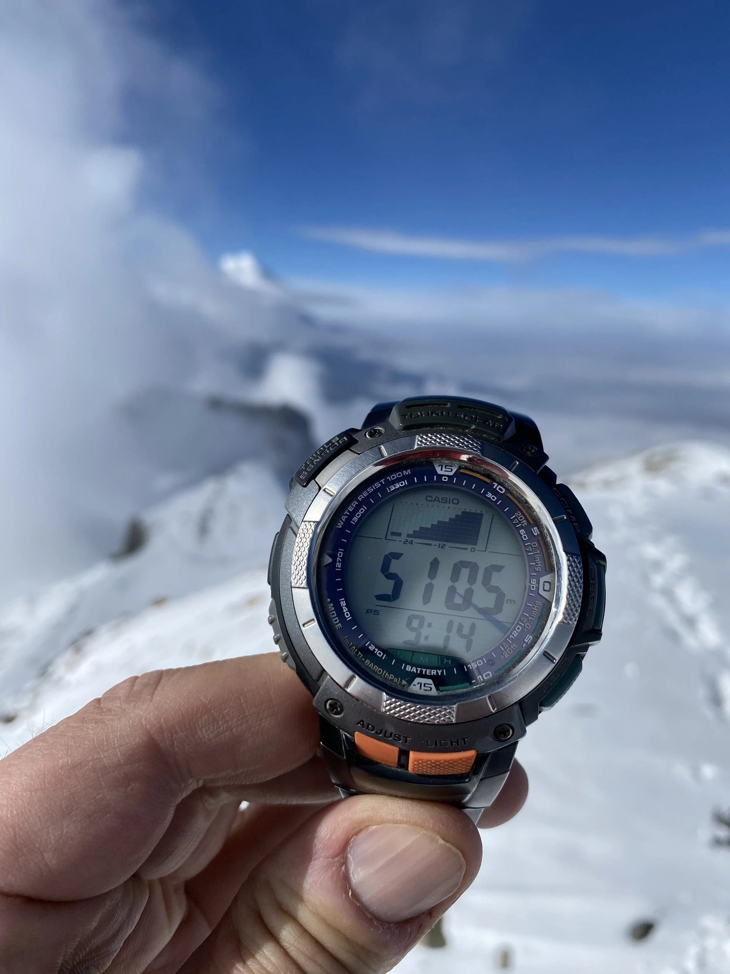
The summit elevation, but add another 180m (my watch is not calibrated). The true summit is at 5,286m or 17,343ft. It took us 8hr to get here (with an 1 hr break at the hut).
The twin summit and another traverse. We were the only two persons on the entire mountain!
The crater of Izta Volcano
The start of our descend into the cloud.
We dropped into the clouds. Mesh, my guide, knows the mountain well and decided to return via a shorter but steeper route.
Looking back at the slope of our descend. The walking was over the field of loose rocks covered in fresh snow and ice. No trail. One had to be careful with each step.
Looking back at the descend slope. There is a glacier up there in the mist.
Our fun descend
This is the entire ridge of Izta from the valley below. You can see how long it is. We started on the left and the summit is on the right.
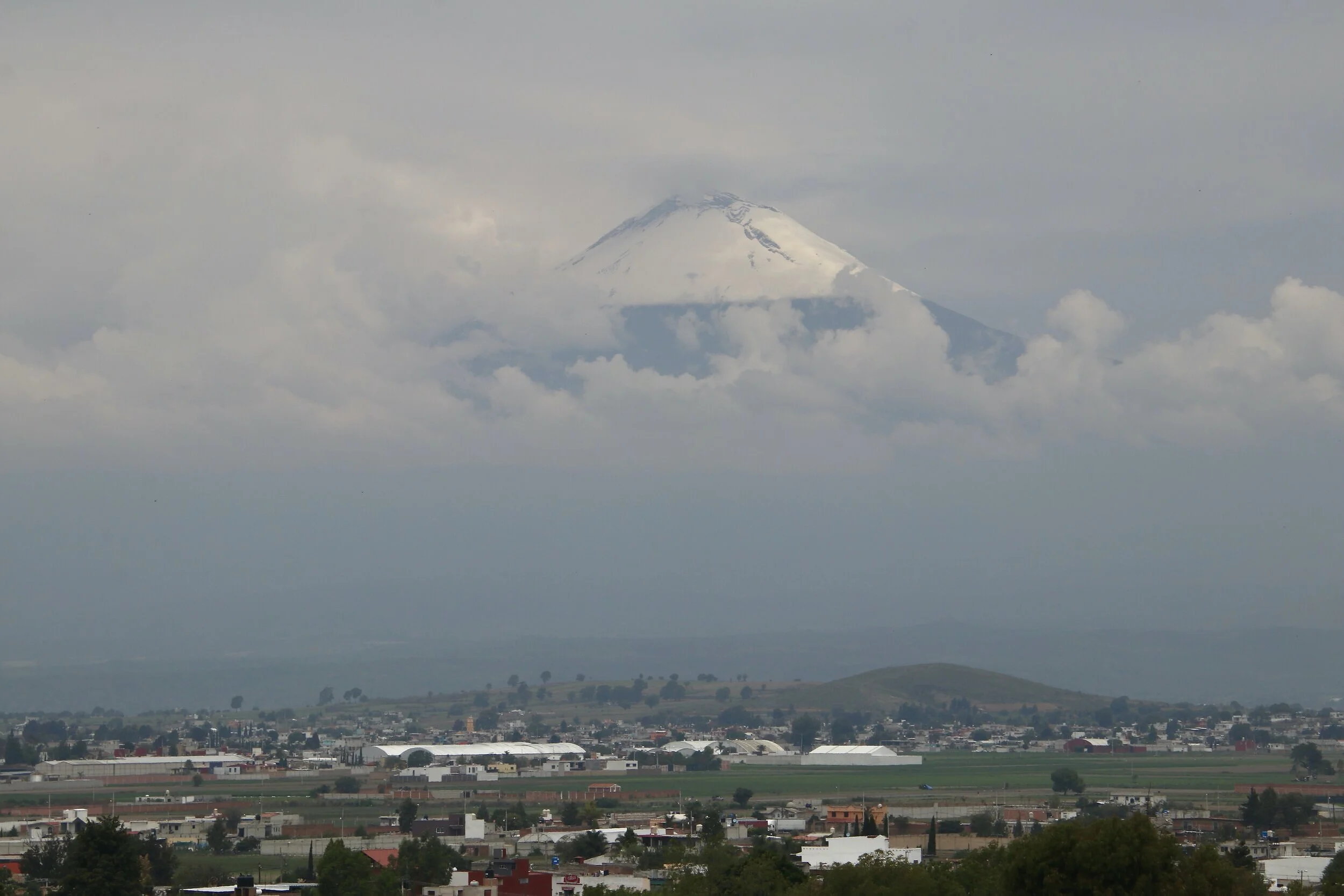
Popocatopetl towering above the villages and the valley.
Join the discussion
Share thoughts, tips, or questions about this trip.
Please keep it kind and relevant.
All Trips and Adventures by Year
A chronological archive of trip reports, photo essays, and route notes across decades.
2026
2025
2024
- Mon - Bhutan
- Bhutan - Snowman Trek Part 1
- Bhutan - Snowman Trek Part 2
- Bhutan - Snowman Trek Part 3
- North of 60º - Polar Adventures
- East Greenland 66º North
- On the Trail of Teutonic Order Castles in Northern Poland
- Wolfsschanze Hitler's HQ, Ketrzyn Poland and Peenemunde WW2 V1/V2 Research Centre in North Germany
- Central Mexico - Mexico City, Puebla and Teotihuacan
- Venezuela - Orinoco River Delta
- Venezuela - Mount Roraima Trek 2810m
- Venezuela - Angel Falls
2023
2022
- Nepal Solukhumbu - Sumna Pass and Lobuche East trip summary
- Nepal Khumbu and Kangchendzonga from the Air
- Nepal Solukhumbu Sundar Peak 5000m and Sumna Pass 5400m
- Nepal Solukhumbu Chola Pass 5450m Lobuche East Ridge 6090m
- Renjola La 5360m Gokyo Ri 5450m, and Cho Oyu BC Photos
- Iceland - Hellismannaleid, Laugavegur and Fimmvorduhals Trails
- The Yukon and the Alaska Highway
- Mount Robson
- Yellowstone National Park
- Grand Teton and Glacier National Parks
2021
- The Rockies of Alberta, Western BC and the Yukon
- Columbia Icefield from the Air
- Waterton Lakes National Park
- Colombia
- Los Nevados National Park Colombia
- Colombia Tayrona National Park
- Colombia Teyuna - Ciudad Perdida Trek (The Lost City)
- Mexico Pico de Orizaba 5,630m
- Mexico - Sierra Negra 4,650m and Izaccihuatl 5,350m
- Chitwan National Park Nepal
2020
2019
- The Grand Mustang Circuit - Part 1: Chame to Kagbeni via Thorong La Pass
- The Grand Mustang Circuit - Part 2: Kagbeni to Lo Mantang
- The Grand Mustang Circuit - Part 3: Lo Mantang to TeriLa Pass
- The Grand Mustang Circuit - Part 4: Terila Pass to Chame via Naar and Kangla Pass
- Kamchatka Trip Report
- Камча́тка, Russia - The Mutnowski and Gorely Volcanoes
- Камча́тка, Russia - The Tolbachik Volcano Circuit and Volcano Bezimienny
- Russia Far East - Sakhalin, Vladivostok, Petropawlowsk-Kamchatsky
- Taiwan
- Ancohuma 6,427M Bolivia
- Huayna Potosi 6,088m Bolivia
- Ausangate Trek Peru
- Yellowstone National Park in Winter 2019
2018
- Calgary Mountain Film Festival
- Langtang, Tilman Pass and Ganjala Trip Report
- Langtang Trek - Tilman Pass
- Langtang Trek - Ganjala Pass
- Paria River Wilderness - USA, Utah
- Slot Canyons - USA, Arizona
- Bryce National Park - USA, Utah
- Zion National Park and Cedar Breaks - USA, Utah
- Norway
- Poland - The Slav and Viking Festival in Wolin
- Iceland
- Bolivia Cordillera Real and Sajama National Park
- Bolivia - Tiwanaku and La Paz
- Togo and Benin
- Benin - Egungun Masquerade
- Benin - Voodoo Festival
- Ghana - The Gold Coast and the Land of the Ashanti
2017
- Annapurna Basecamp and Annapurna Sanctuary Photos
- Annapurna Sanctuary Trip Summary
- Dhaulagiri Basecamp Trek, Dhampus Pass - Trip Summary
- Dhaulagiri Circuit Photos - Nepal
- Peru Central - Huaraz, Cordillera Blanca and Chavin de Hauntar
- Peru South, Sacred Valley - the Land of the Incas, Rainbow Mountain and Lima
- Mt. Brazeau and Maligne Lake in Jasper National Park in Alberta, Canada
- China Shanghai Beijing Wuhan
- Papua New Guinea
2016
- China Far West - Kashgar and Shiphton Arch
- China Far West - Pamir and The Tajik Games
- K2 Basecamp North, Shaksgam Valley Trip Summary
- Chinese K2 (BC North), Shaksgam Valley - Chinese Karakoram
- North Peru Chachapoyas Trip Report
- Peru North - Kuelap, Chachapoyas and Royal Tombs of Sipan
- Wapta Icefiled Area, Alberta, Canada
- The Caribbean and the Panama Canal
- China Far West - Ancient Silk Road Trip Summary
- China Far West - Ancient Silk Road
2015
2014
2013
2012
2011
2010
2009
2008
2007
2006
2004
2002
2001
1996
Get new trip reports when they land
One email when a new story is published. No noise. Just the trail.