
The Grand Mustang Circuit - Part 1: Chame to Kagbeni via Thorong La Pass
November 23, 2019
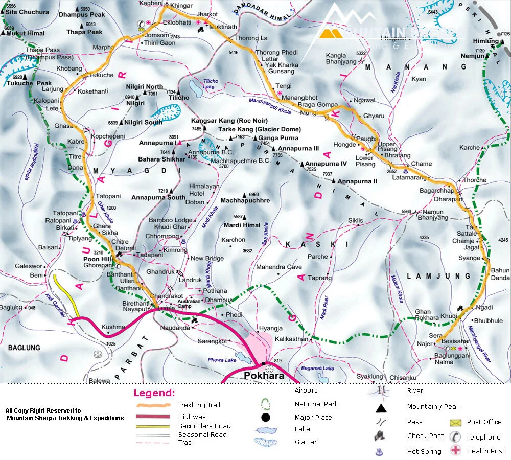
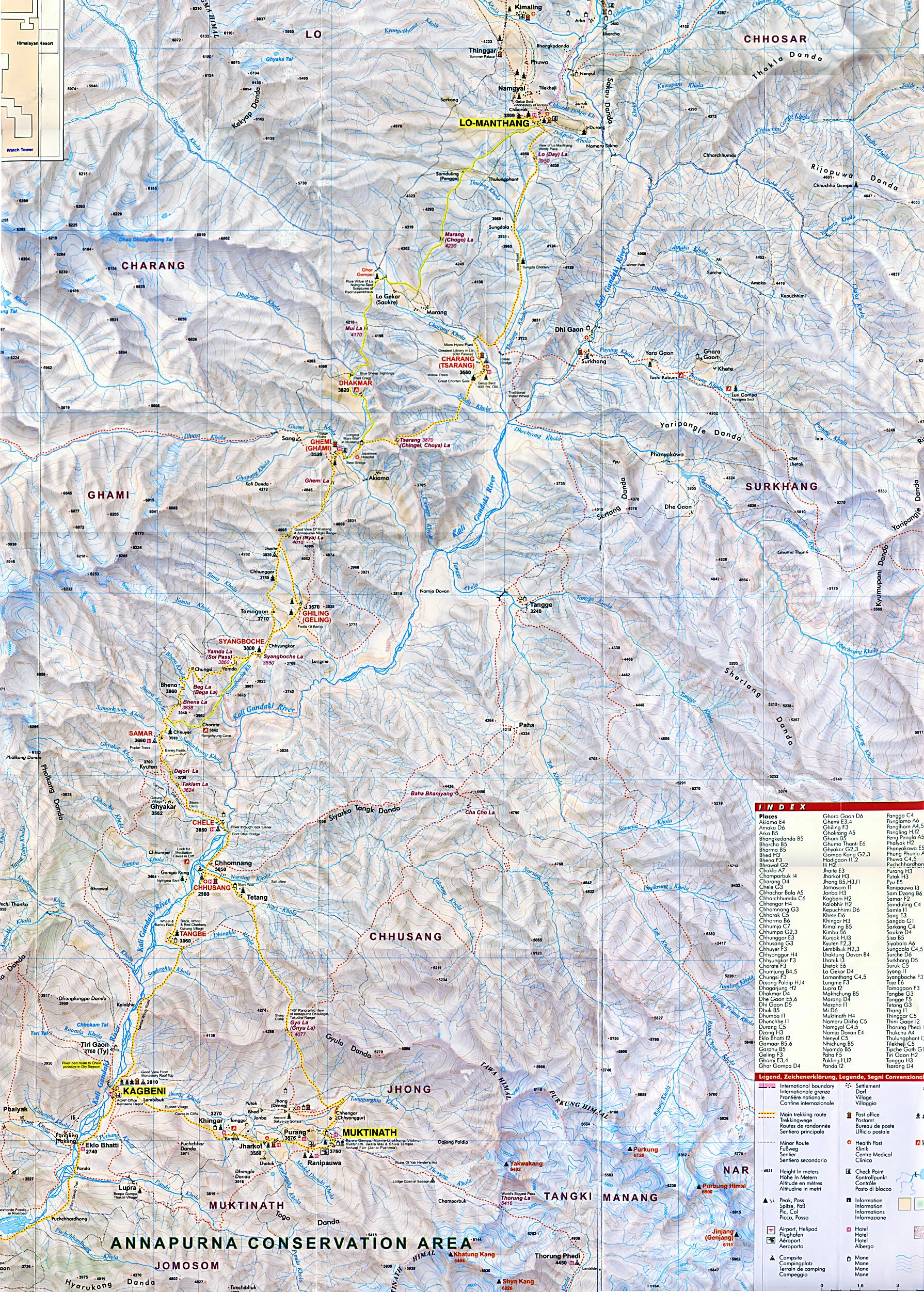


The Grand Mustang Circuit is a combination of the Annapurna Circuit (or what is left of it), the classic Mustang trek, the Terila Trek and the trek trough the Naar/Phu region. To finish things off in “style”, we returned to the starting point via Kangla Pass. The total distance of this EPIC trek was 380km which we walked over 24 days. We climbed 12km in total elevation (probably descended the same) and crossed 3 passes over 5,000m and a quite a few passes over 4,000m. Half of the trek is through sparsely populated regions requiring camping and self sufficiency. It is a spectacular route through some of the most culturally interesting areas of the Buddhist Nepal with a thriving culture. Again, many thanks to the Mountain Sun Valley and Rajendra for putting this together.
It is not technically difficult but it is long. It also has a lot of ups and downs, especially in the Mustang region, where one has to constantly climb into and out of river gorges that cut through the landscape. The trek offers spectacular scenery that is very different from what I have seen in other parts of Nepal. It is a truly unique experience both visually and culturally.
This part of the trek was a warmup for things to come. We went from 2500m to 5400m in 4 days. Fortunately we did not have any altitude issues. It took us 6 days to go from Chame to Kagbeni.
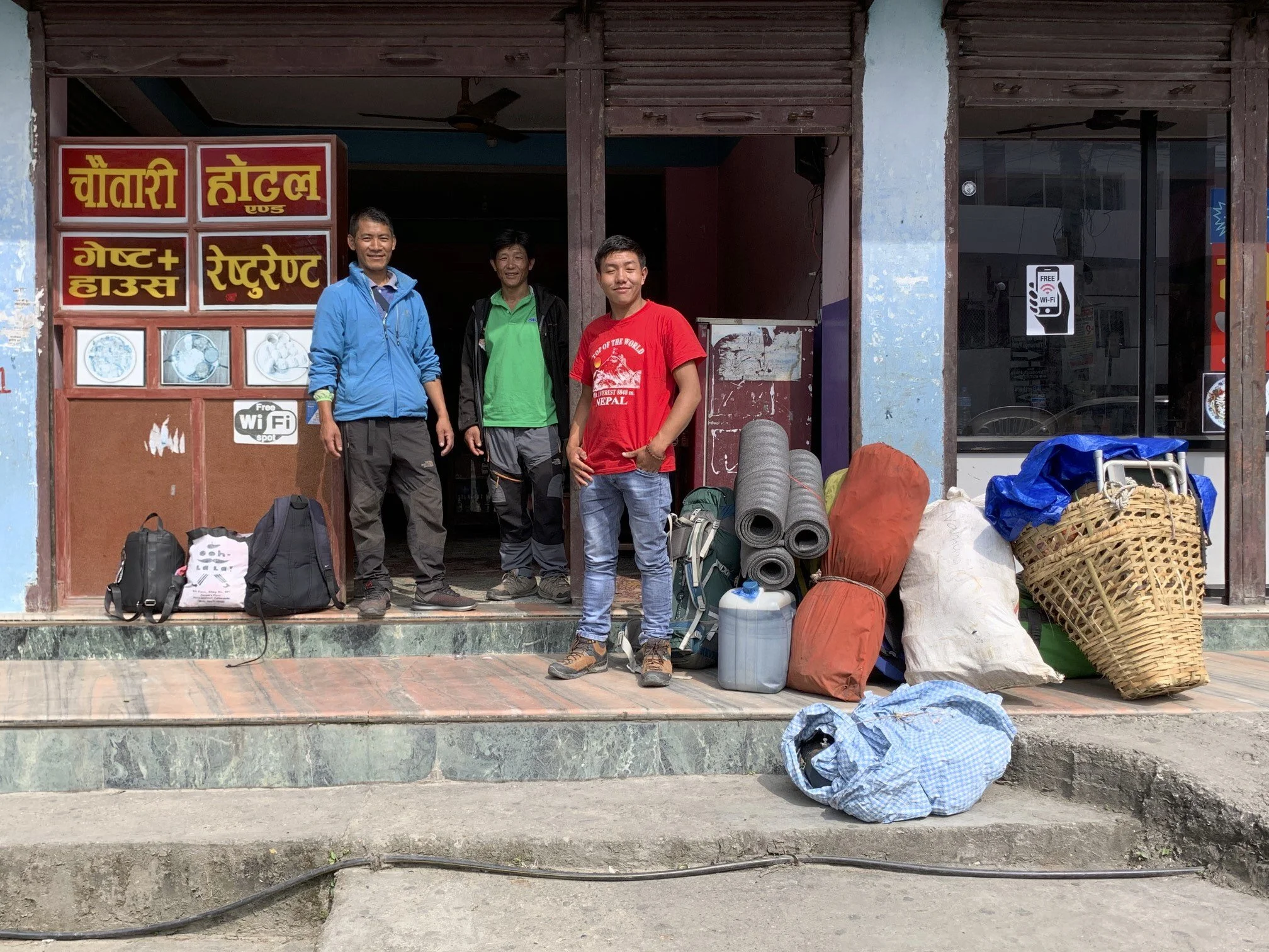
Ready to go! Taking care of last minute supplies in the town of Beisishar, the “end of the paved road” and the former starting point of the Annapurna Circuit.
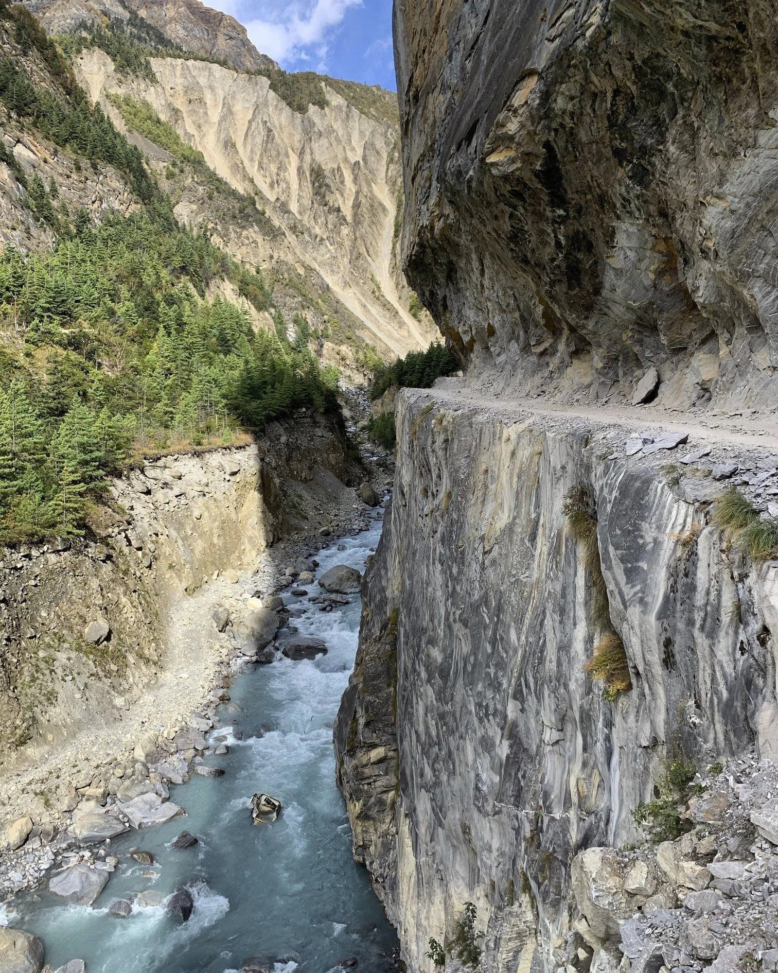
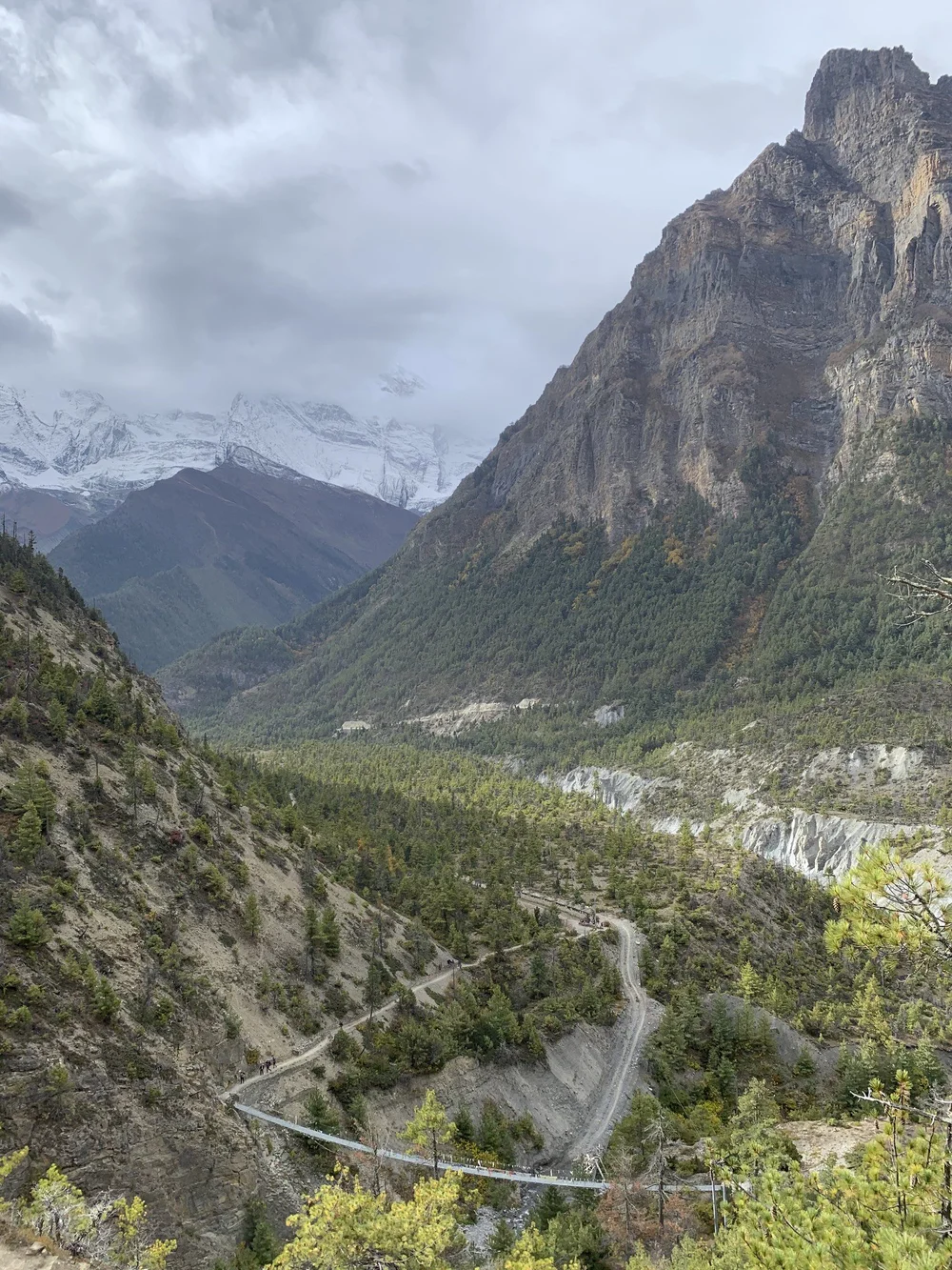
The road from Beisishar to Manang takes the entire day to travel. It is a rough track that will separate meat from the bone and cover you and your bags in a layer of thick dust.
In some places the road is literally chiseled from the side of the mountain. The jeep in the river below did not quite make it…I walked through this area in 2011 when the road was being built.
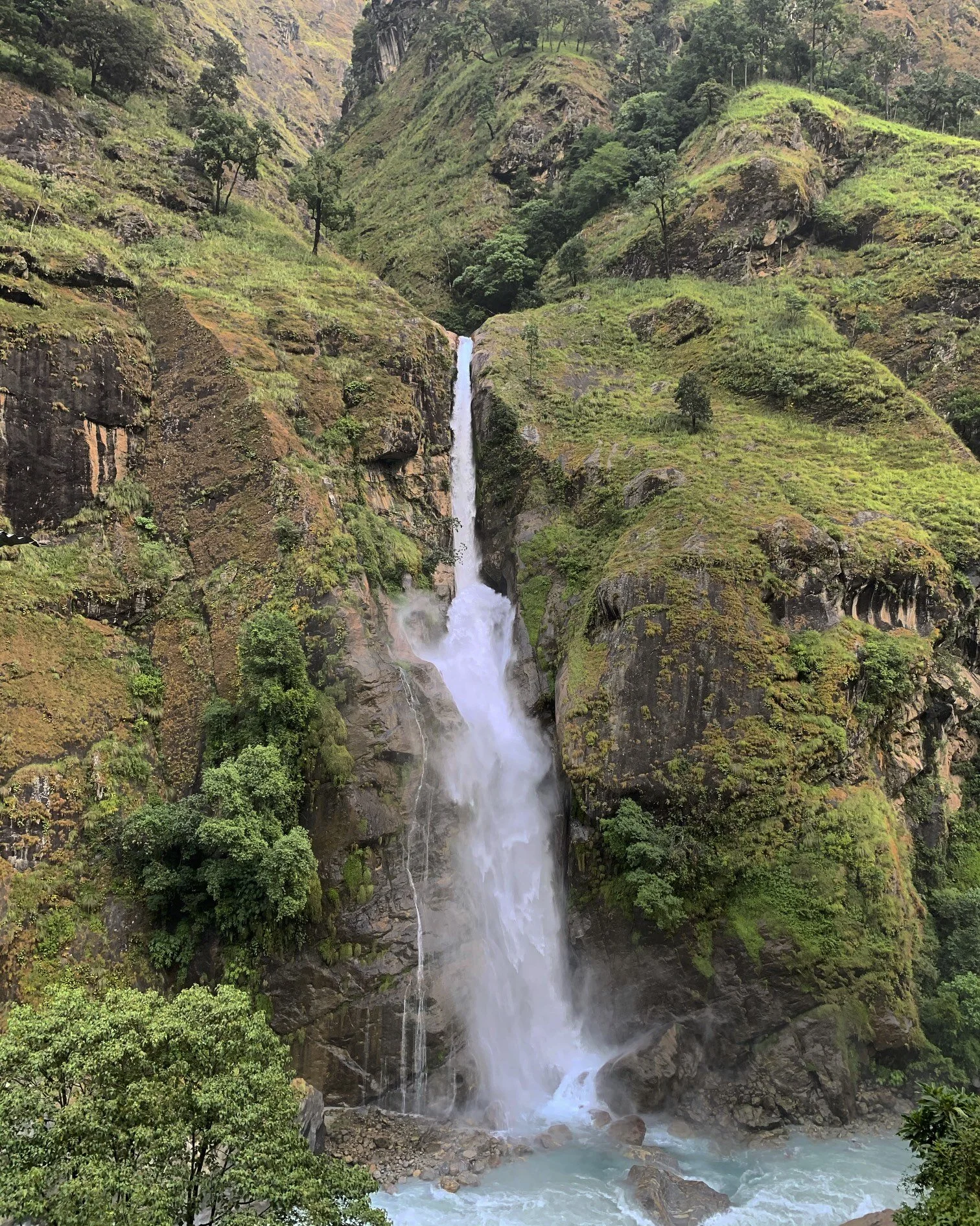
We passed many beautiful waterfalls.
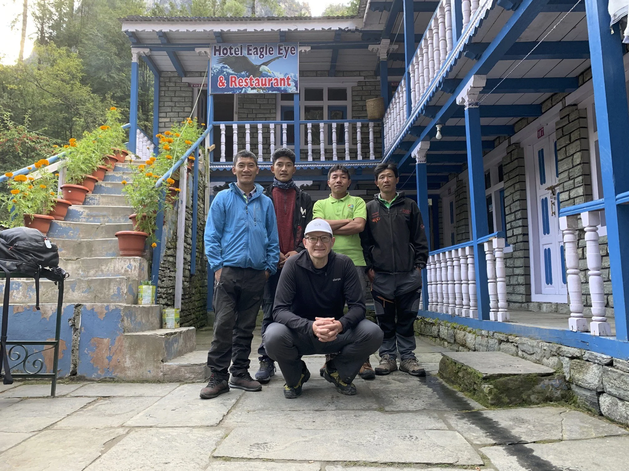
In Chame, still clean and ready to go!
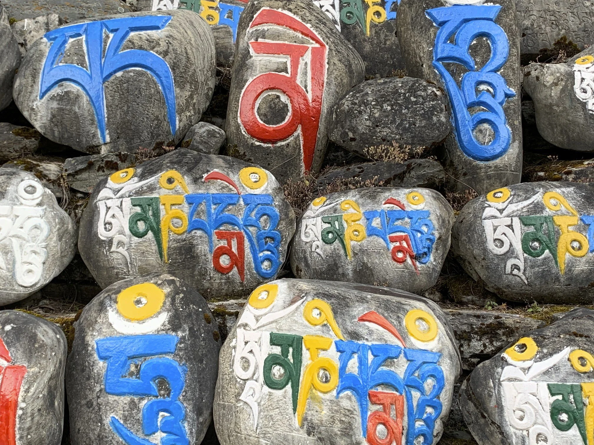
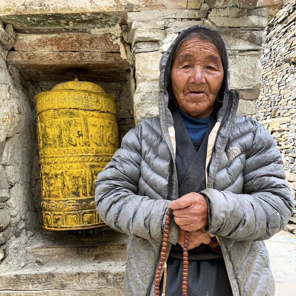
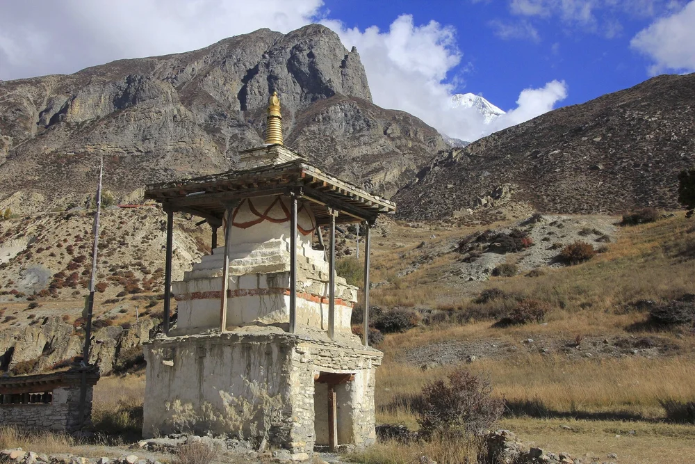
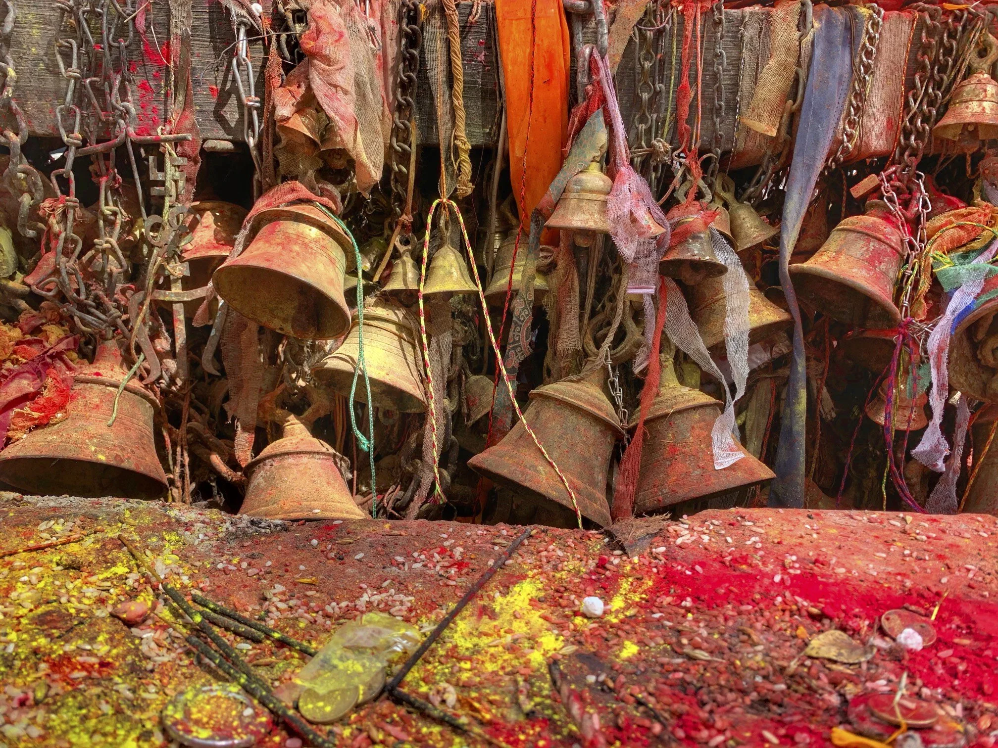
The north side of the Annapurna Circuit passes through many places of worship. We are now in the land of Buddhism.
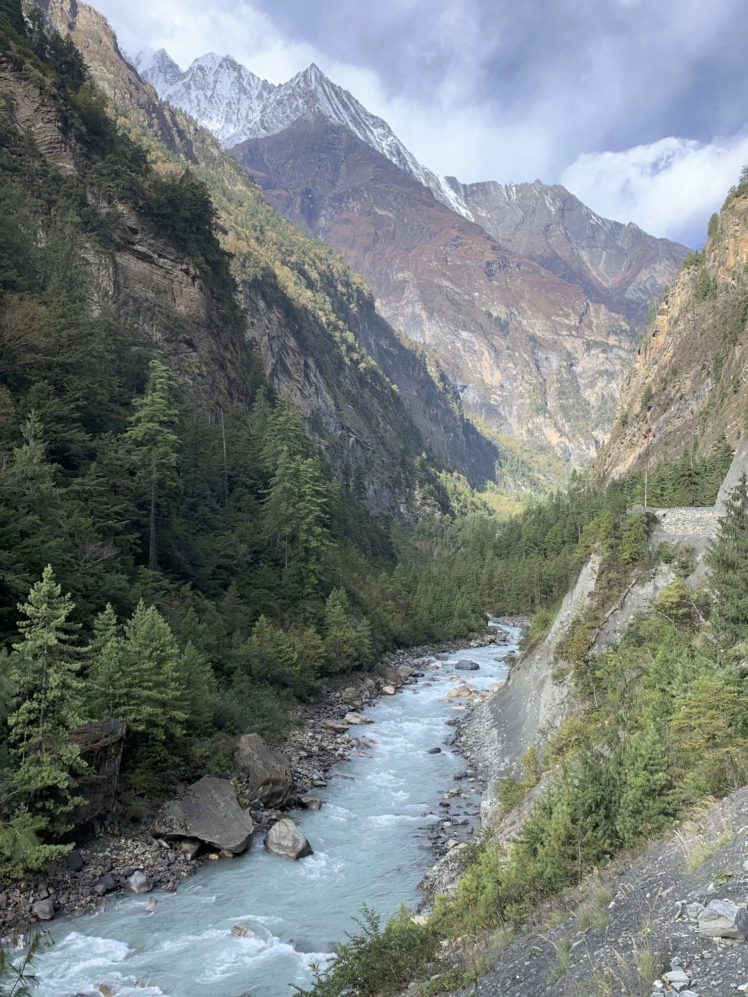
The trail between Chame and Lower Pisang.
Ridges of Annapurna II from Lower Pisang
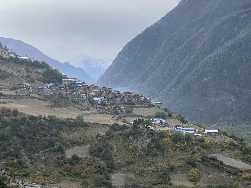
Upper Pisang and Annapurna II
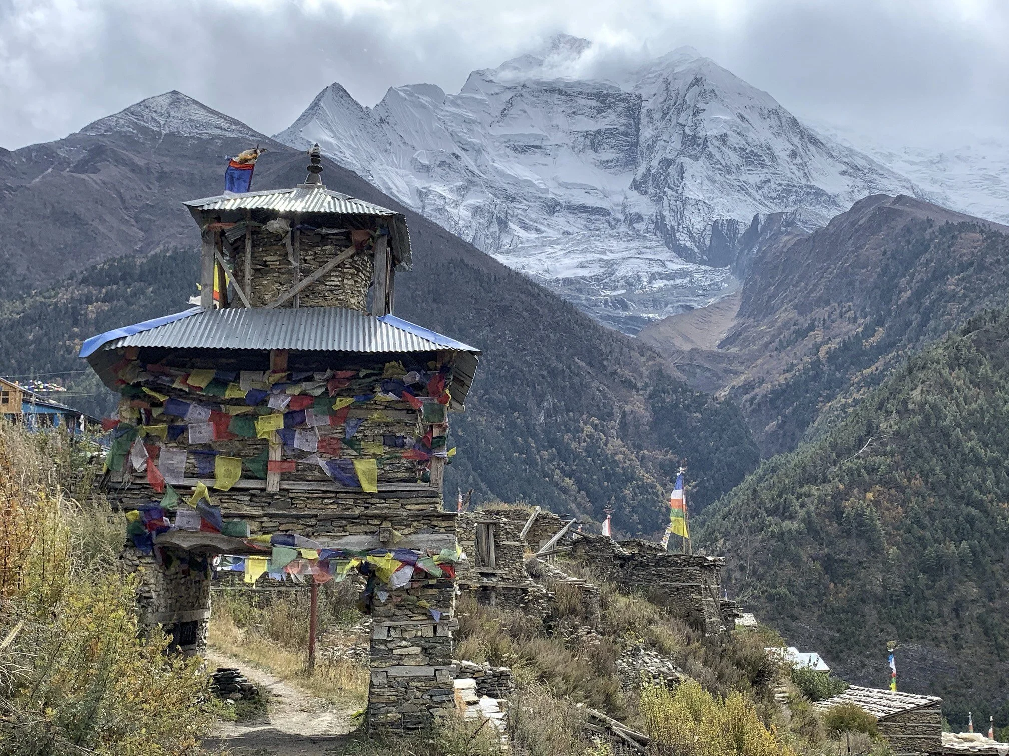
The new gompa in Upper Pisang. The gompa was built 100% from the contributions from the locals.
Upper Pisang and Annapurna II
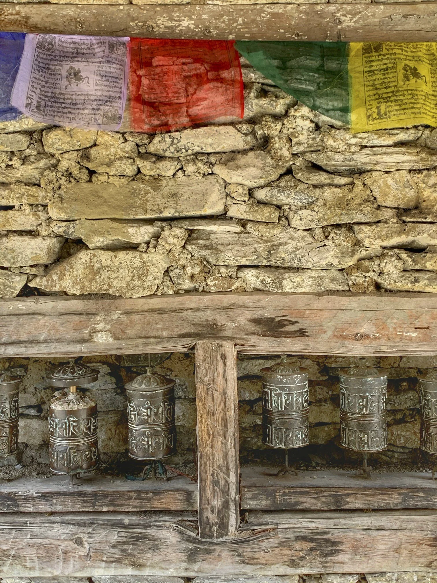
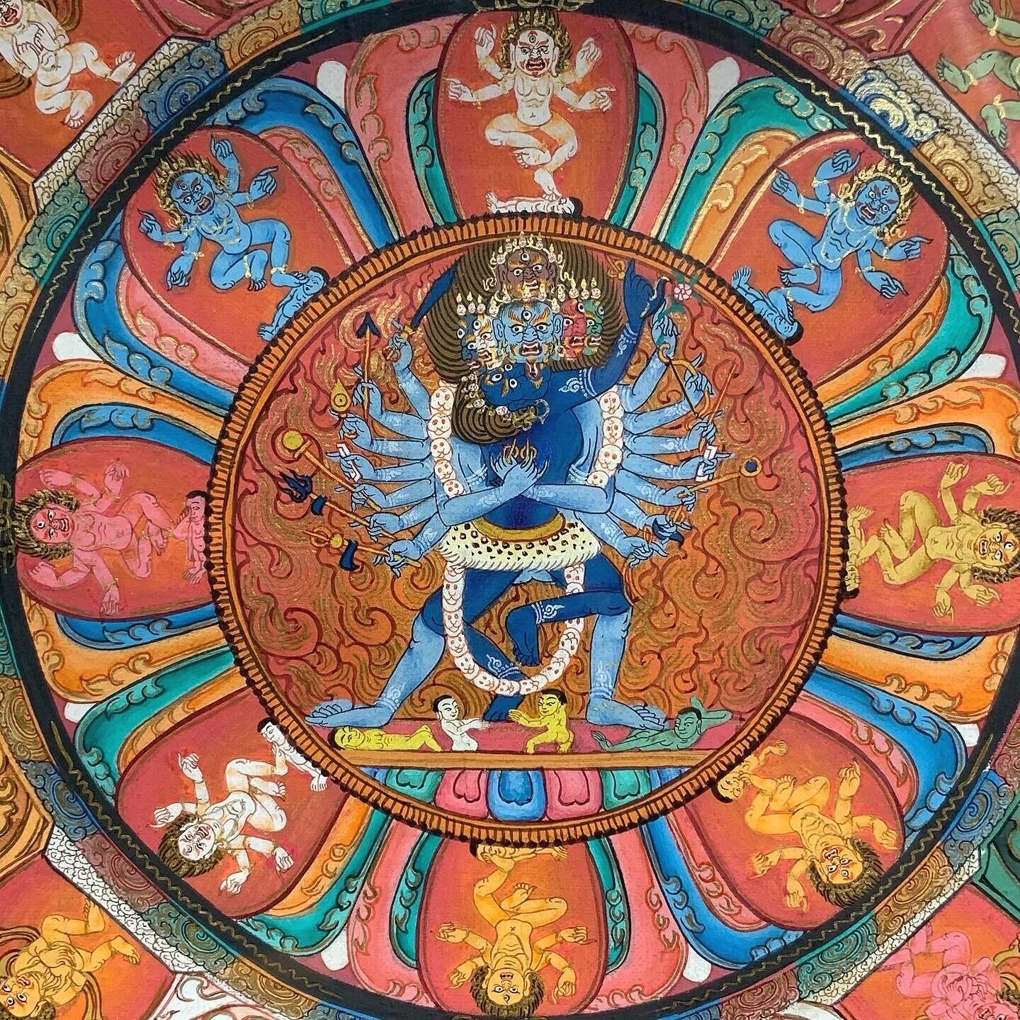
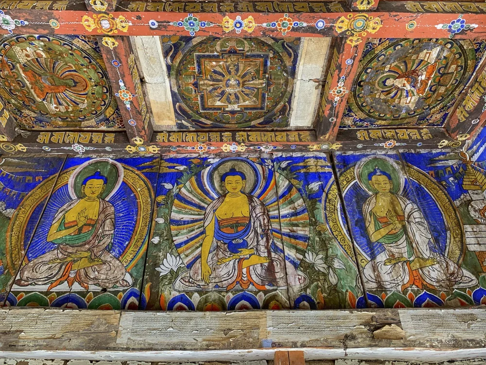
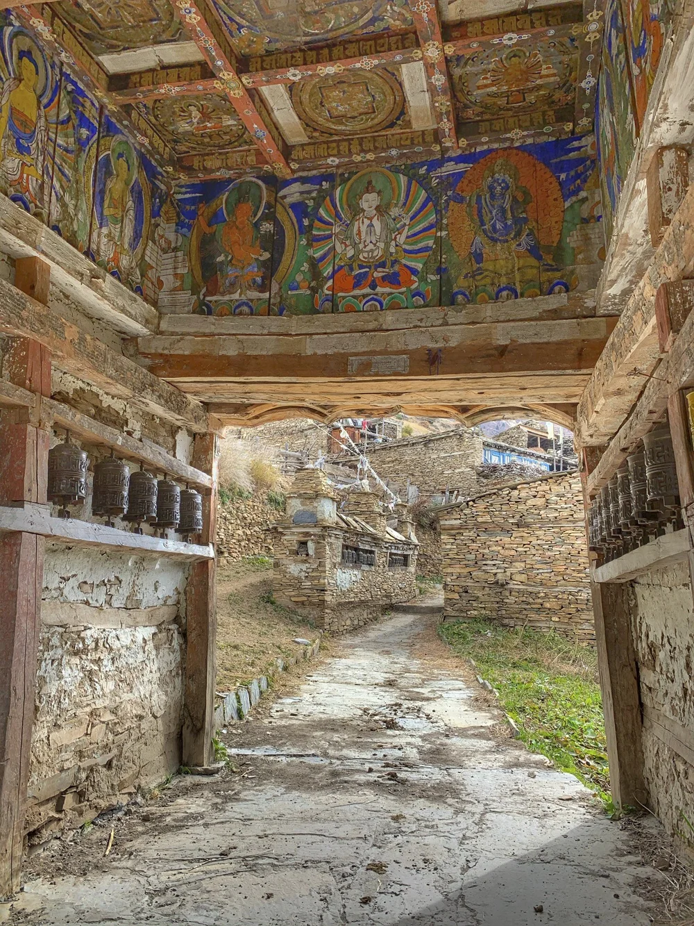
Beautiful paintings inside a chorten gate to Upper Pisang.
A mandala on the ceiling of the chorten gate.
The chorten gate
From Upper Pisang the trail to Manang climbs a steep hill from where there are extensive views of the entire valley. Unfortunately this year the weather did not cooperate. I had more luck in 2011.
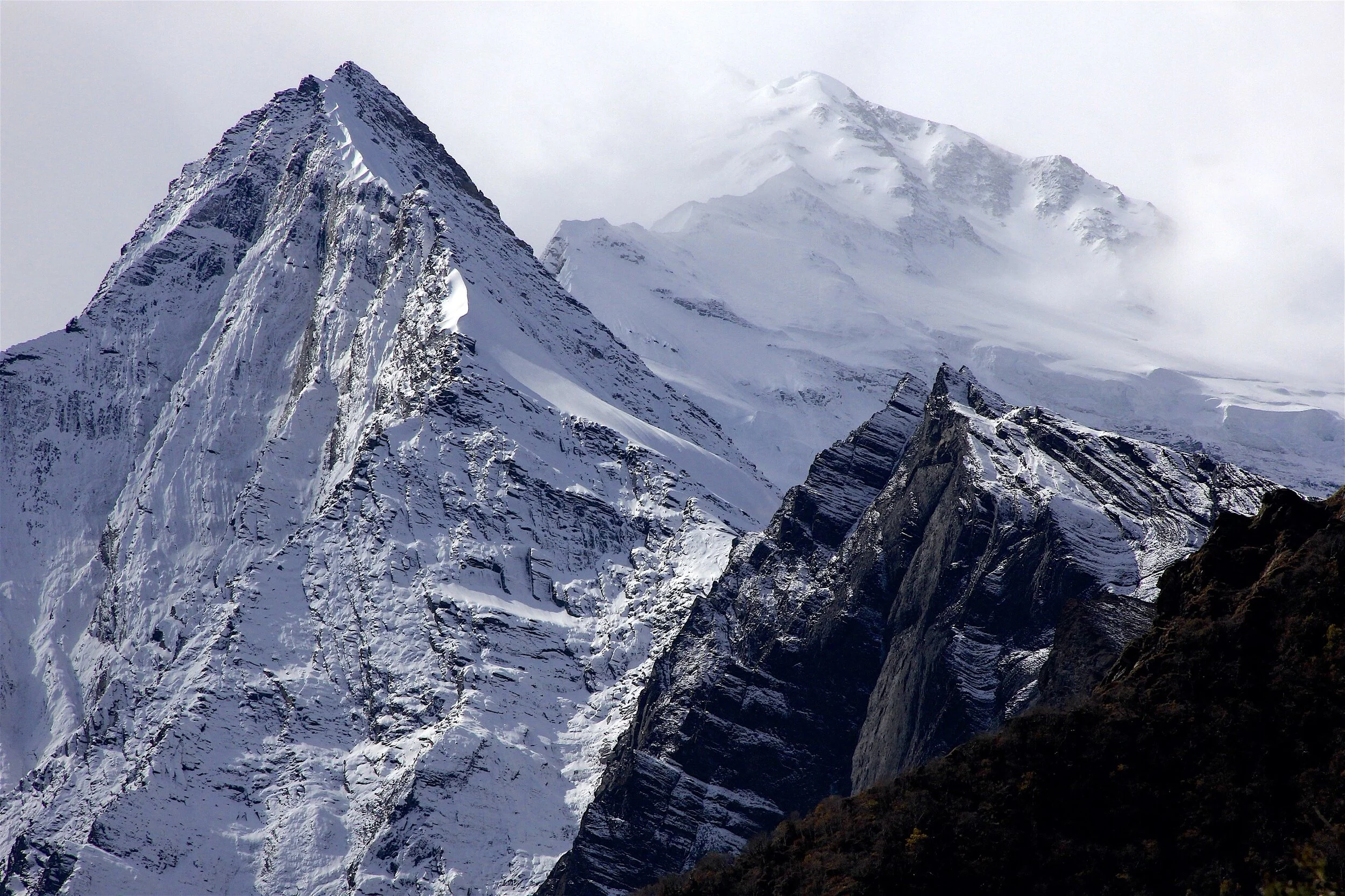
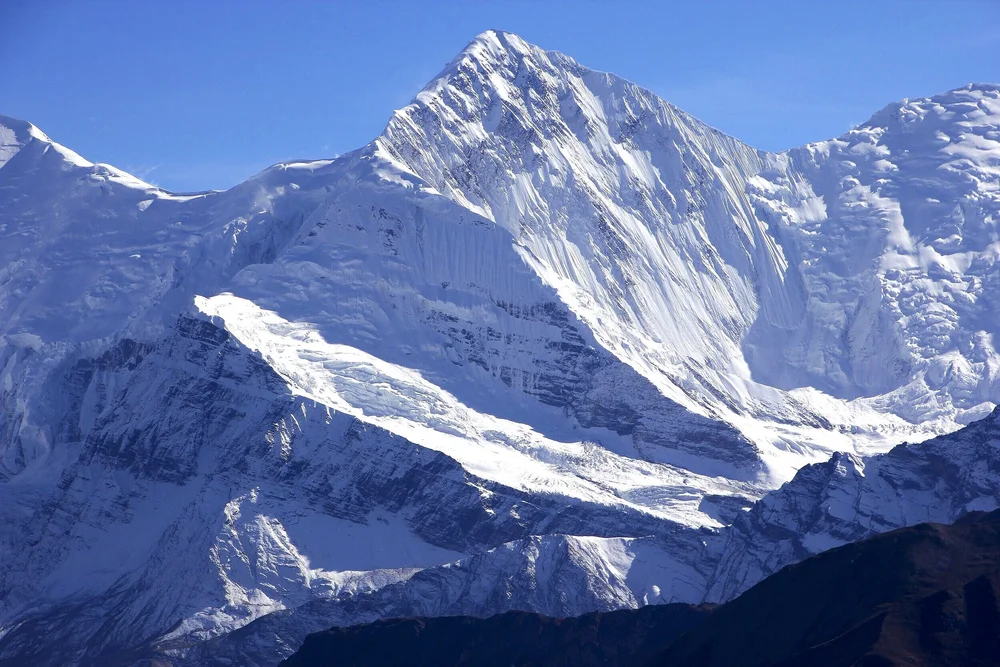
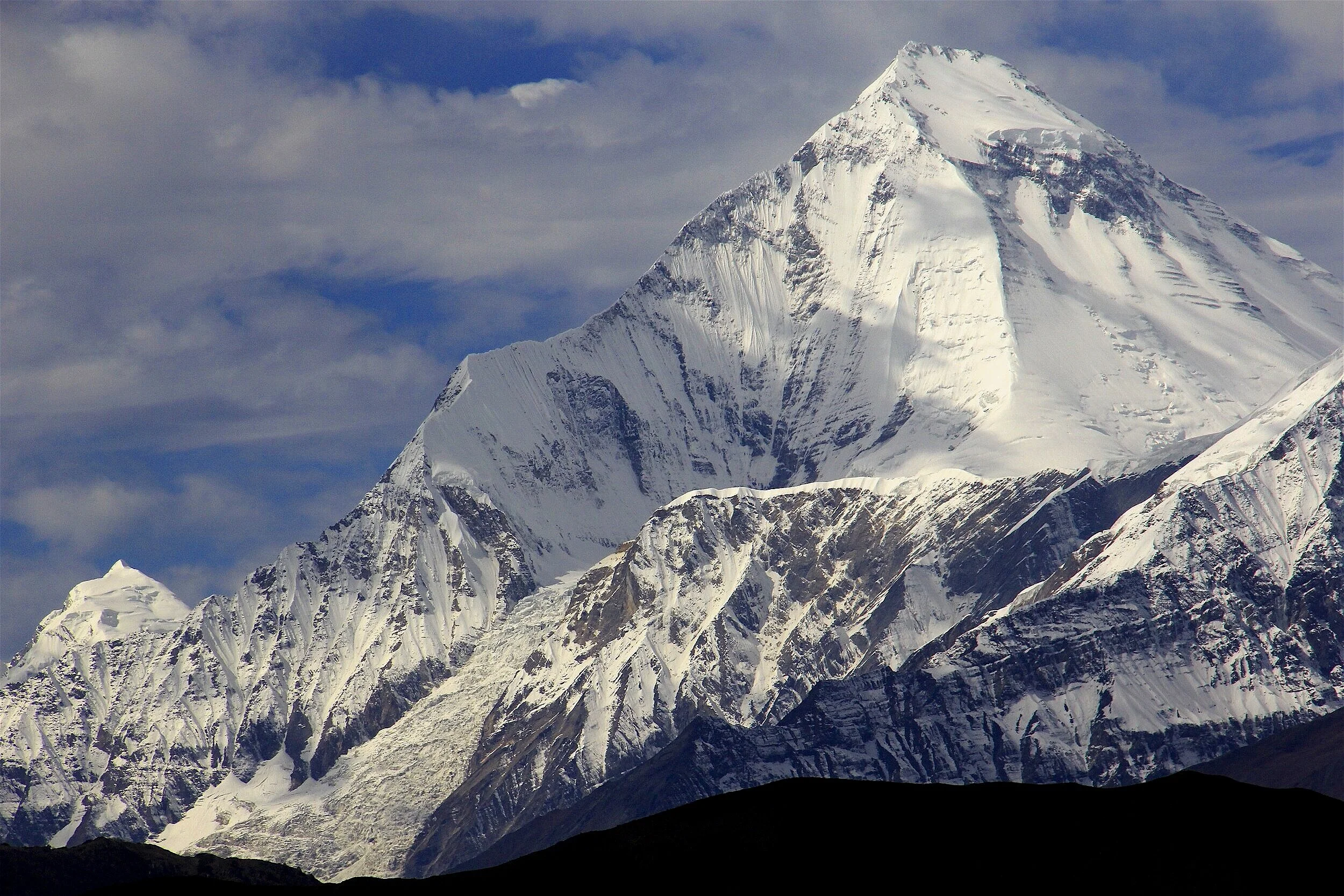
Annapurna III 7,555m from the village of Barga
Annapurna III 7,555m from Barga
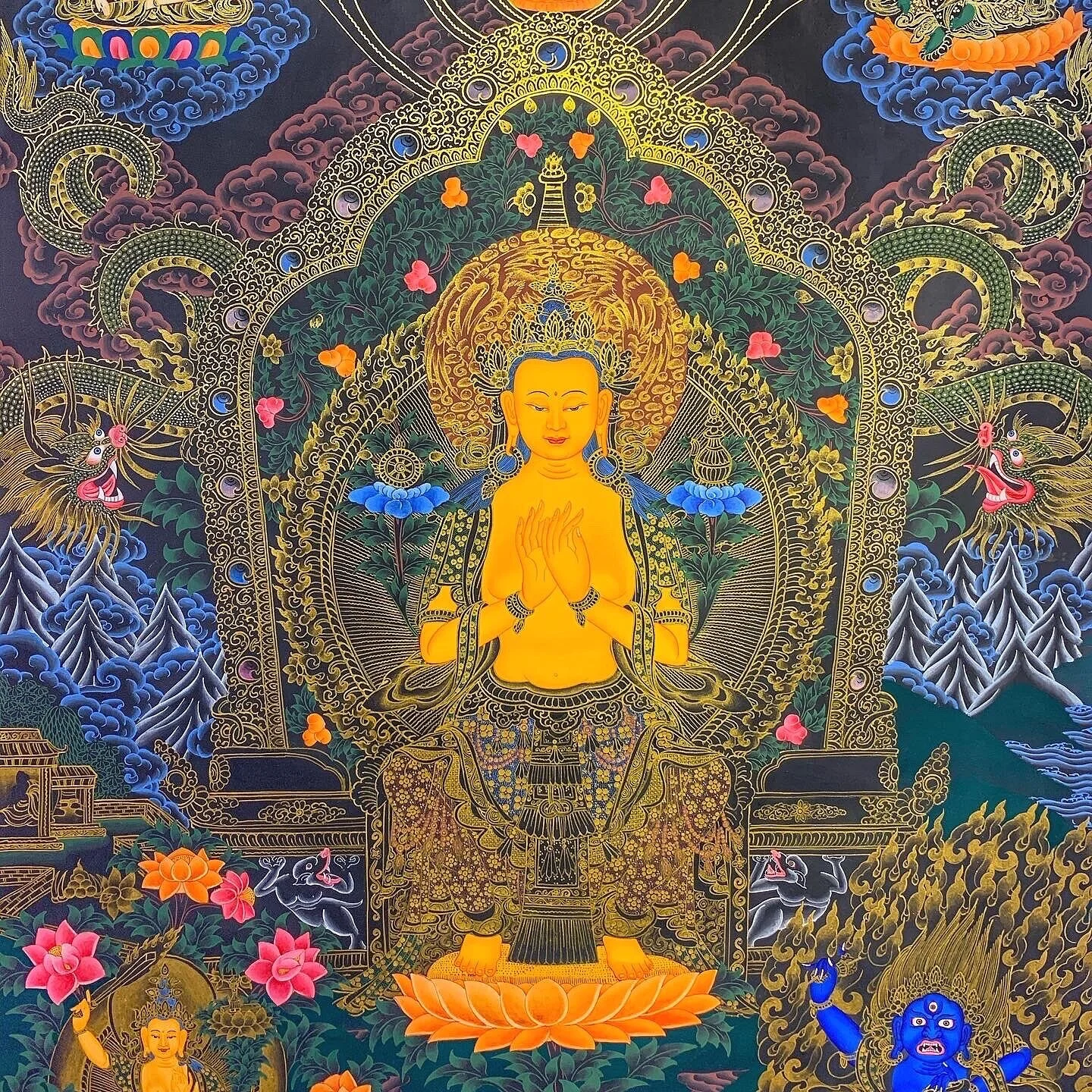
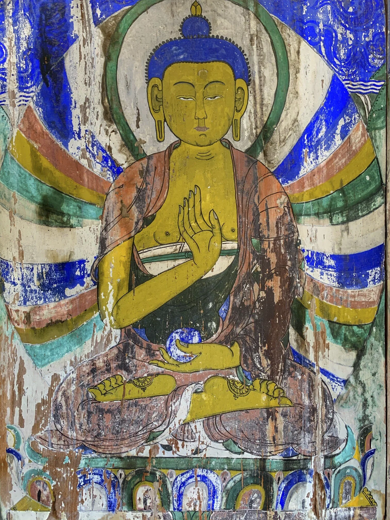
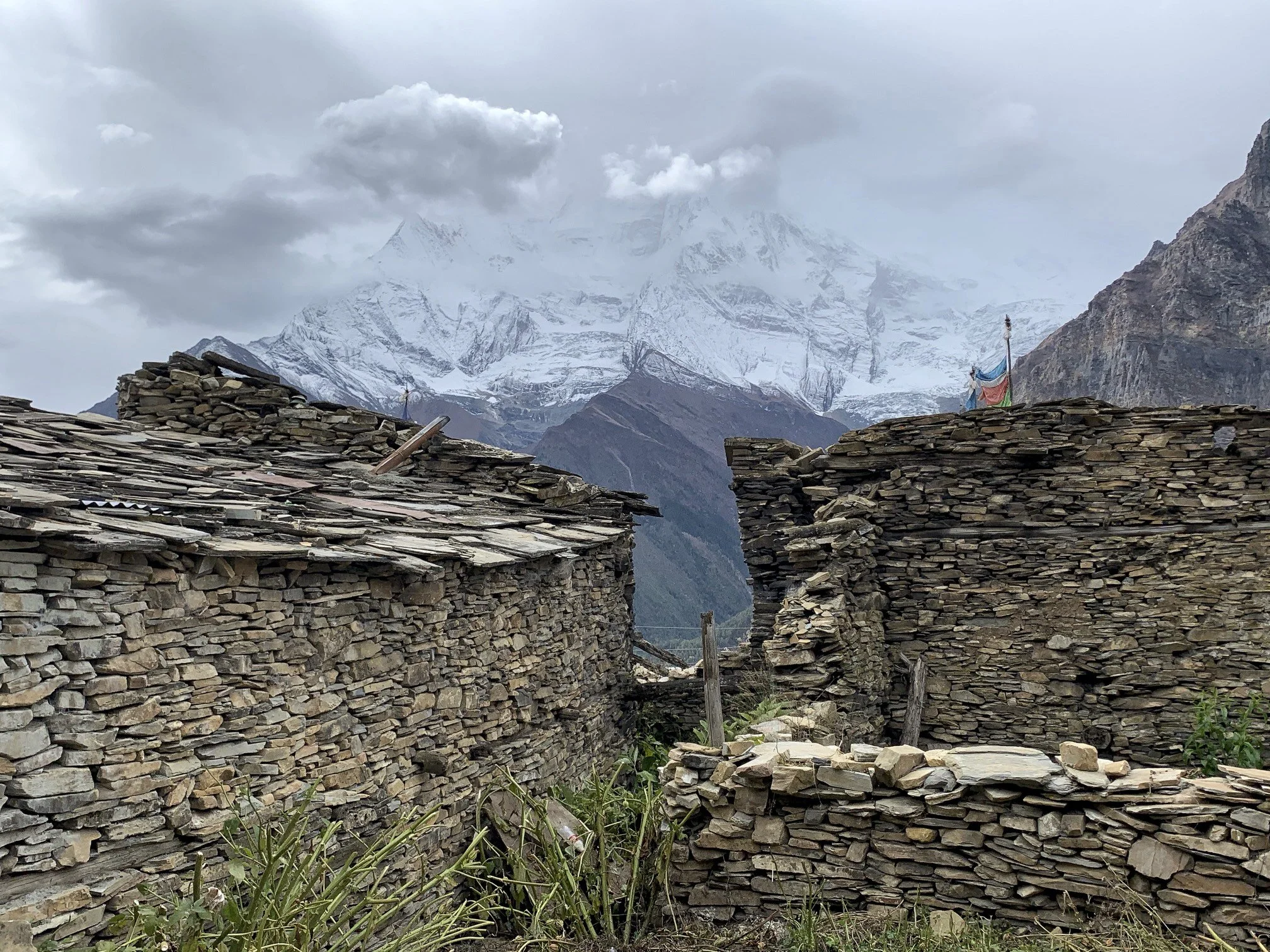
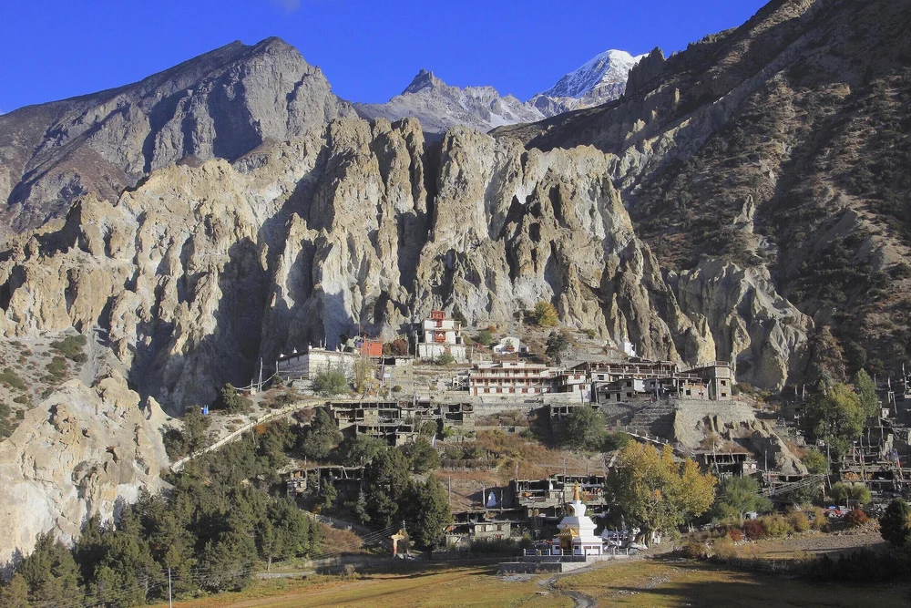
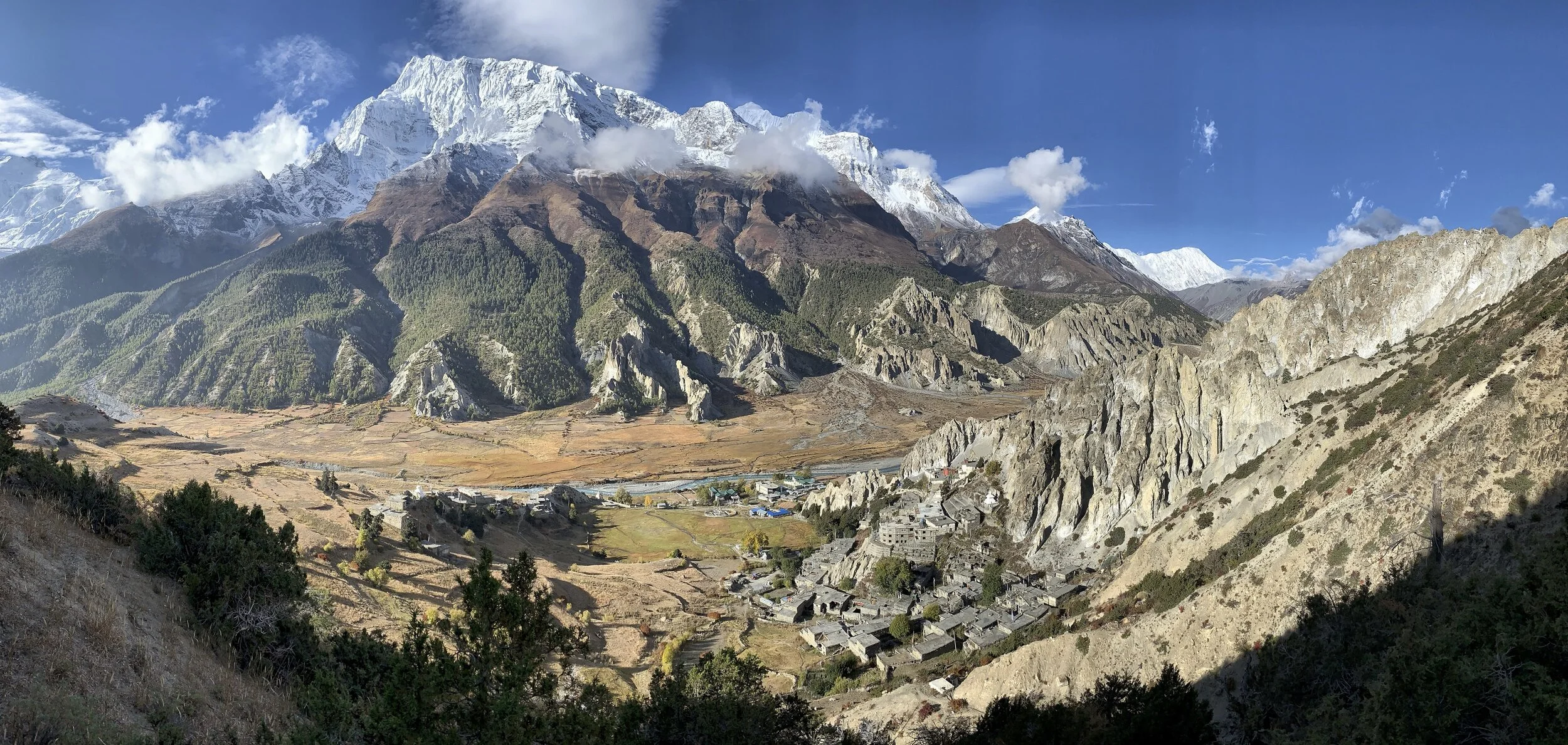
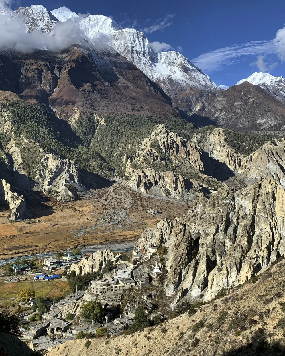
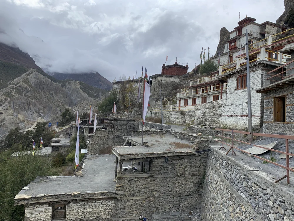
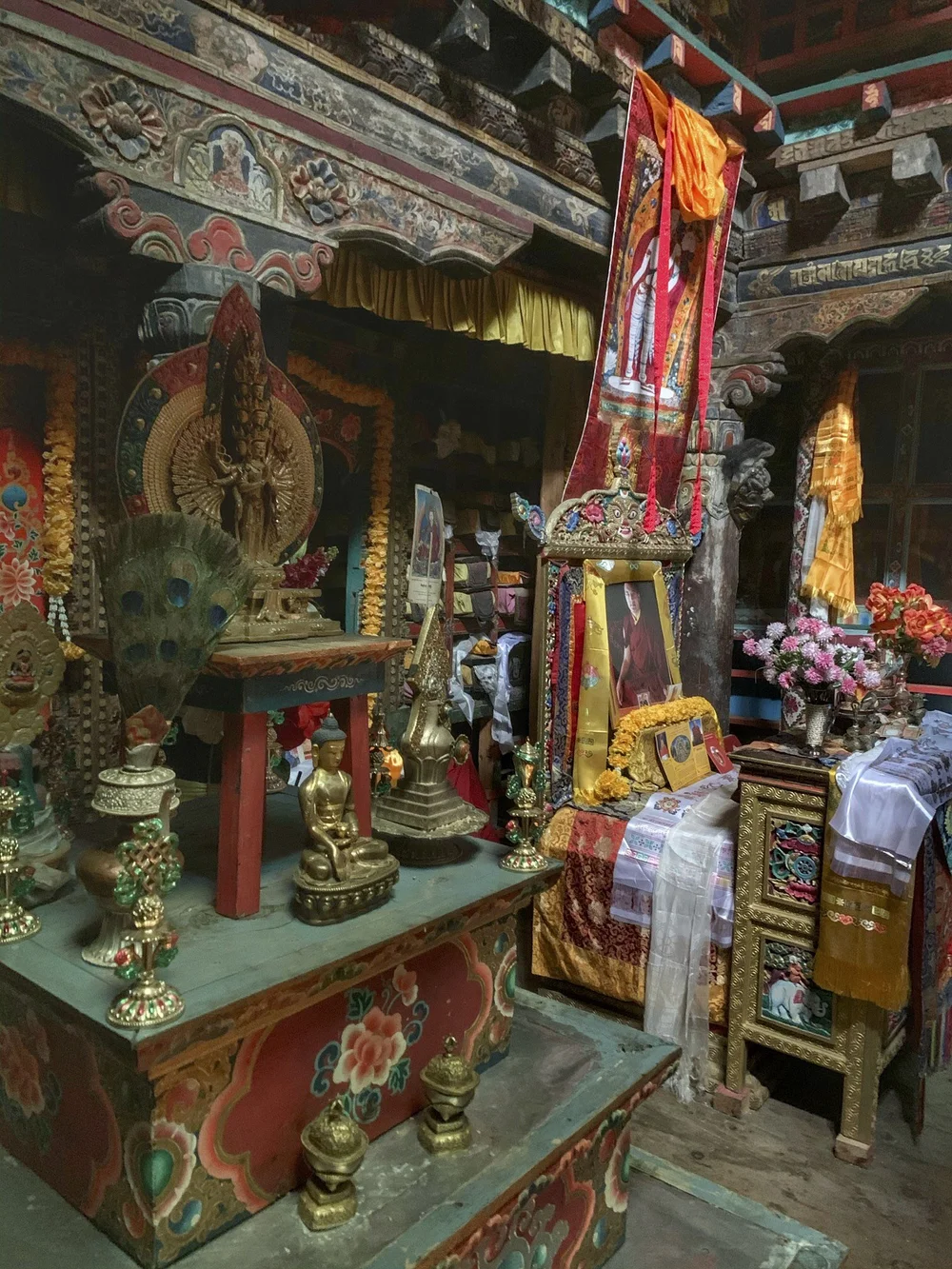
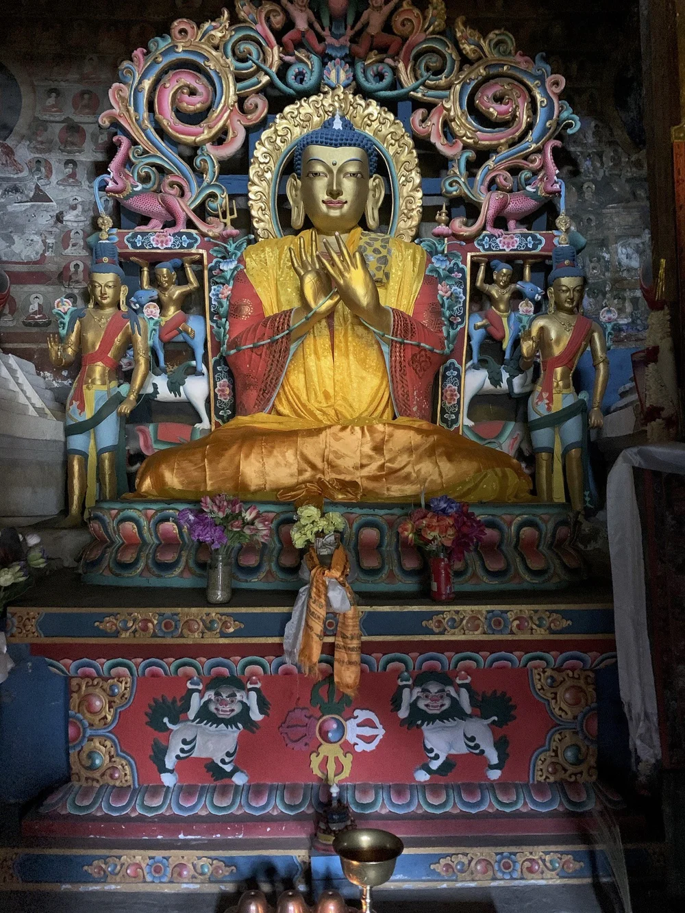
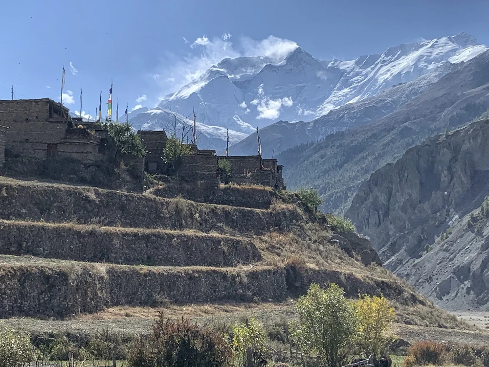
The village of Barga is nested against wild rock formations. The monastery (gompa) is over 1000 years old. It consists of 3 separate prayer halls. We were lucky to get a tour by a visiting former monk who had the keys to the various chambers. It is definitely the cultural highlight of the Annapurna Circuit.
On the trail to Manang
The panoramic view of the village of Barga and the Annapurna III/Gangapurna mountains. Tilicho Peak can be seen far in the distance on the right. See my 2011 trek to the tilicho Lake for some fantastic views of these mountains.
Mount Gangapurna and the village of Barga.
The monastery of Barga
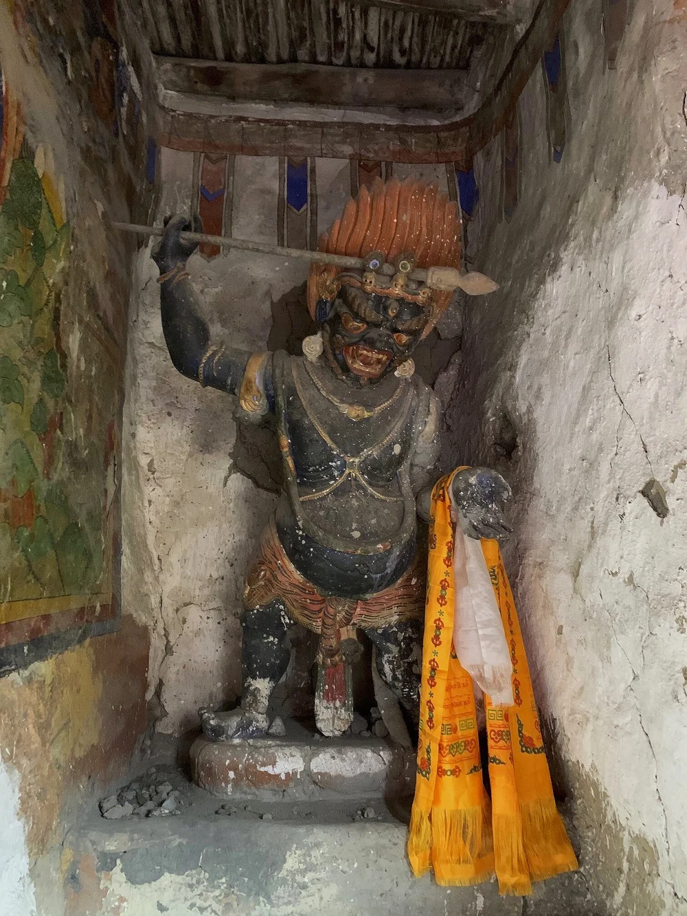
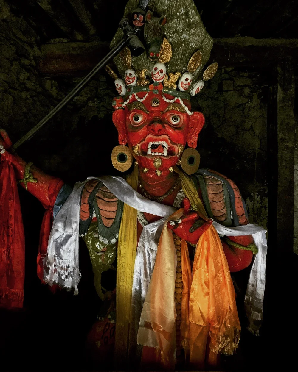
The “protector” at the entrance to the Barga monastery.
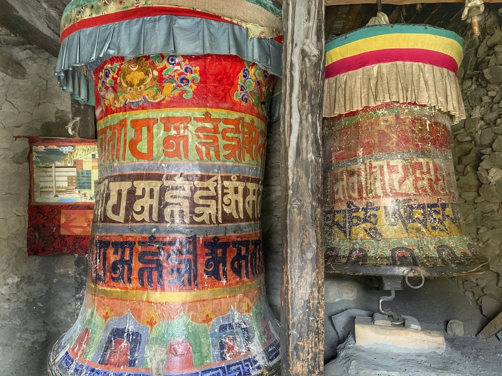
Old prayer wheels at the entrance to the Barga monastery.
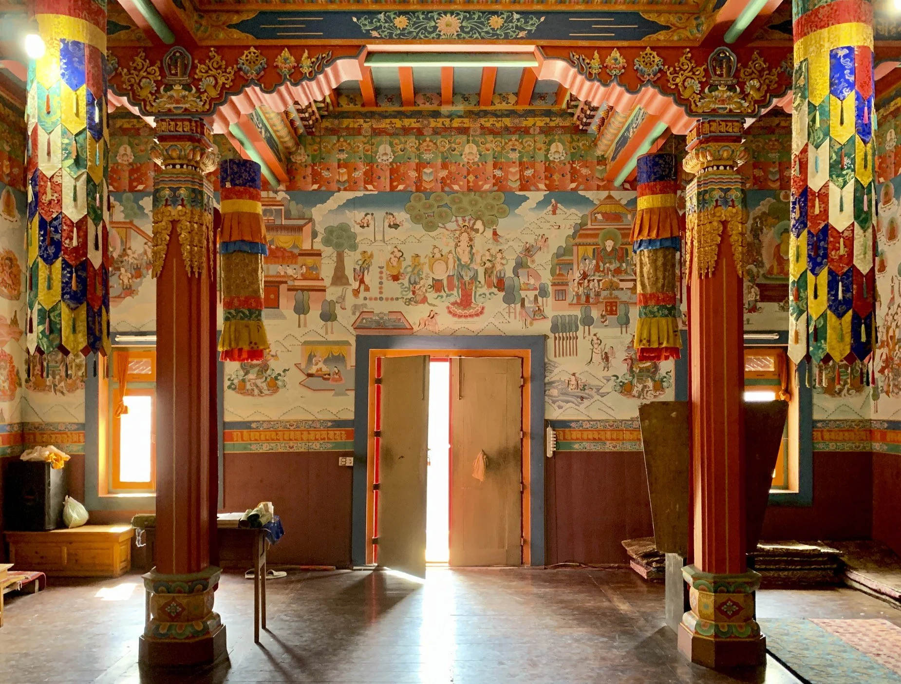
The main and oldest prayer hall in the Barga monastery.
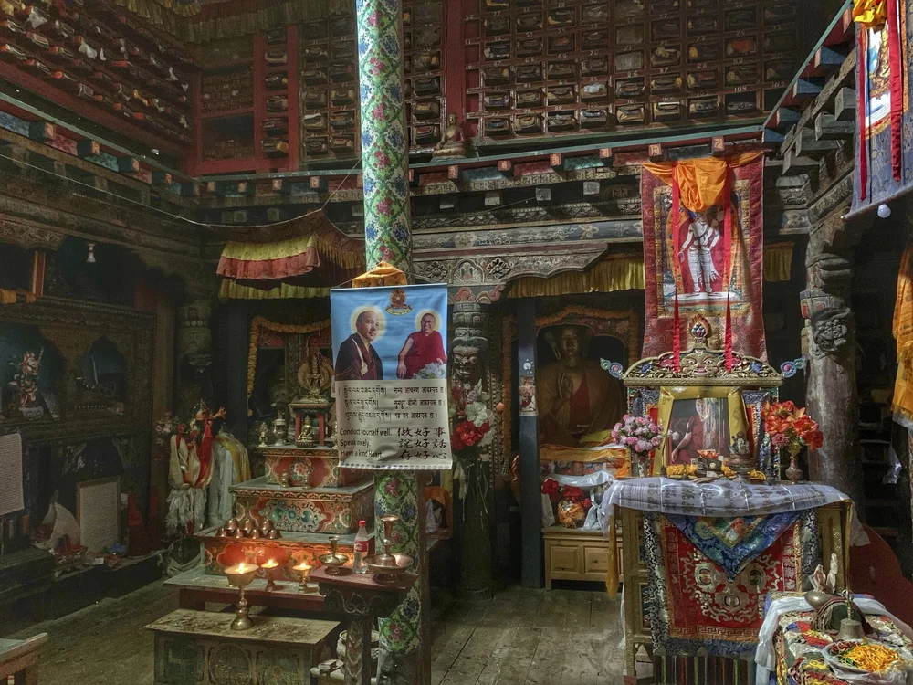
The Buddhist prayer books are stored in the gallery above the main prayer hall.
The village of Manang and Annapurna II.
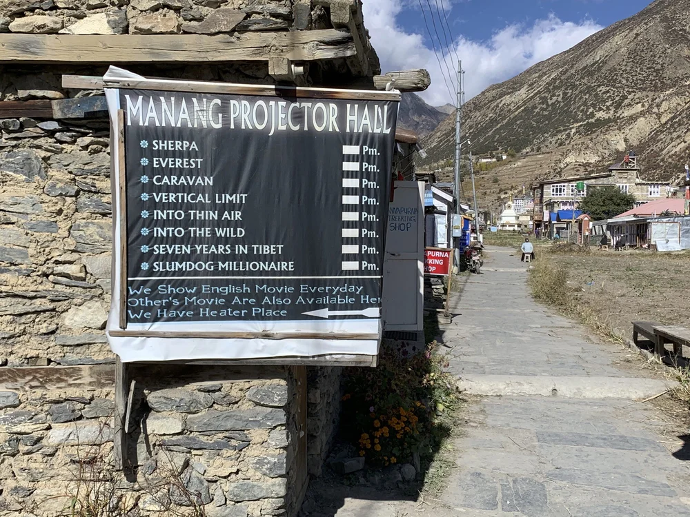
The selection of movies is definitely Himalaya focused!
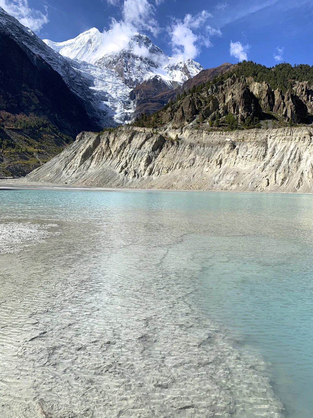
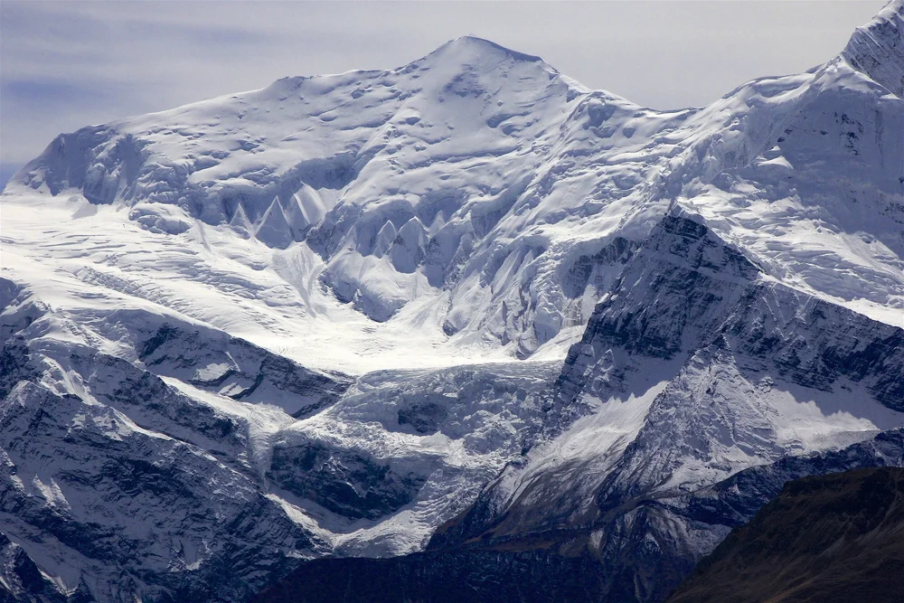
Mount Gangapurna and the glacial lake formed by water from the Gangapurna icefall. This small lake is a short walk from Manang.
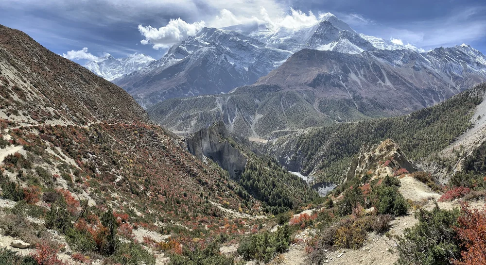
The trail between Manang and Thorong La basecamp. Gangapurna, Annapurna III dominate the view.
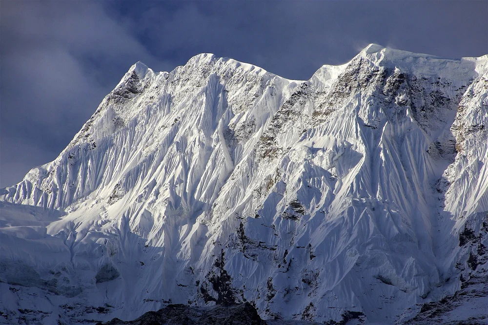
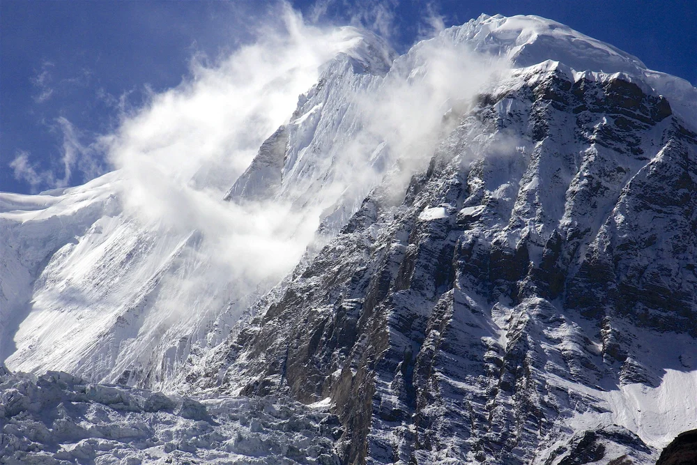
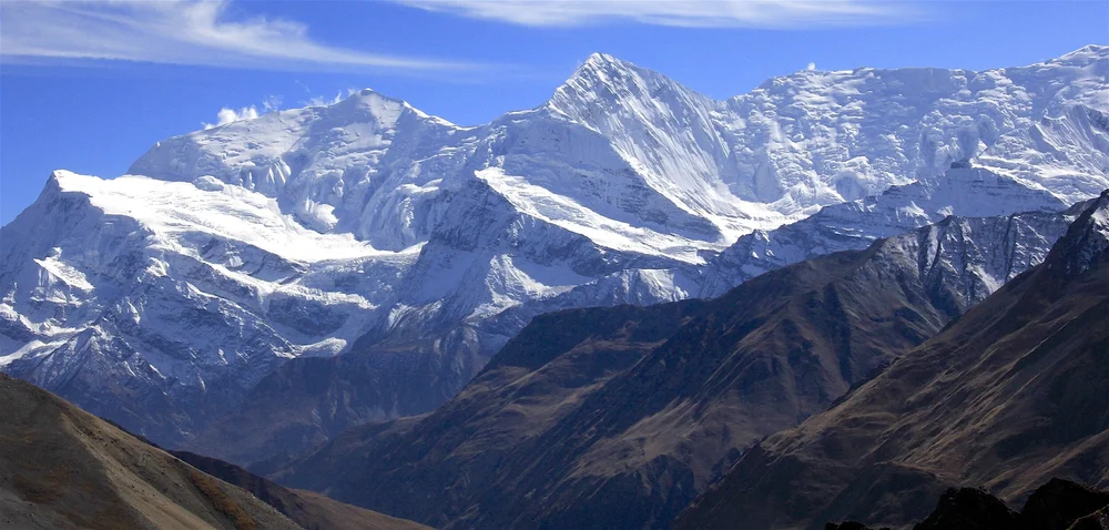
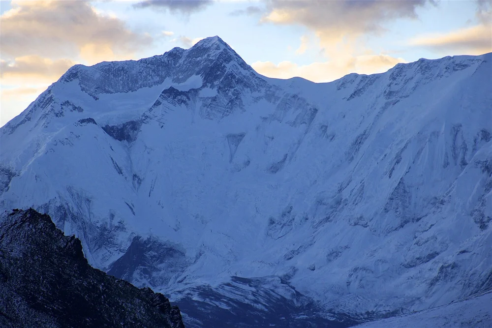
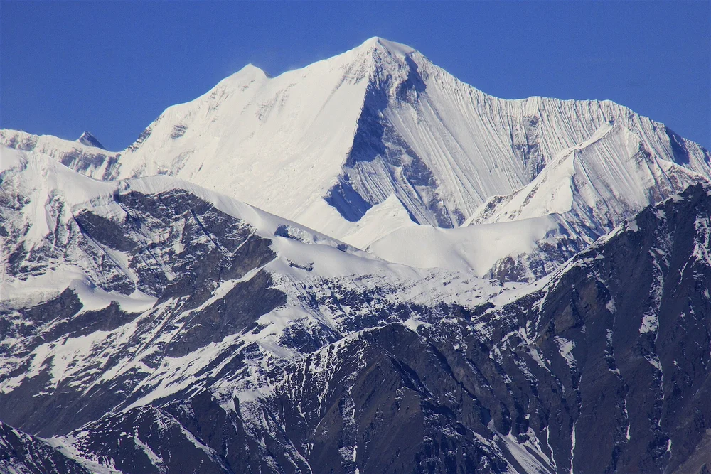
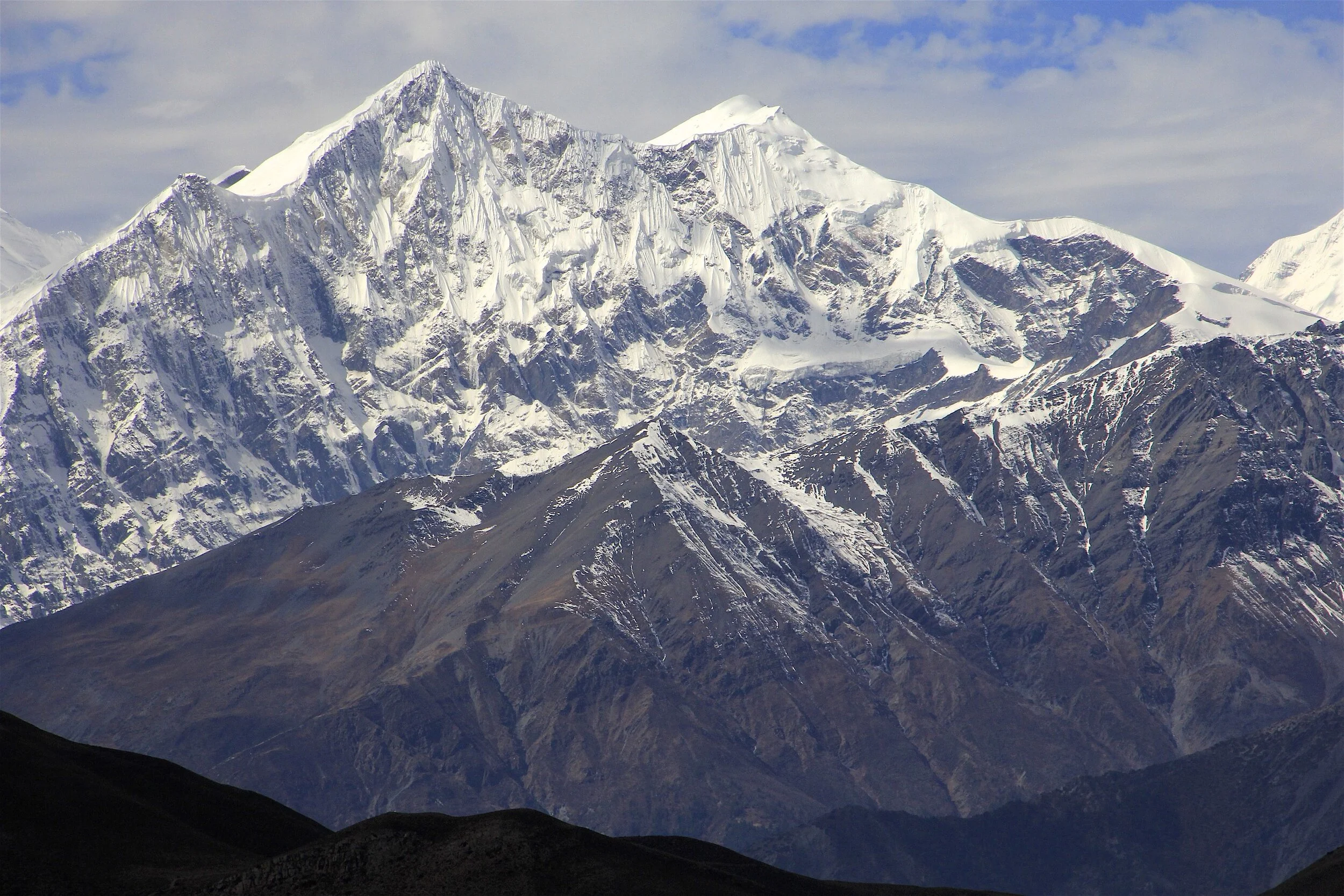
Gangapurna 7,455m
Annapurna III 7,555m
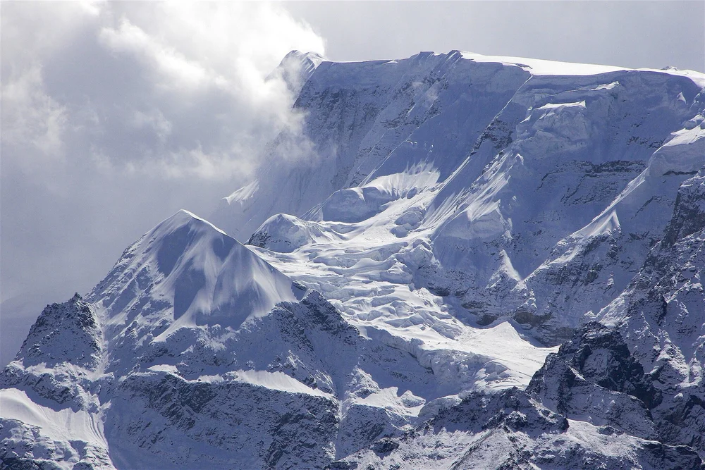
Glacier Dome
Gangapurna 7,455m from Thorong La basecamp at 4,800m
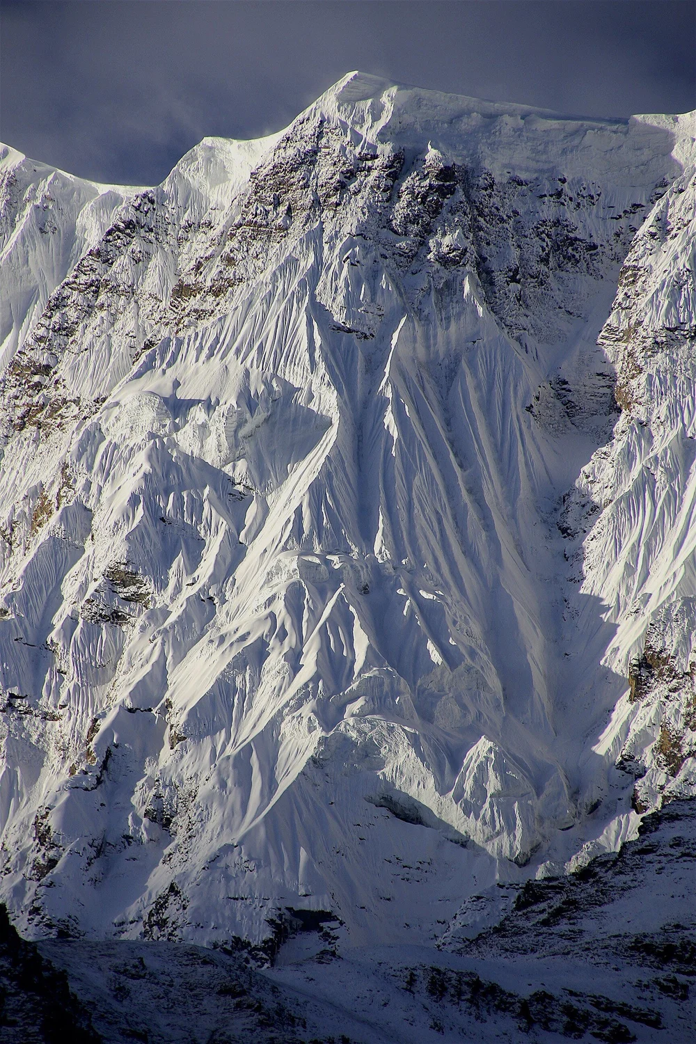
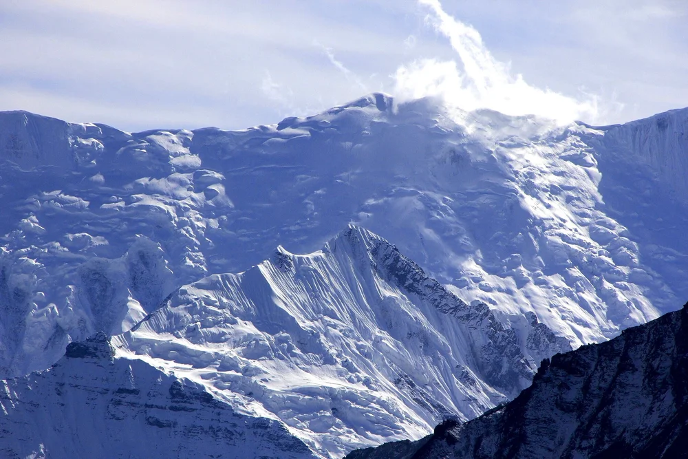
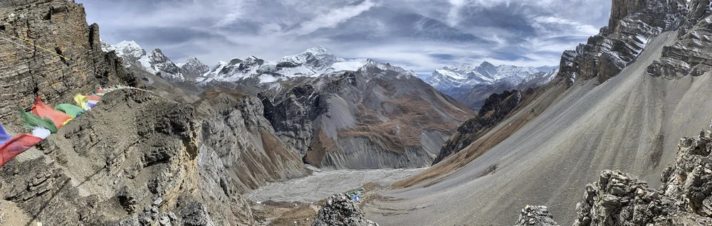
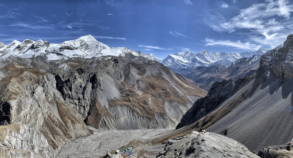
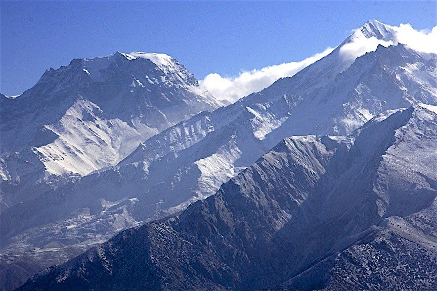
The Great Barrier and Glacier Dome from the Thorong La basecamp. See the 2011 photos.
The Great Barrier above the Tilicho Lake from the Thorong La basecamp at 4,800m
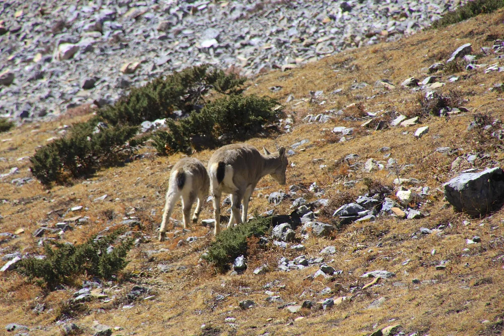
We were lucky to see some wildlife!
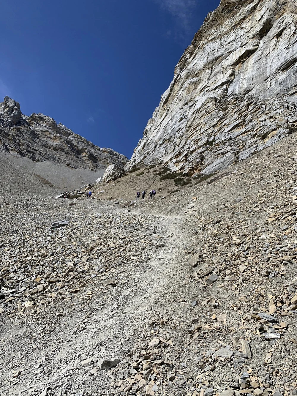
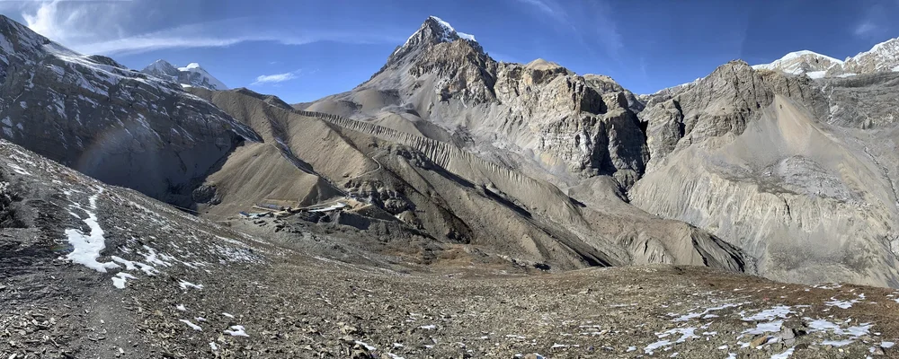
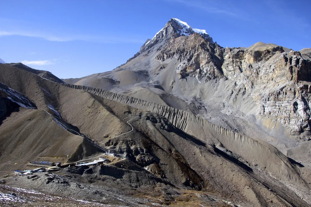
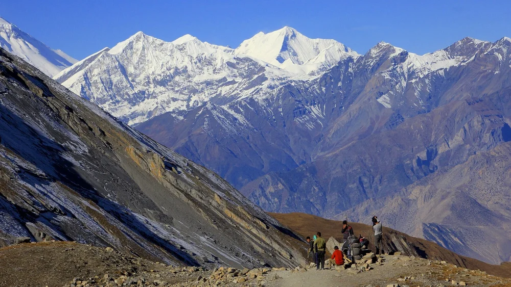
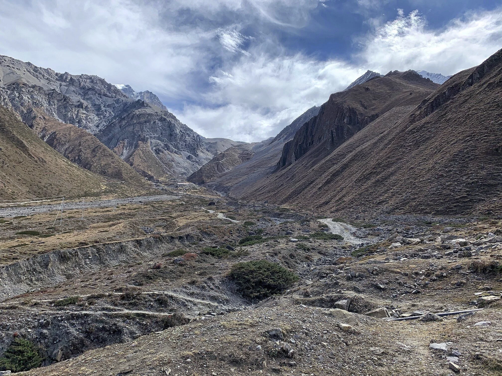
The short steep climb to the Thorong La basecamp from Thorong La Phedi. The climb is from 4200m to 4800m. If you are not fully acclimatized like me, slow and steady does the trick.
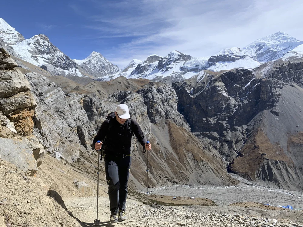
As I approach the Thorong La basecamp, the views are getting better.
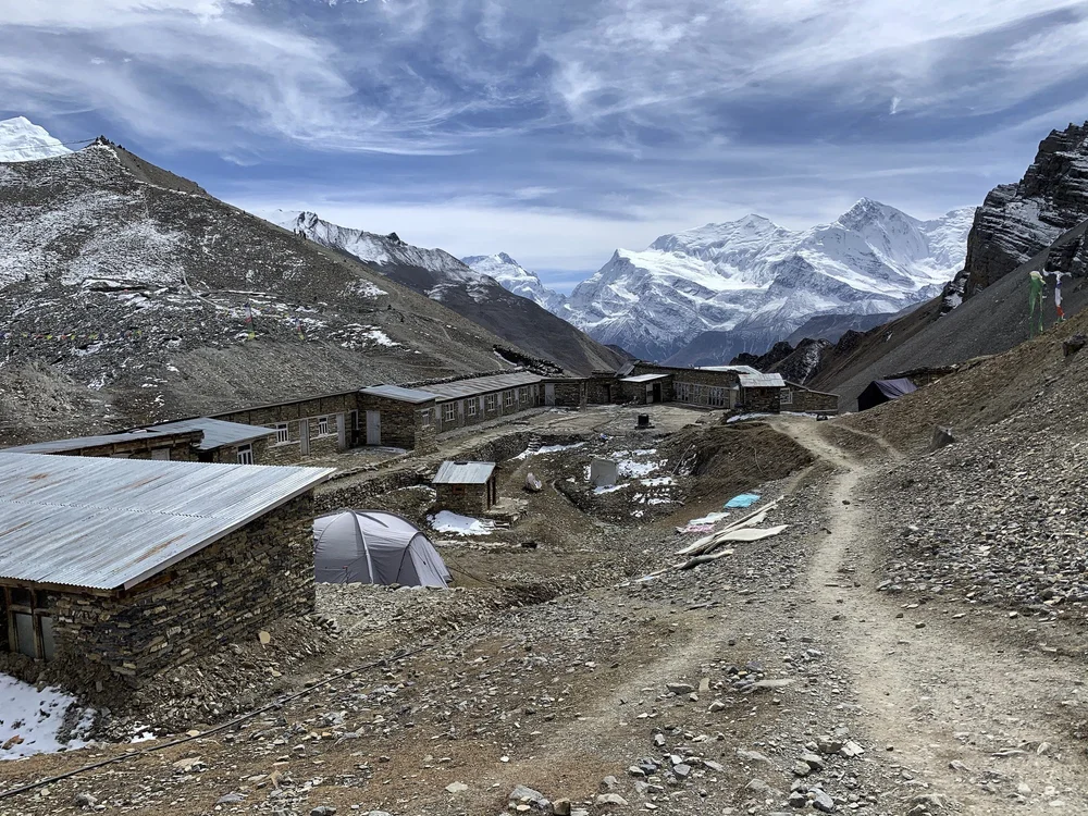
Thorong La basecamp at 4,800m.
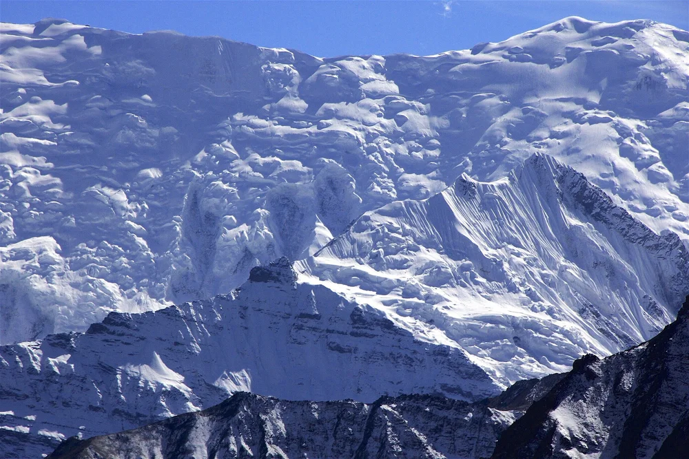
The view of Annapurna III 7,555m, Gangapurna 7,455m and the Great Barrier from the Thorong La basecamp at 4,800m.
The Damodar Himal from the Thorog La basecamp.
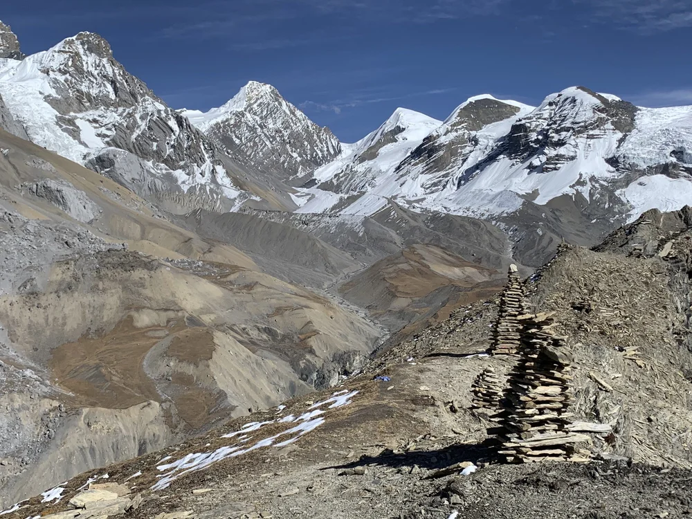
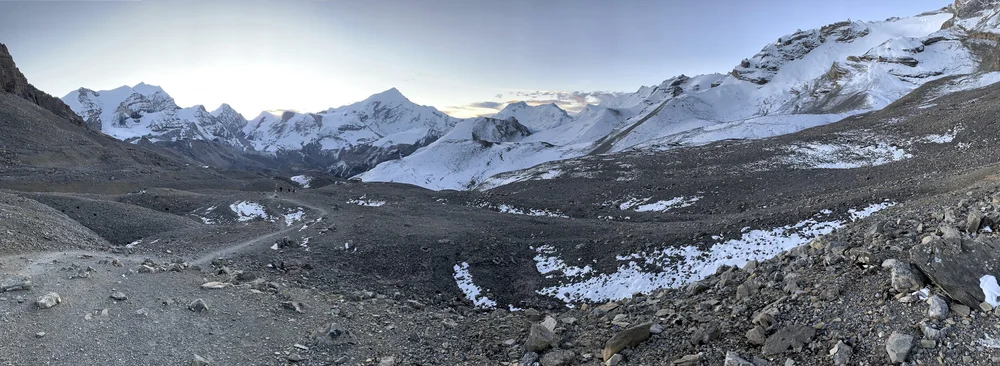
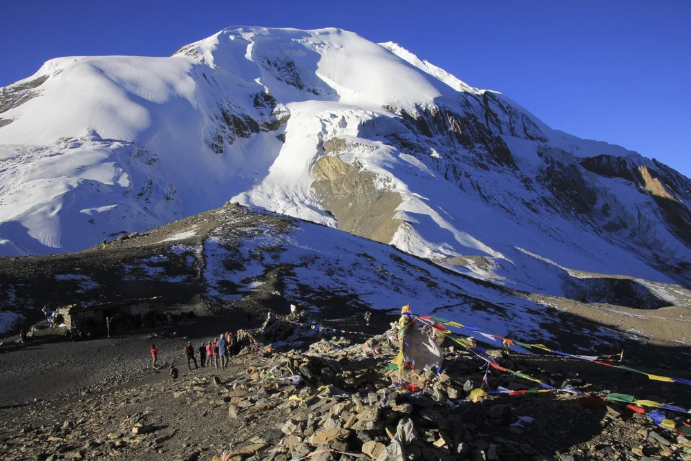
The view of the Thorong La basecamp at 4800m and the trail to the Thorong La pass at 5430m
The Thorong La basecamp.
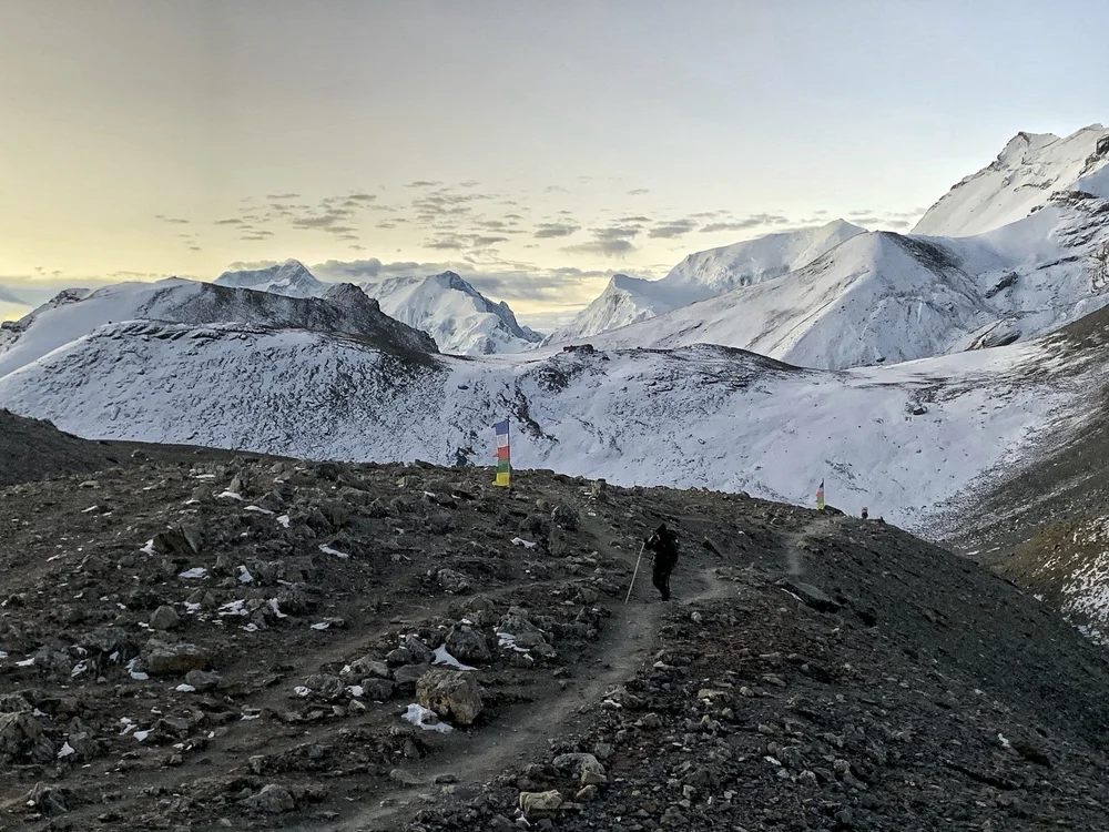
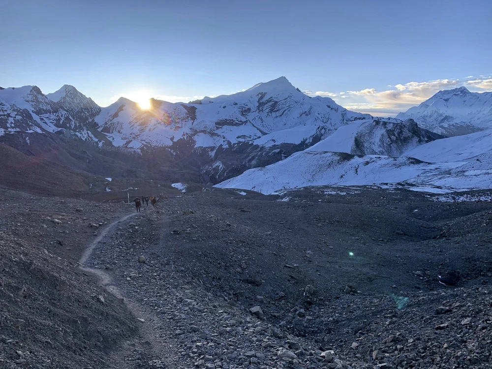
We started our hike to Muktinagh via Thorong La pass before sunrise. The view to the Annapurna Range was beautiful in the morning light. We had little wind and no snow. The bulky mountain on the horizon is Annapurna II and Annapurna IV. It is hard to believe that this place was the location the worst trekking disaster in Nepal’s history.
The 2014 Nepal snowstorm disaster occurred in central Nepal during the month of October and resulted in the deaths of at least 43 people of various nationalities, including at least 21 trekkers. Injuries and fatalities resulted from unusually severe snowstorms and avalanches on and around the mountains of Annapurna and Dhaulagiri.
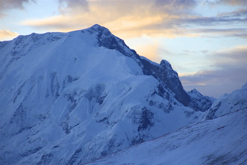
Annapurna II 7,937m
Annapurna IV 7,525m and the gap between Annapurna III and Annapurna IV. It is the only low point in otherwise uninterrupted ridge between Annapurna I and II.
As we approached the pass, the sun rose from behind the Chulu Peaks. On 14 October 2014 a snowstorm and series of avalanches occurred on and around Annapurna and Dhaulagiri in the Manang and Mustang Districts of Nepal within the Himalaya range. According to an unnamed expert the storm arose from Cyclone Hudhud and was the worst in a decade with almost 1.8 metres (5 ft 11 in) of snow falling within 12 hours. See the article in outsideonline about the disaster.
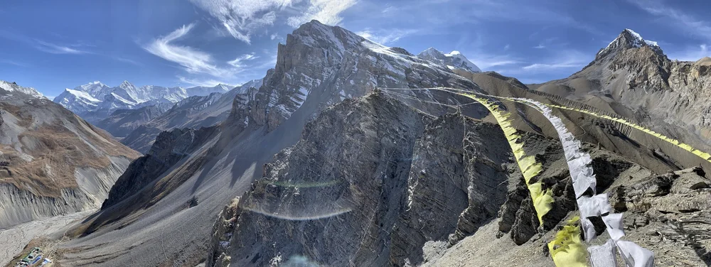
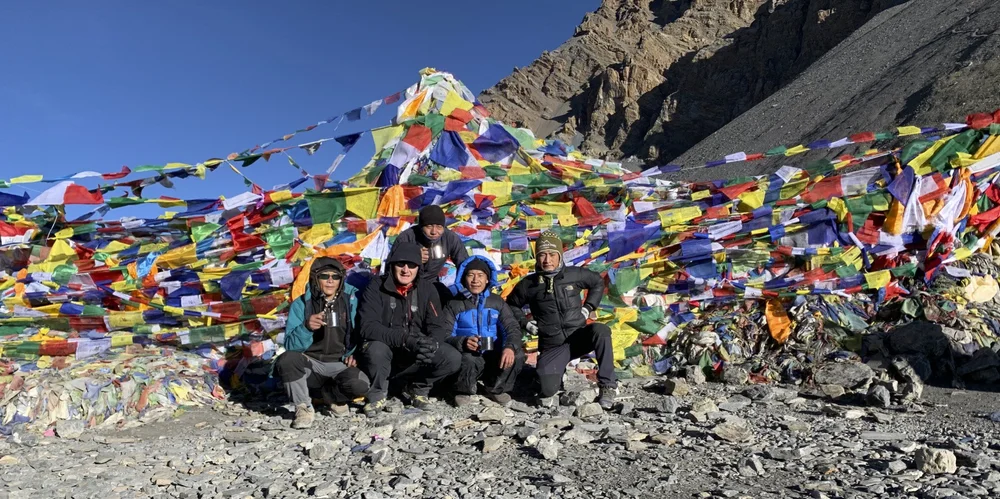
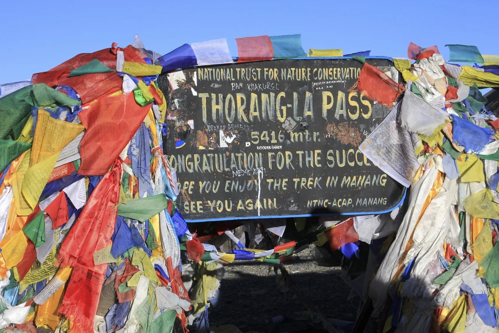
Thorong La pass. There is even a tea house serving tea! What luxury! Thorong Peak towers over the pass.
Our small team sipping hot tea at the Thorong La pass - the first pass, one of many more to come.
Annapurna II 7,937m
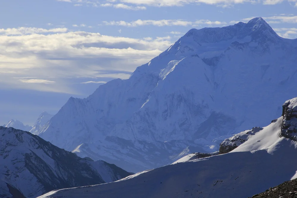
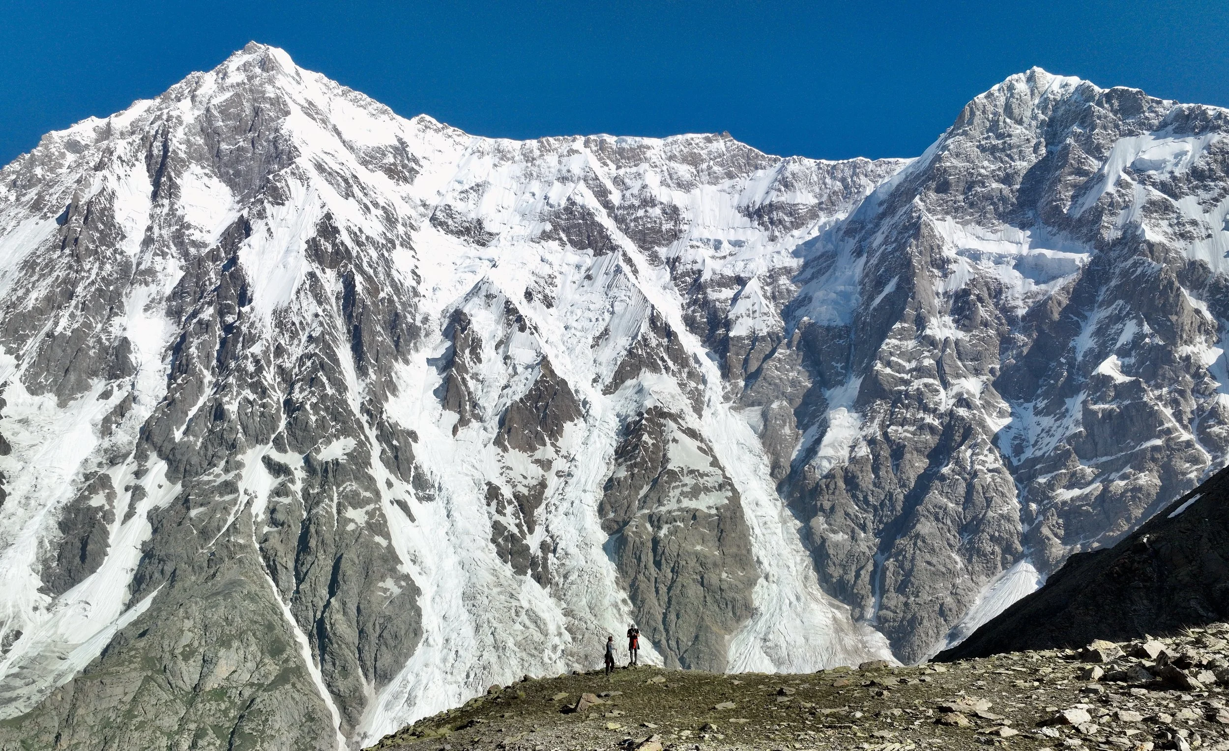
Looking west from the Thorong La Pass to the Dhaulagiri Himal. Dhaulagiri II is the large pyramidal peak in the background and Tukche Peak is the highest one of the three smaller peaks. The Dhampus Pass is visible directly below Dhaulagiri II. We crossed the Dhampus Pass in 2017 during the Dhaulagiri Circuit trek in less than ideal conditions.
Dhaulagiri II 7,751m and the Dhampus Pass. See The Dhaulagiri Circuit Trek for more photos of these mountains.
Thorogla Pass from Dhampus Pass
Ascending Thorong La Pass from the west. You get a better view of the Thorong Peak from this angle.
The massive Dhaulagiri I 8,167m from the trail between the pass and Muktinagh.
Tukche Peak and the Dhampus Pass. See The Dhaulagiri Circuit Trek .
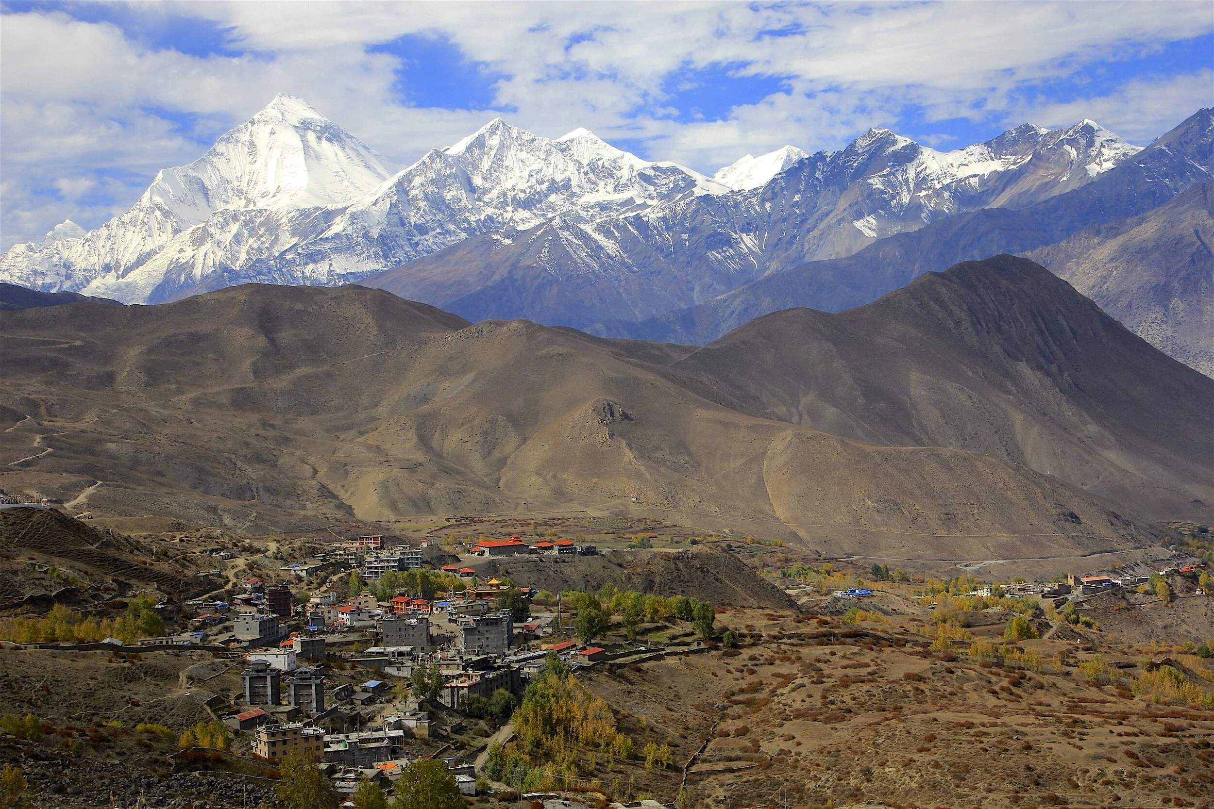
Looking west from the descent from Thorong La pass. The village below is Jharkot. Unfortunately we did not have the time to explore it.
Looking back to the Thorong La pass. The pass is beyond the visible low point between the mountains. It is over 10km from the spot from which this photo was taken.
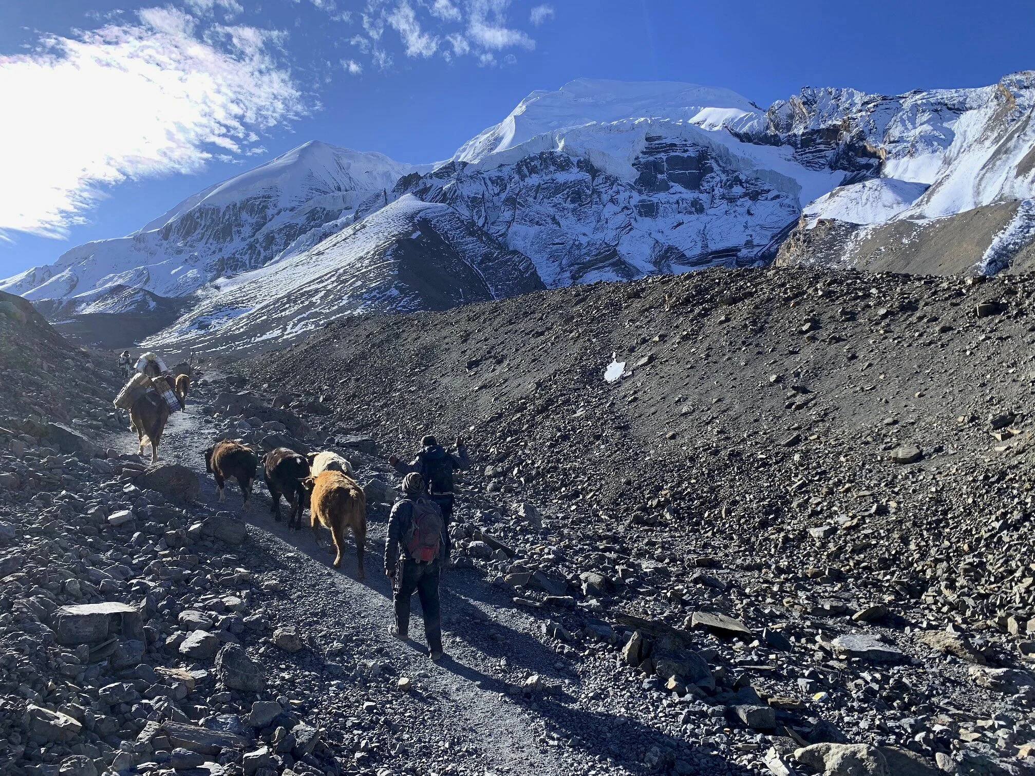
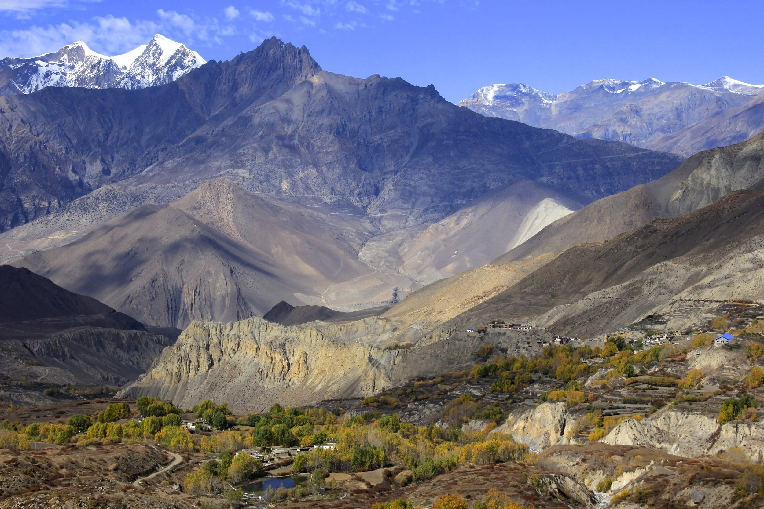
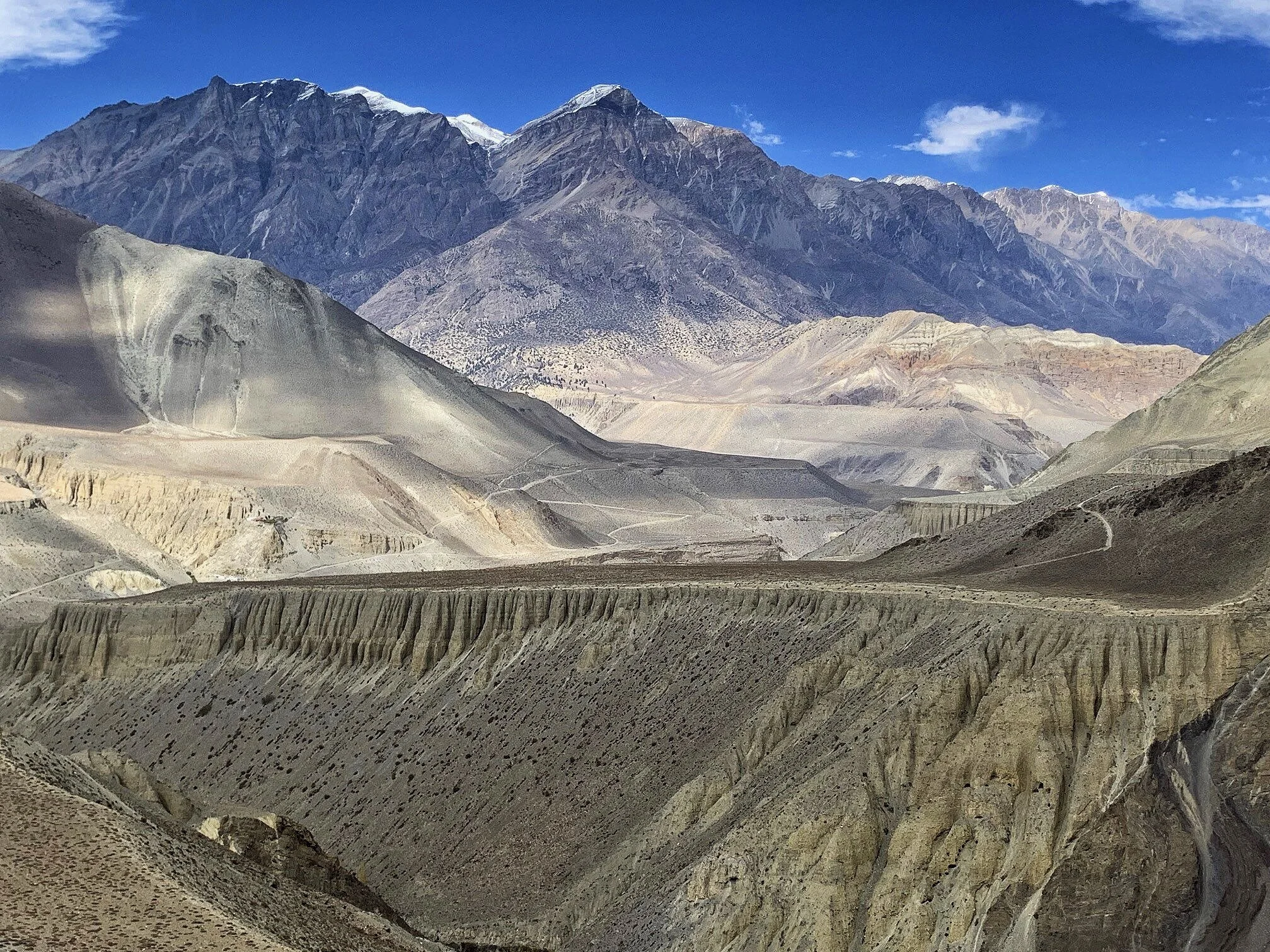
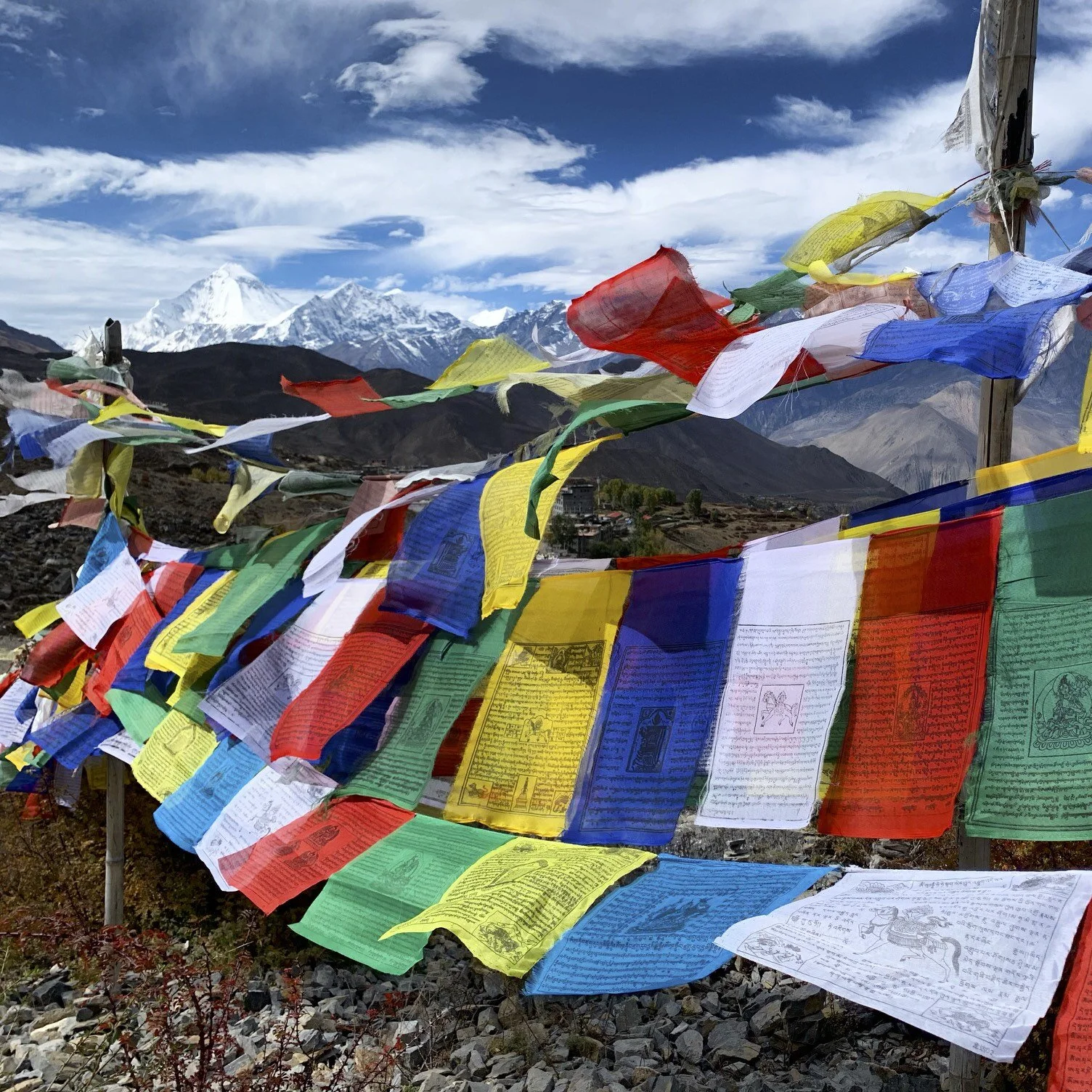
We could see the Upper Mustang from the trail from Thorong La Pass. Soon we would cross these dry hills and valleys!
The town of Muktinagh and the Dhaulagiri massif.
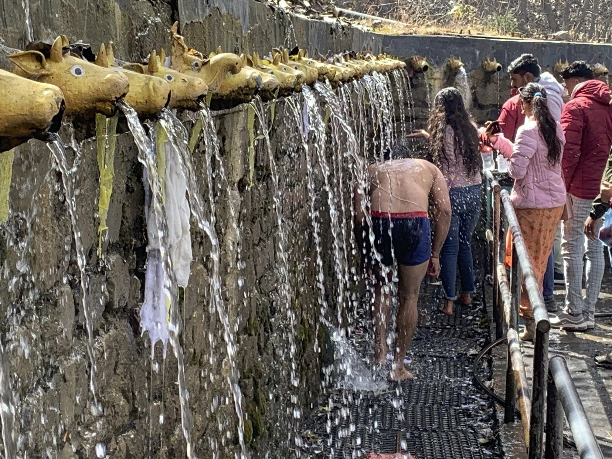
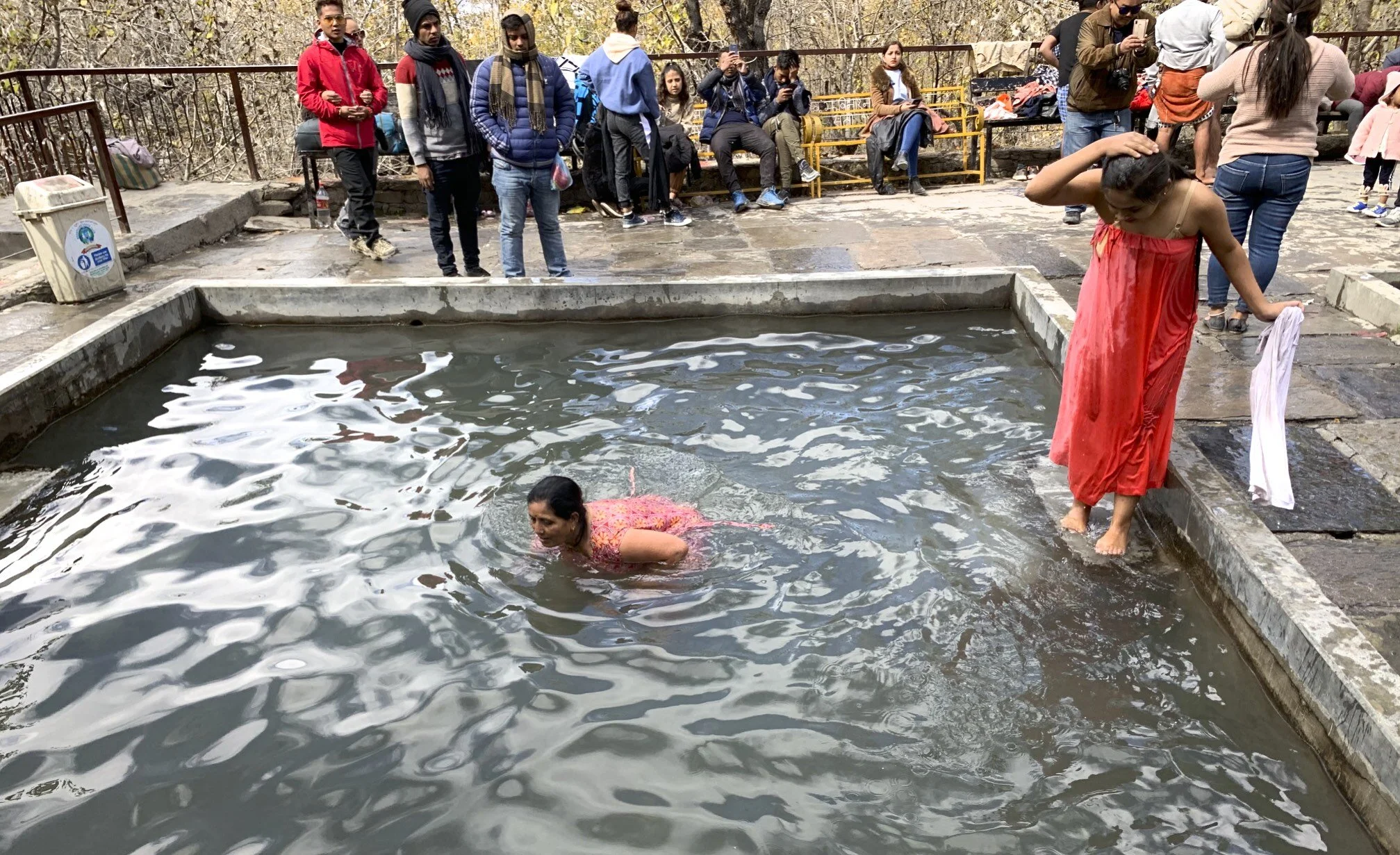
Muktinath is a Vishnu temple, sacred to both Hindus and Buddhists. It is located in Muktinath Valley at the foot of the Thorong La mountain pass in Mustang, Nepal. It is one of the world's highest temples (altitude 3,800 m).
The prakaram (outer courtyard) has 108 bull faces through which water is poured. The sacred water that flows in 108 pipes around the temple complex denotes the sacred Pushkarini waters (Temple Tanks) from the 108 Sri Vaishnava Divya Desams, where devotees take their sacred bath even in freezing temperatures.
The waterway downstream from Muktinath along Kali Gandaki is the source of the Silas or Shaligrams that are required to establish a temple of Vishnu. It is considered to be one of the holiest places of pilgrimage for Hindus and Buddhists.
It has 108 water springs, a number that carries great significance in Hindu philosophy. As an example of the mystery surrounding the number 108, Hindu astrology mentions 12 zodiacs (or Rashi) and 9 planets (or Graha), giving a total of 108 combinations. 27 lunar mansions (or Nakshatras) are divided into four quarters (or Padas) each giving a combination of 108 Padas in total.
Hindu and Buddhist traditions claim this site to be the only place on Earth to host all five elements (fire, water, sky, earth and air) from which all material things in the universe are made.
The riverbed of the Gandaki river has Shaligram stones that are used to worship Lord Vishnu.
According to Sri Vaishnava philosophy, it is considered to be one of the most-sacred places of worship of Lord Vishnu
Dhaulagiri 1 and the Tibetan prayer flags
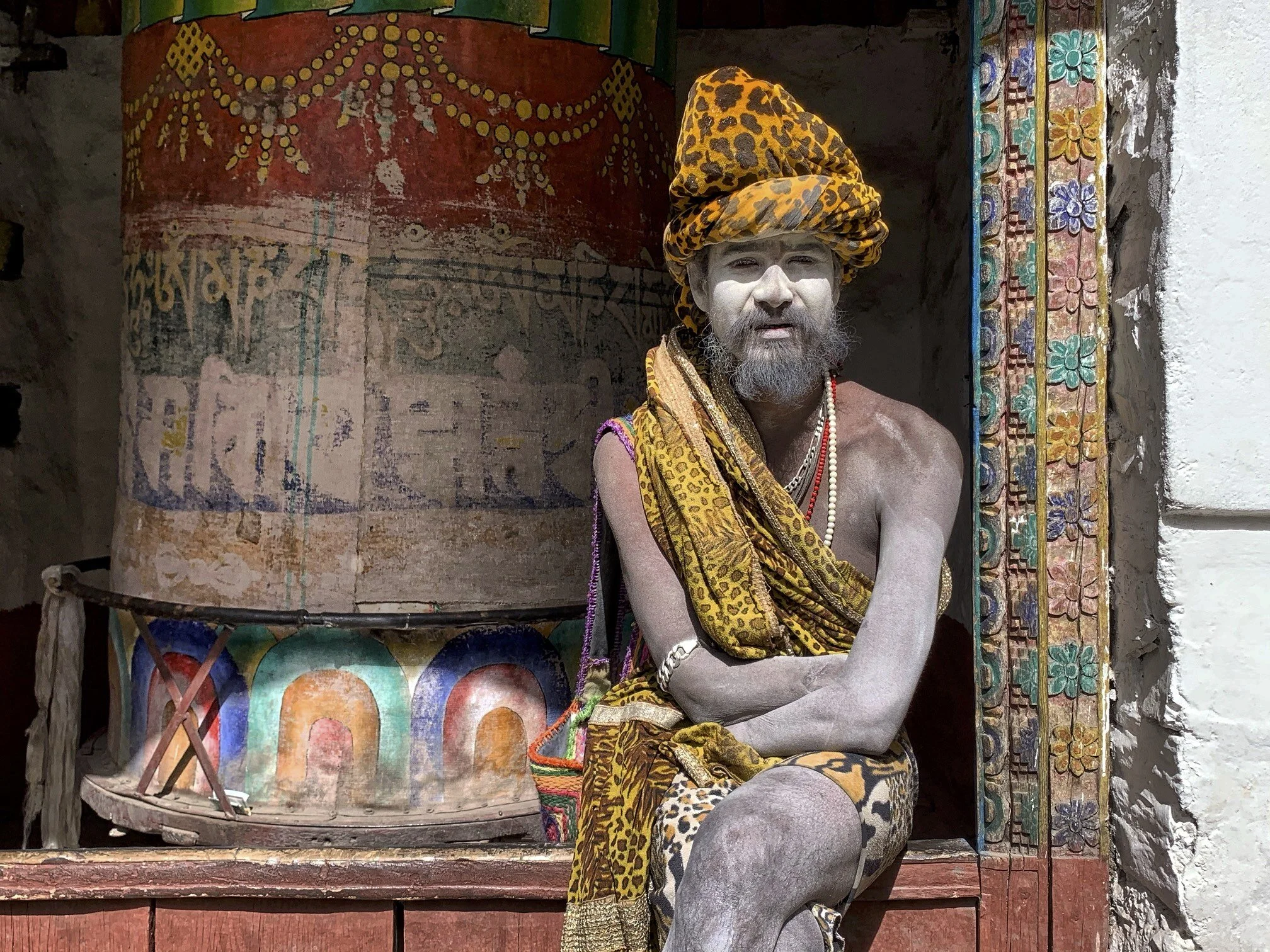
One of the sadhus in the temple in Mugtinagh. A sadhu is an holy man who pursues a sadhana or path of spiritual discipline. Usually, a sadhu is an ascetic who has renounced material attachments in order to practice yoga and meditation. The term in Indian religions means to “accomplish.” Although the sadhu may not have accomplished the complete realization of spirit, he perseveres wholeheartedly in his spiritual pursuit.
Nevertheless, encountering temptations, a sadhu may fall from his noble spiritual calling. For example, spiritual pride may delude devotees for many lifetimes. Intellectual or spiritual doubts, fears, and self-involvement may also sway the sadhu in his path. Delusion itself, or the Satanic force, may arise in countless manifestations. But the sadhu who commits himself to overcoming ego limitations and attaining spirit will surely reach his end. As Paramhansa Yogananda said, “A saint is a sinner who never gave up.”
Join the discussion
Share thoughts, tips, or questions about this trip.
Please keep it kind and relevant.
All Trips and Adventures by Year
A chronological archive of trip reports, photo essays, and route notes across decades.
2026
2025
2024
- Mon - Bhutan
- Bhutan - Snowman Trek Part 1
- Bhutan - Snowman Trek Part 2
- Bhutan - Snowman Trek Part 3
- North of 60º - Polar Adventures
- East Greenland 66º North
- On the Trail of Teutonic Order Castles in Northern Poland
- Wolfsschanze Hitler's HQ, Ketrzyn Poland and Peenemunde WW2 V1/V2 Research Centre in North Germany
- Central Mexico - Mexico City, Puebla and Teotihuacan
- Venezuela - Orinoco River Delta
- Venezuela - Mount Roraima Trek 2810m
- Venezuela - Angel Falls
2023
2022
- Nepal Solukhumbu - Sumna Pass and Lobuche East trip summary
- Nepal Khumbu and Kangchendzonga from the Air
- Nepal Solukhumbu Sundar Peak 5000m and Sumna Pass 5400m
- Nepal Solukhumbu Chola Pass 5450m Lobuche East Ridge 6090m
- Renjola La 5360m Gokyo Ri 5450m, and Cho Oyu BC Photos
- Iceland - Hellismannaleid, Laugavegur and Fimmvorduhals Trails
- The Yukon and the Alaska Highway
- Mount Robson
- Yellowstone National Park
- Grand Teton and Glacier National Parks
2021
- The Rockies of Alberta, Western BC and the Yukon
- Columbia Icefield from the Air
- Waterton Lakes National Park
- Colombia
- Los Nevados National Park Colombia
- Colombia Tayrona National Park
- Colombia Teyuna - Ciudad Perdida Trek (The Lost City)
- Mexico Pico de Orizaba 5,630m
- Mexico - Sierra Negra 4,650m and Izaccihuatl 5,350m
- Chitwan National Park Nepal
2020
2019
- The Grand Mustang Circuit - Part 1: Chame to Kagbeni via Thorong La Pass
- The Grand Mustang Circuit - Part 2: Kagbeni to Lo Mantang
- The Grand Mustang Circuit - Part 3: Lo Mantang to TeriLa Pass
- The Grand Mustang Circuit - Part 4: Terila Pass to Chame via Naar and Kangla Pass
- Kamchatka Trip Report
- Камча́тка, Russia - The Mutnowski and Gorely Volcanoes
- Камча́тка, Russia - The Tolbachik Volcano Circuit and Volcano Bezimienny
- Russia Far East - Sakhalin, Vladivostok, Petropawlowsk-Kamchatsky
- Taiwan
- Ancohuma 6,427M Bolivia
- Huayna Potosi 6,088m Bolivia
- Ausangate Trek Peru
- Yellowstone National Park in Winter 2019
2018
- Calgary Mountain Film Festival
- Langtang, Tilman Pass and Ganjala Trip Report
- Langtang Trek - Tilman Pass
- Langtang Trek - Ganjala Pass
- Paria River Wilderness - USA, Utah
- Slot Canyons - USA, Arizona
- Bryce National Park - USA, Utah
- Zion National Park and Cedar Breaks - USA, Utah
- Norway
- Poland - The Slav and Viking Festival in Wolin
- Iceland
- Bolivia Cordillera Real and Sajama National Park
- Bolivia - Tiwanaku and La Paz
- Togo and Benin
- Benin - Egungun Masquerade
- Benin - Voodoo Festival
- Ghana - The Gold Coast and the Land of the Ashanti
2017
- Annapurna Basecamp and Annapurna Sanctuary Photos
- Annapurna Sanctuary Trip Summary
- Dhaulagiri Basecamp Trek, Dhampus Pass - Trip Summary
- Dhaulagiri Circuit Photos - Nepal
- Peru Central - Huaraz, Cordillera Blanca and Chavin de Hauntar
- Peru South, Sacred Valley - the Land of the Incas, Rainbow Mountain and Lima
- Mt. Brazeau and Maligne Lake in Jasper National Park in Alberta, Canada
- China Shanghai Beijing Wuhan
- Papua New Guinea
2016
- China Far West - Kashgar and Shiphton Arch
- China Far West - Pamir and The Tajik Games
- K2 Basecamp North, Shaksgam Valley Trip Summary
- Chinese K2 (BC North), Shaksgam Valley - Chinese Karakoram
- North Peru Chachapoyas Trip Report
- Peru North - Kuelap, Chachapoyas and Royal Tombs of Sipan
- Wapta Icefiled Area, Alberta, Canada
- The Caribbean and the Panama Canal
- China Far West - Ancient Silk Road Trip Summary
- China Far West - Ancient Silk Road
2015
2014
2013
2012
2011
2010
2009
2008
2007
2006
2004
2002
2001
1996
Get new trip reports when they land
One email when a new story is published. No noise. Just the trail.