Pakistan Haramosh La 5,150m
August 11, 2023

Haramosh La is one of the more challenging passes to cross in the Karakoram. It is situated in the Lesser Karakoram Range but there is NOTHING lesser about it. The altitude is gained very rapidly (from 2000m to 5200m in 3 days), the ascent is dotted with crevasses and the descent is a 1800m+ drop on day 1 and another 1500m on day 2. The descent slope is a 50 degree mass of loose rocks that is just waiting to be dislodged and catapult down to the valley. One has to descent the slope diagonally to avoid dropping rocks on anyone below in the party. We had a very competent local guide Hussain from Arando. He was incredibly fast, strong and knew the best way up the Haramosh Glacier and down to the Kutwal Valley. The upper section is quite steep but nothing overly serious. The loose terrain was the biggest challenge with our large group of porters. If the upper section is iced up or snow covered, a fixed rope would be required. We were fortunate to have dry conditions.
Haramosh La is considered the most technical, difficult and dangerous pass in Pakistan.
It is considered a very difficult trek as the glacier on the upper Chugolangma is heavily fissured with the danger of avalanches. The ascent is steep on the west side, requiring the use of rope almost 600/700 meters. It is a challenging trek and is only suited to experienced trekkers with technical mountaineering experience.
The temperature went from -10C on top of the pass to +45C at 2200m in the narrow valley with heat radiating walls. The ever-changing and unpredictable weather adds to the challenge as the pass can only be crossed in clear weather. Crossing it in a snowstorm or rain would be quite dangerous on the descent.
It is not a popular trek and the pass is crossed very rarely (once or maybe twice per year, in a good year). I had it on my radar since 2013 and I finally made it. It is an incredible place with absolutely stunning scenery. Not easy to get to but definitely worth the effort.
Thanks to Adventure Karakoram Pakistan and Ghulam from Mountain Travels Pakistan for their assistance, hospitality and great service!
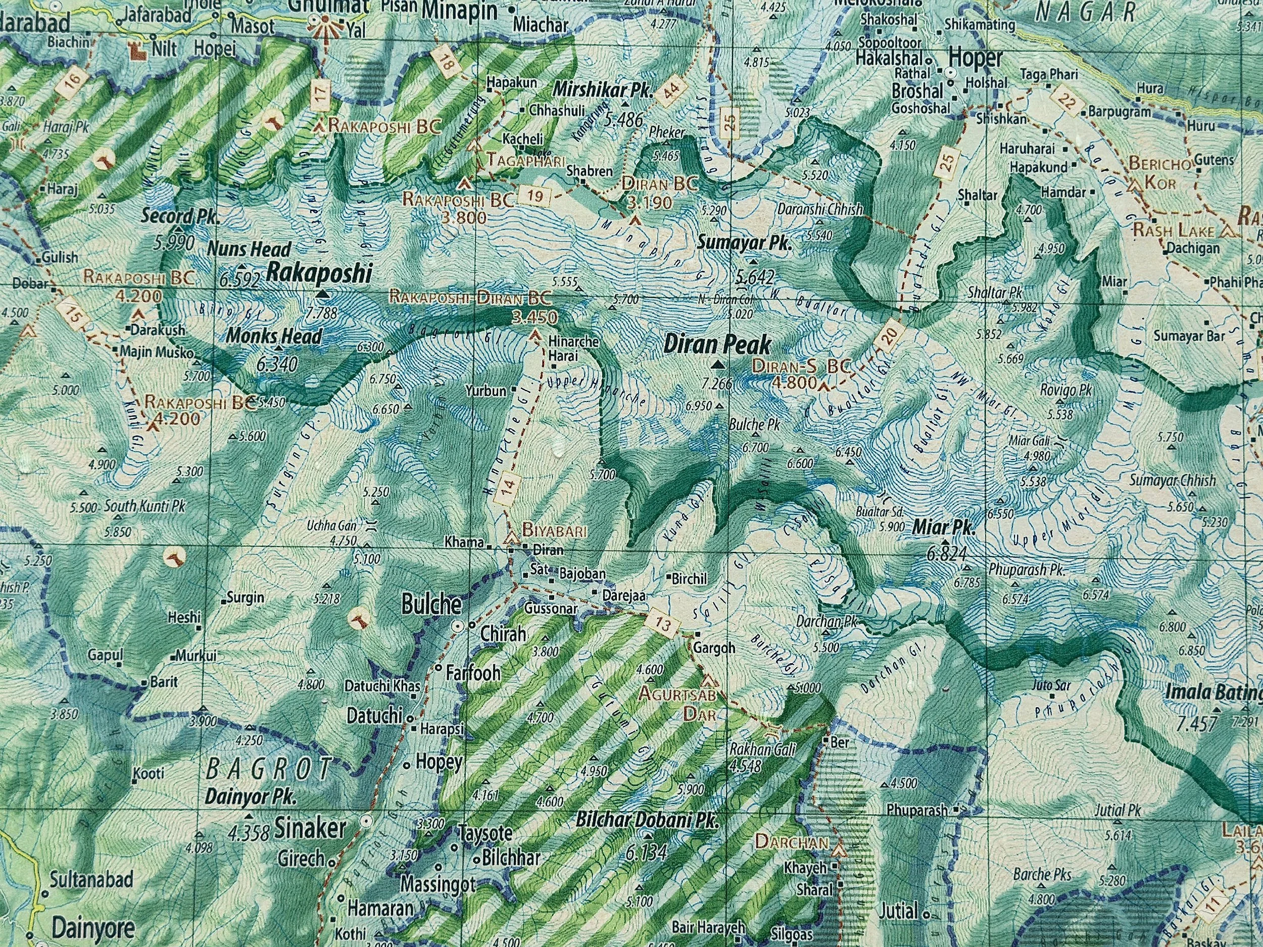
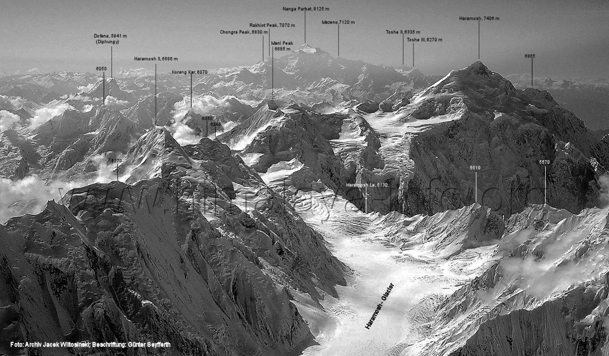
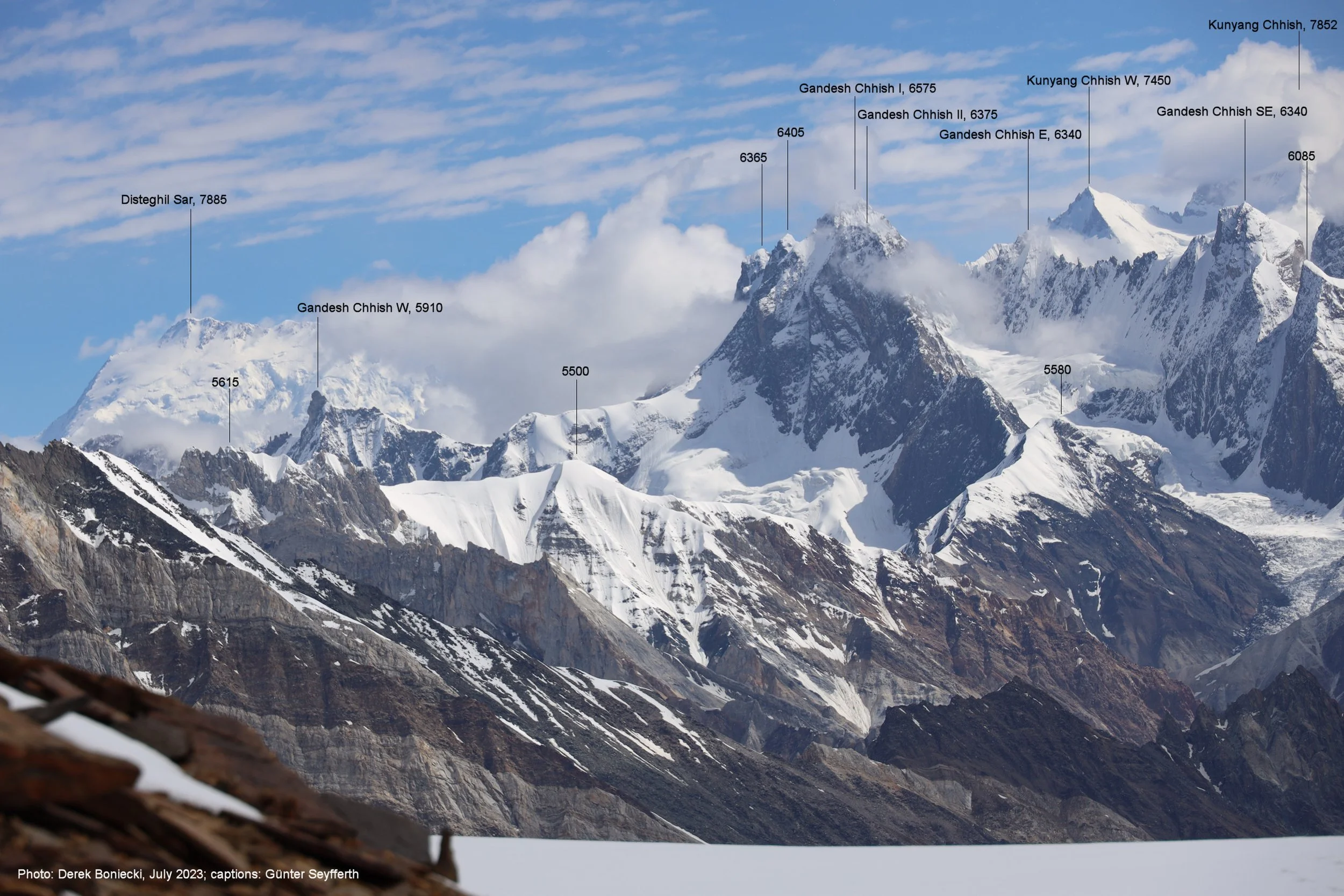
The overview of the Lesser Karakorum. Rakaposhi, Haramosh and Diran are situated in that range. All are over 7000m high.
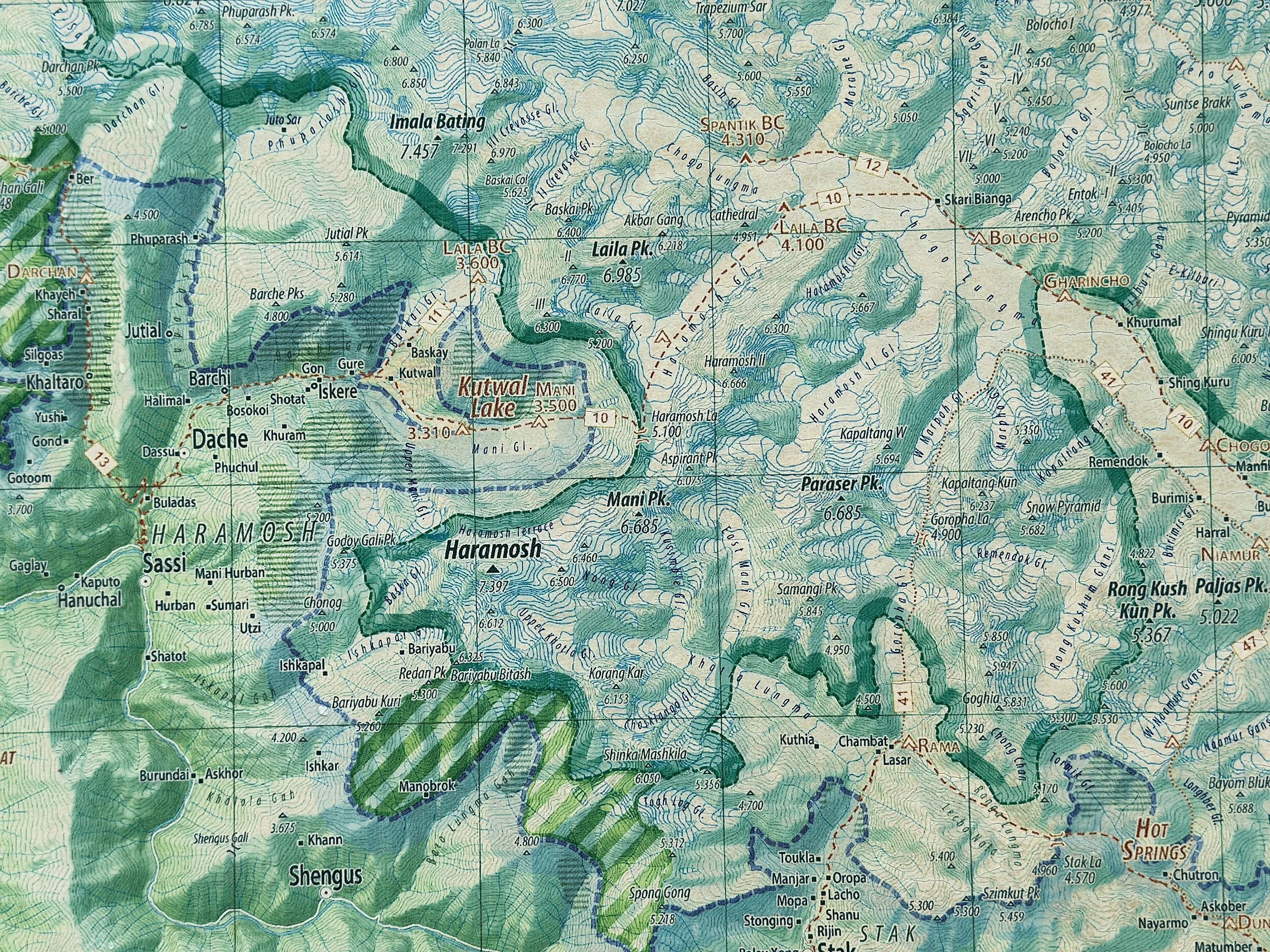
Map of the Haramosh Glacier and Haramosh La (lower left).
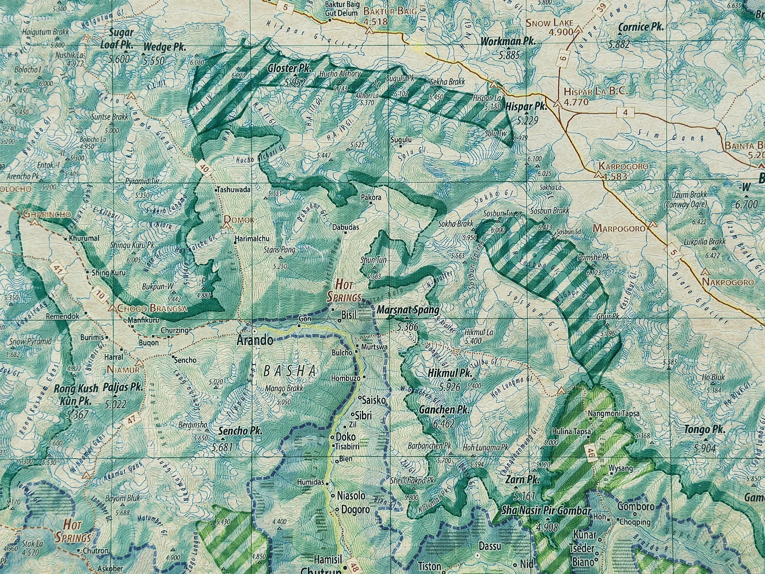
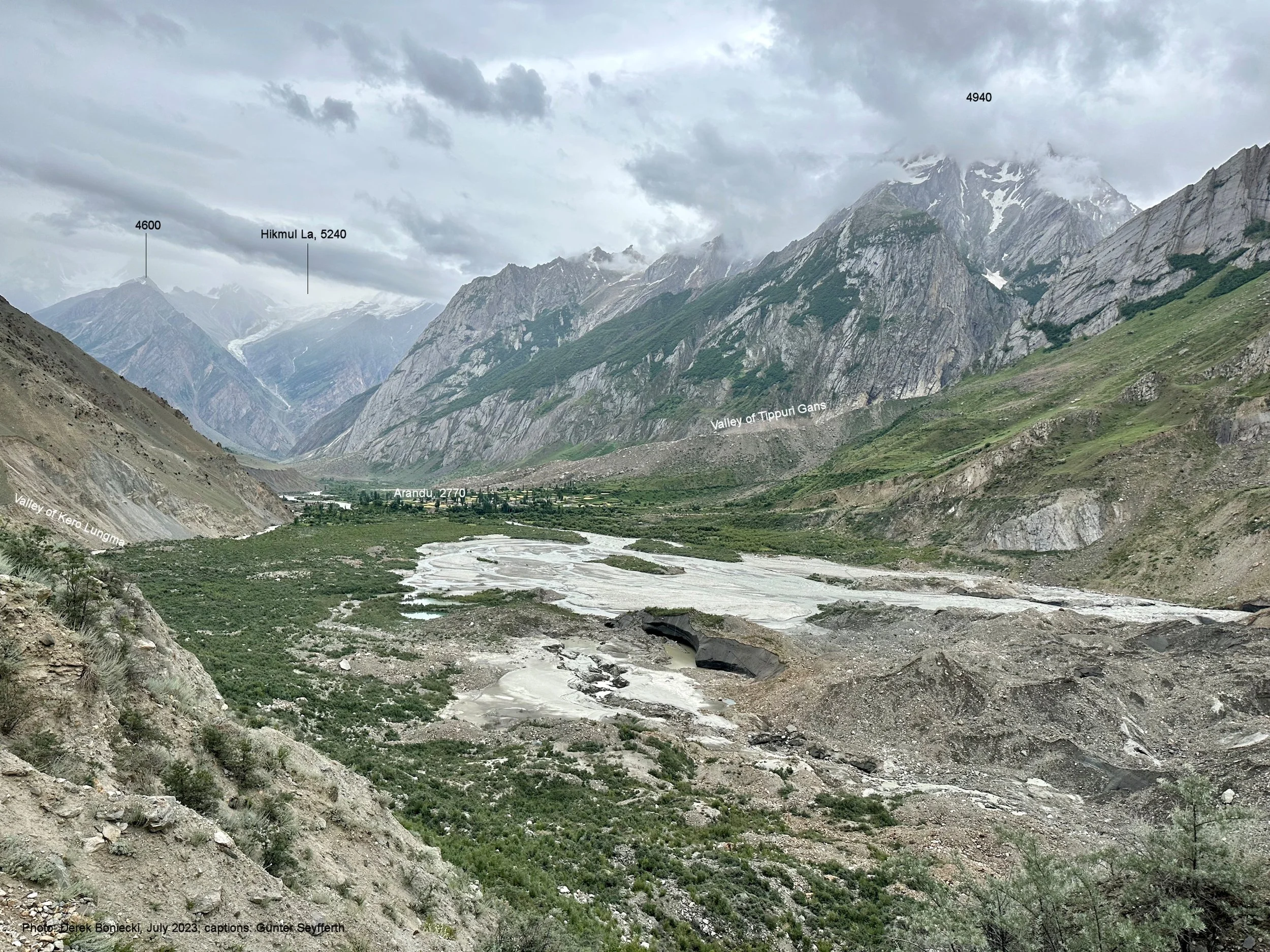
Starting point of the trek is Arando, a 6 hr drive from Skardu.
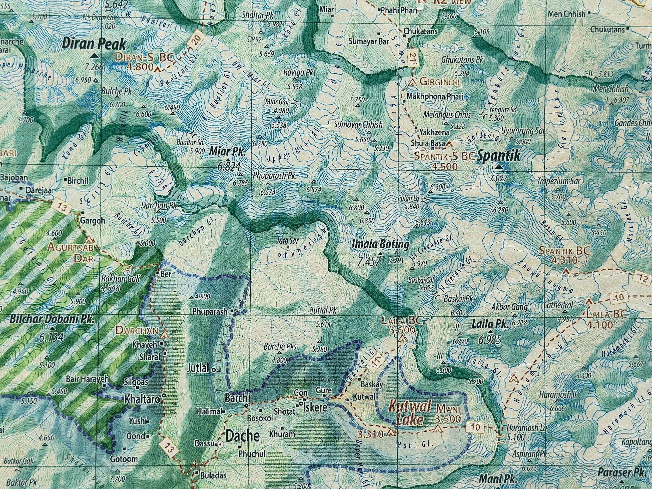
Map of Chogolugma Glacier, Haramosh Glacier and Haramosh La.
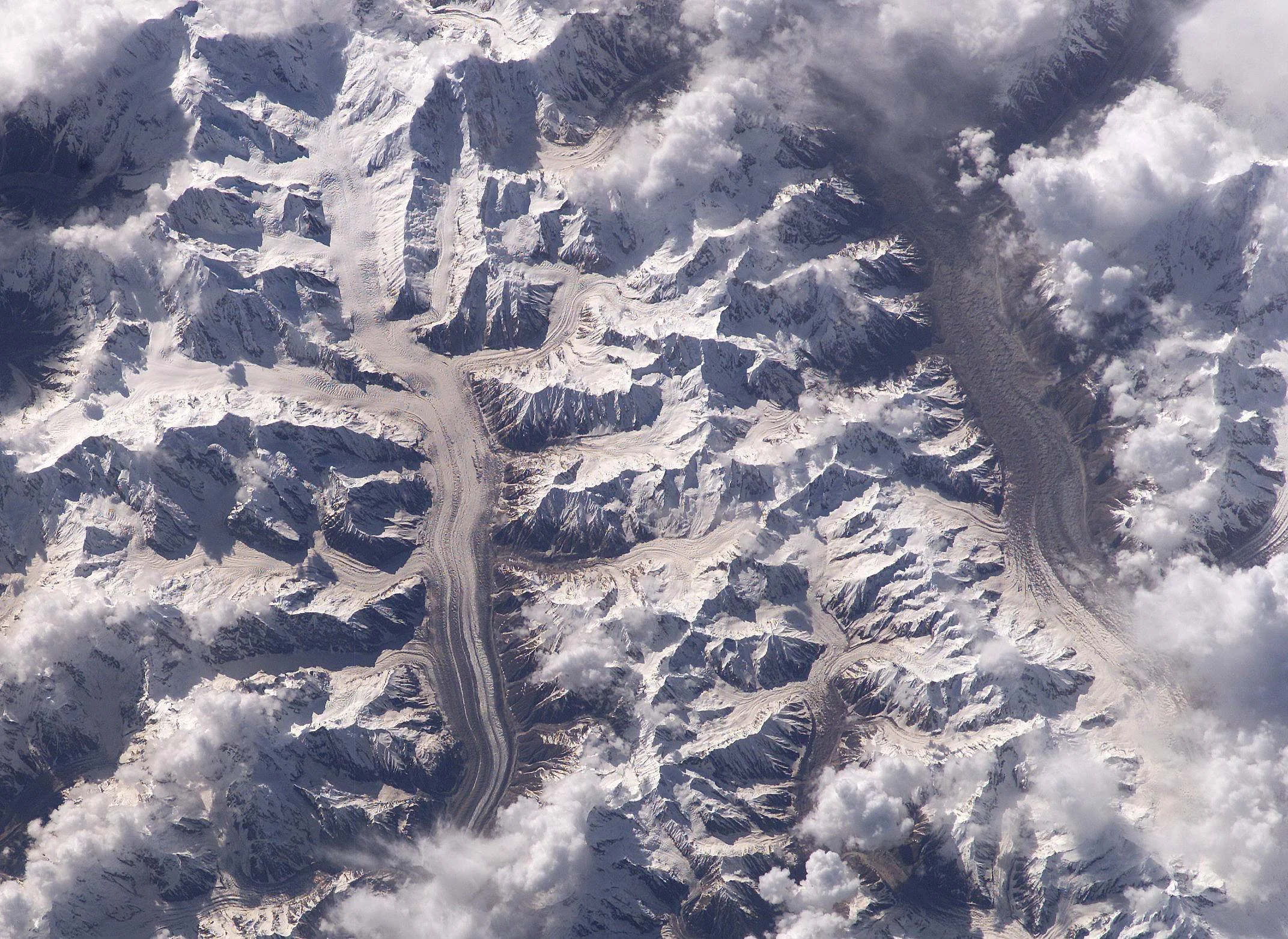
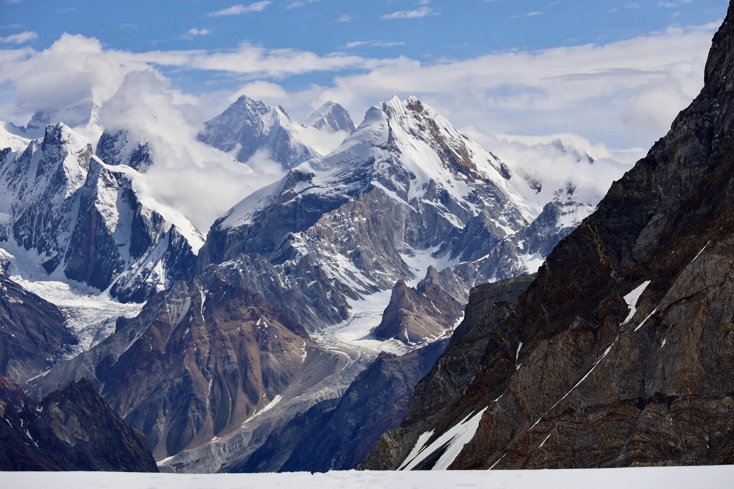
The long glacier on the left is Chogolugma. The Glacier on the right is Hispar. Haramosh Glacier is on the left side flowing into the Chogolugma Glacier in the middle left of the photo.
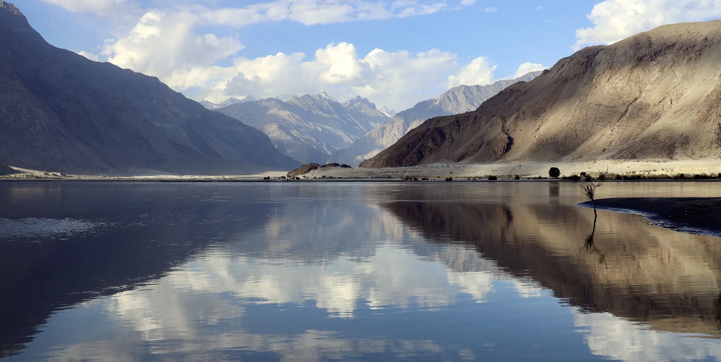
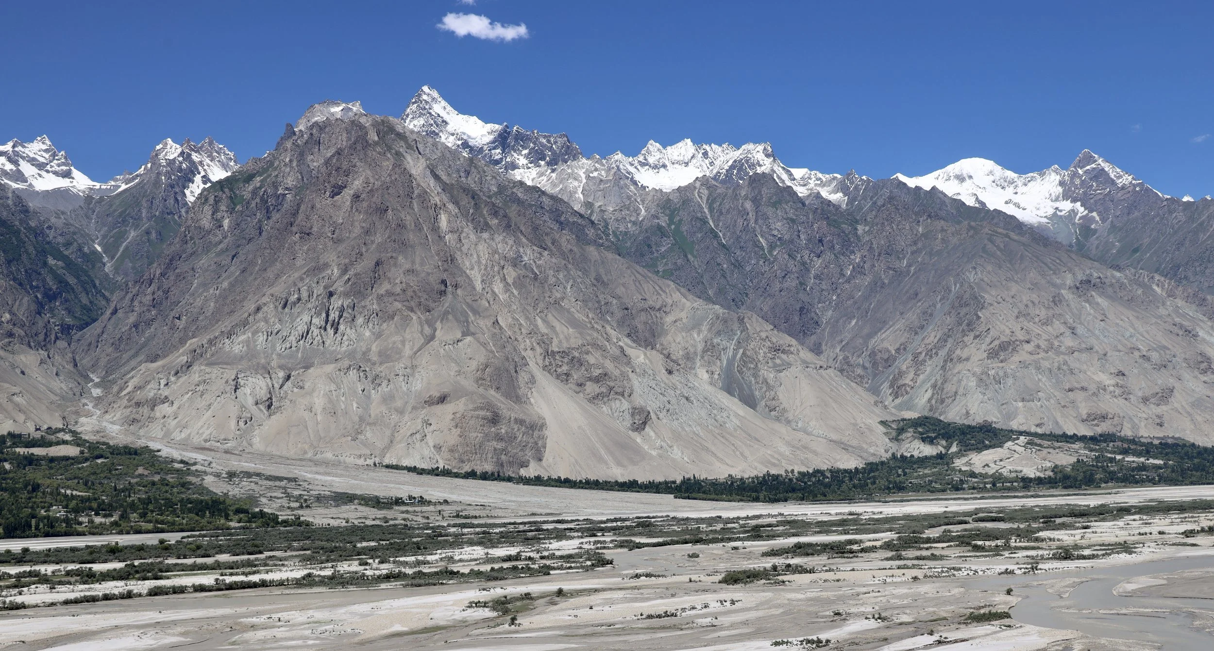
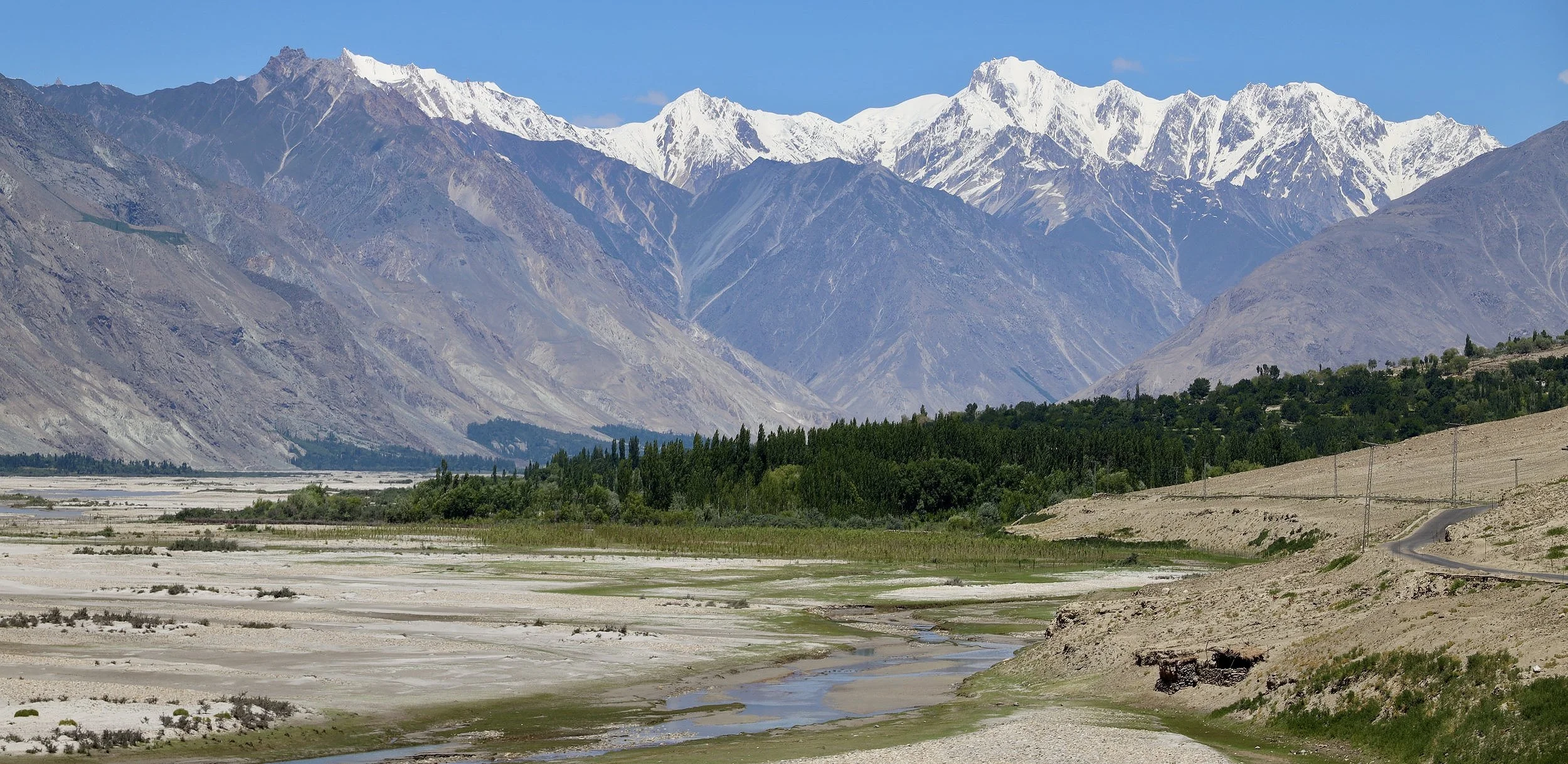
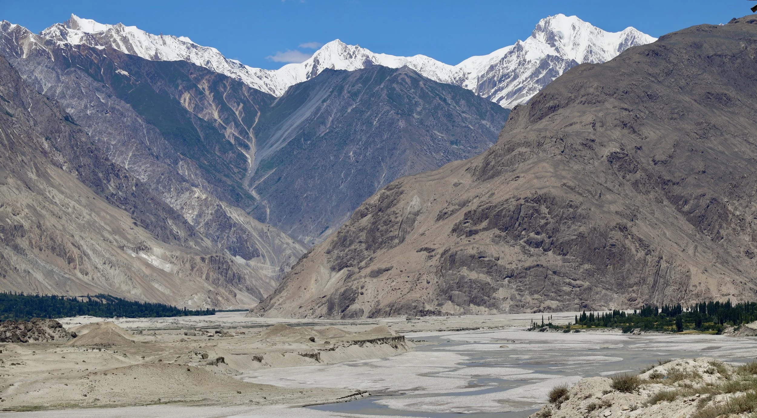
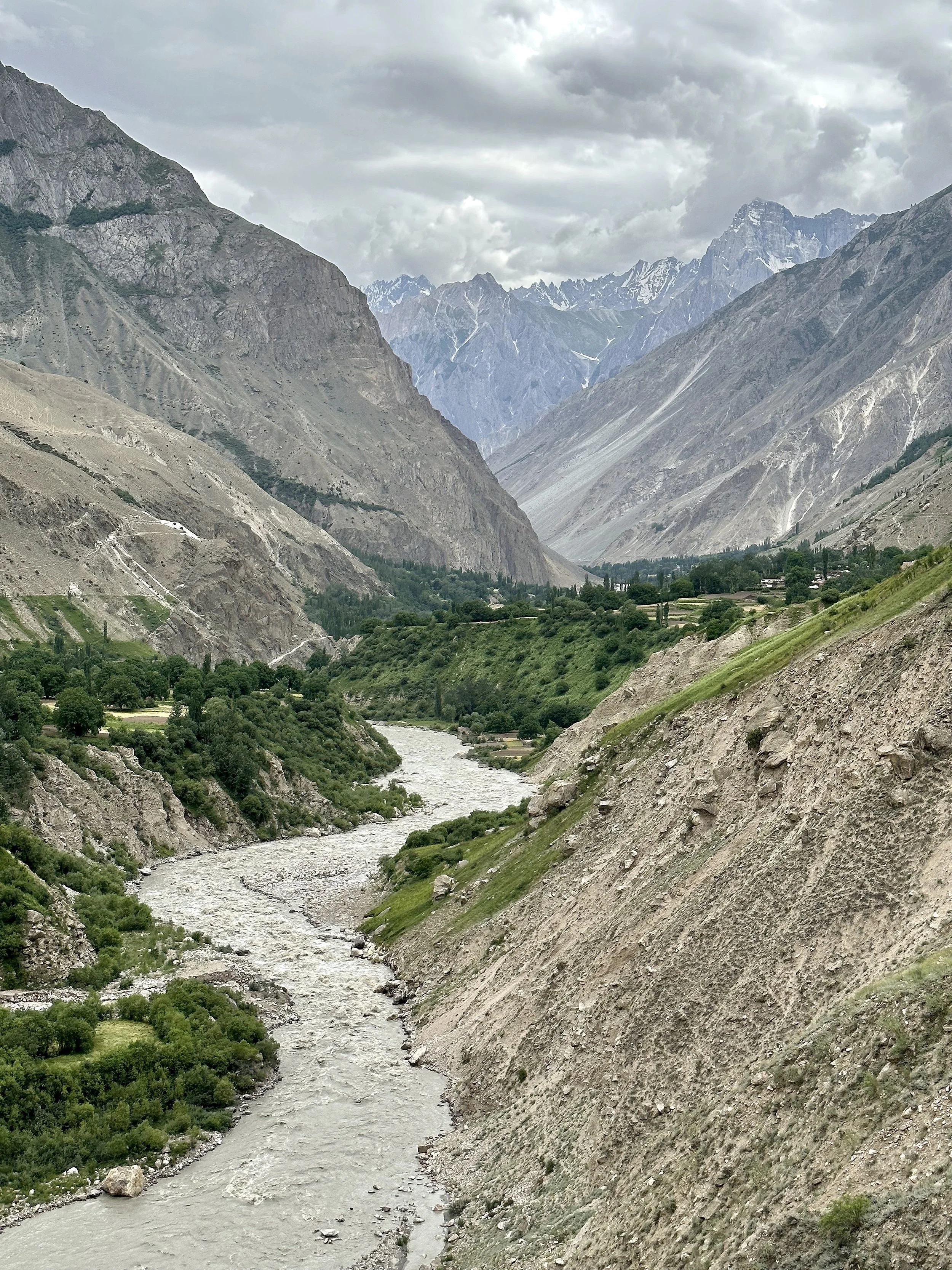
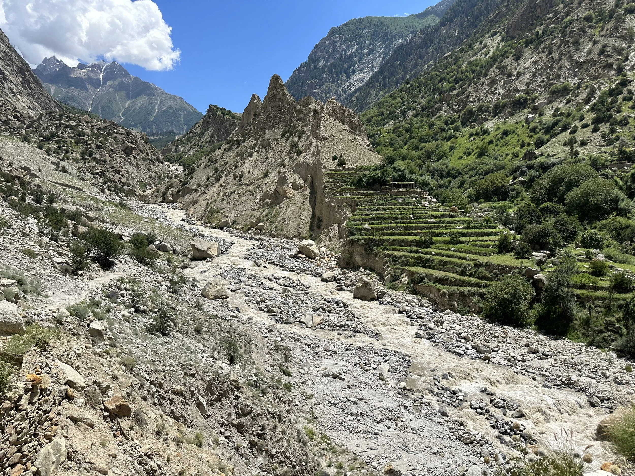
The Indus River and Shigar Valley
Shigar Valley
Shigar Valley
Shigar Valley
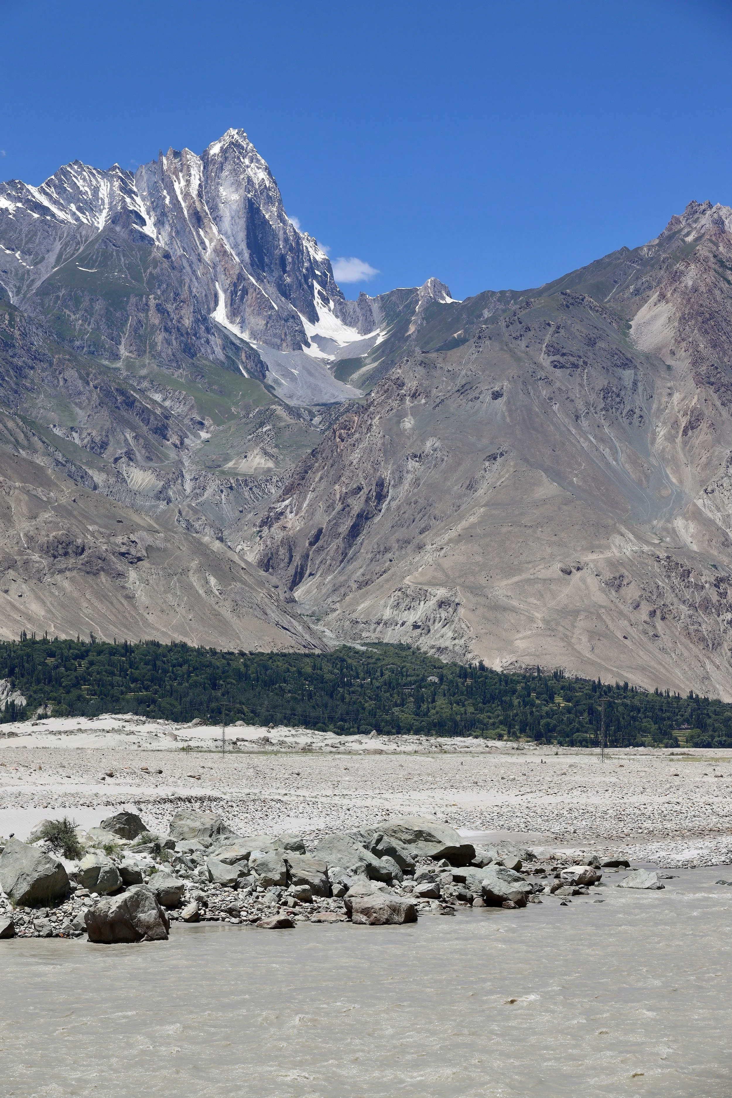
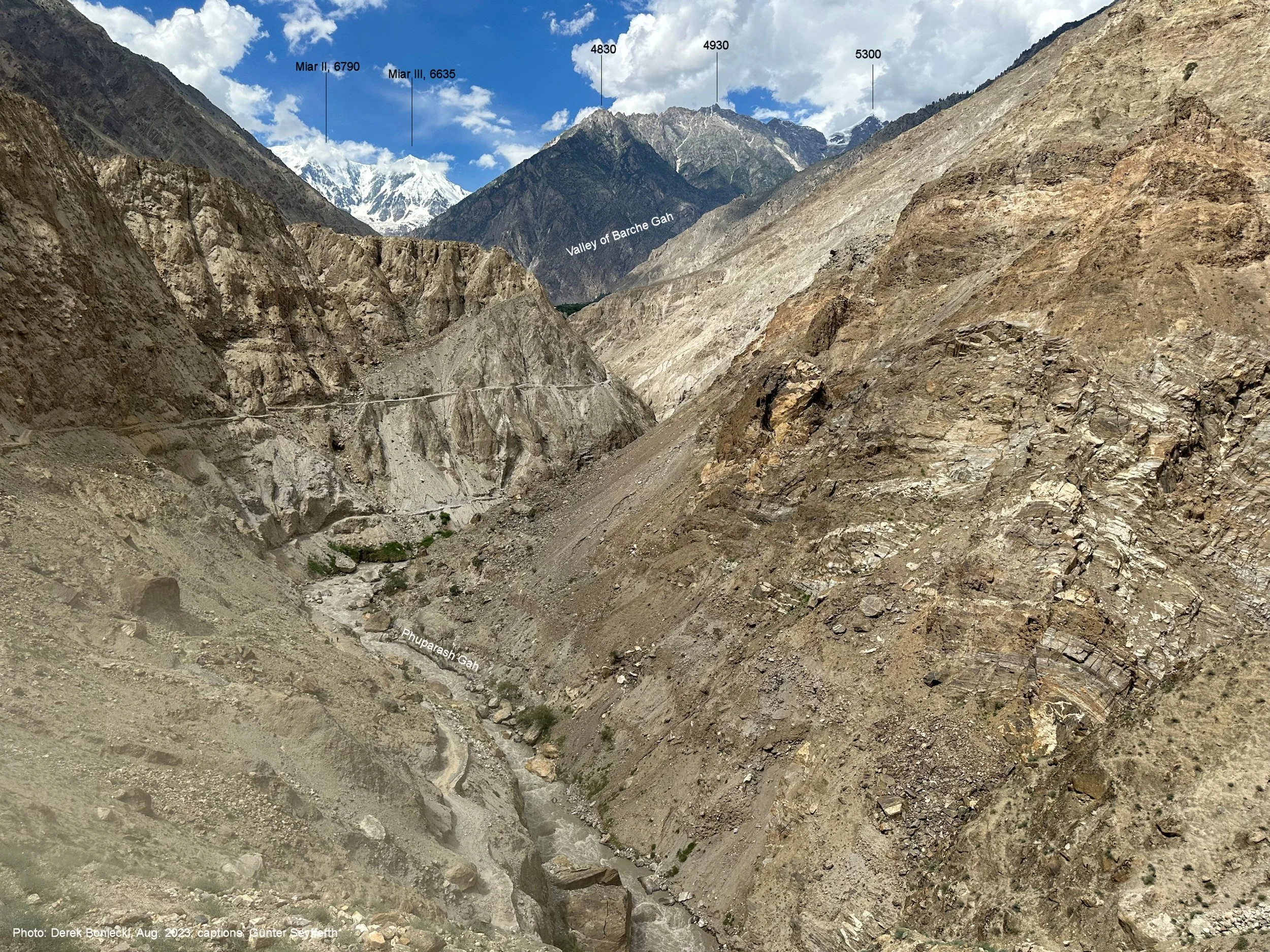
The confluence of Shigar and Basha Rivers. We are going into the valley ahead. The road to Askole turns right.
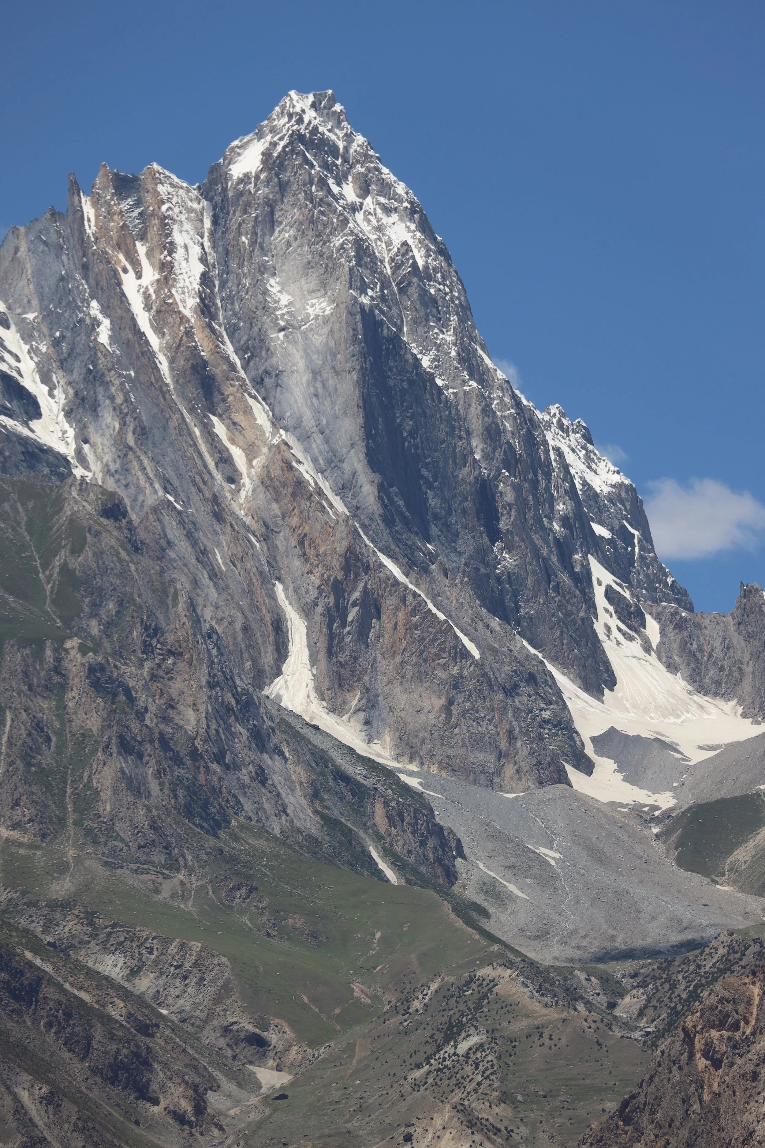
Basha River Valley. The high mountain on the right is Bargincho 5790m.
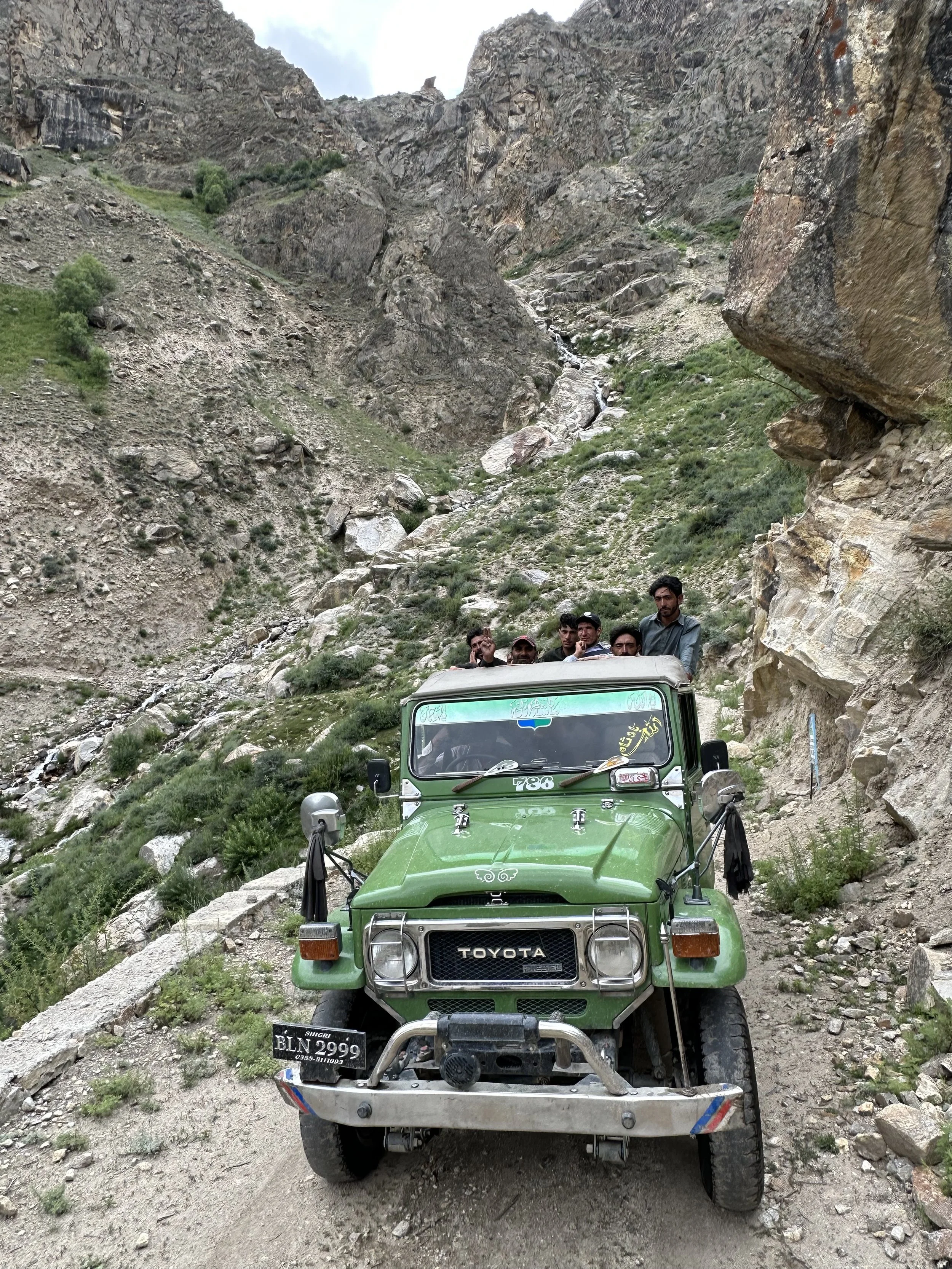
Driving to Arando
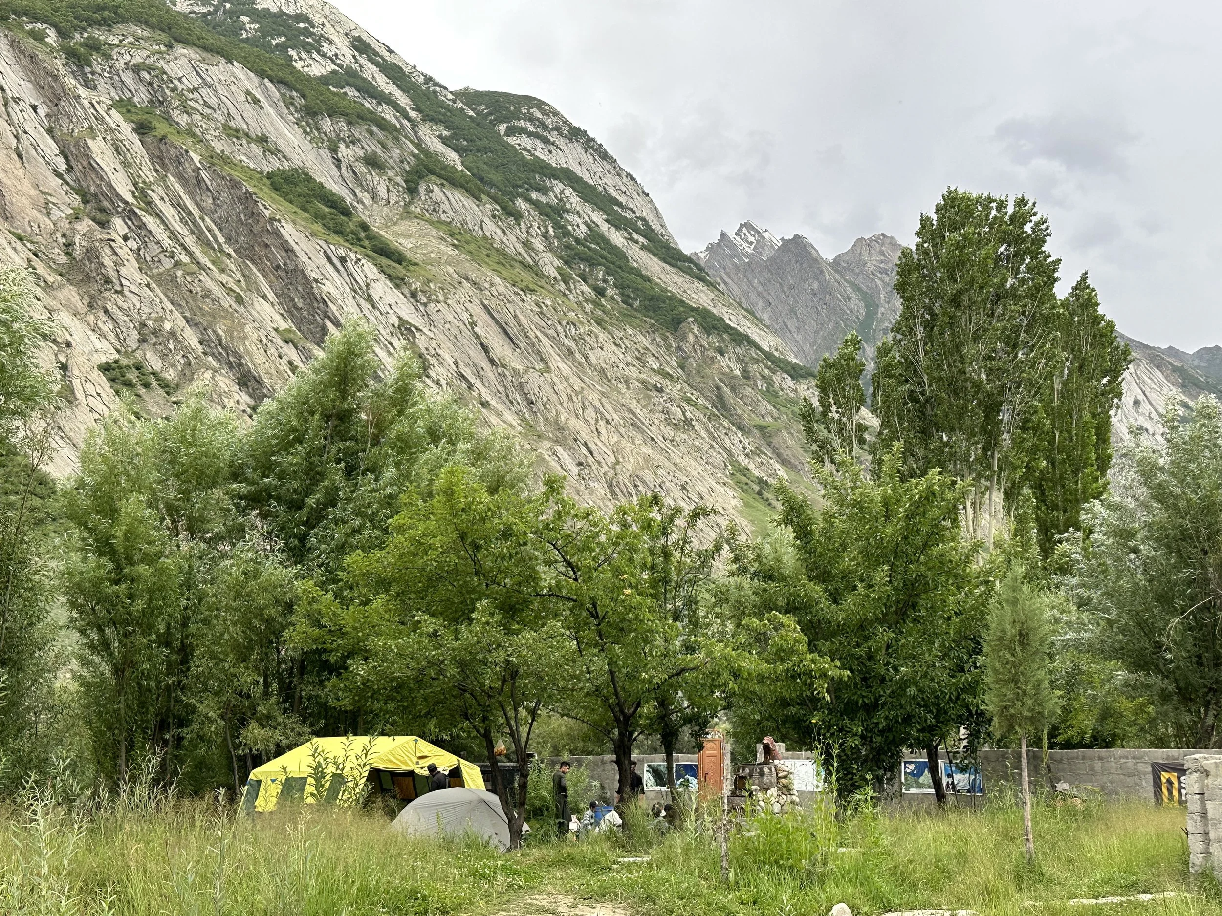
Camp 1 in Arando
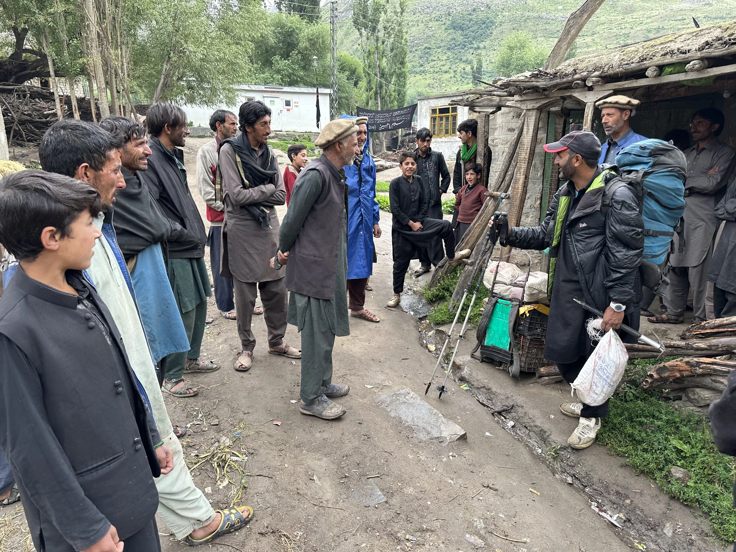
Negotiating with porters in Arando
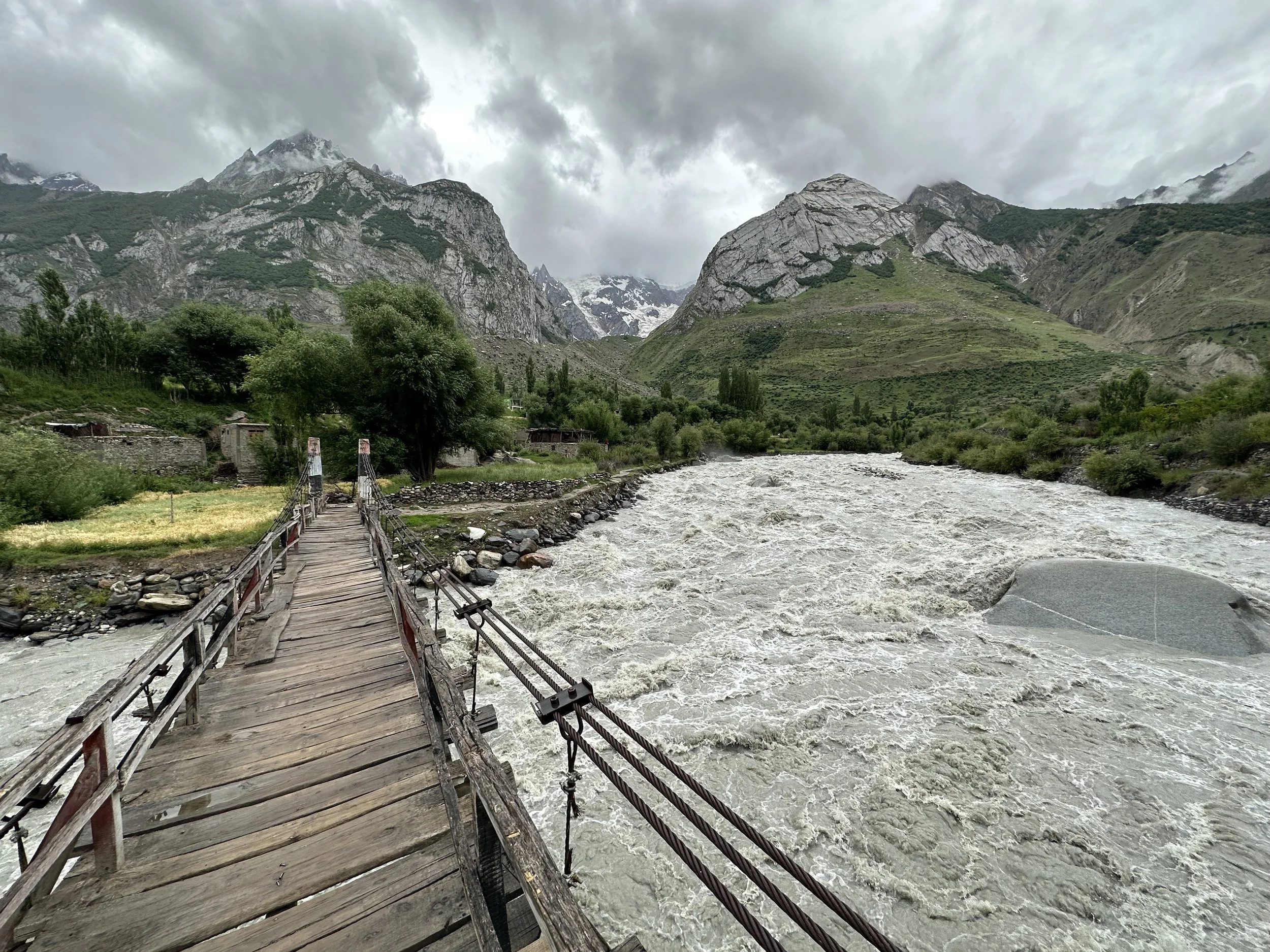
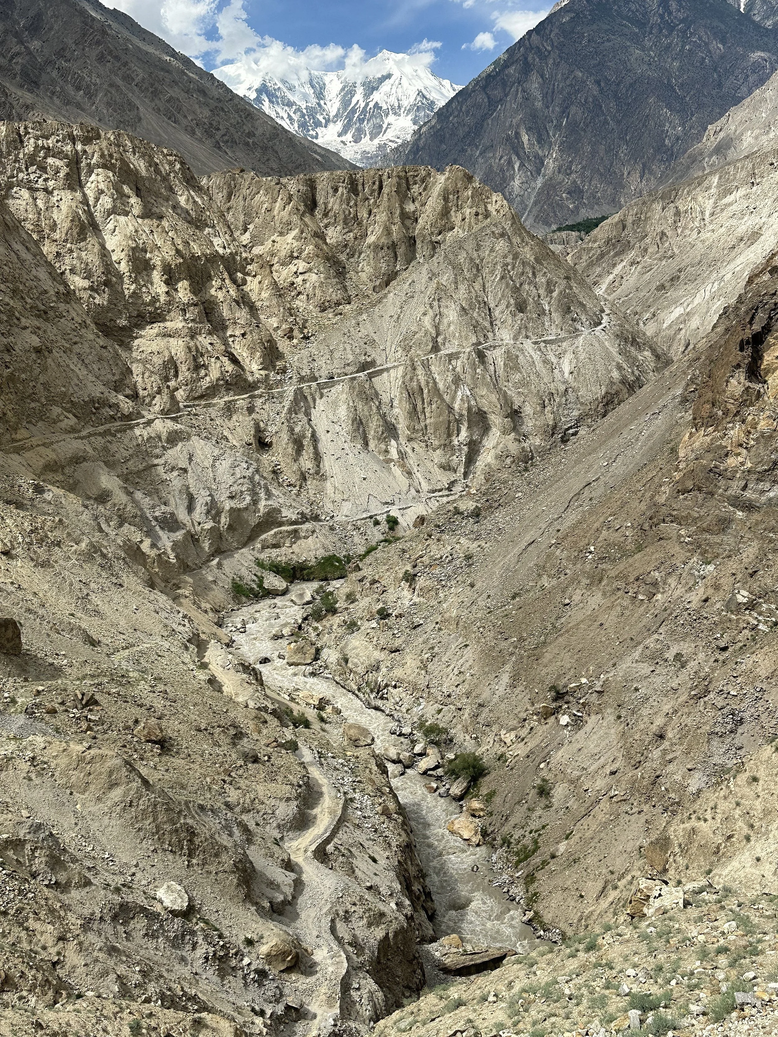
Arando, bridge over Basha River
Arando
Arando, Basha River
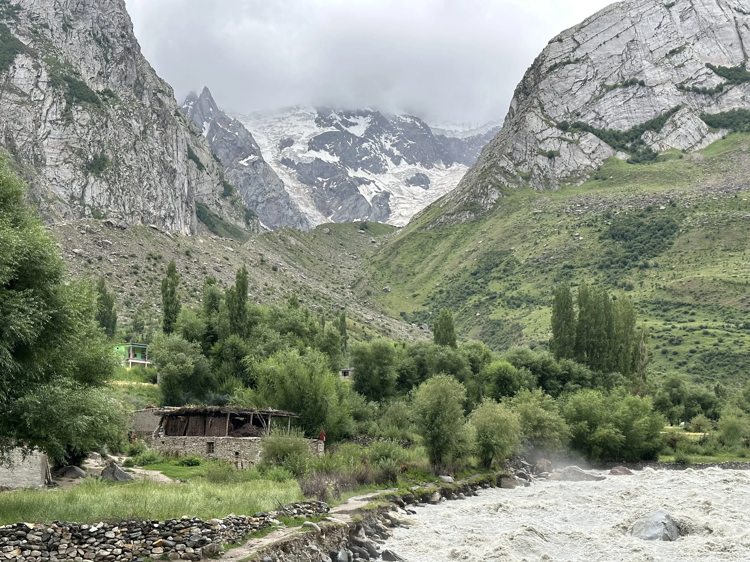
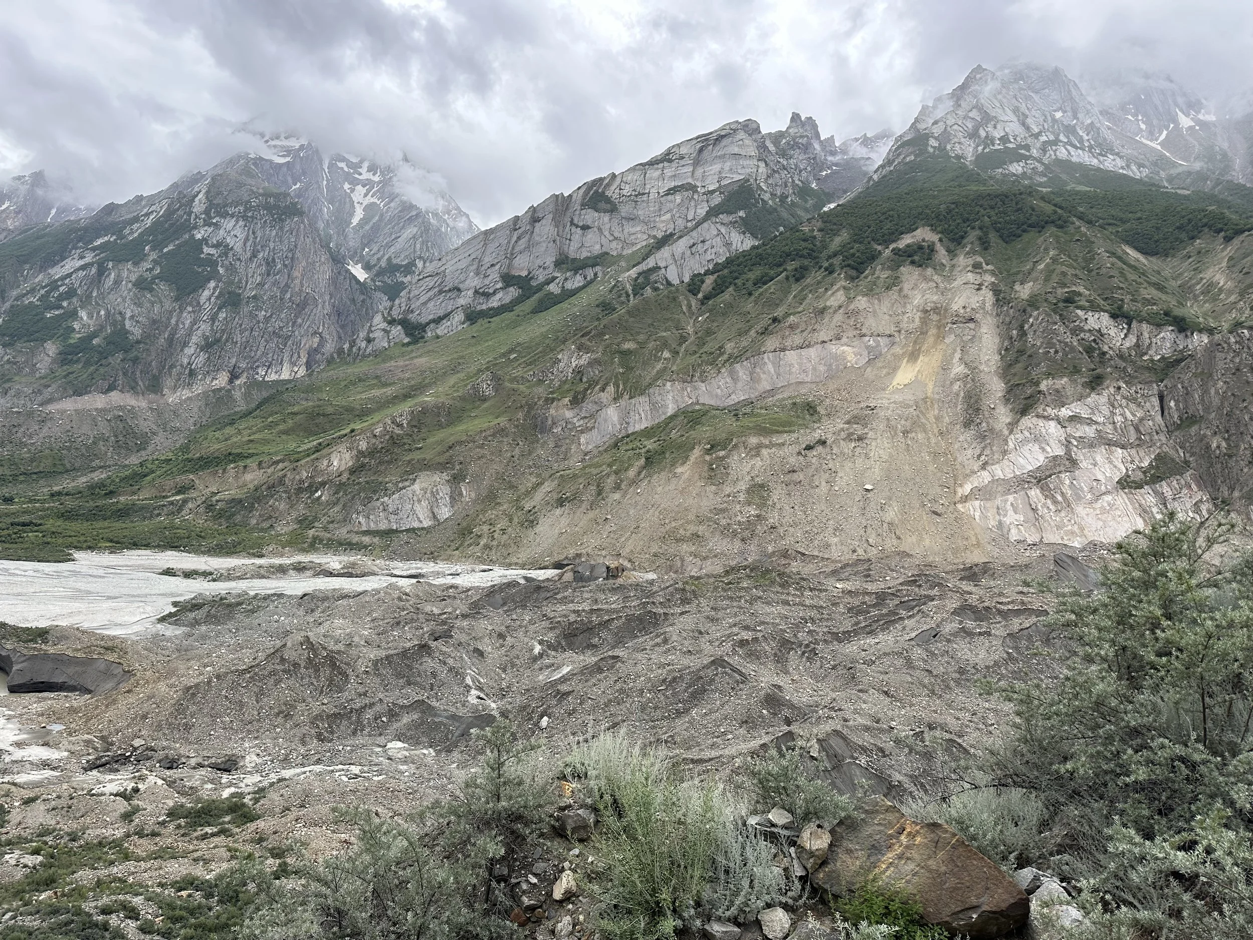
Arando is very close to the terminal moraine of the Chomolugma Glacier and the source of the Basha River.
The terminal moraine of the Chomolugma Glacier
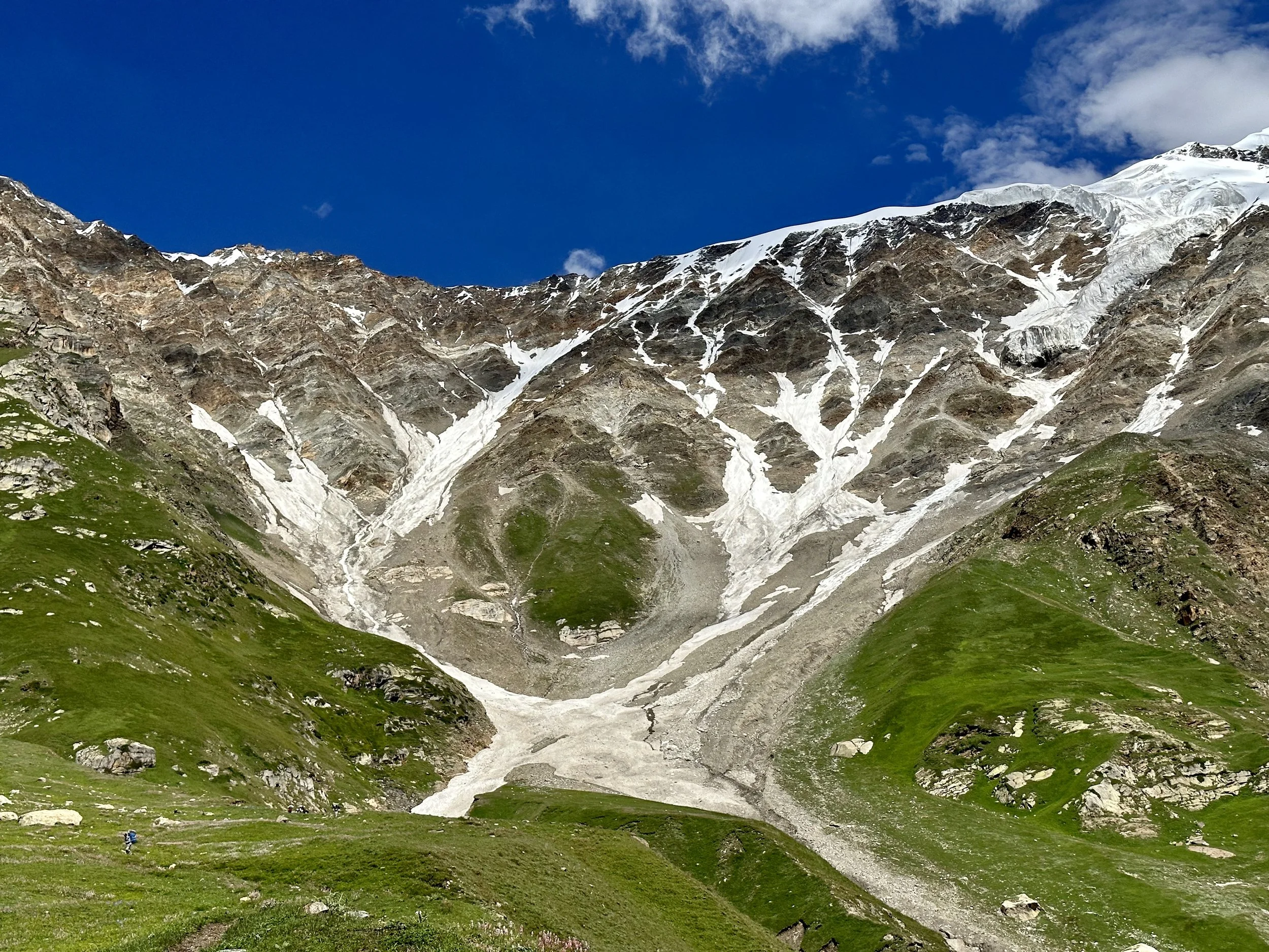
We climbed quite high on day 2. Day 3 and 4 we stayed put to wait out the rain.
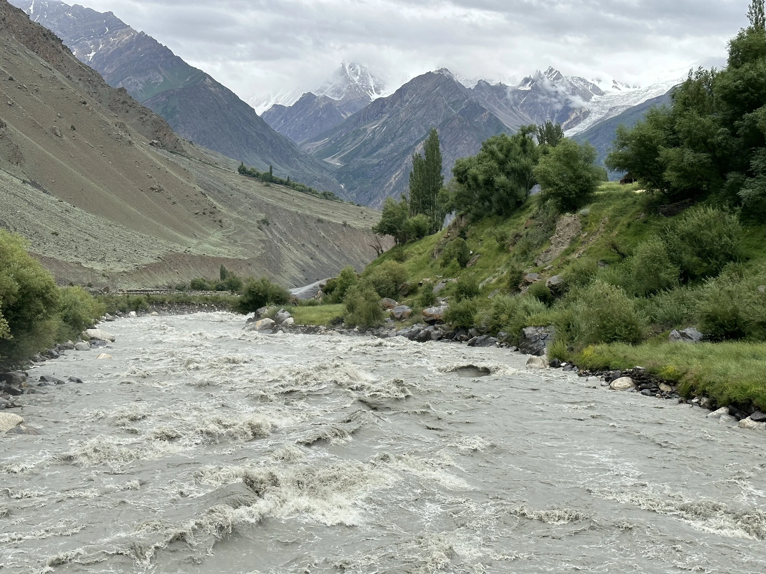
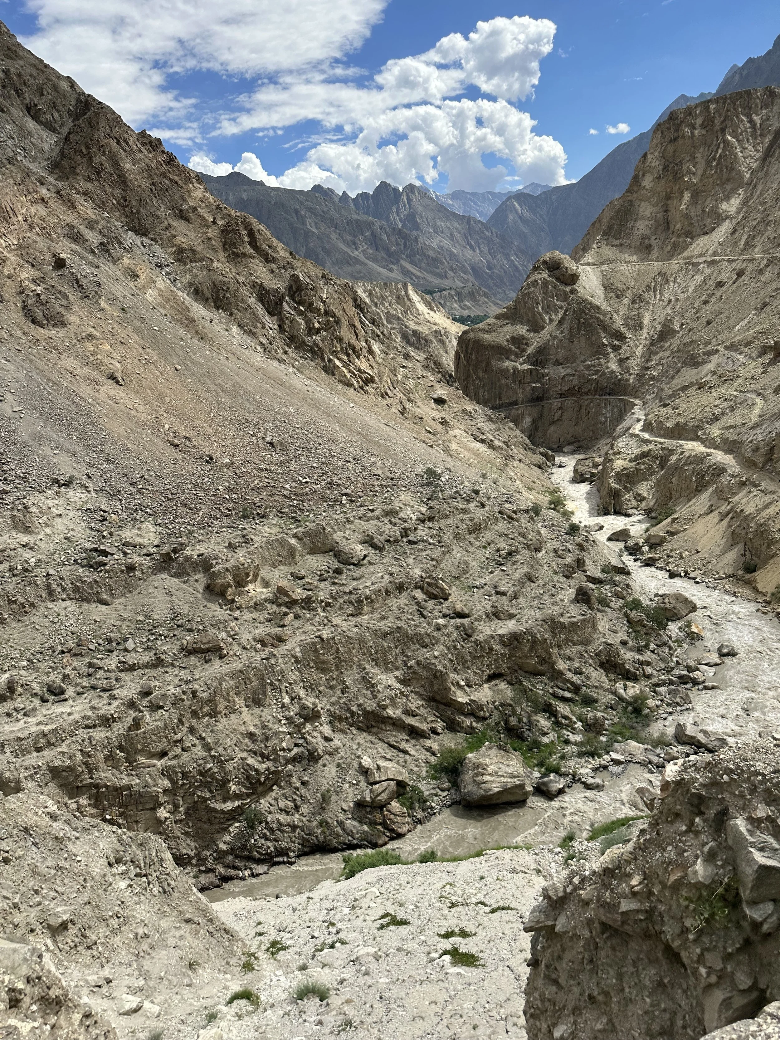
The road to Arando and Basha River
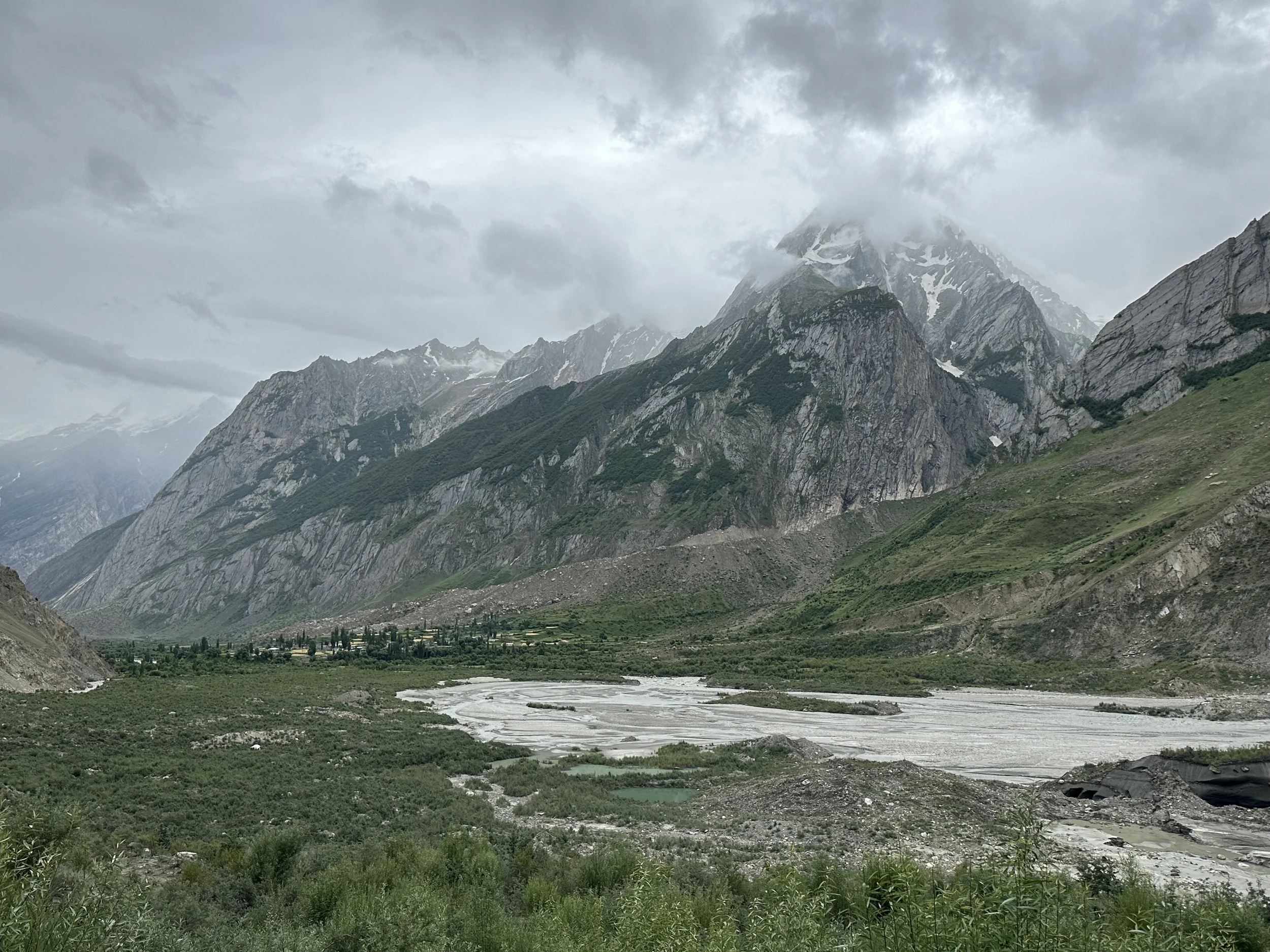
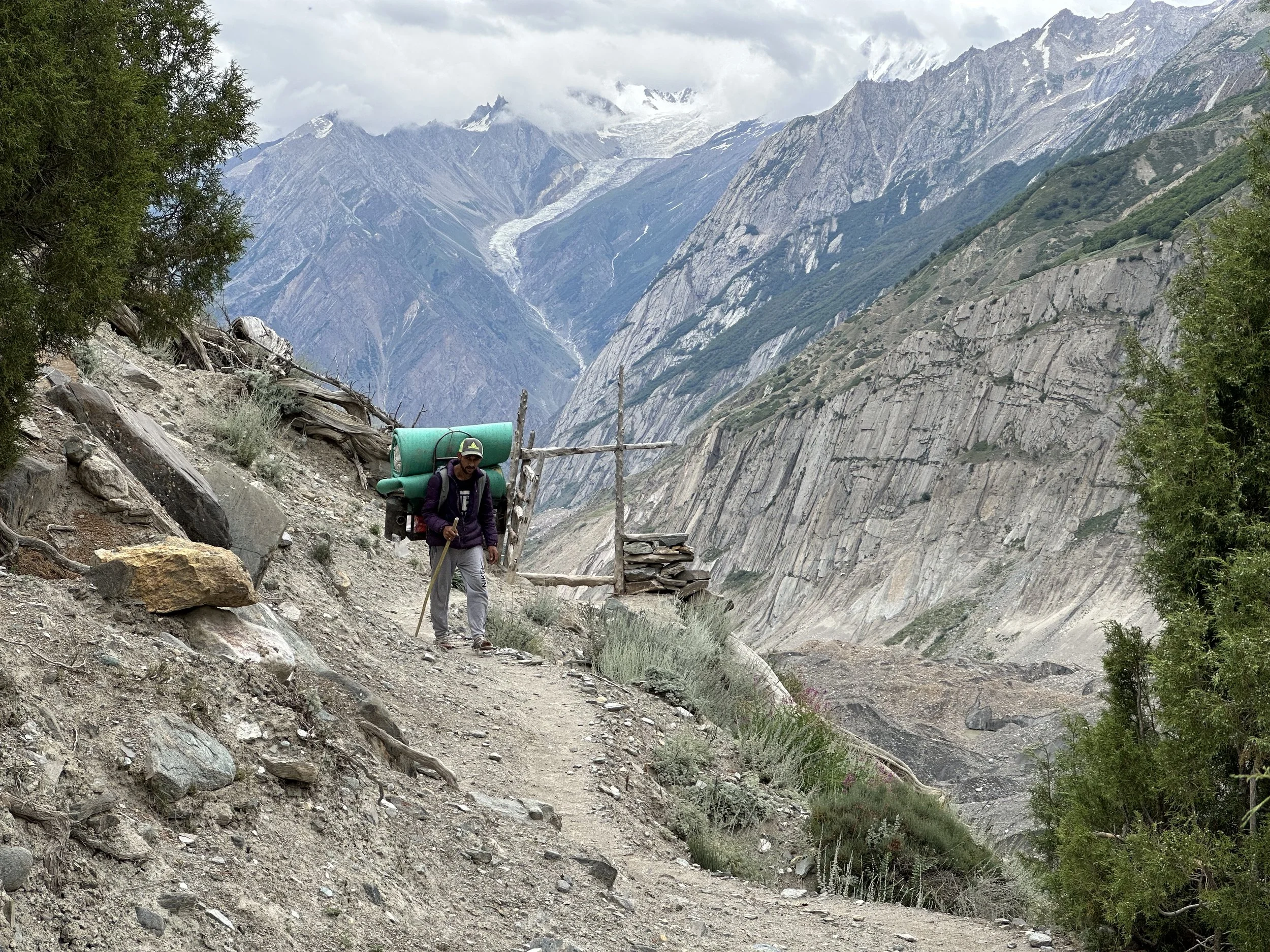
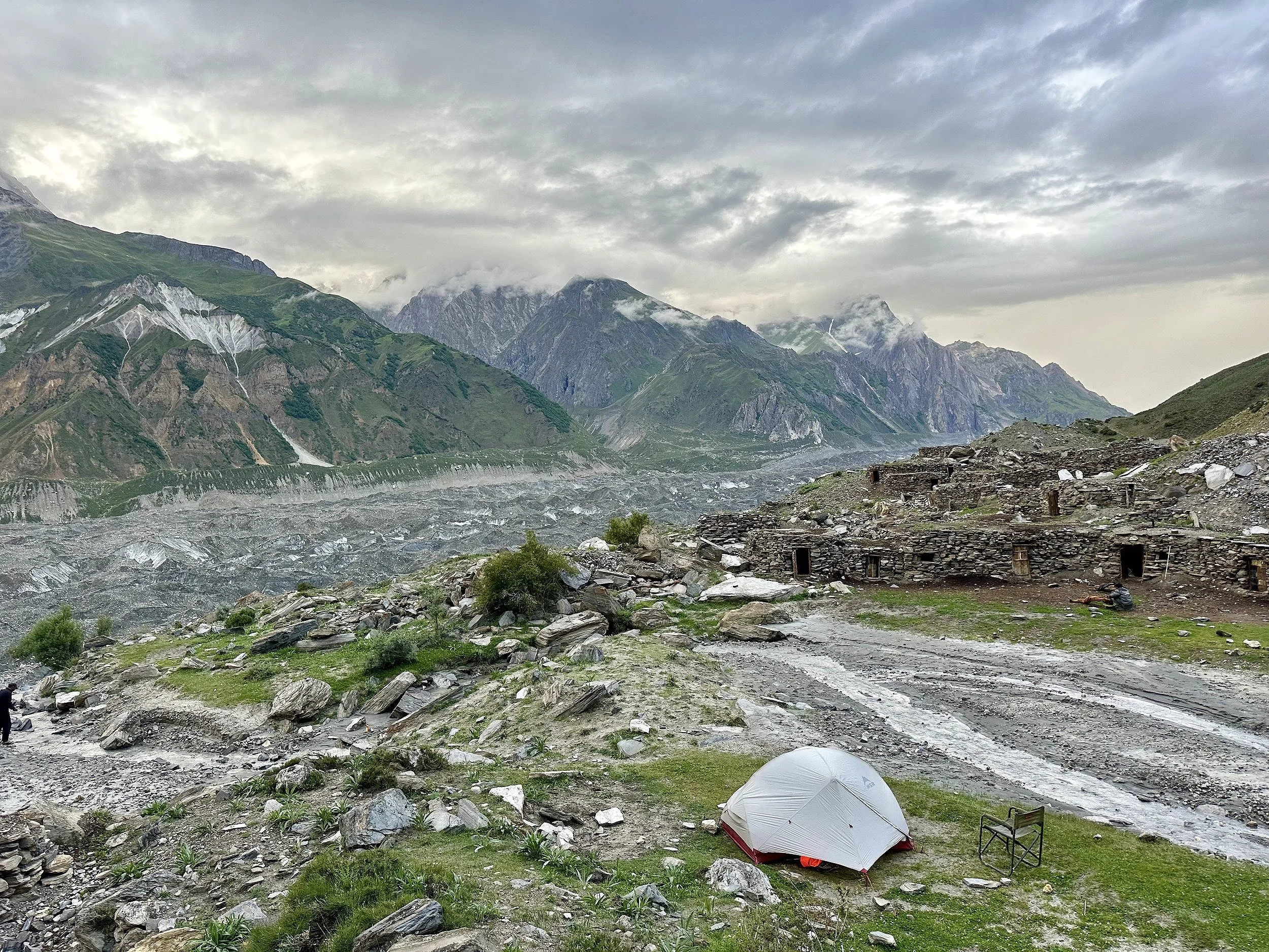
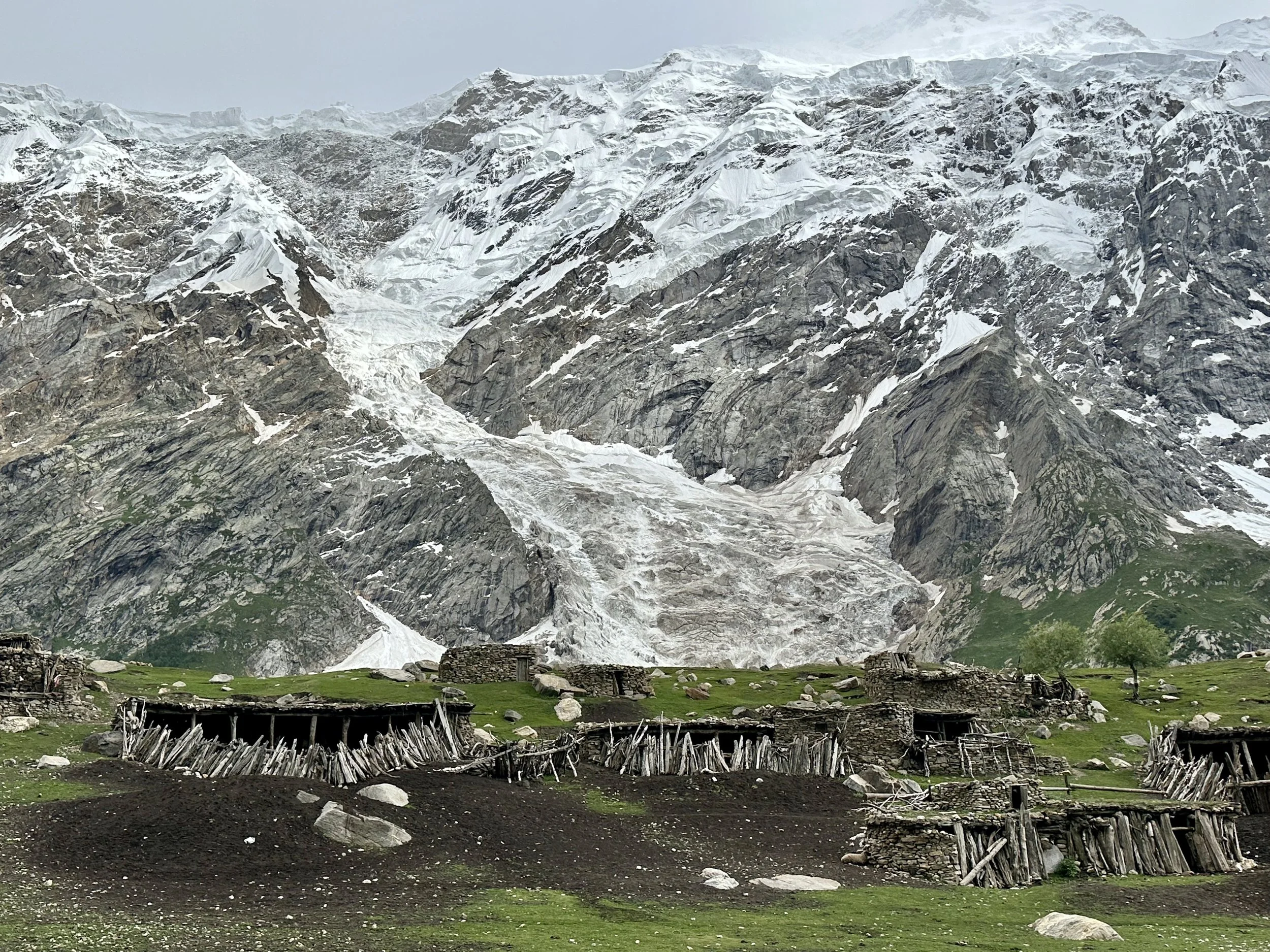
Arando village and the terminus of the Chgolugma Glacier.
Our first camp on the Chogolugma Glacier. We stayed here for two nights to wait out the rain. Since it was a cow pasture we had hundreds of flies in our tents.
Chomolugma Glacier
Day 5 was long but the march was along a flat side valley next to the Chomolugma Glacier.
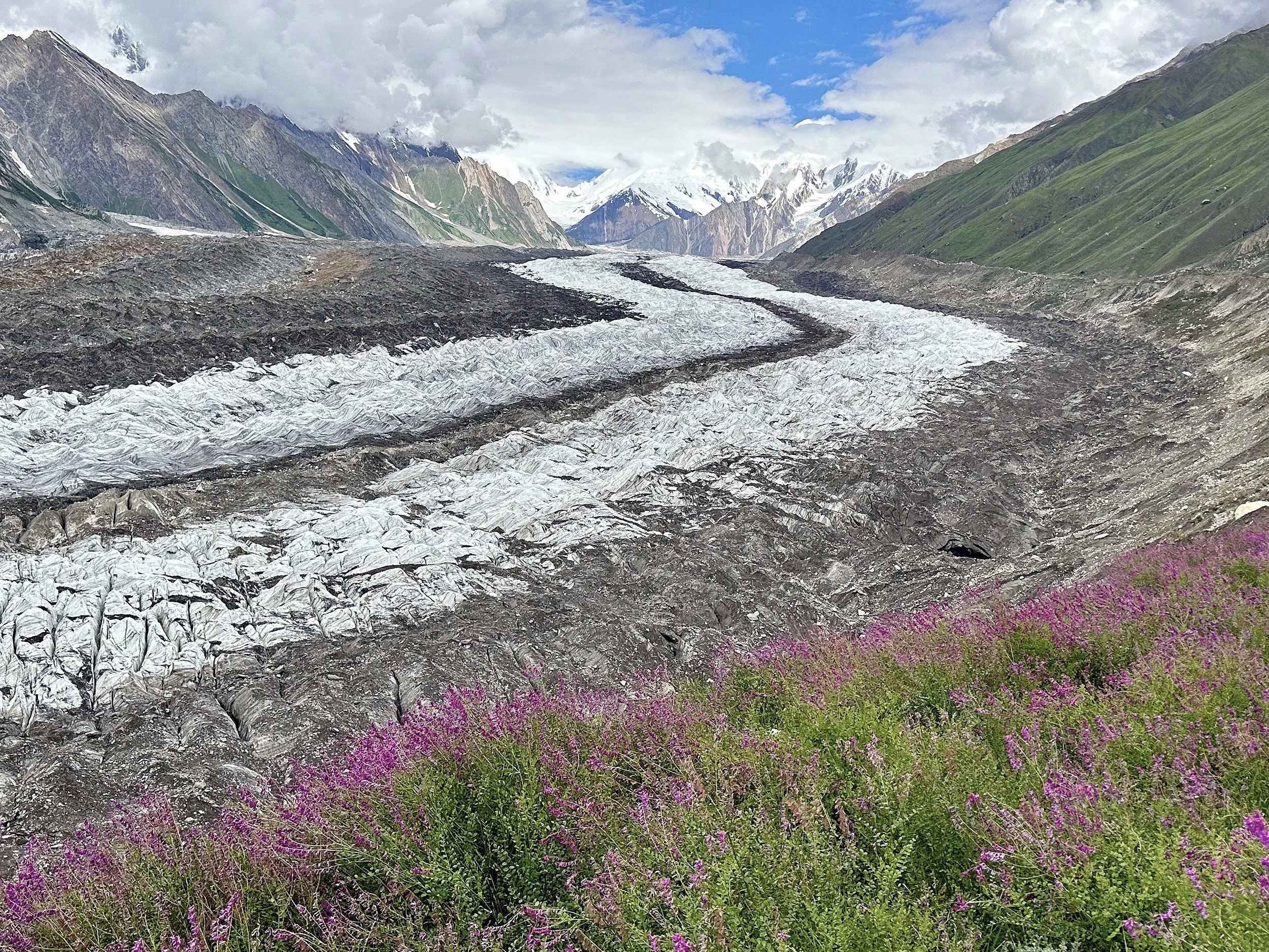
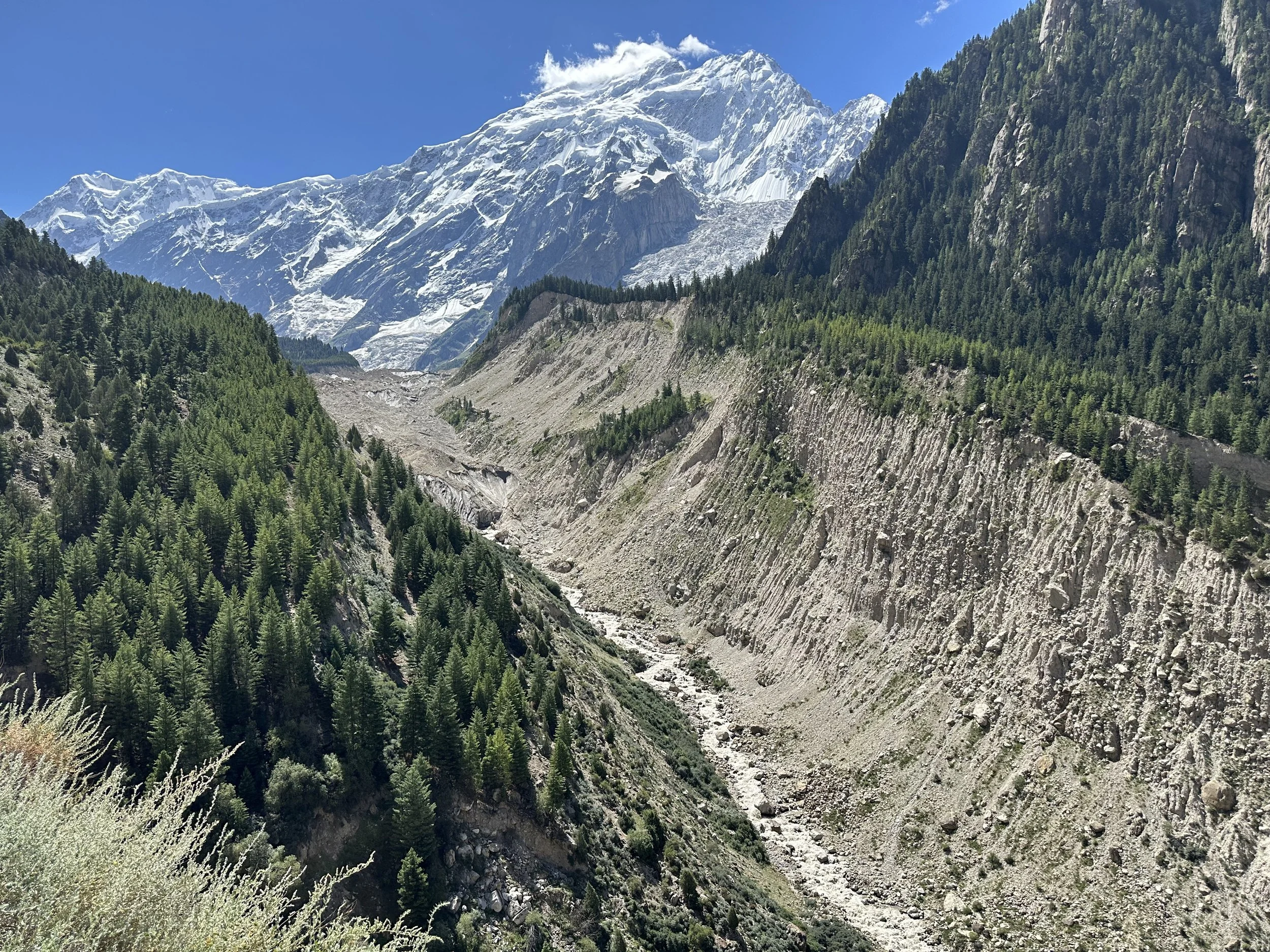
A beautiful flower filled side moraine of the Chogolugma Glacier. Spantik is directly ahead.
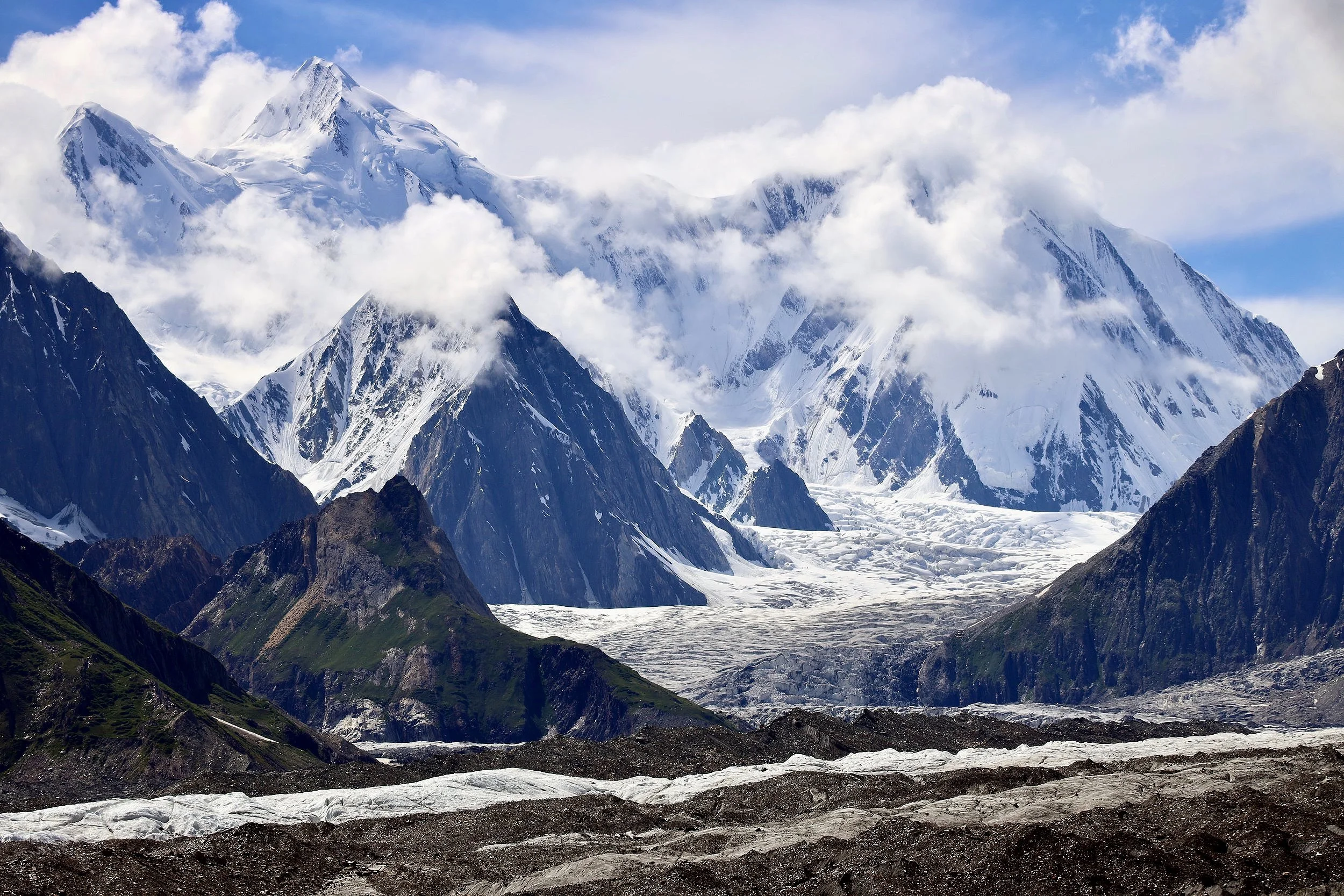
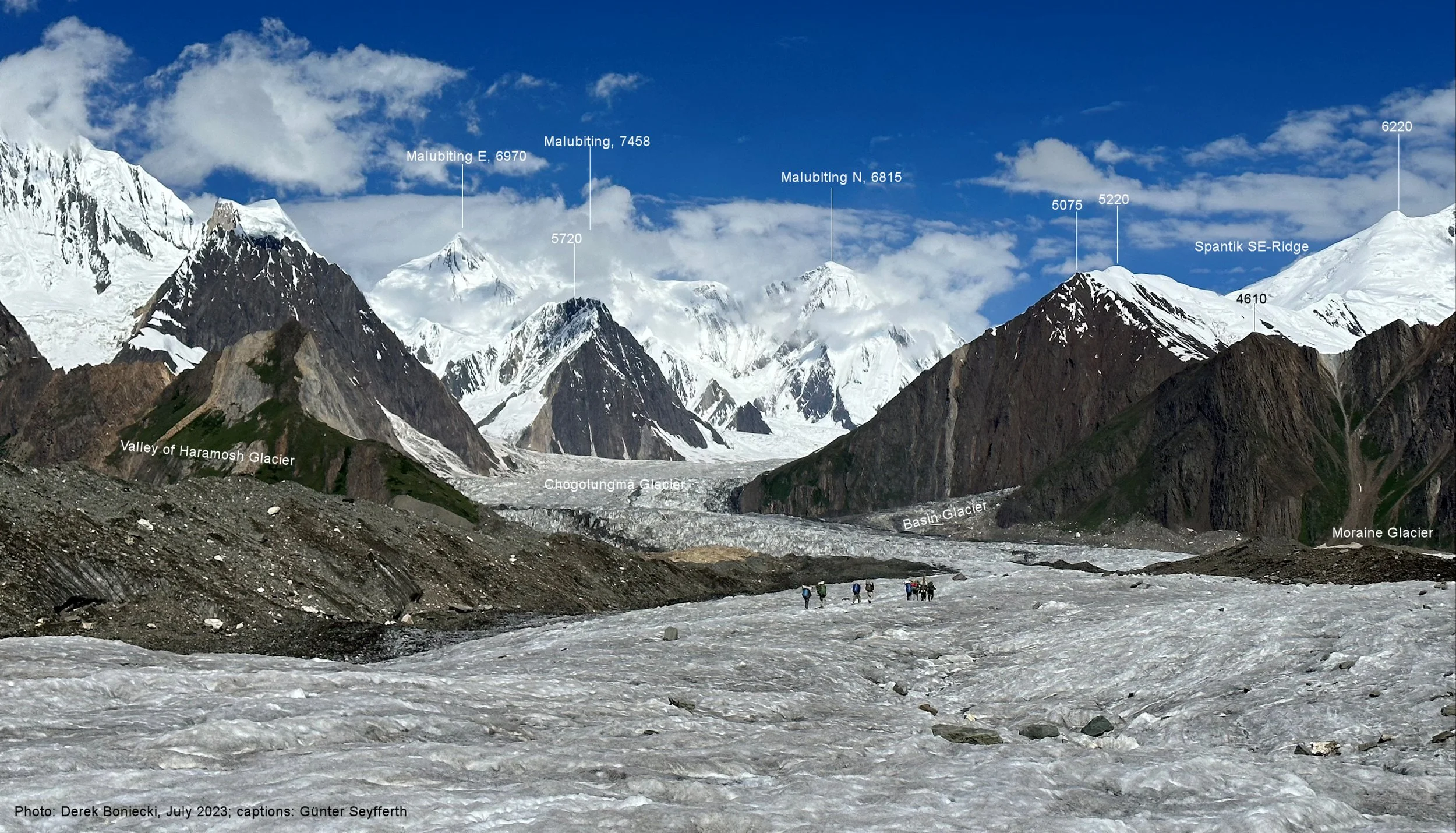
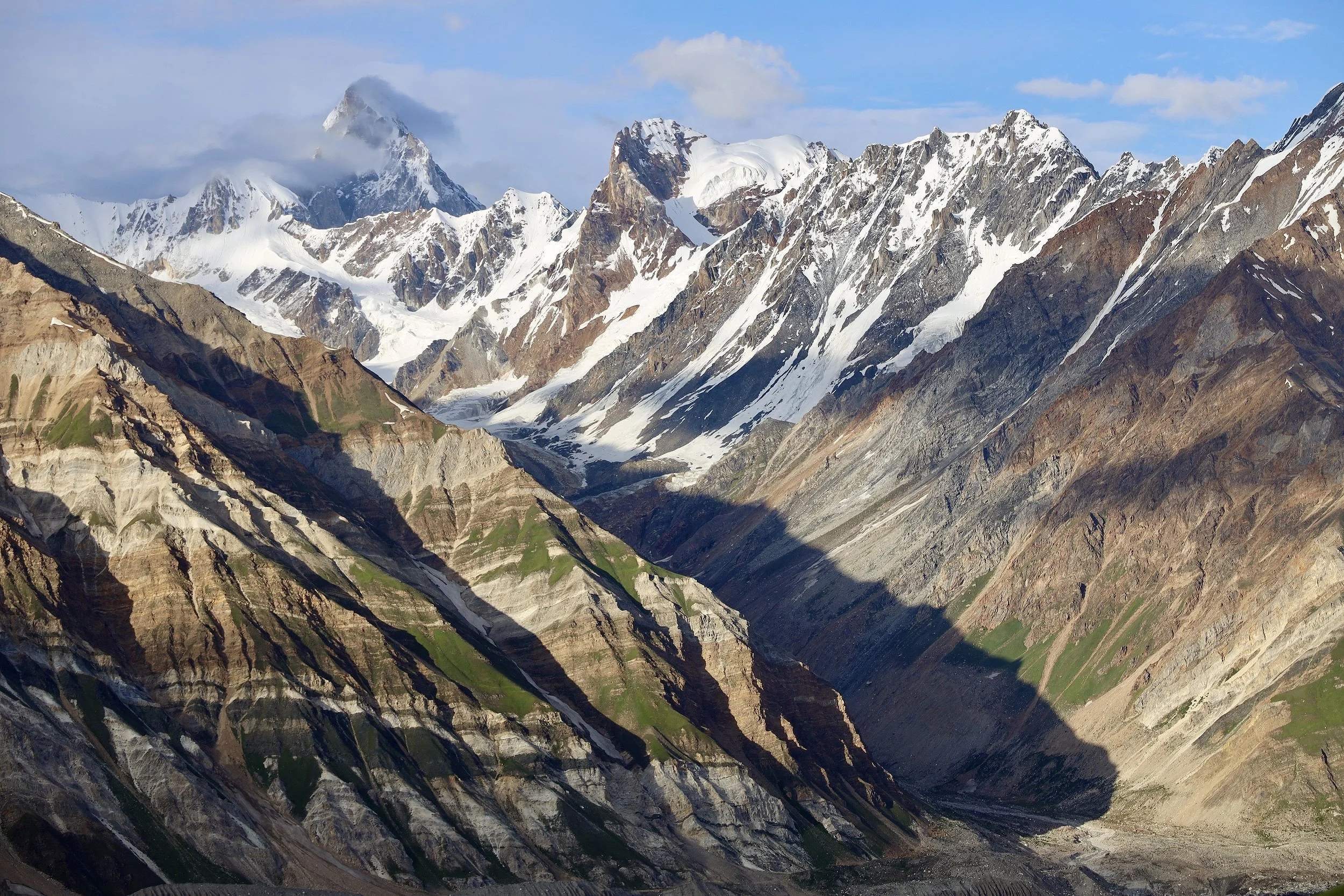
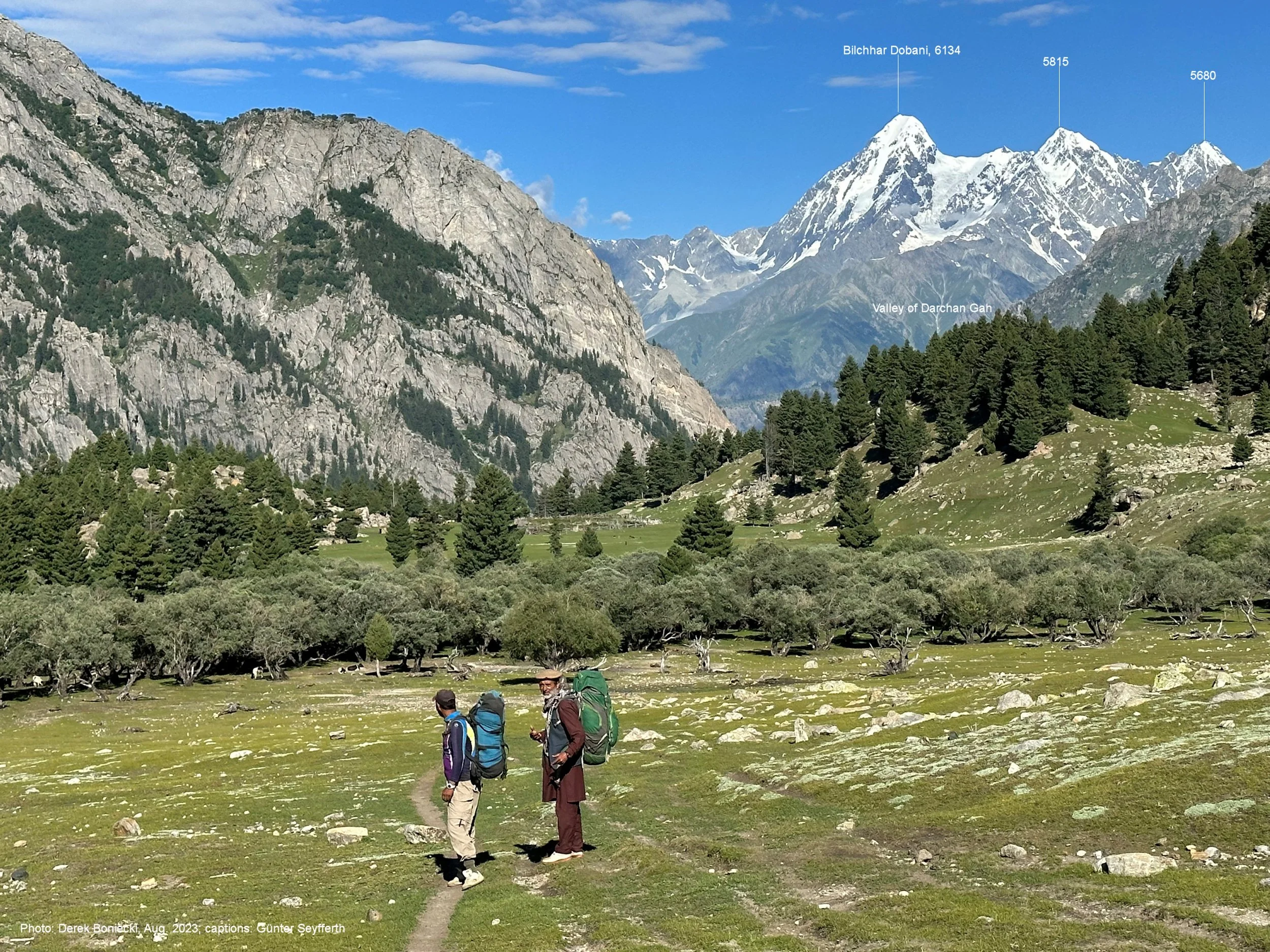
Second East Haramosh Glacier and Paraber Peak 6,315m.
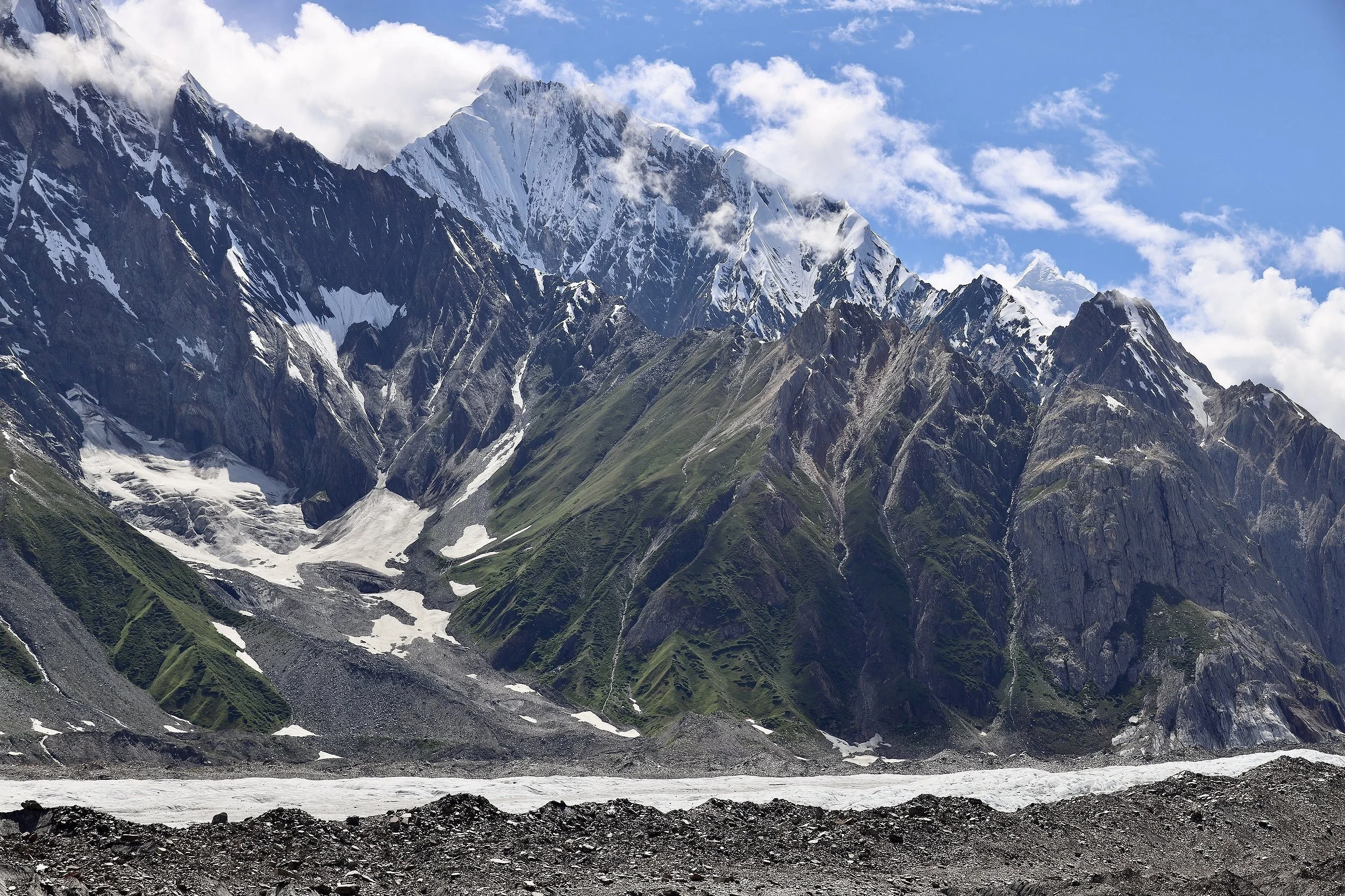
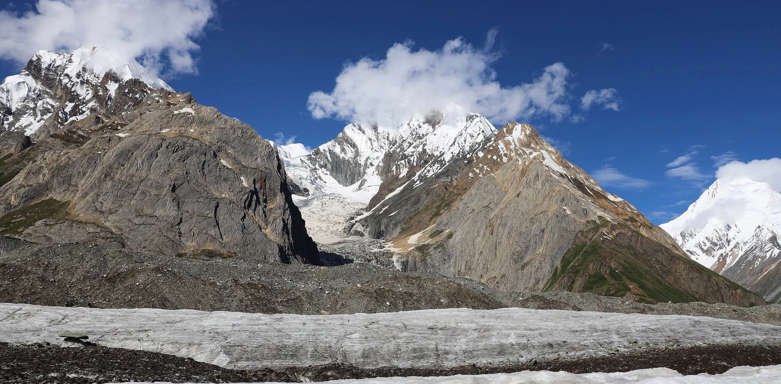
Chomolugma Glacier with Malubitung Peak 7453m on the horizon.
Our camp before we veered off onto the Haramosh Glacier seen in the distance on the left.
Chomolugma Glacier
On the Chomolugma Glacier
Chomolugma Glacier
Malubiting 7453m
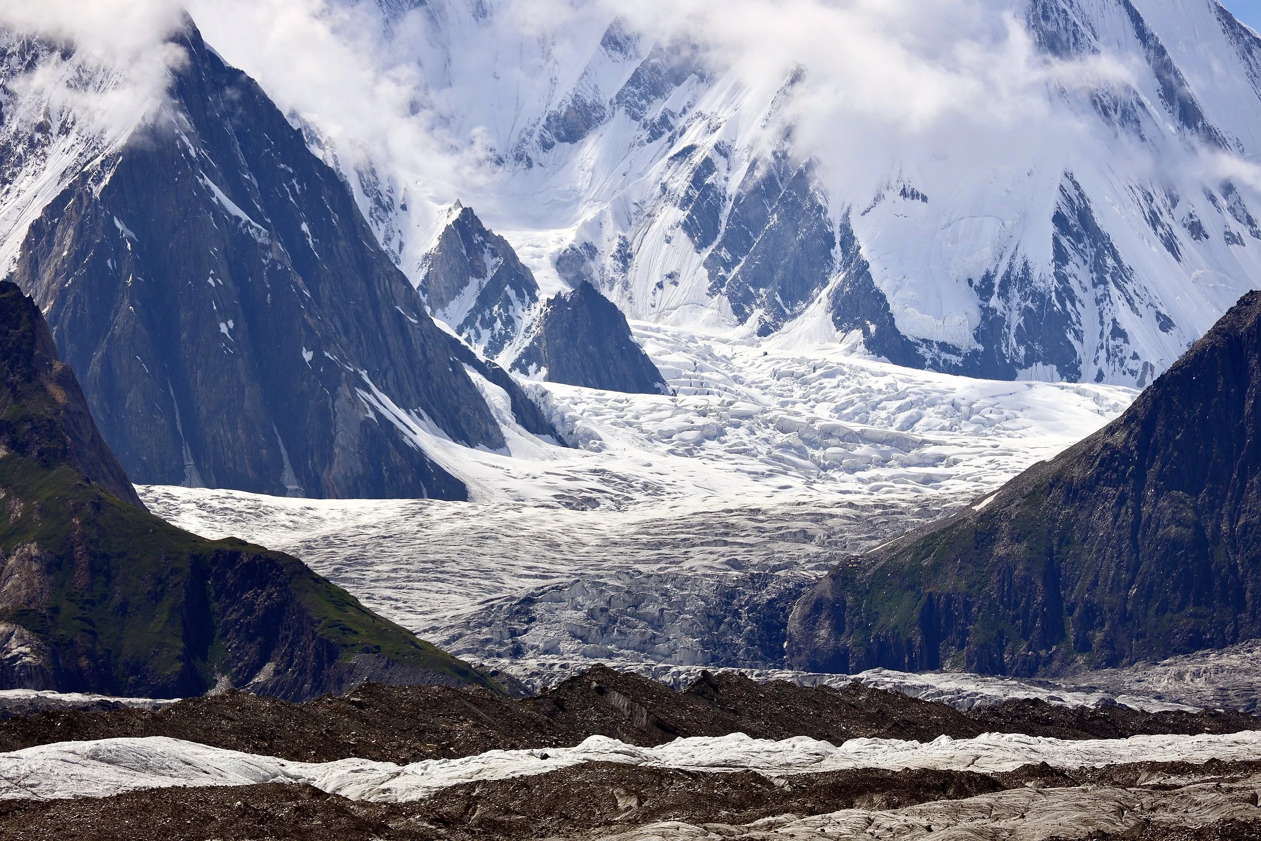
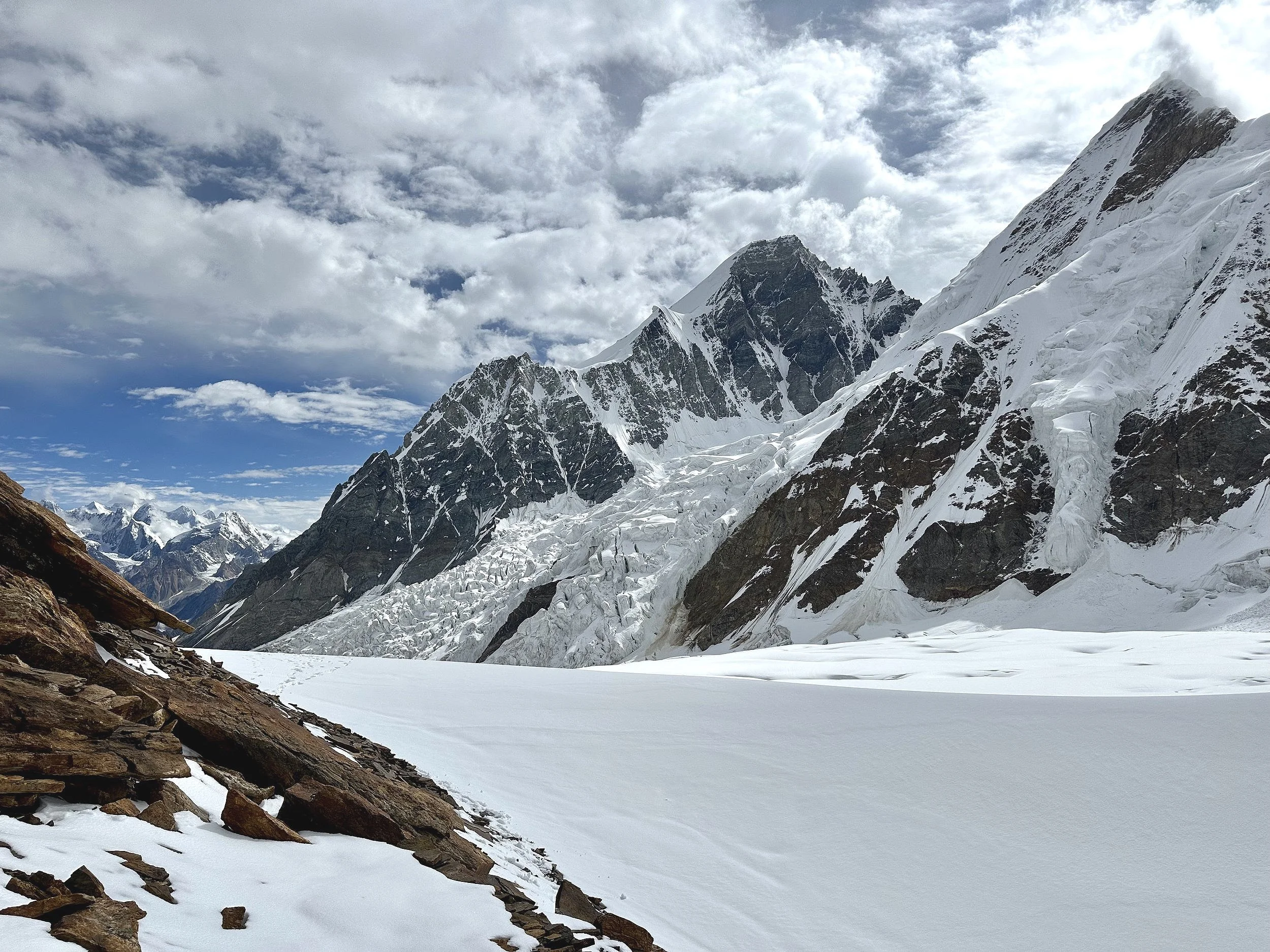
Upper Chomolugma Glacier
Malubiting 7453m
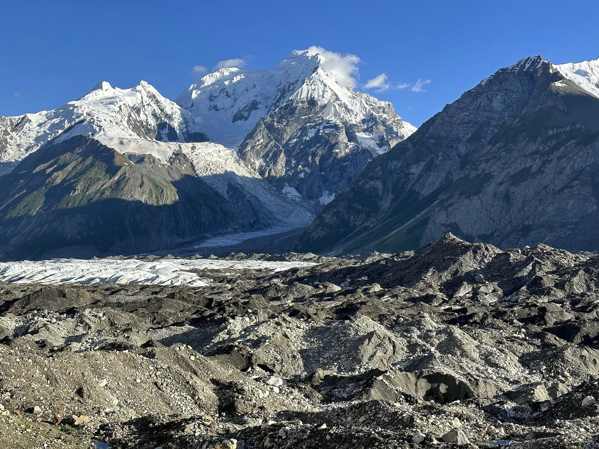
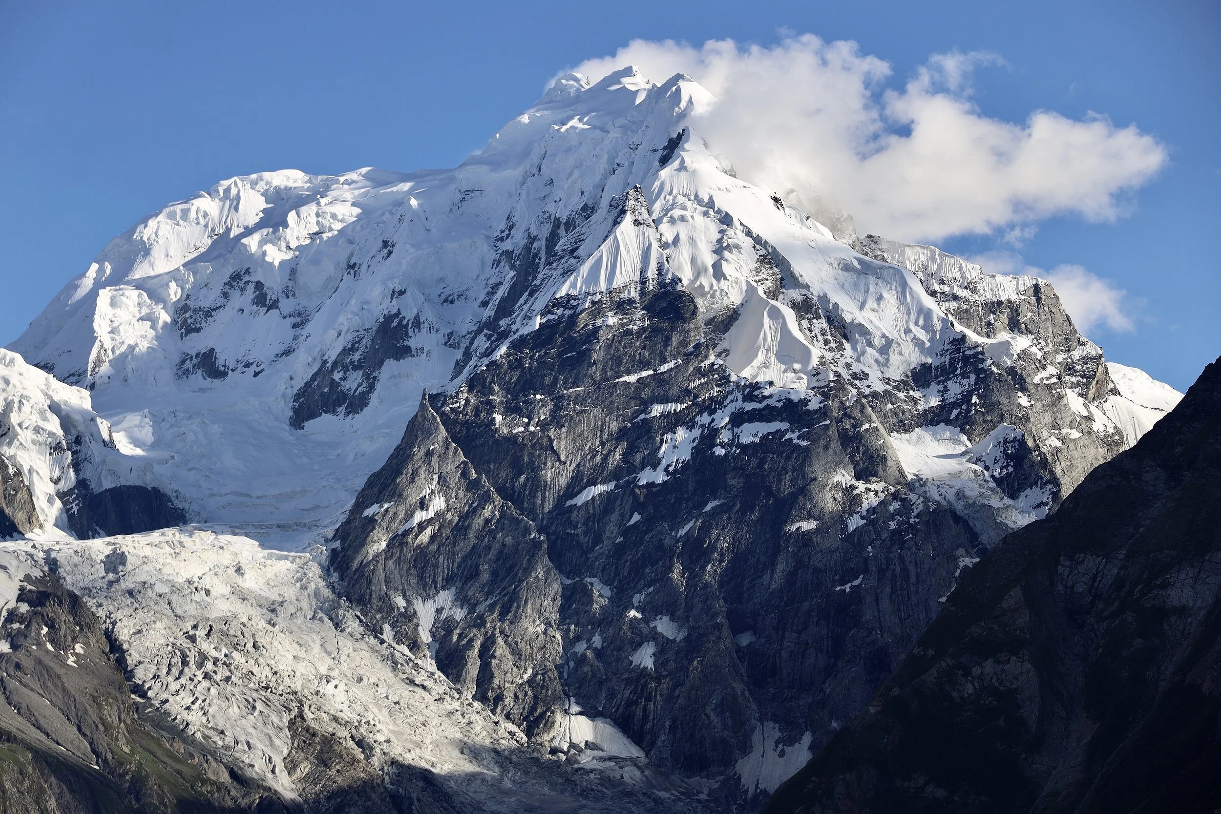
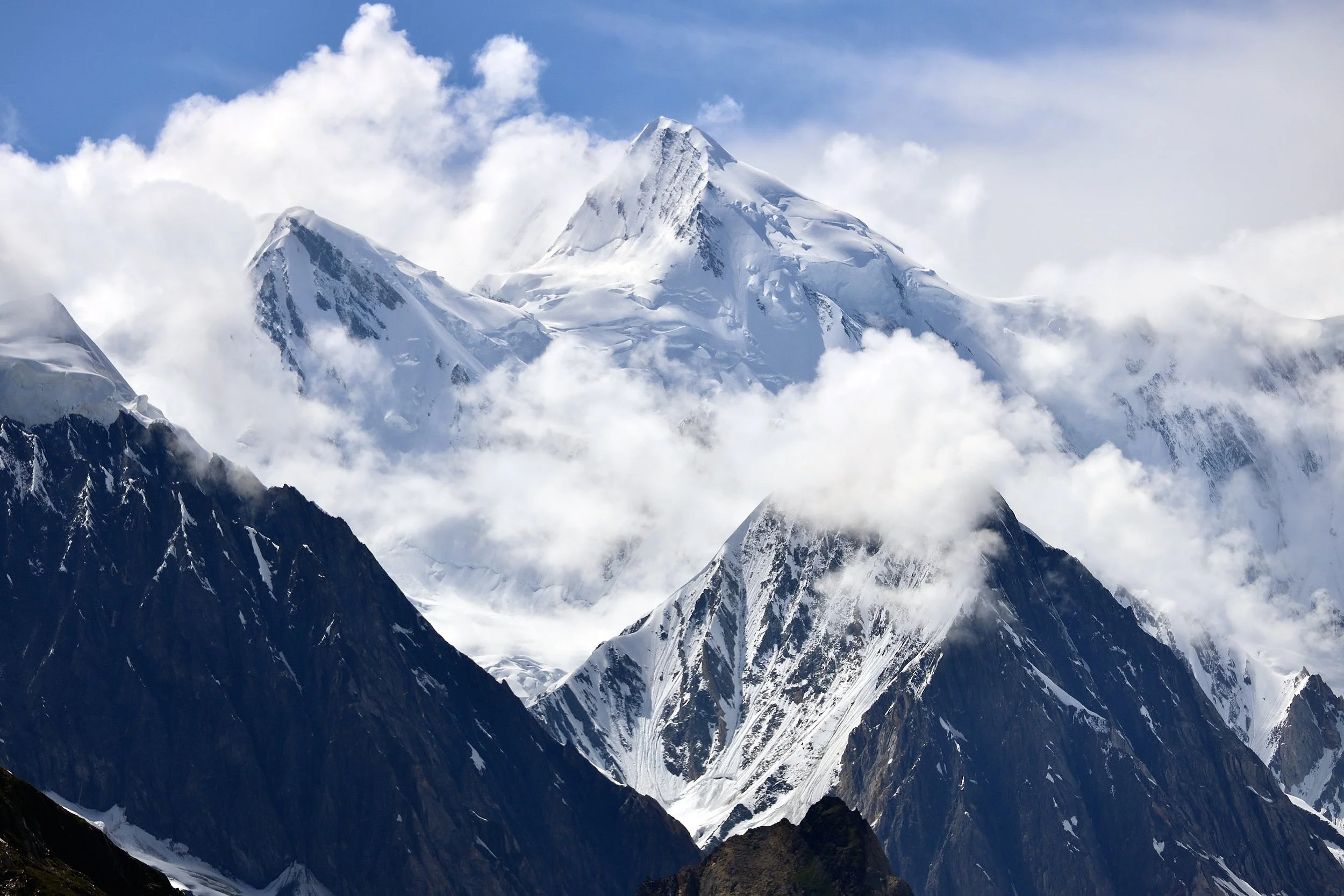
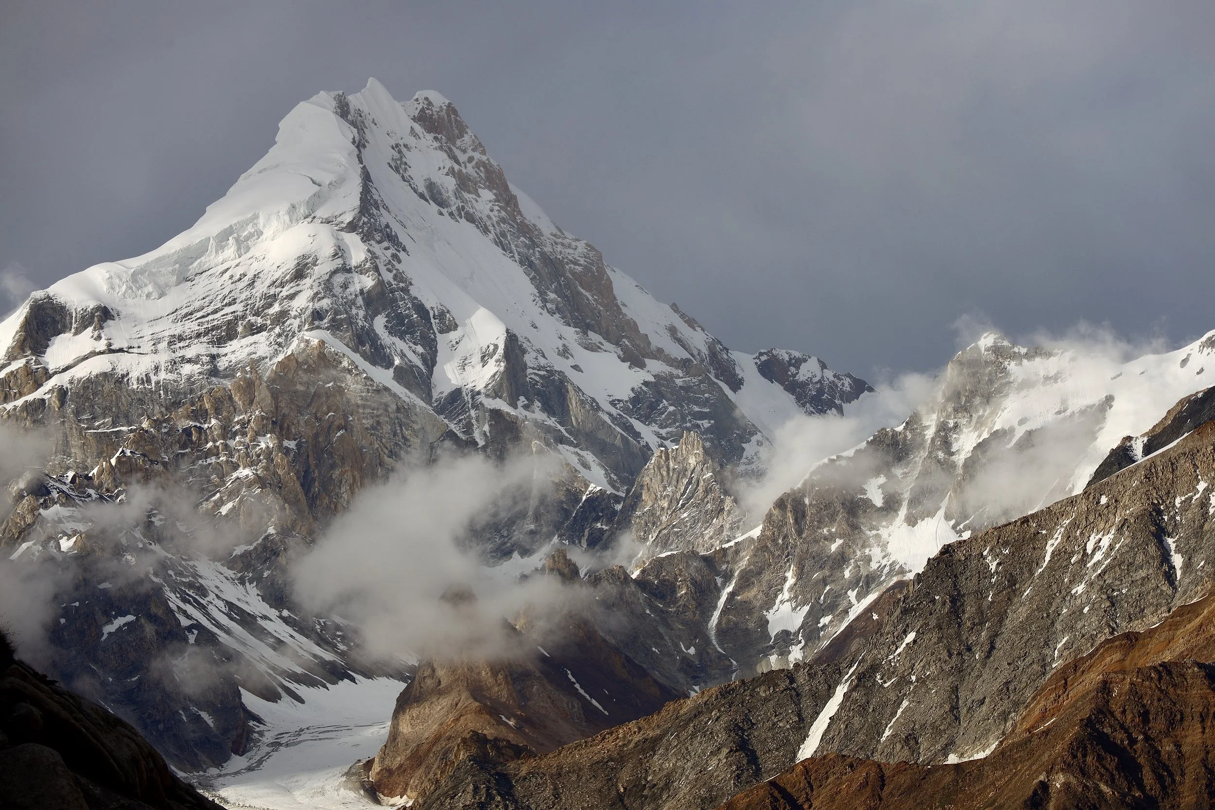
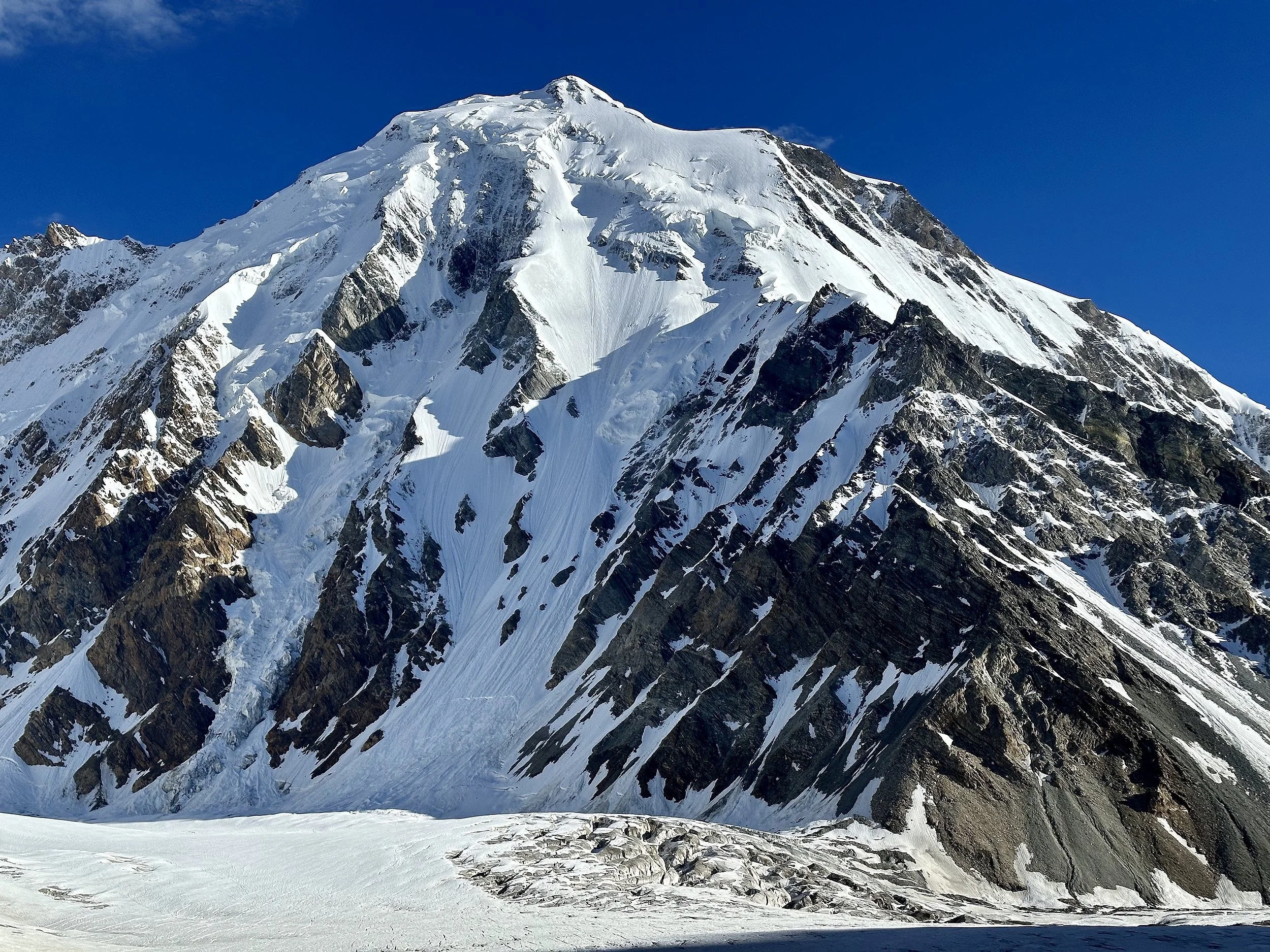
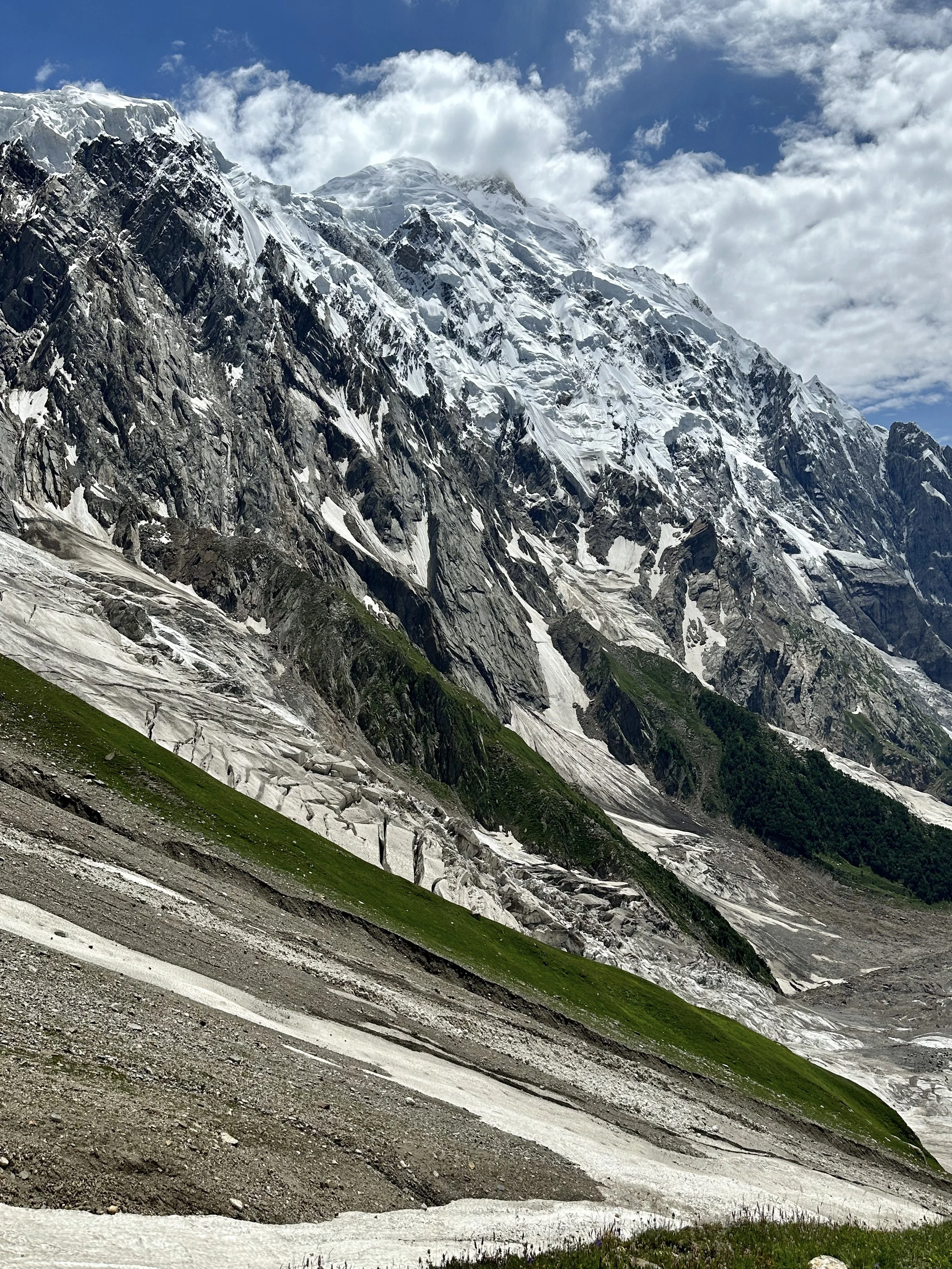
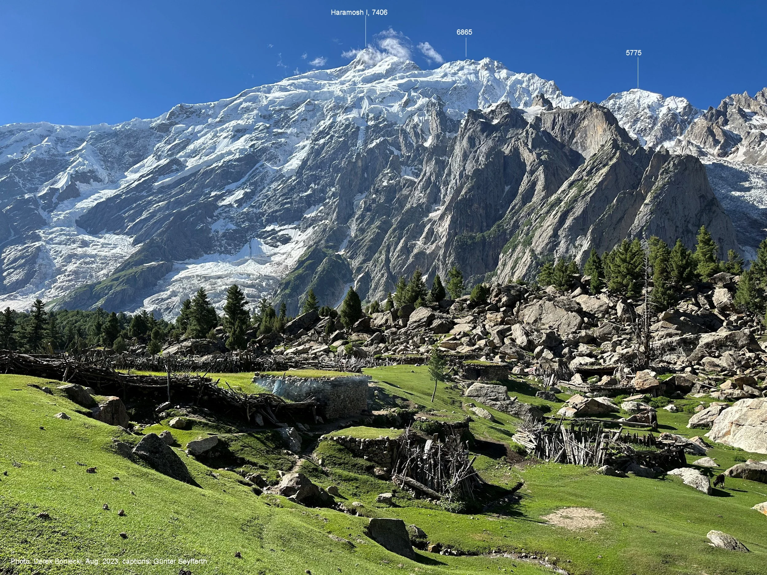
Haramosh 2 with its summit in the cloud.
Spantik is right in front. You can see the ascent ridge and the entire route of the climb.
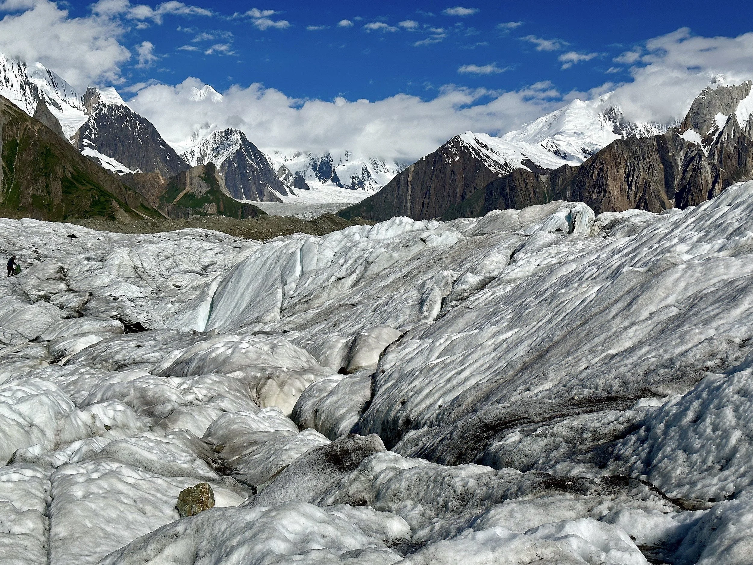
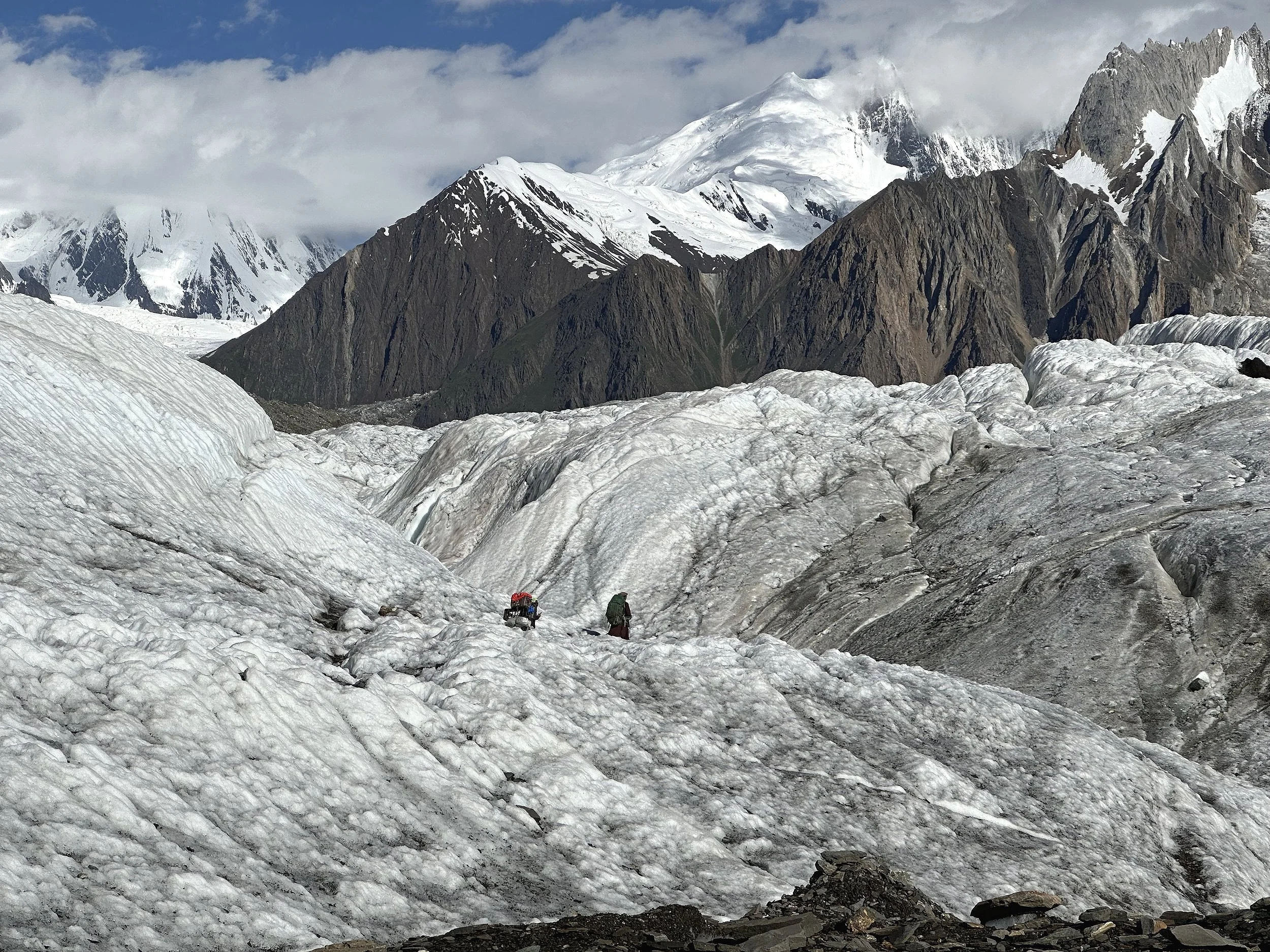
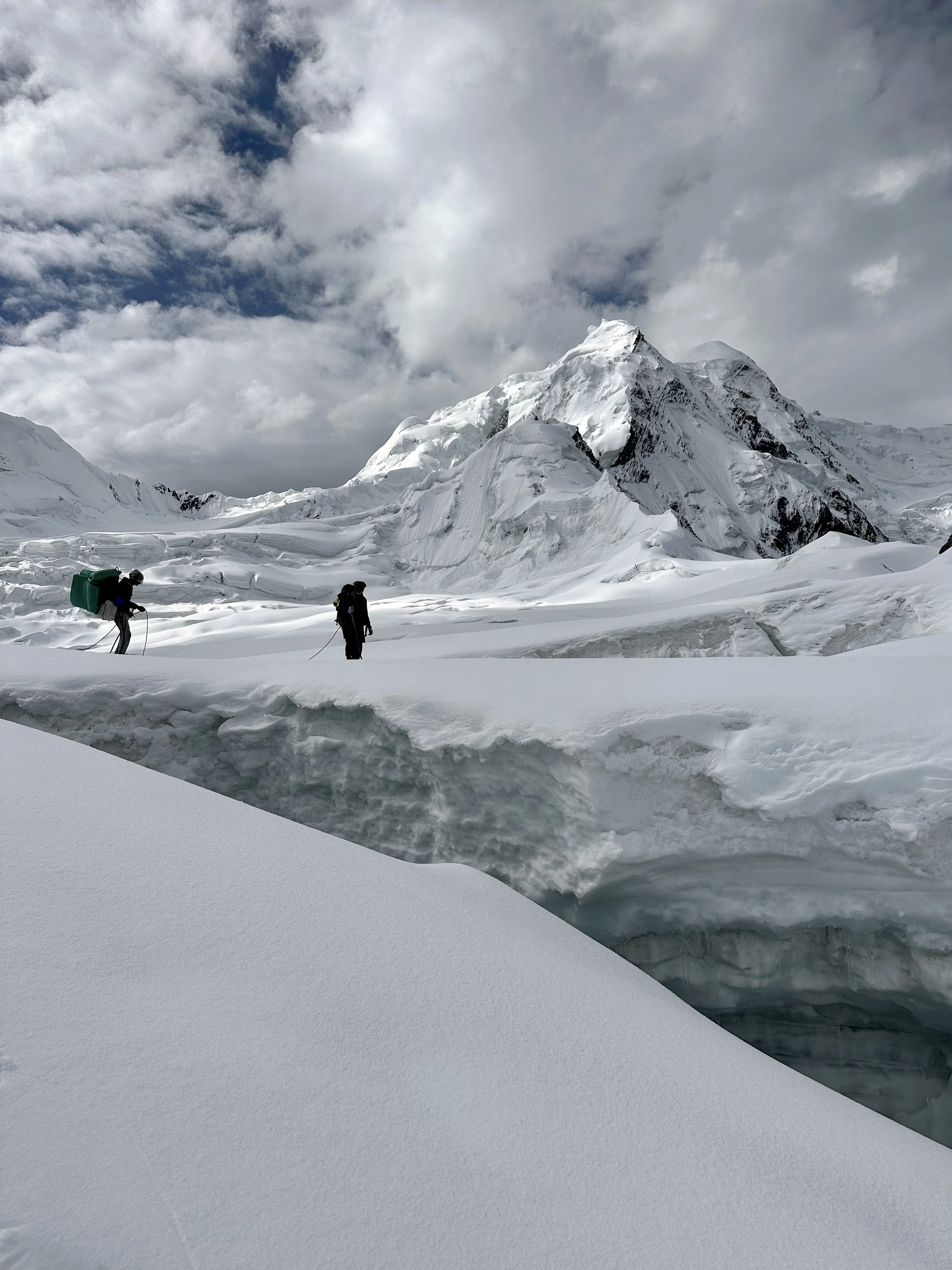
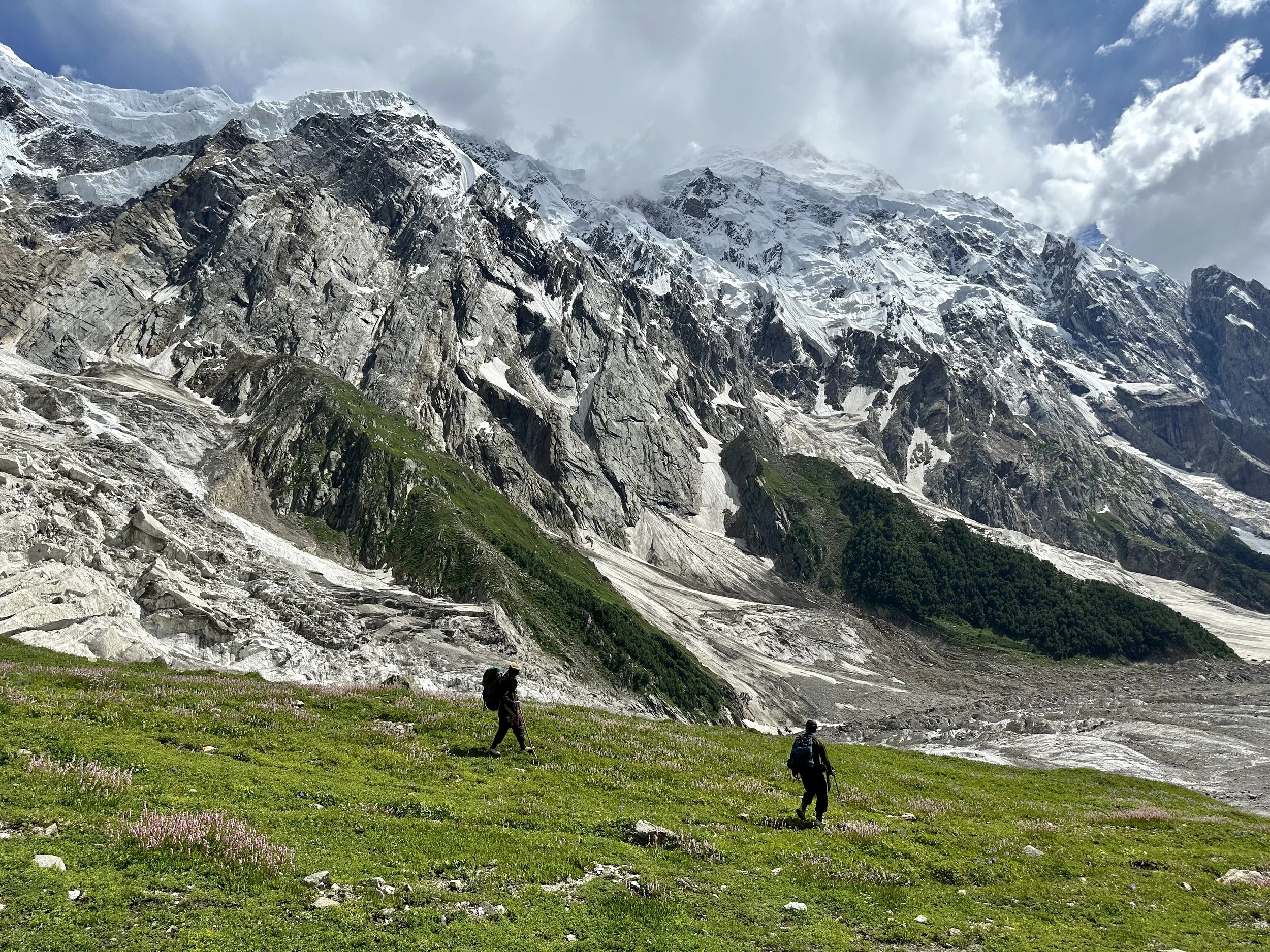
On Haramosh Glacier
On Haramosh Glacier.
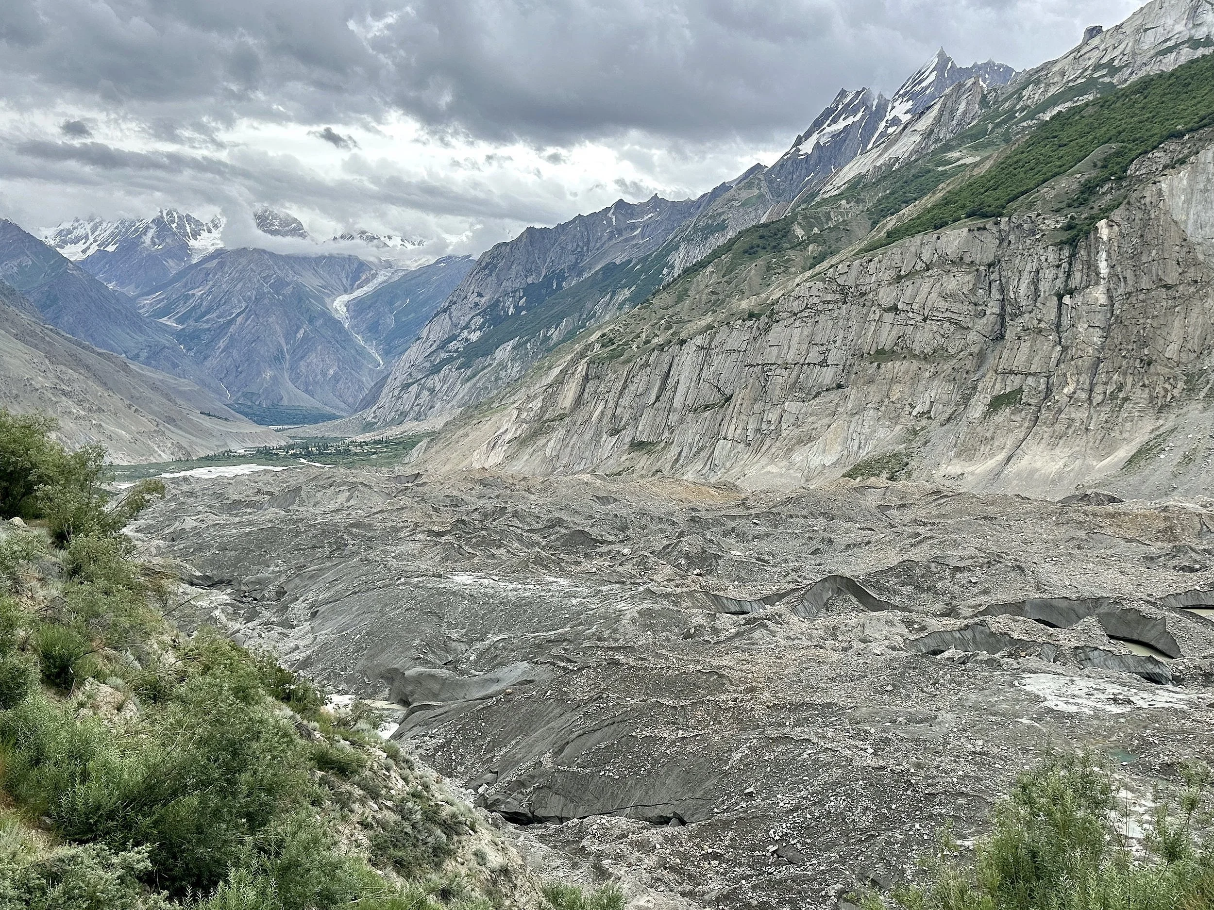
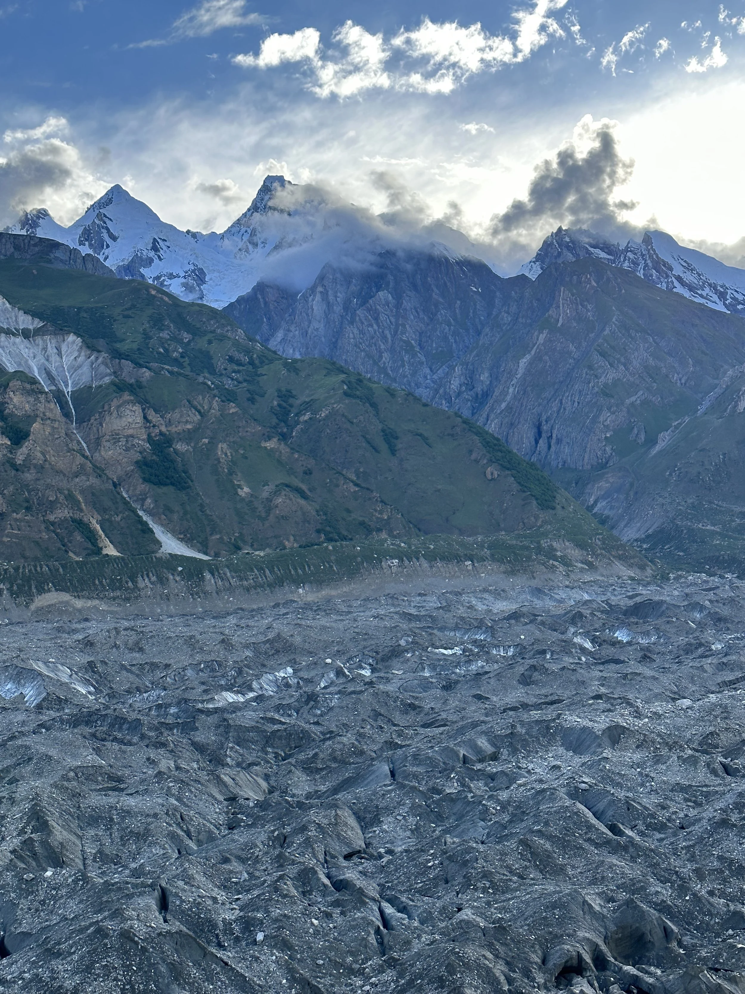
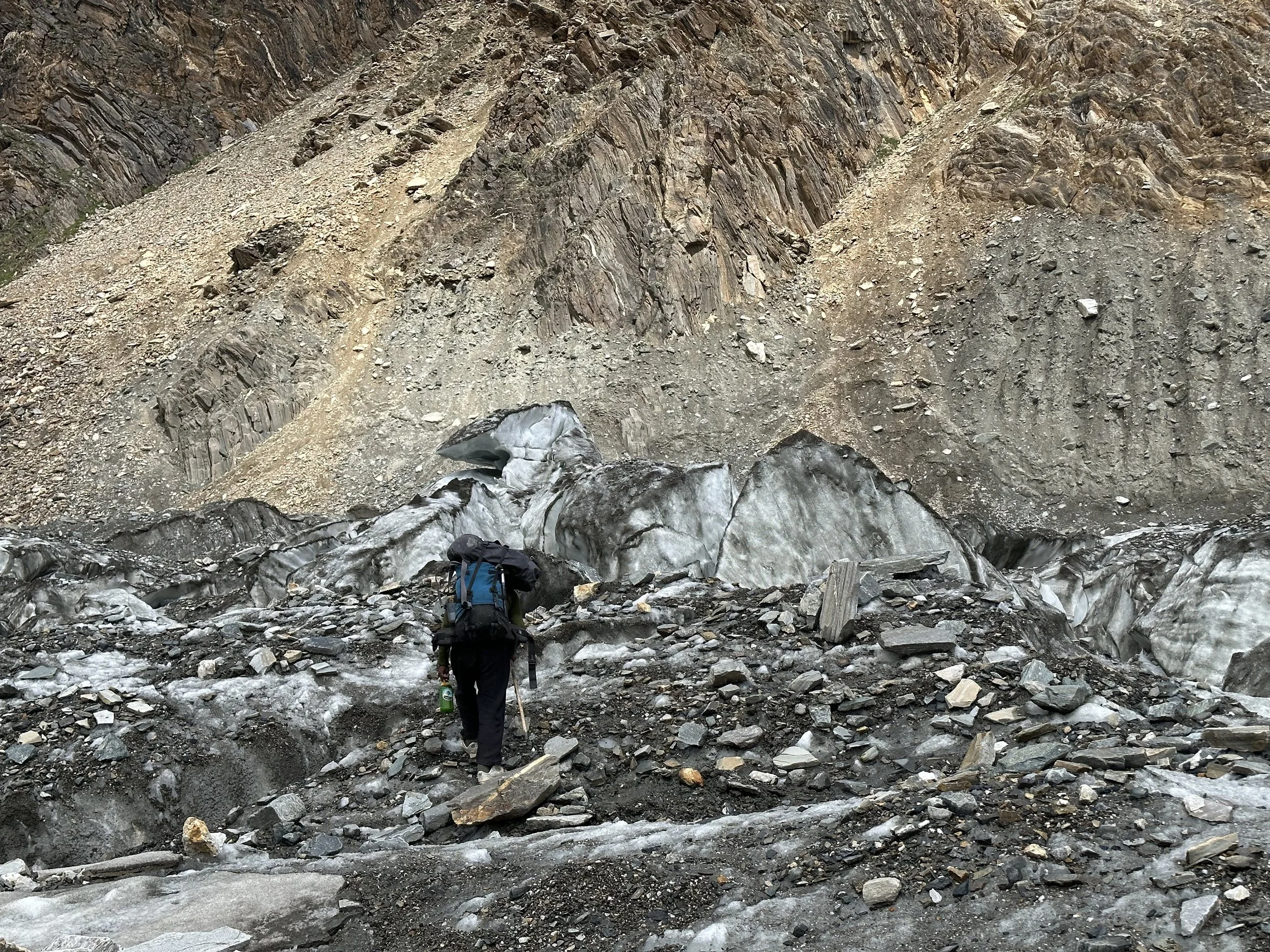
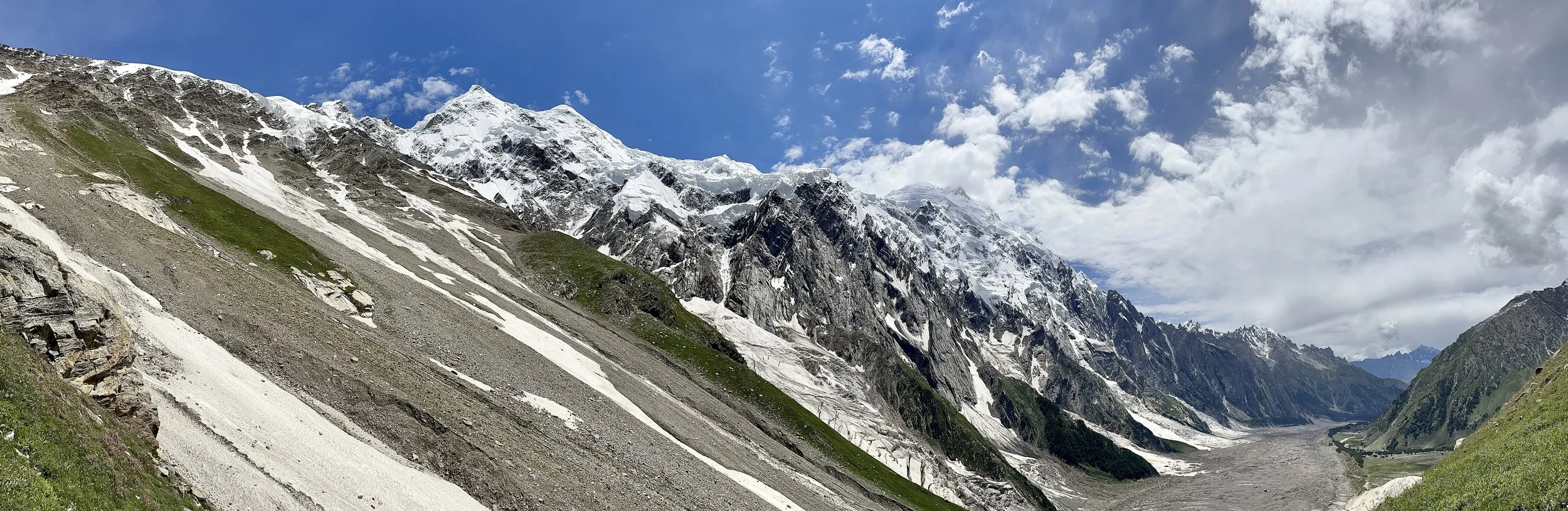
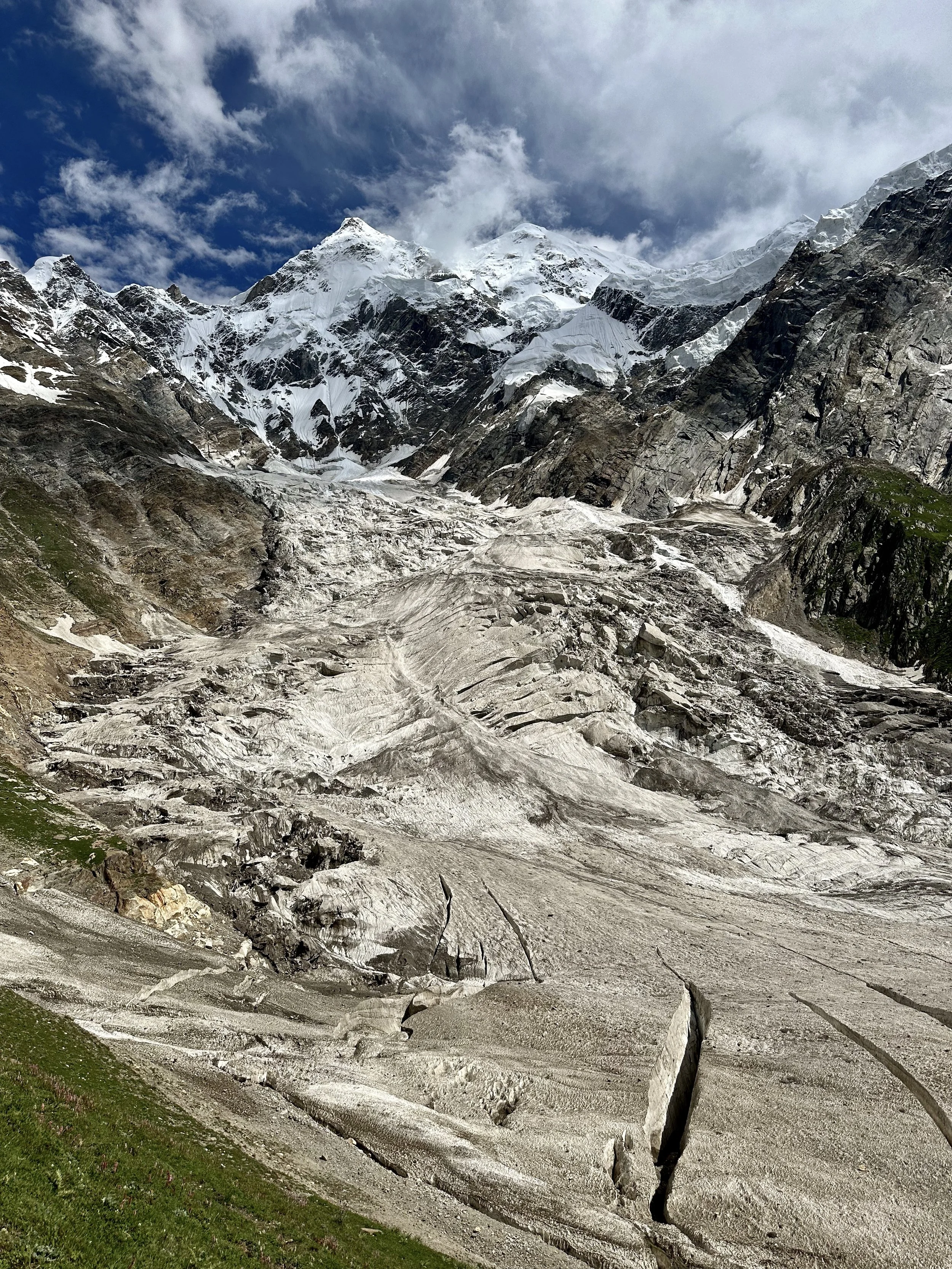
Haramosh Glacier. We had to bypass the heavily crevassed frontal section of the Haramosh Glacier.
Haramosh Glacier
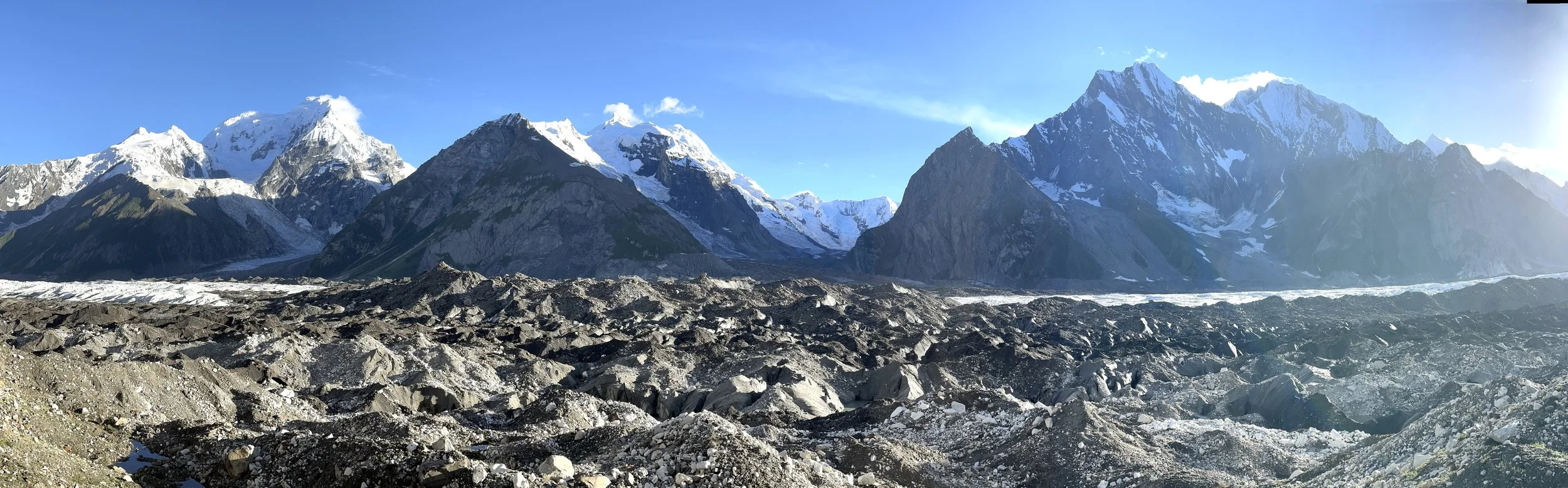
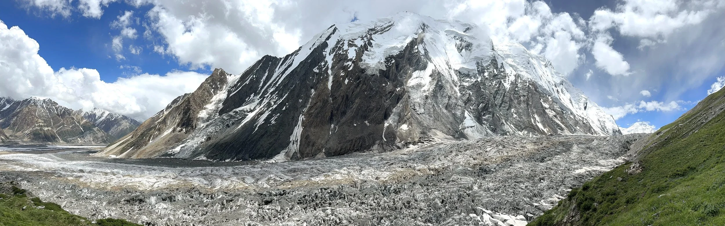
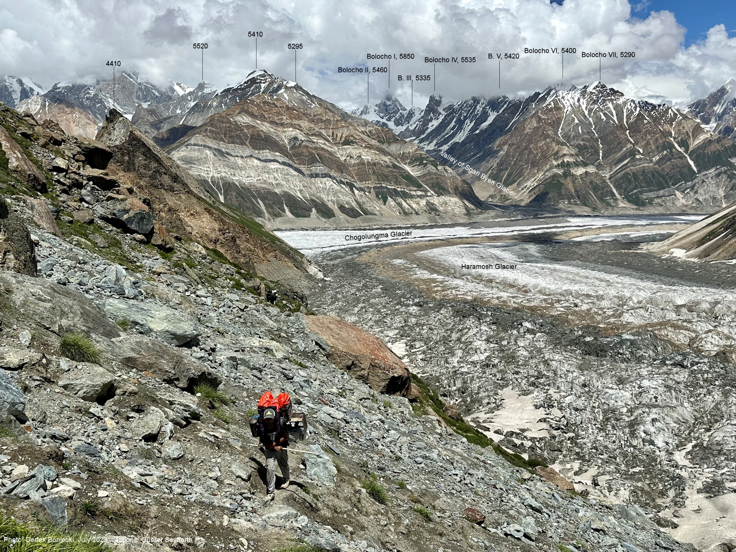
The confluence of the Haramosh and Chomolugma Glaciers.
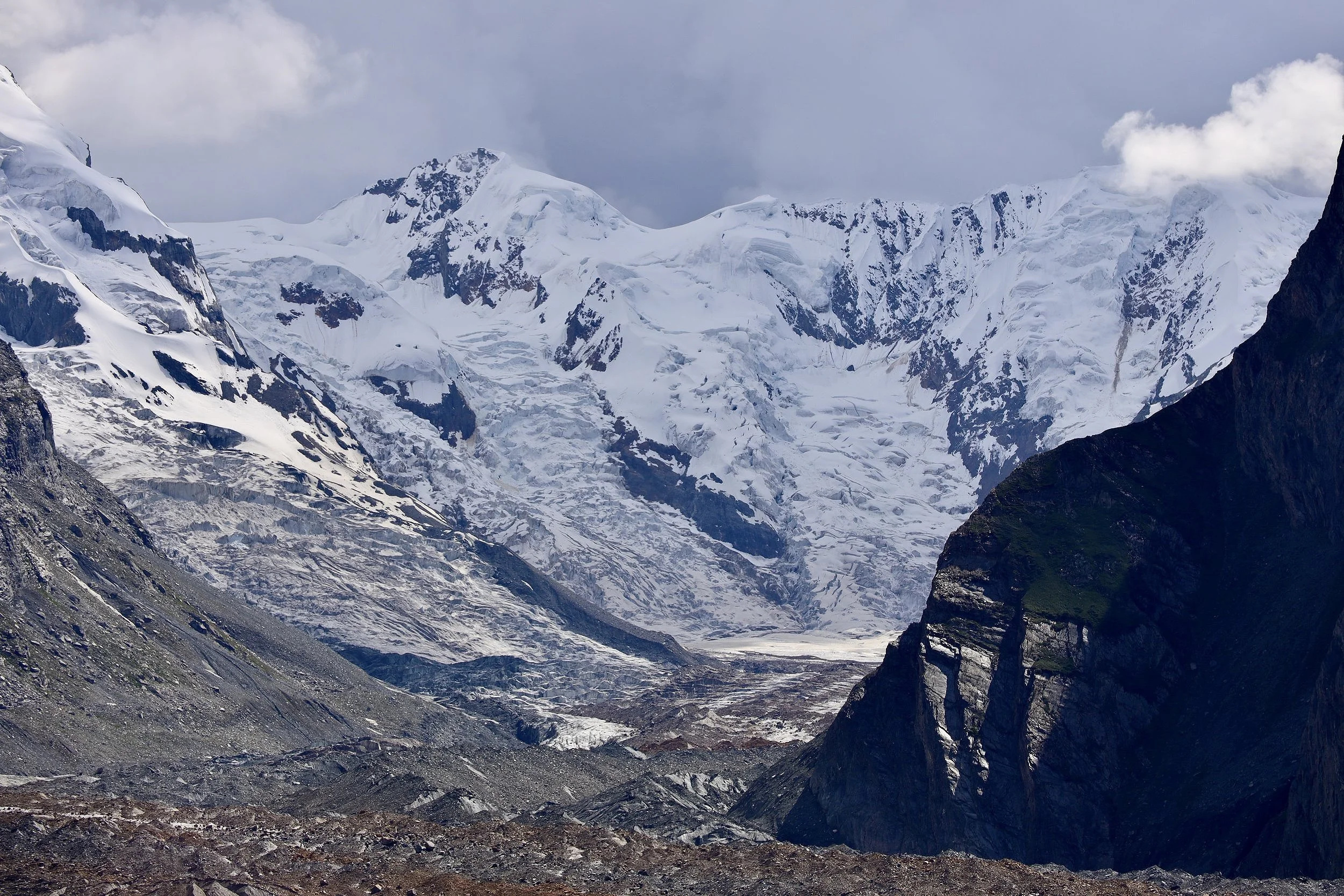
Sgari Glacier and Bolocho 1 (high peak on the left 5850m).
Bolocho 1
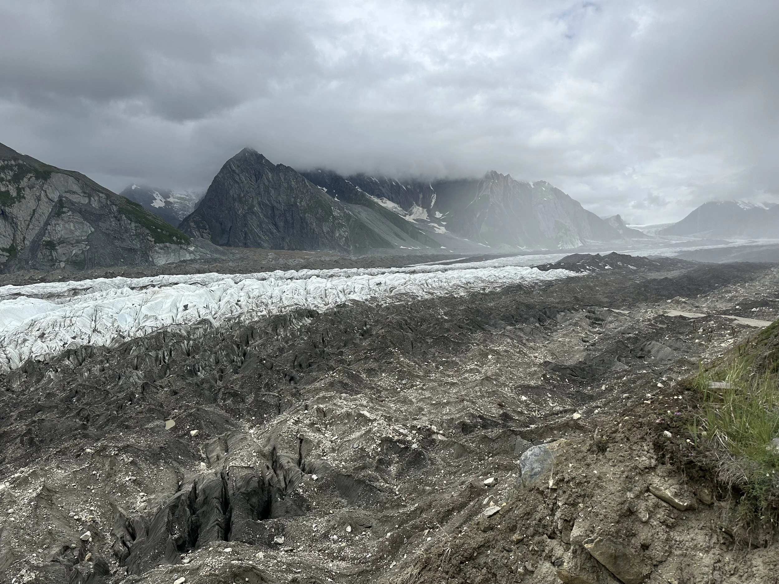
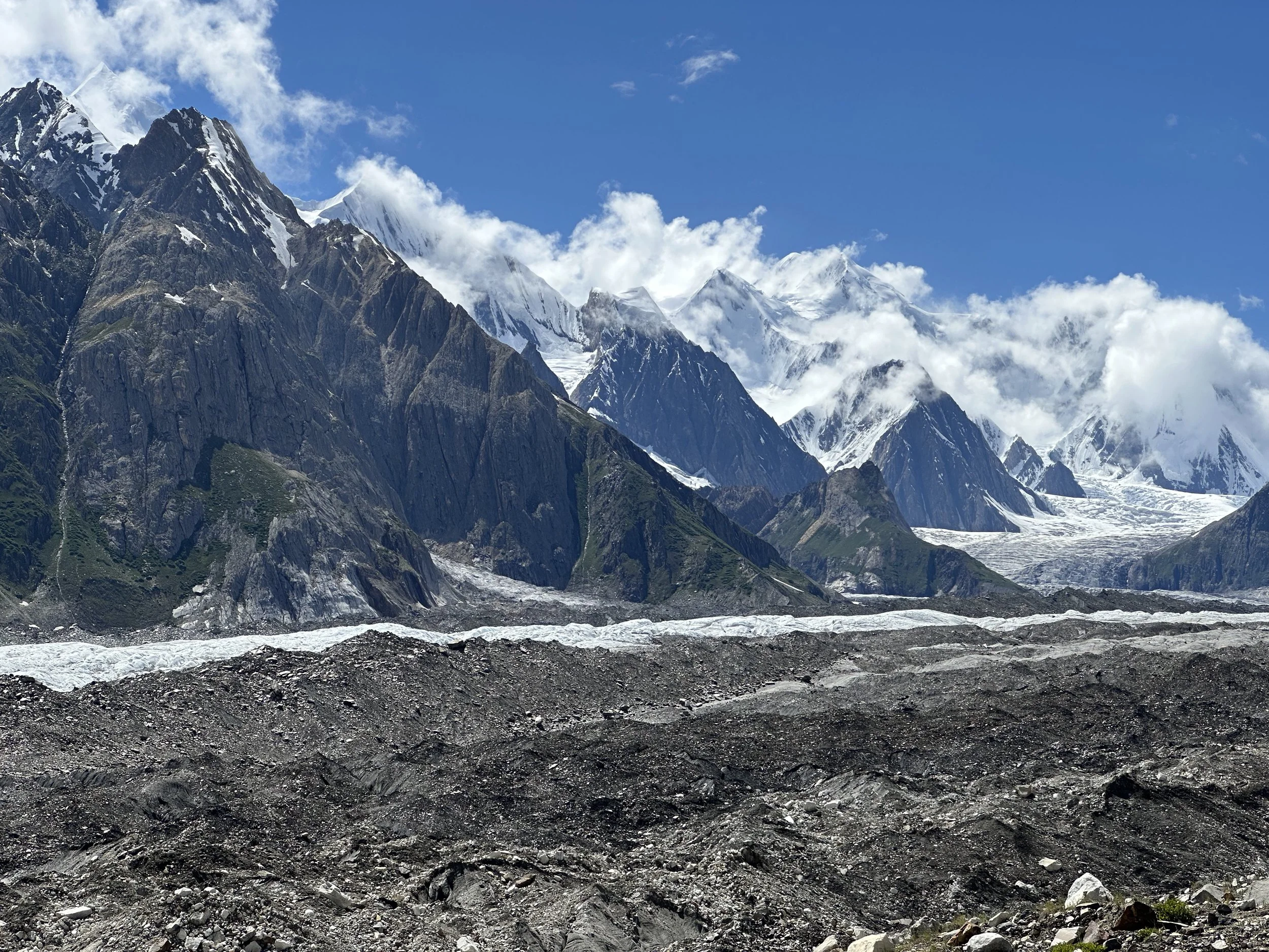
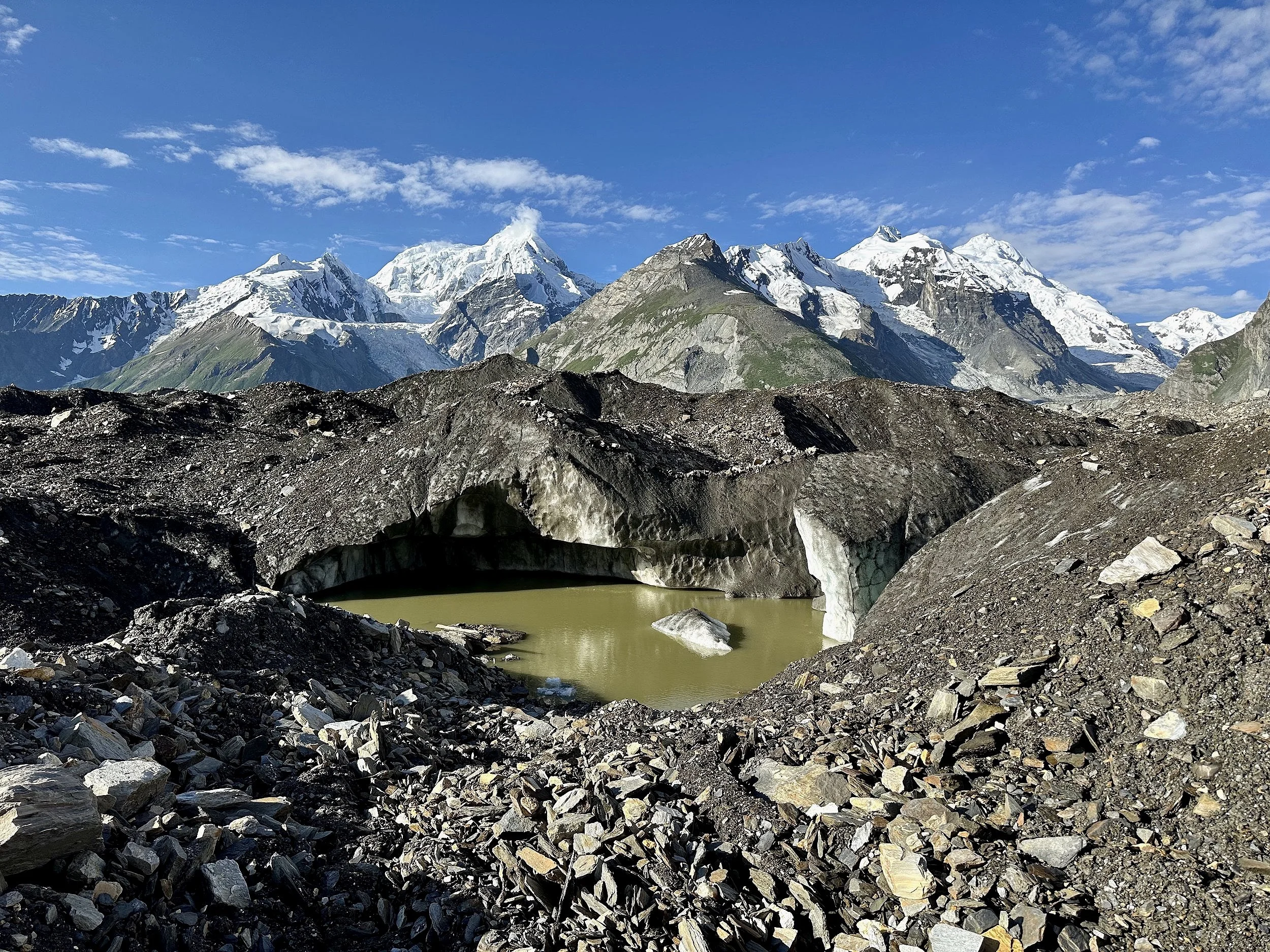
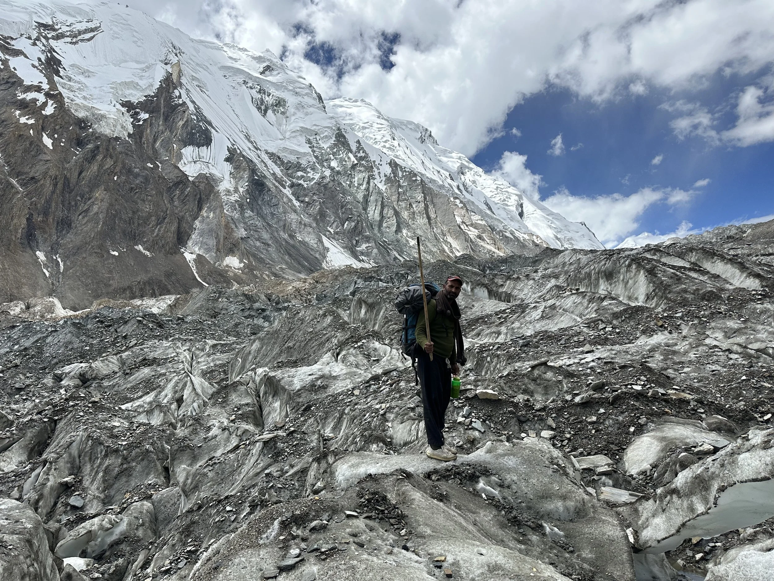
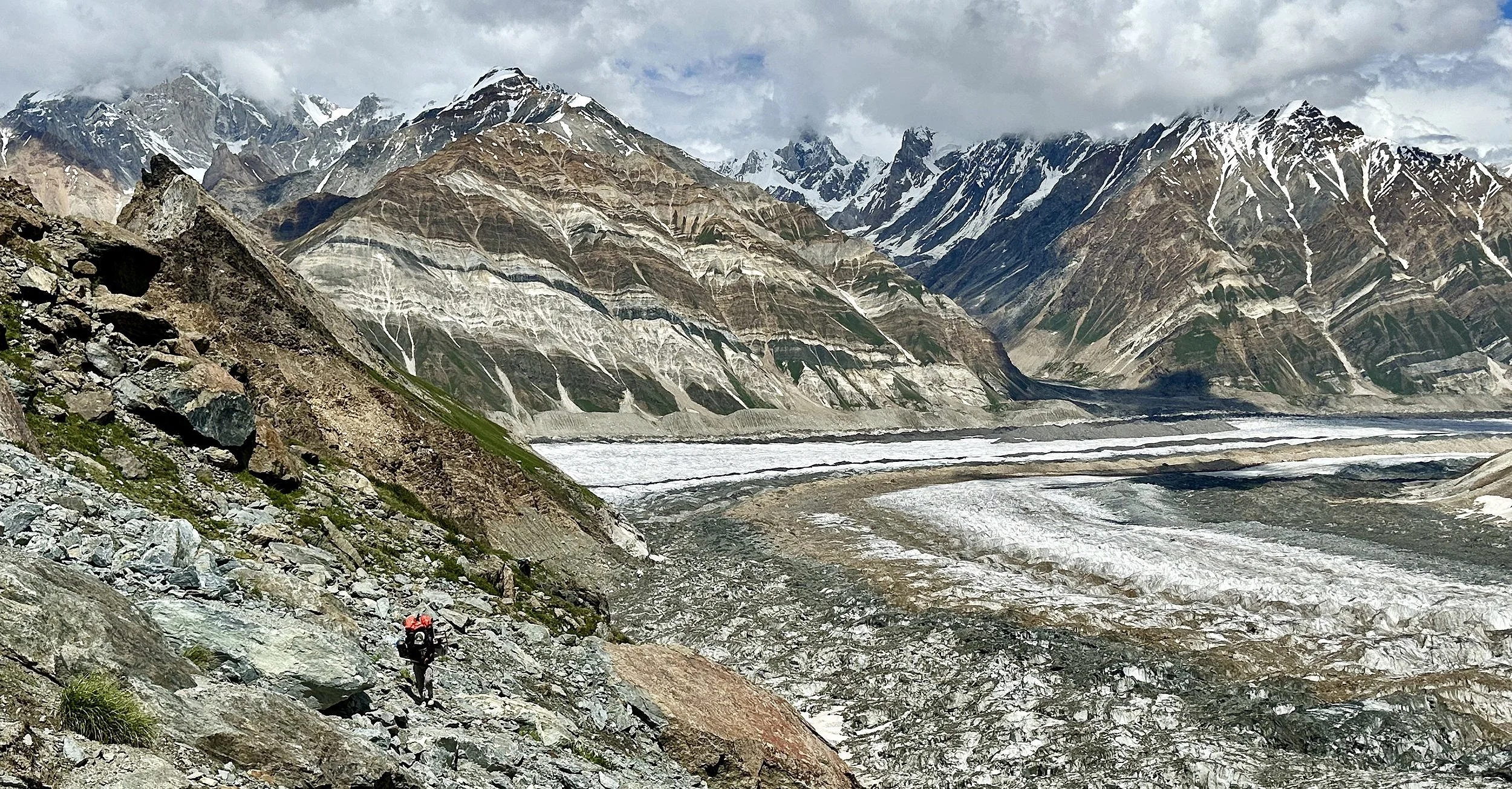
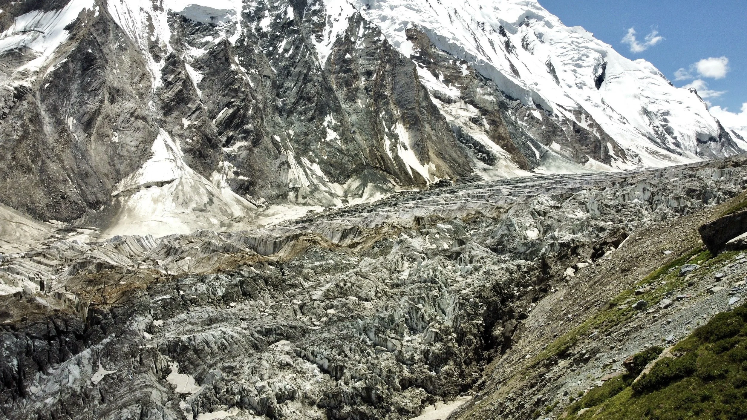
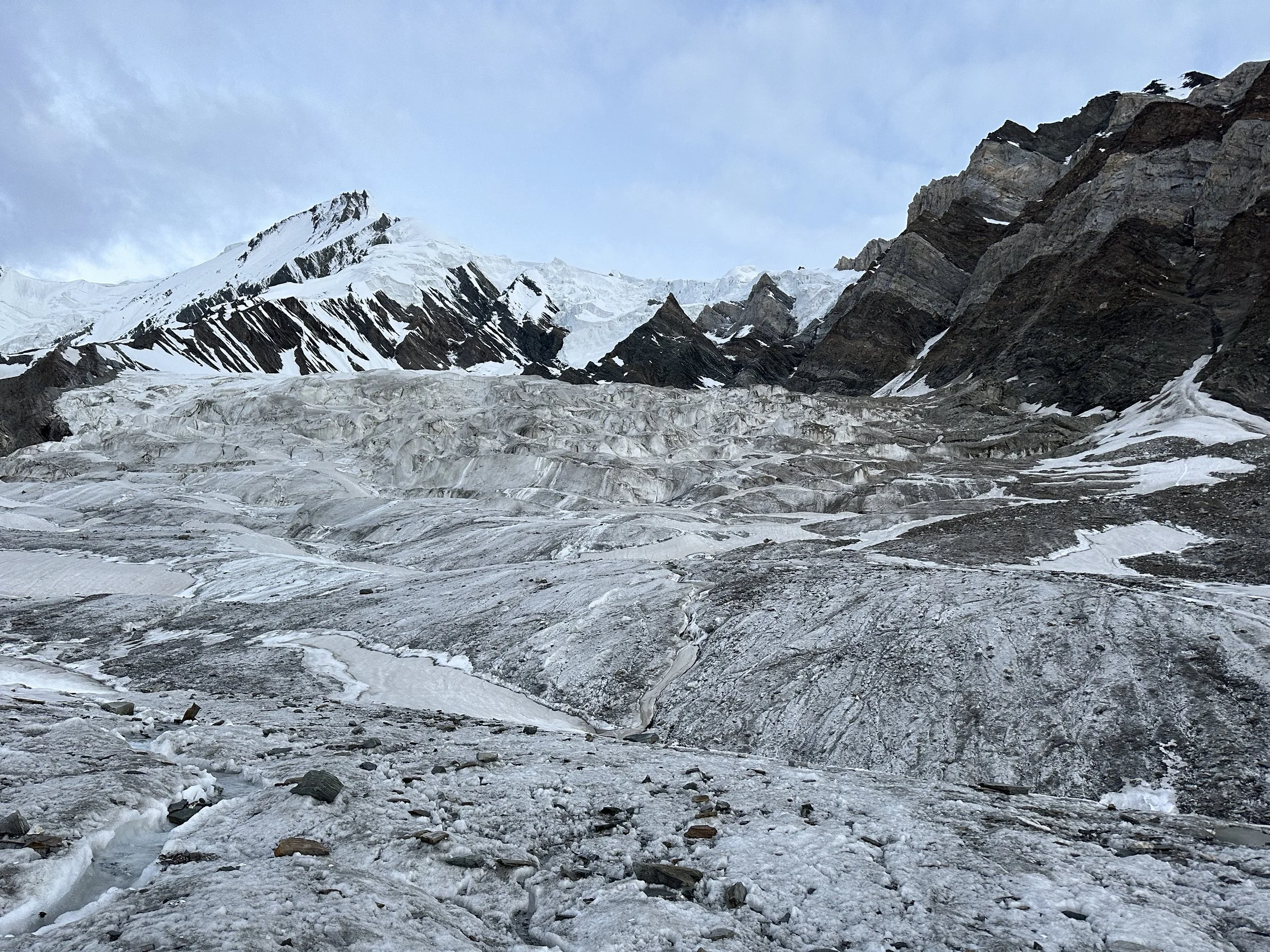
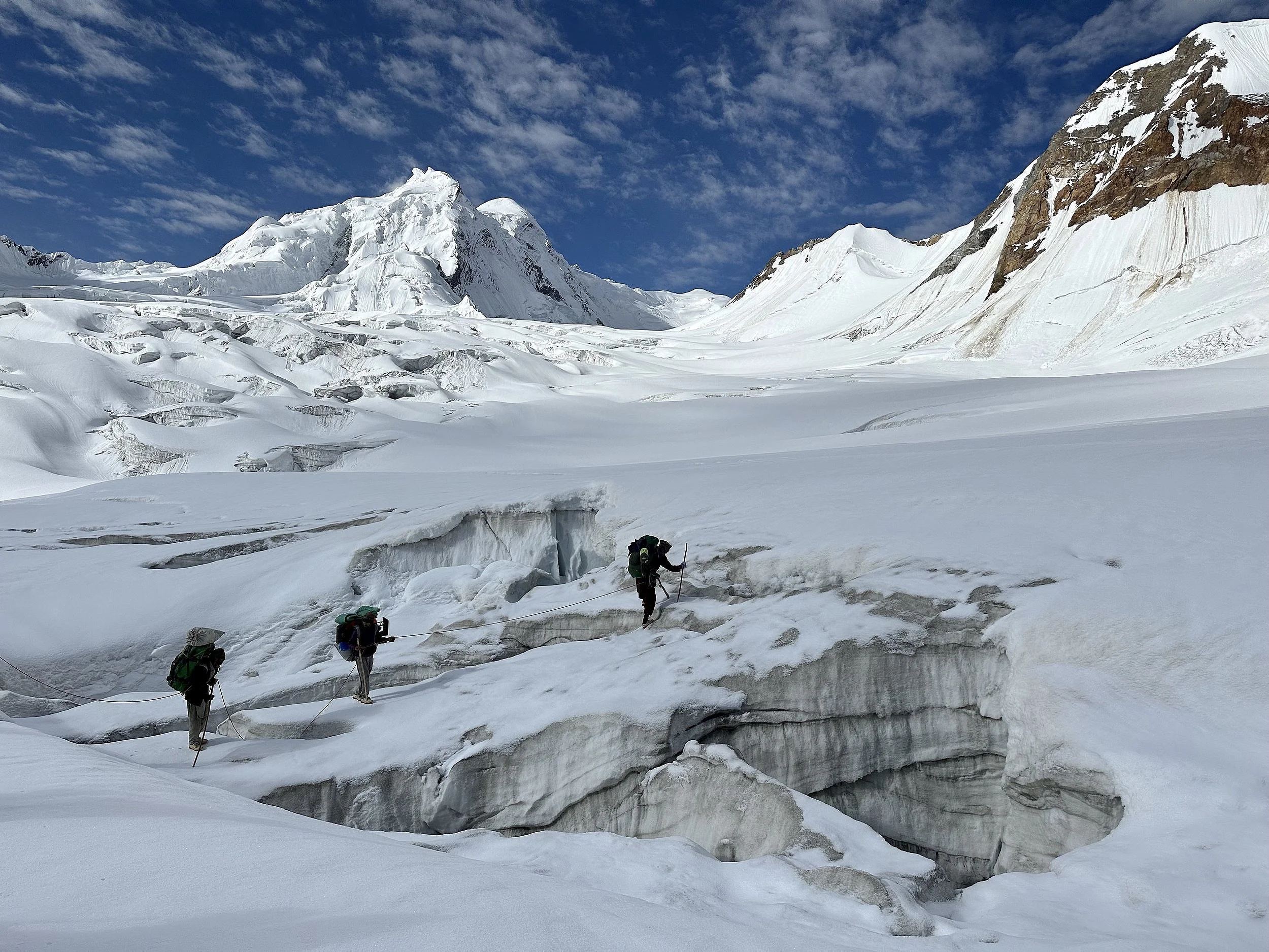
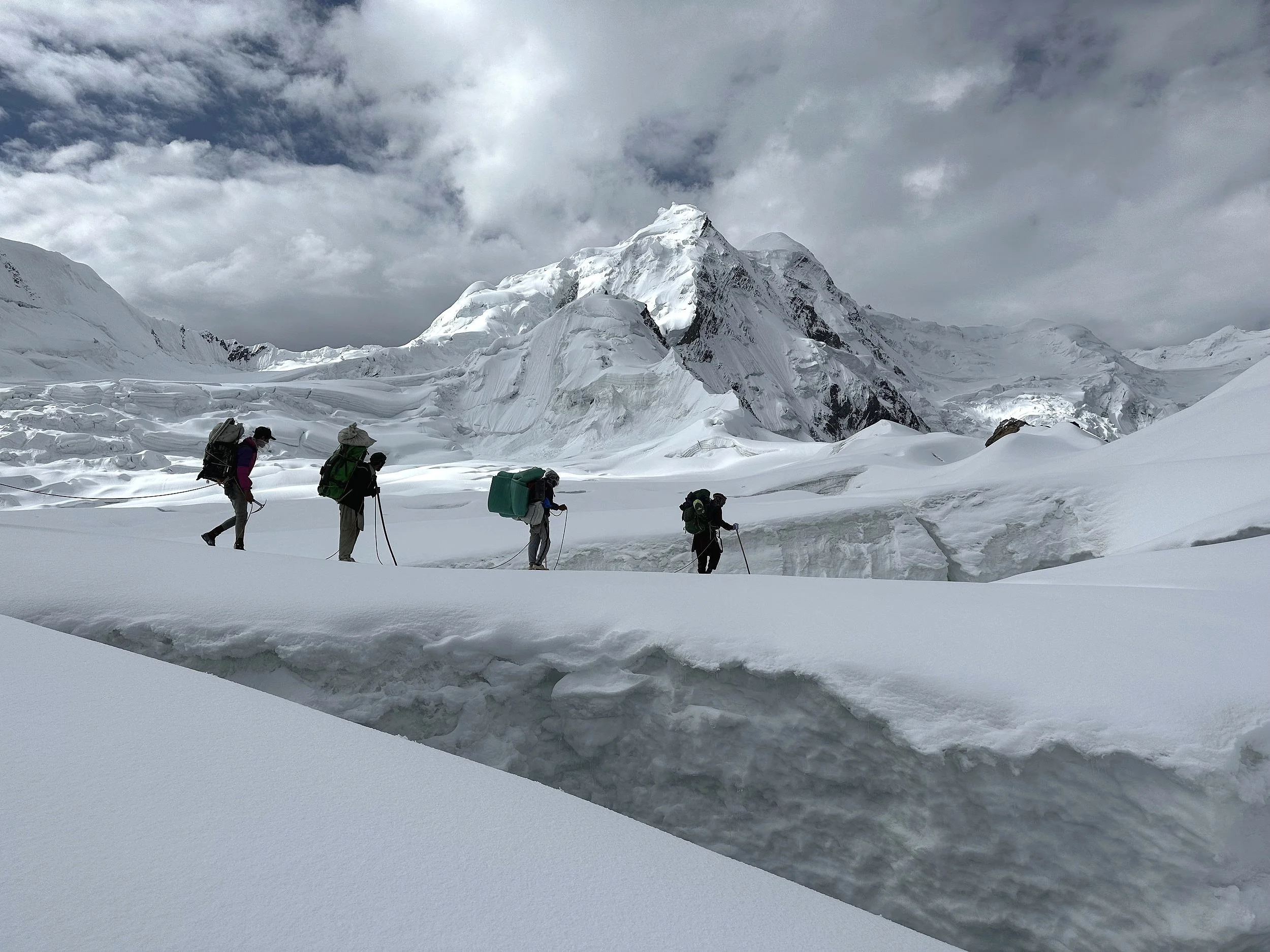
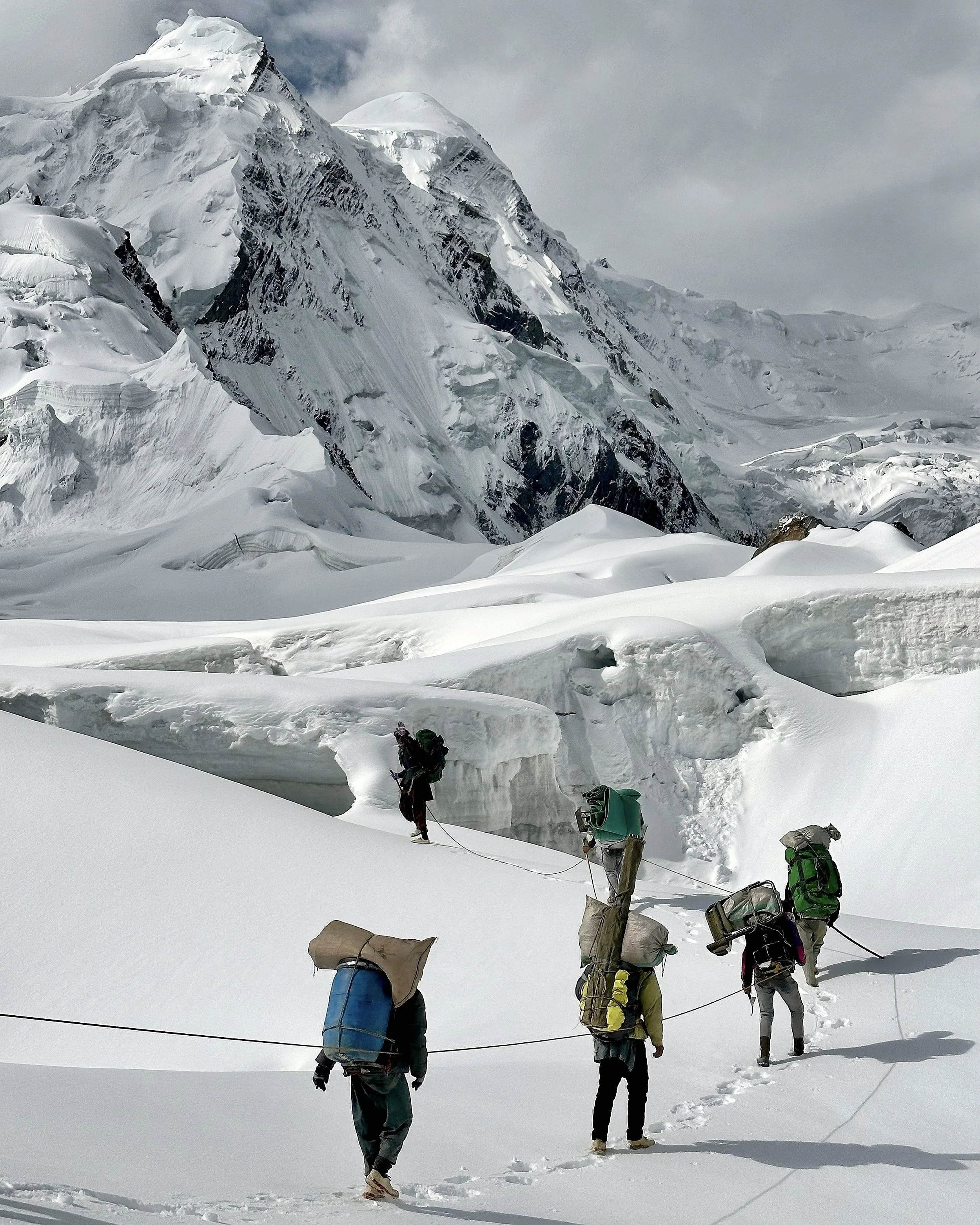
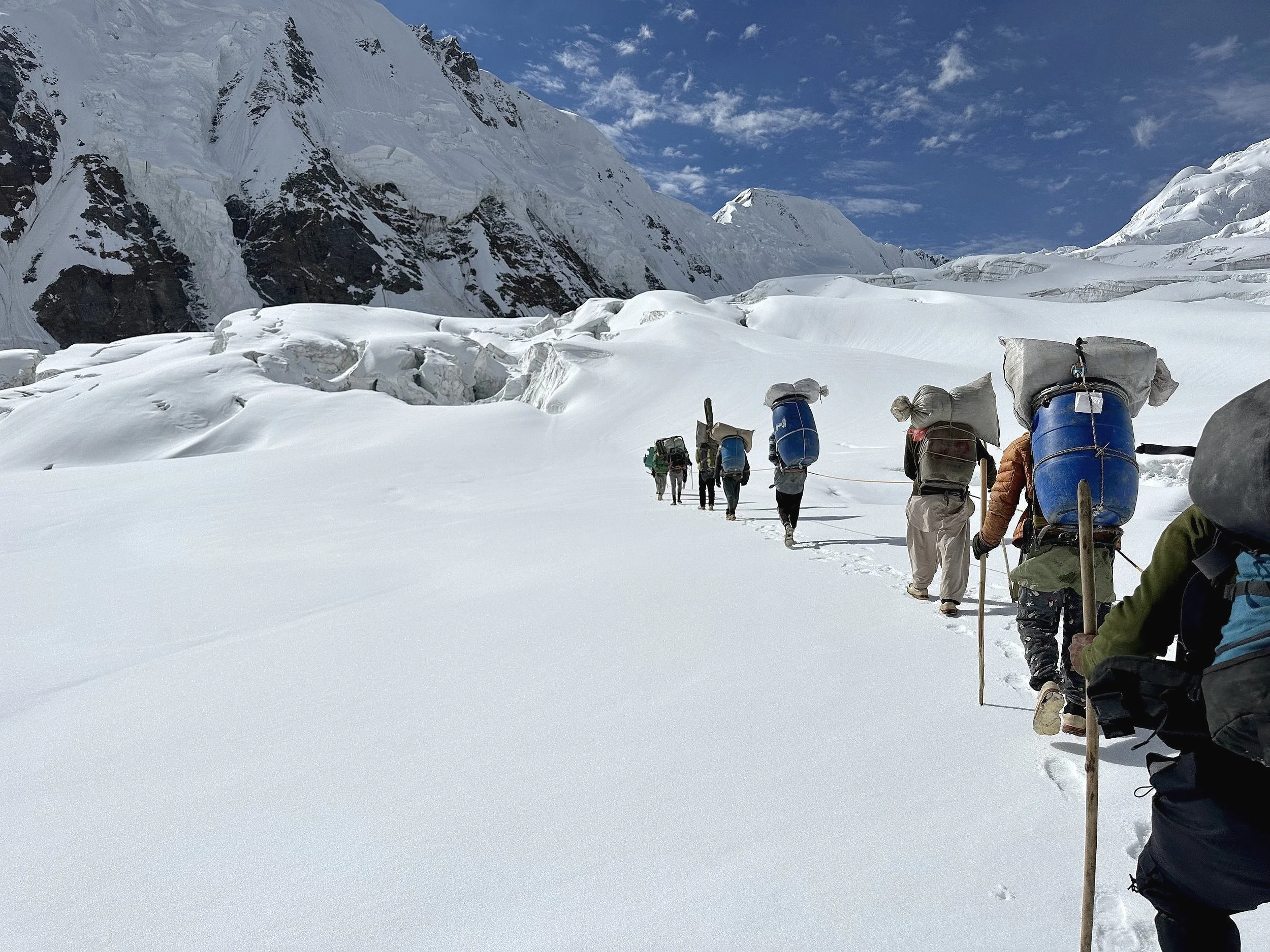
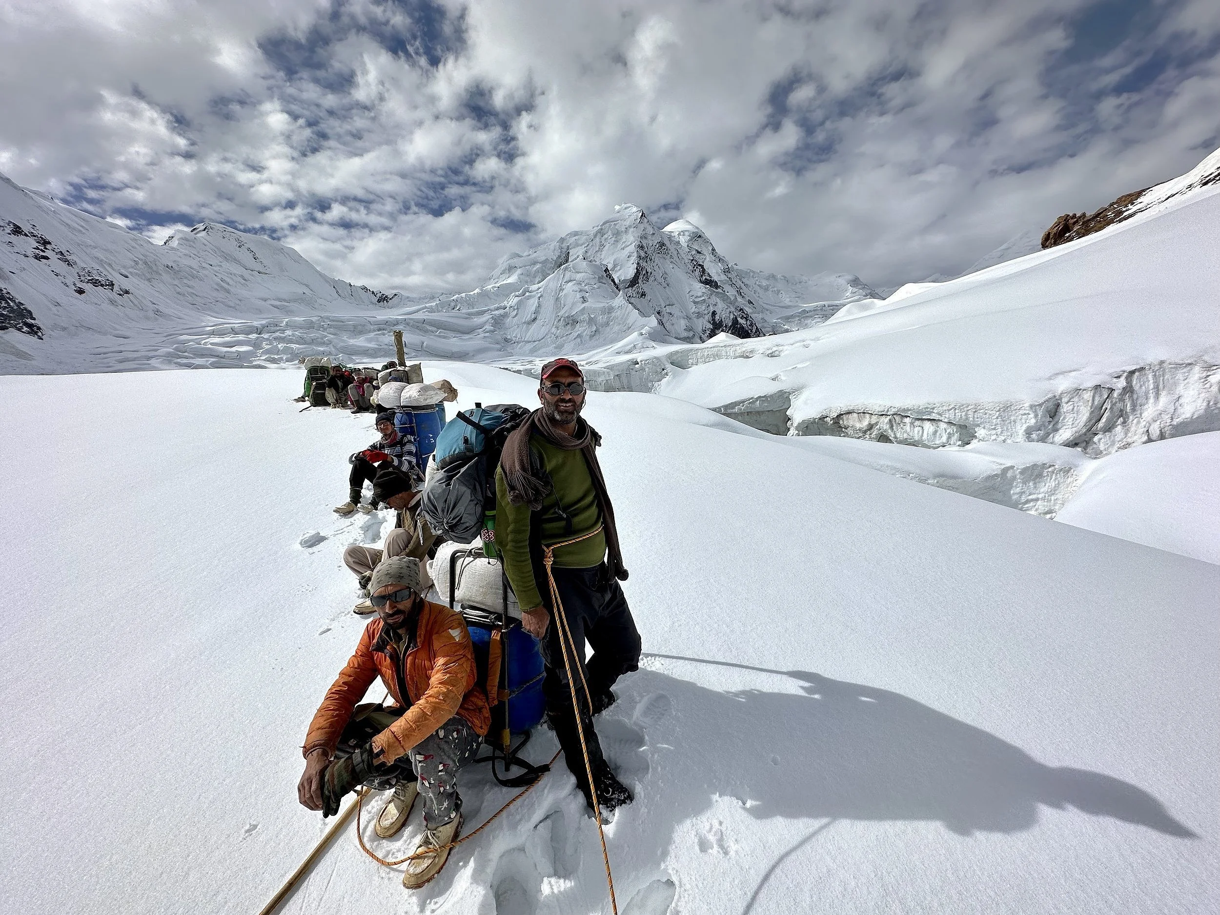
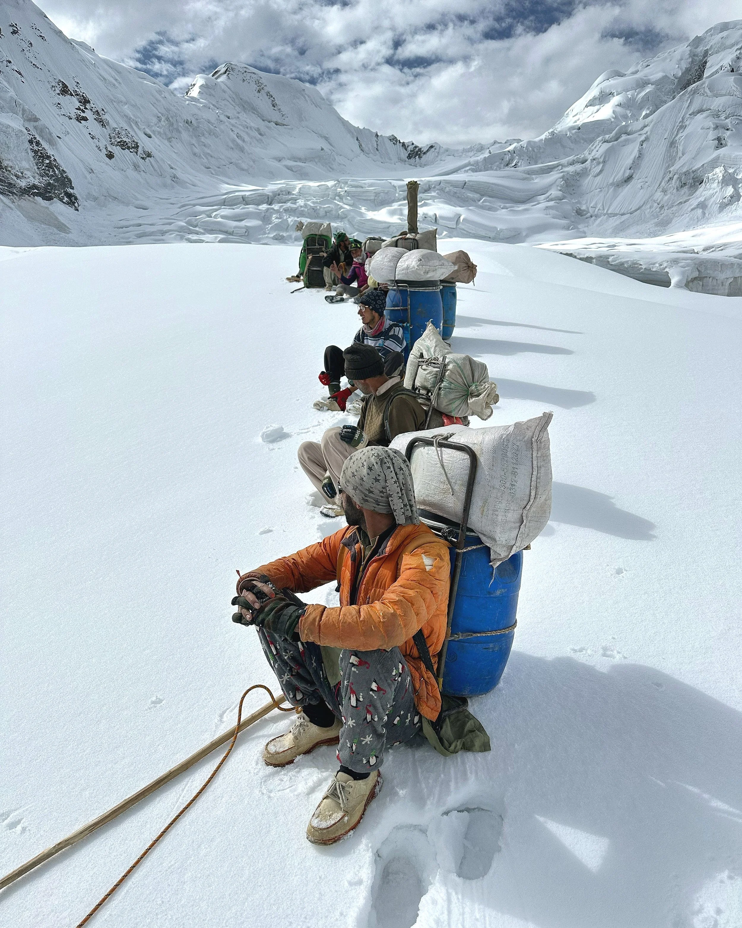
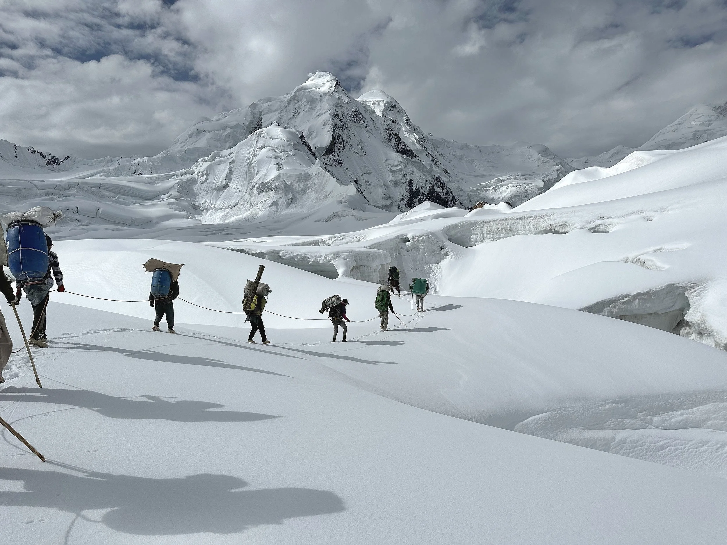
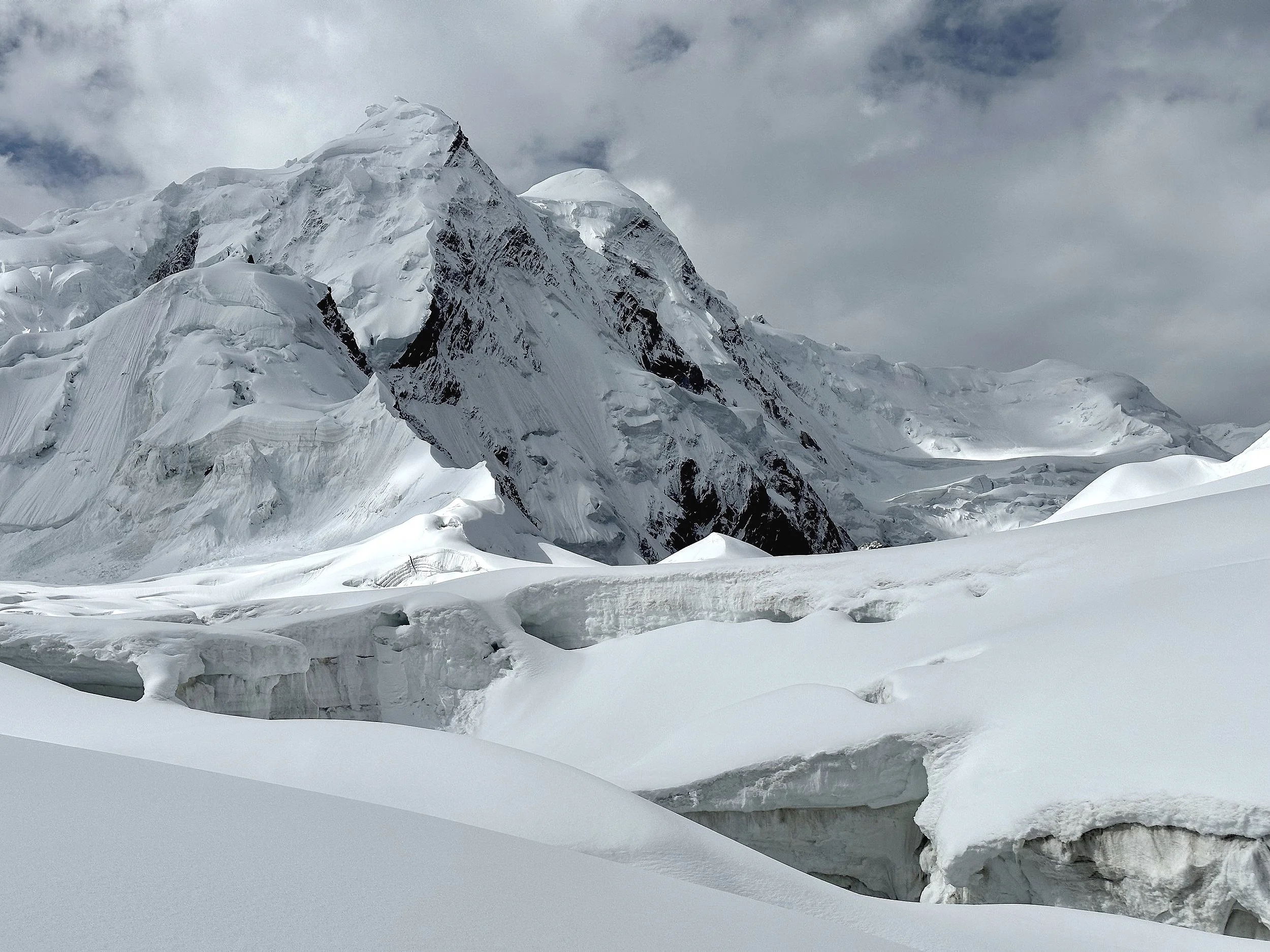
The heavily crevassed Haramosh Glacier.
Haramosh Glacier
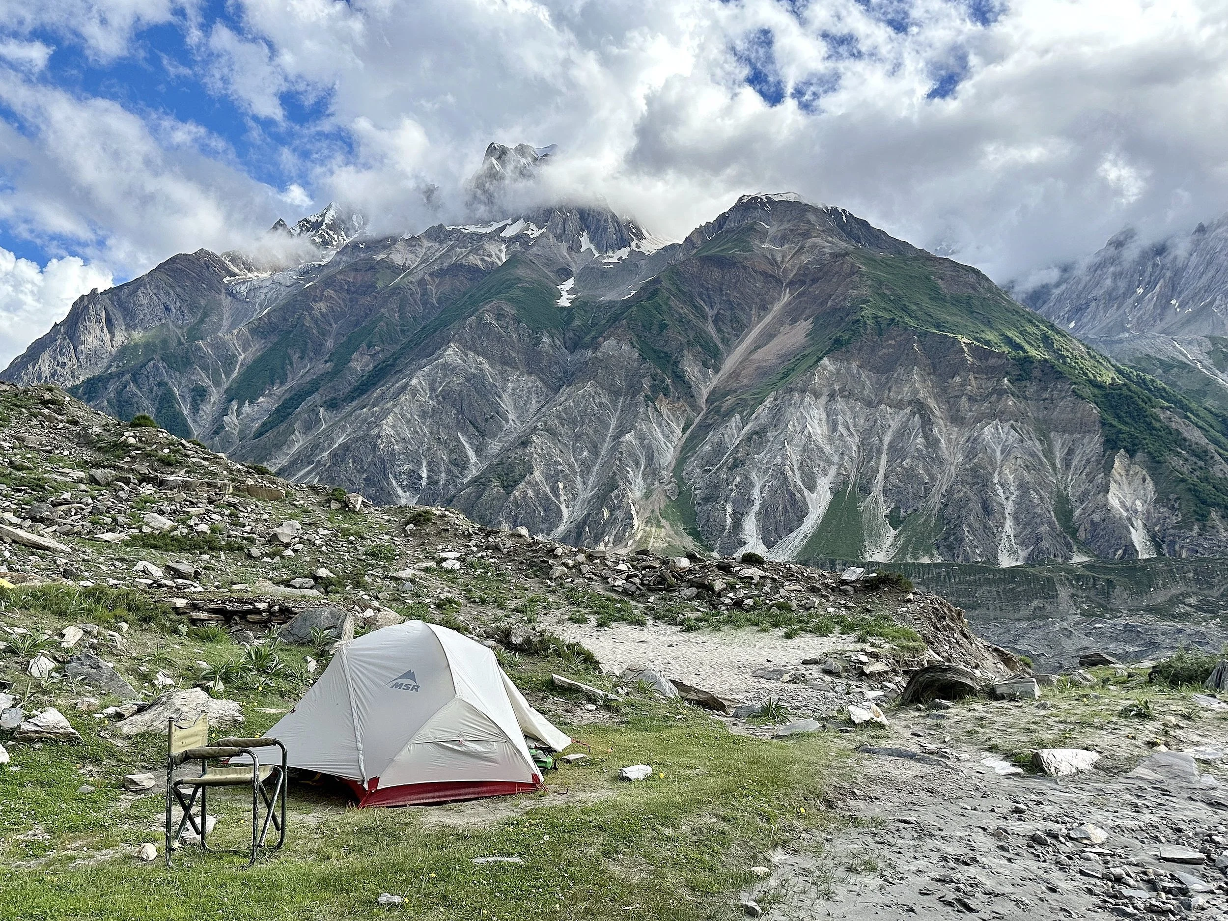
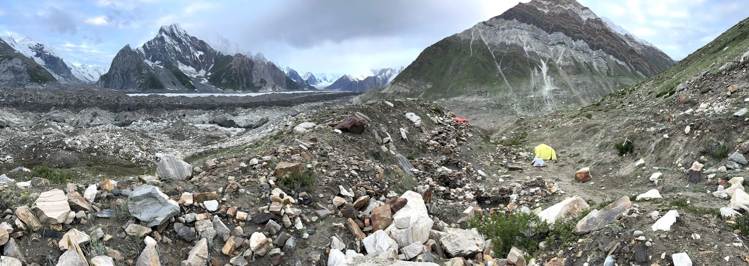
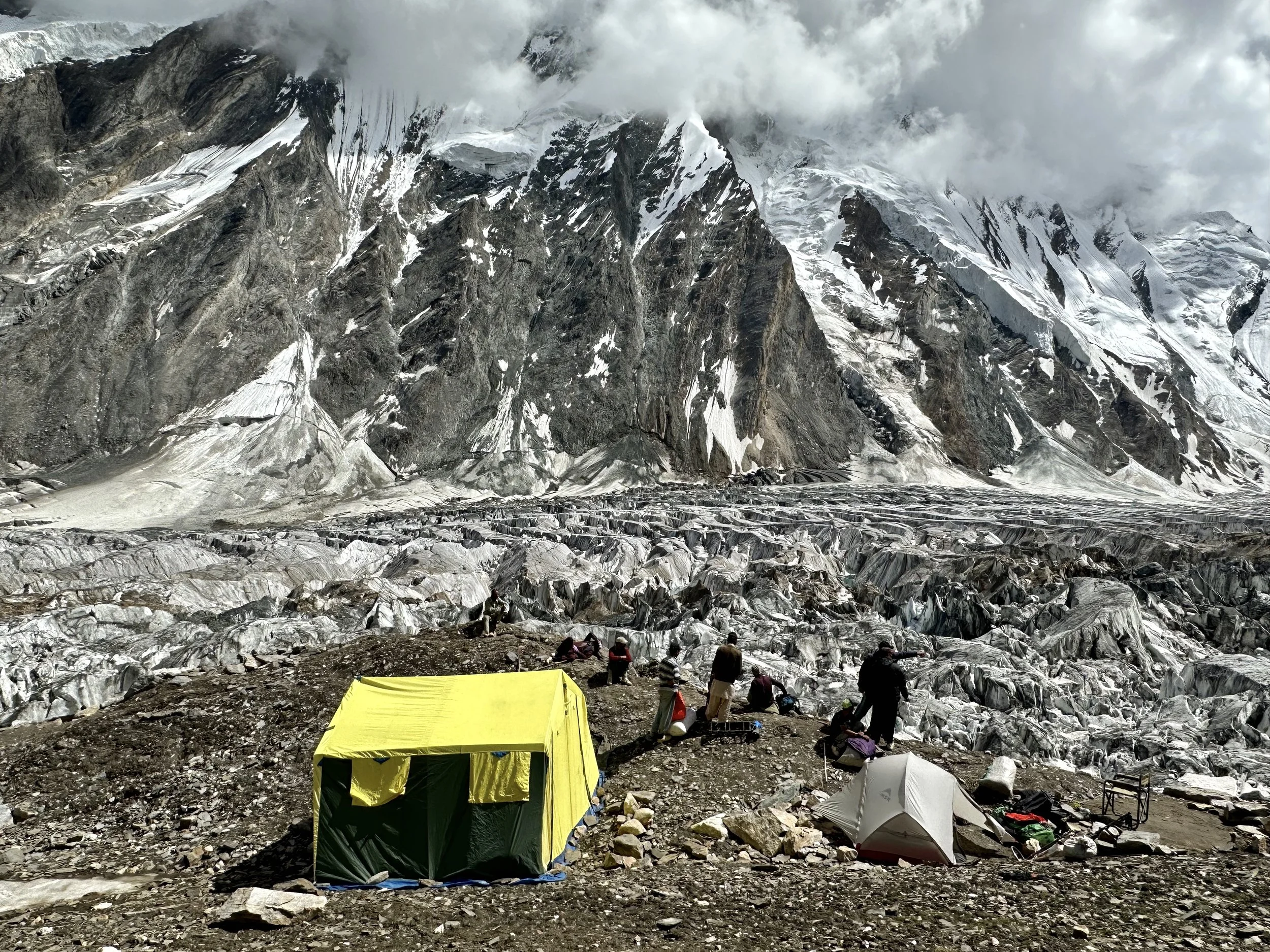
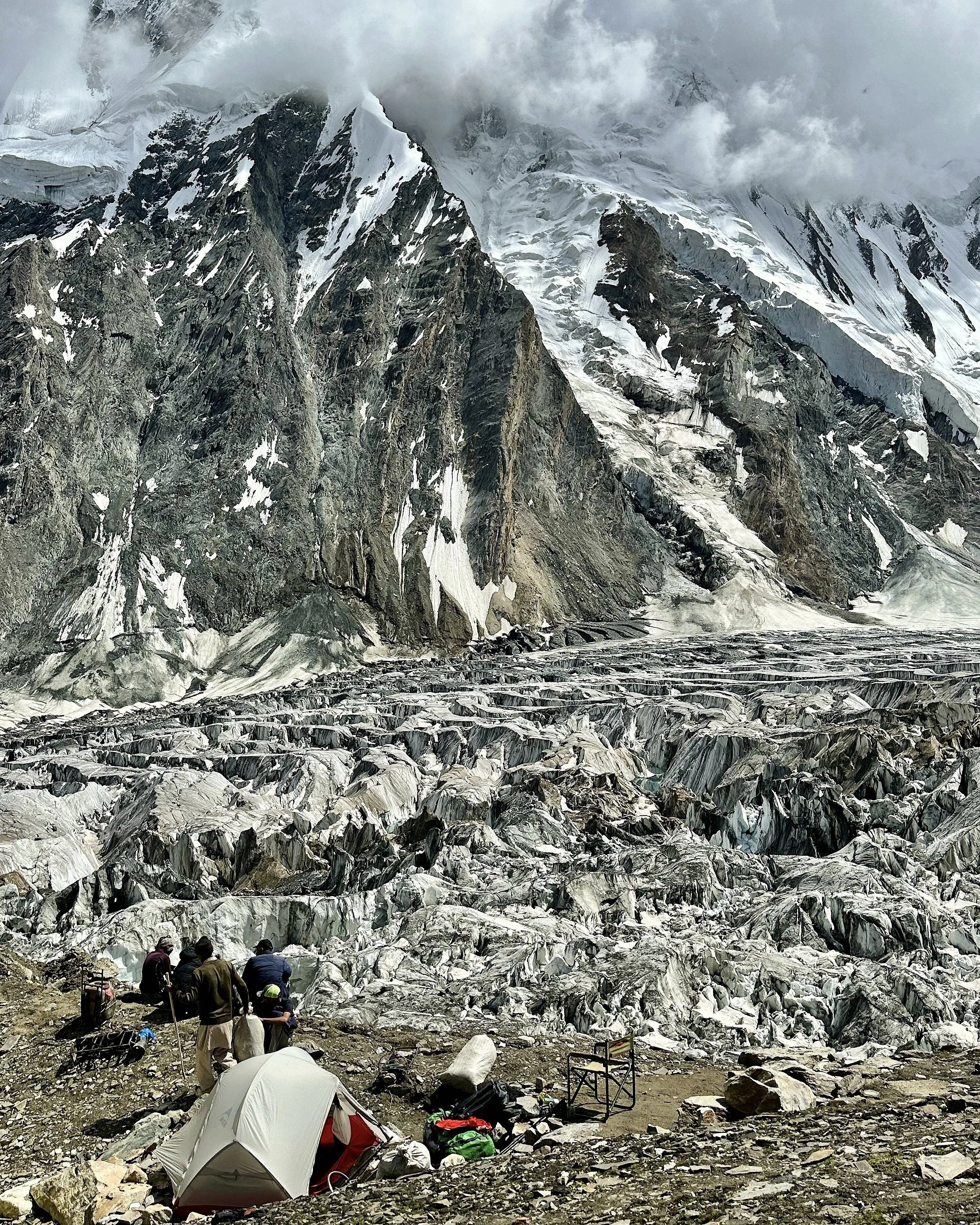
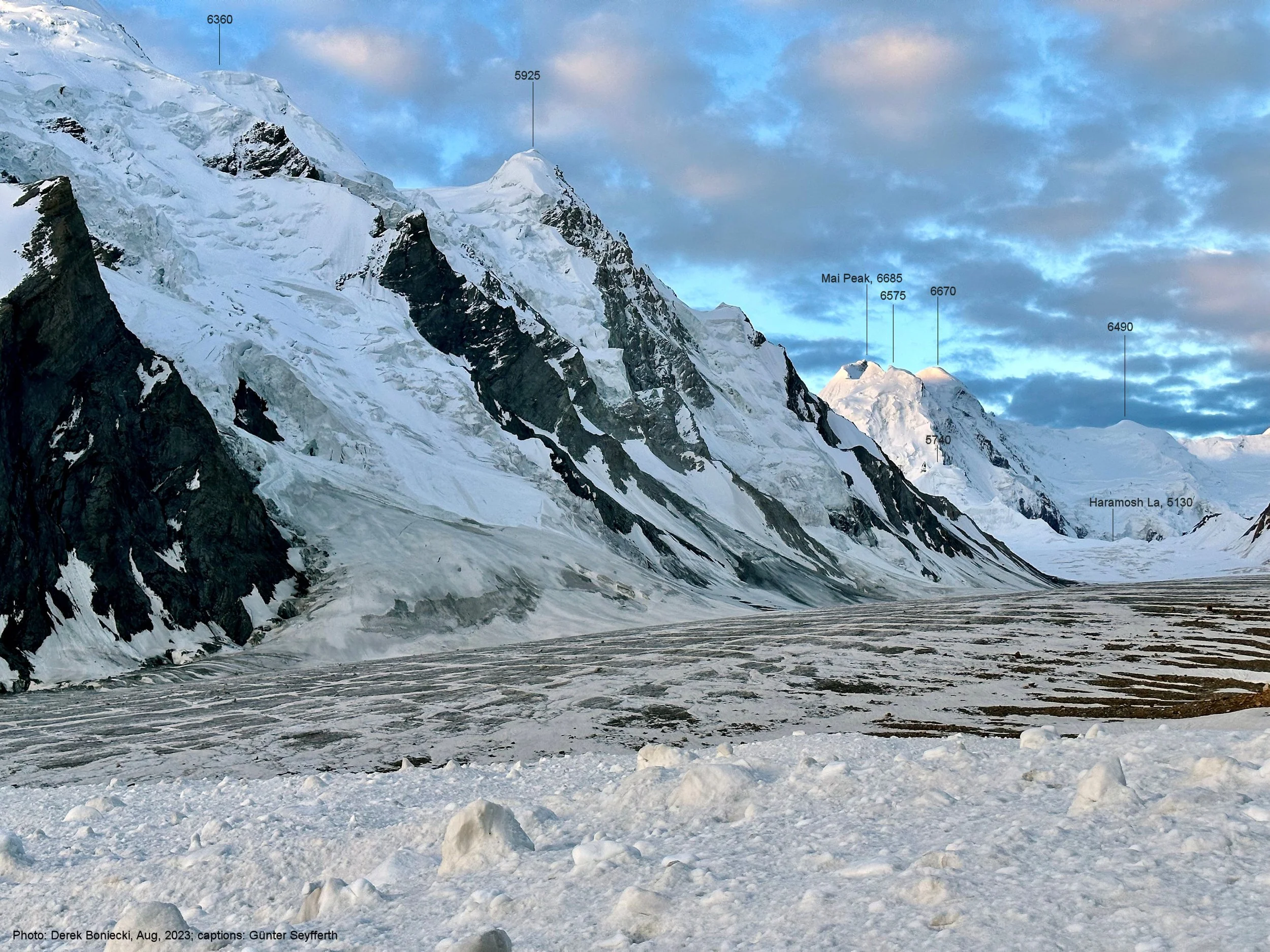
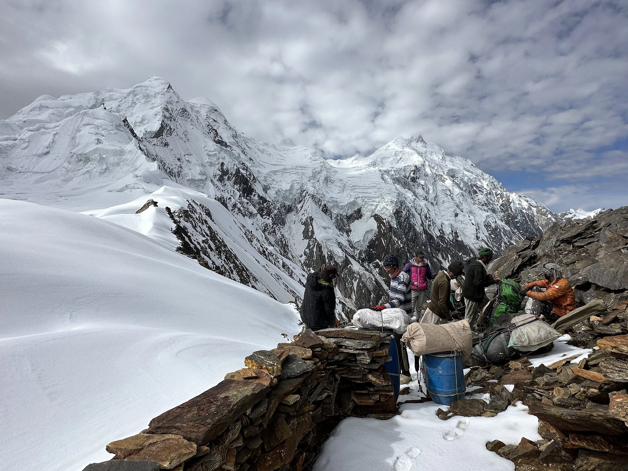
Our incredible camp on the Haramosh Glacier. This is the bc for the Pass.
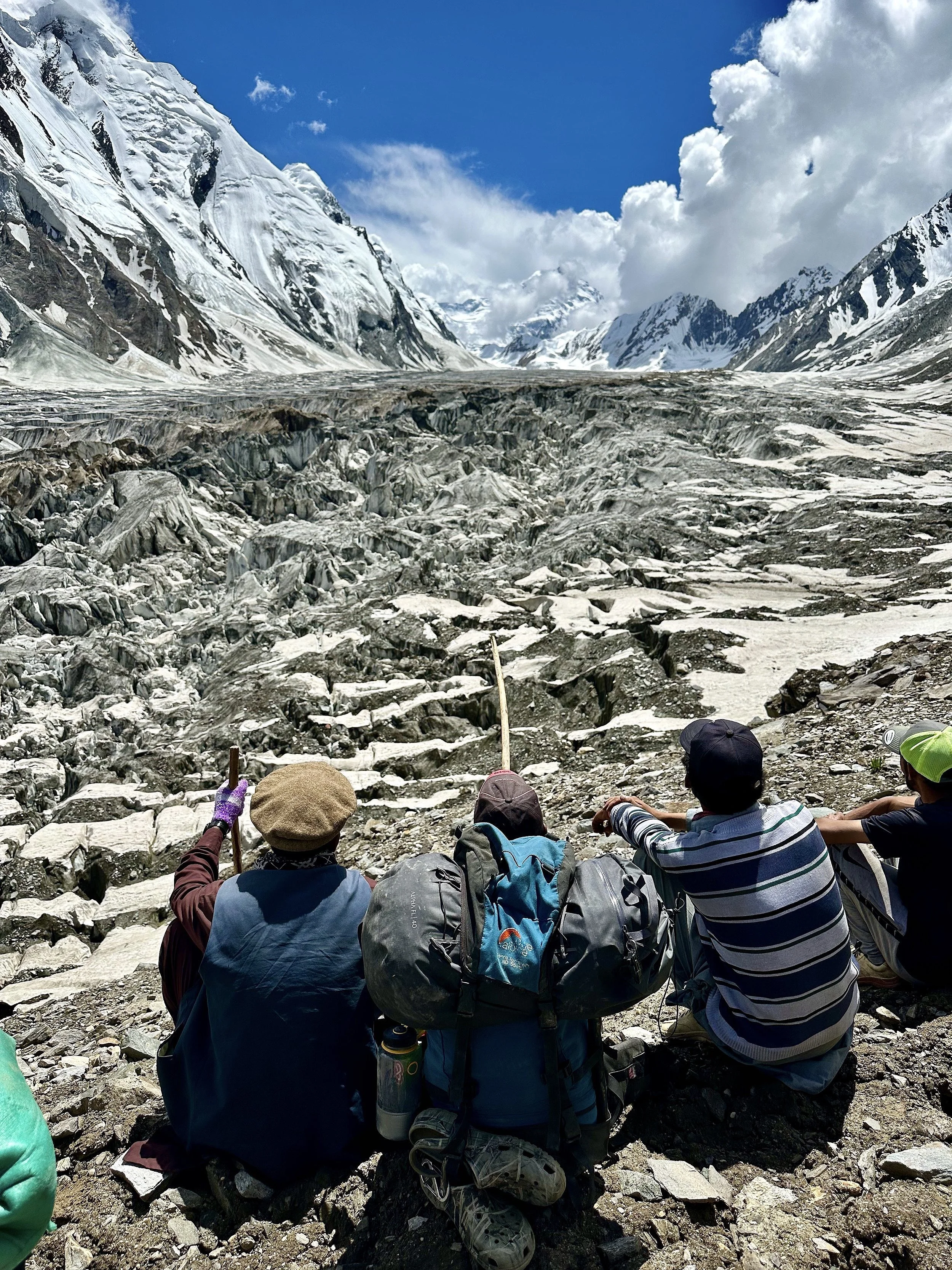
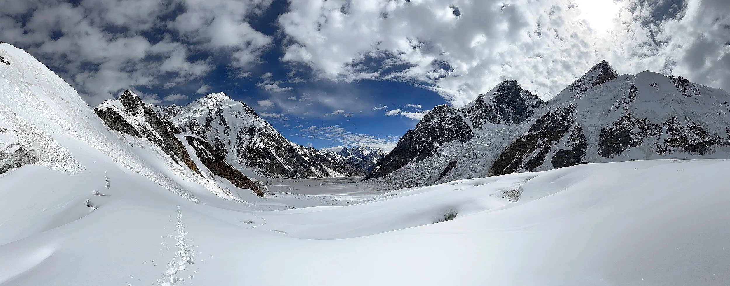
Pointing at the pass 12 km away and another 1000m up along the upper reaches of the Haramosh Glacier.
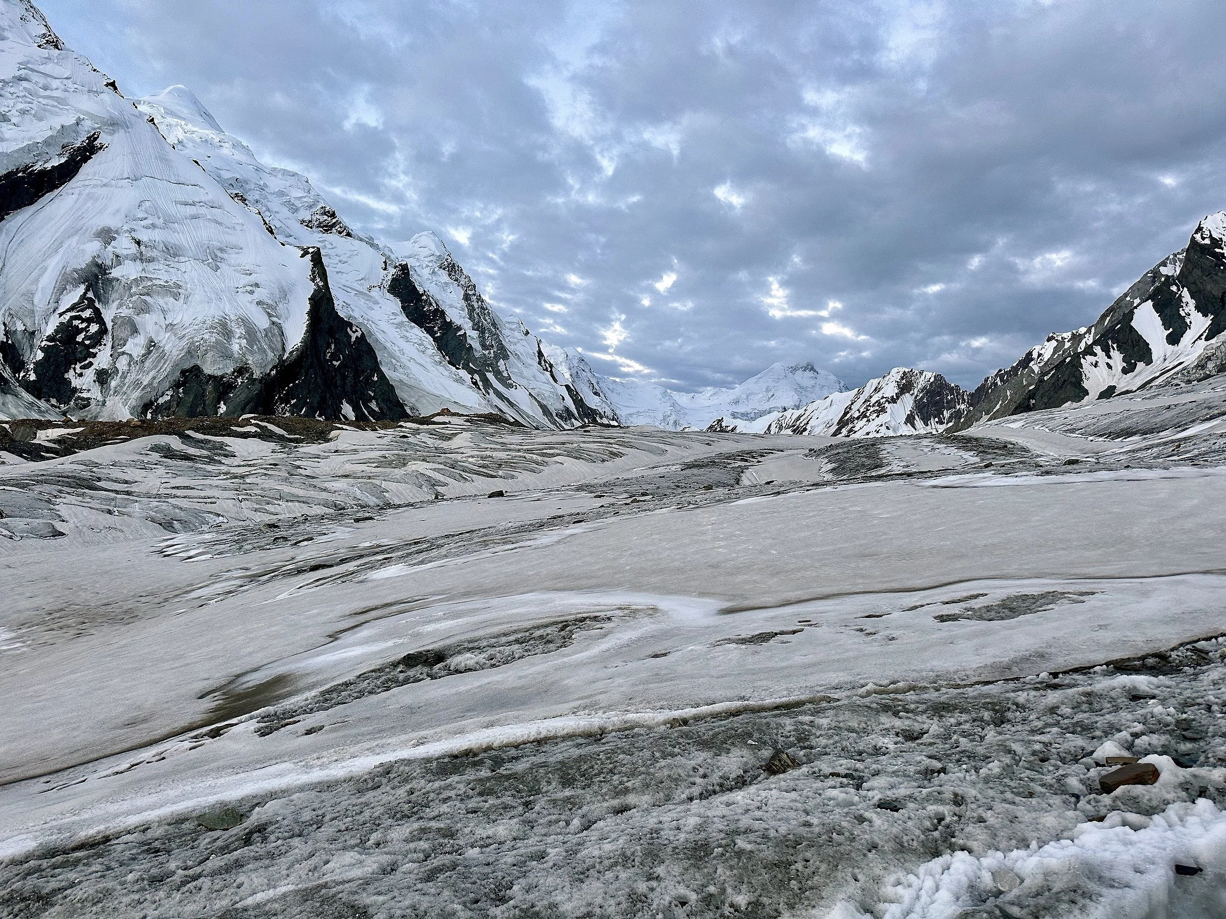
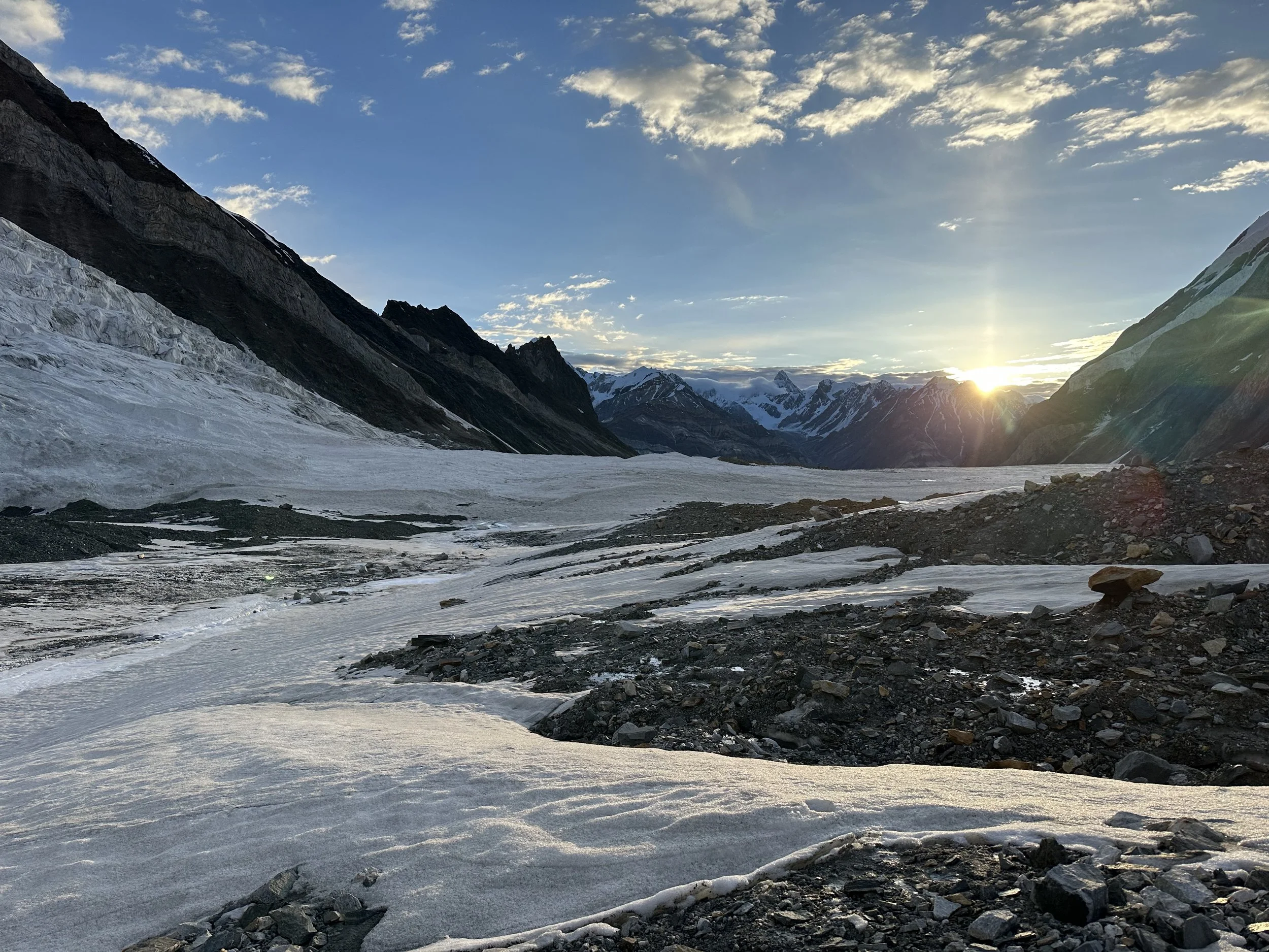
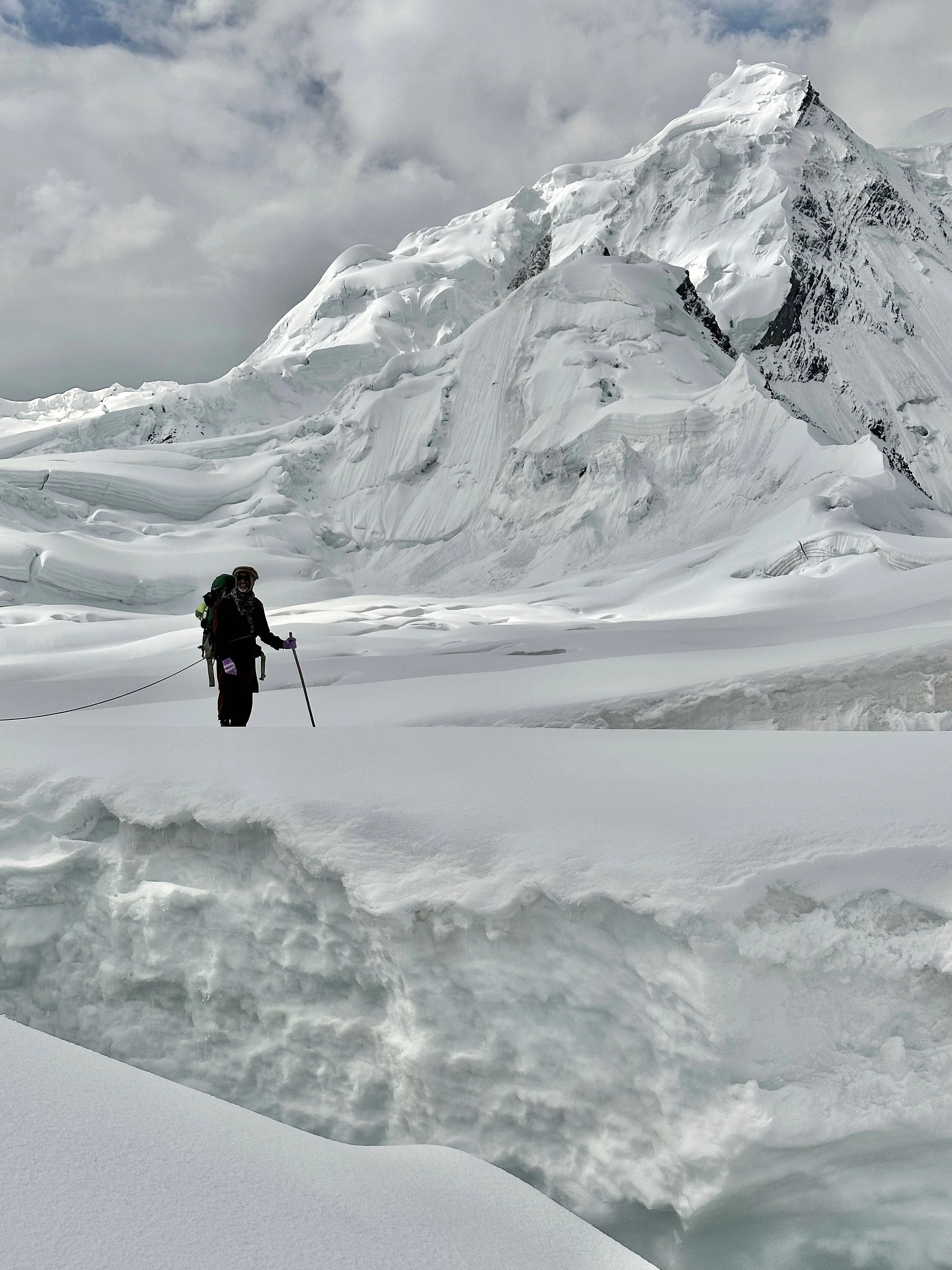
Early morning on the upper Haramosh Glacier
The sunrise on the Haramosh Glacier
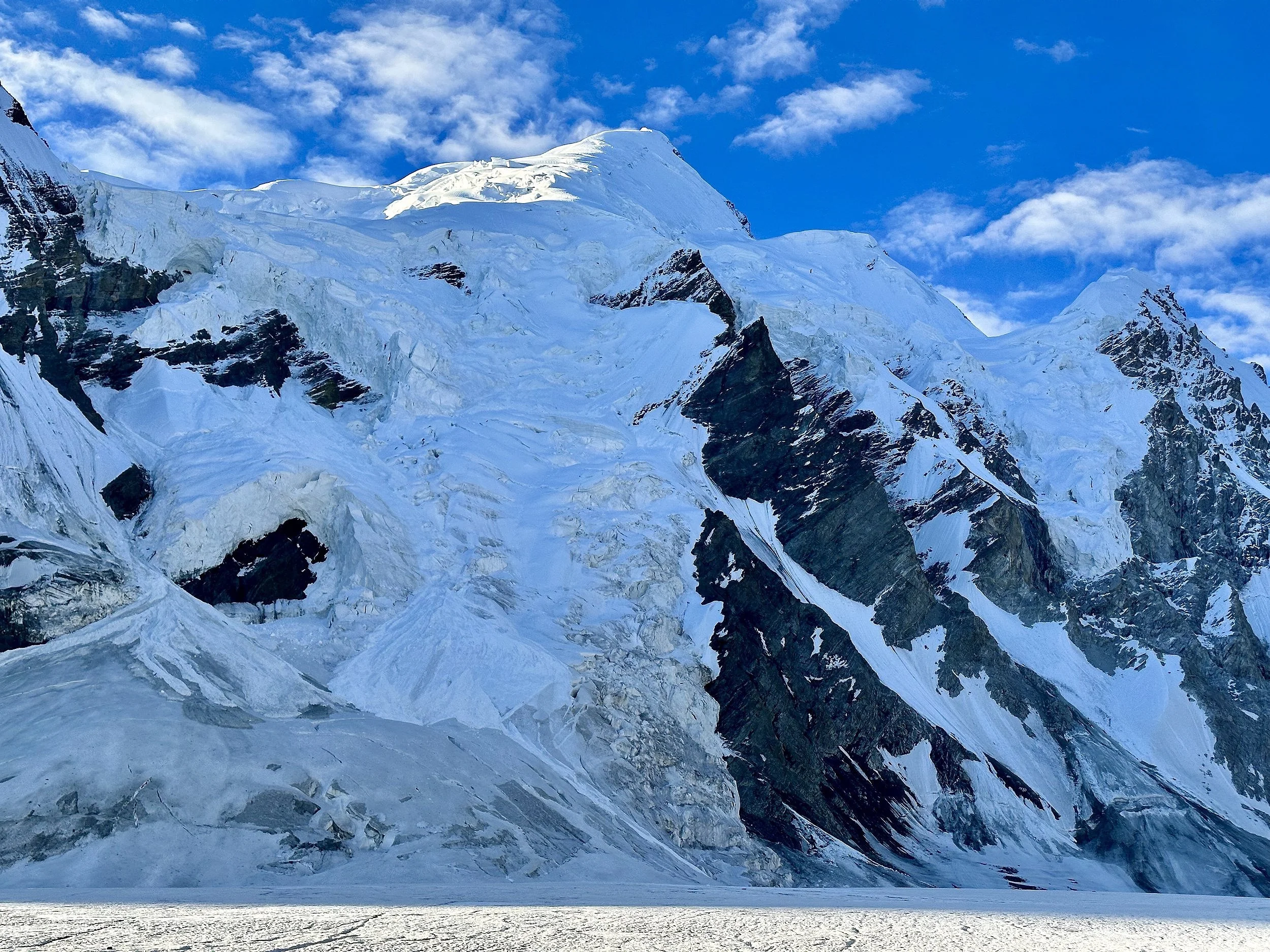
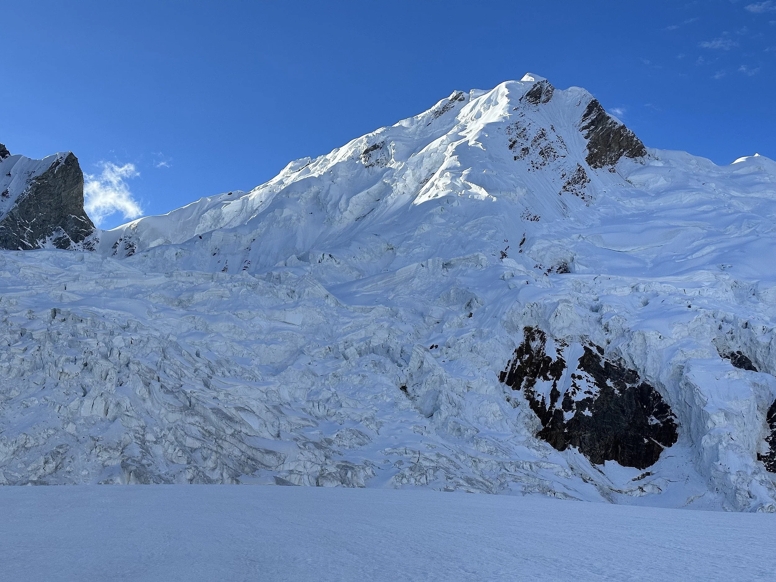
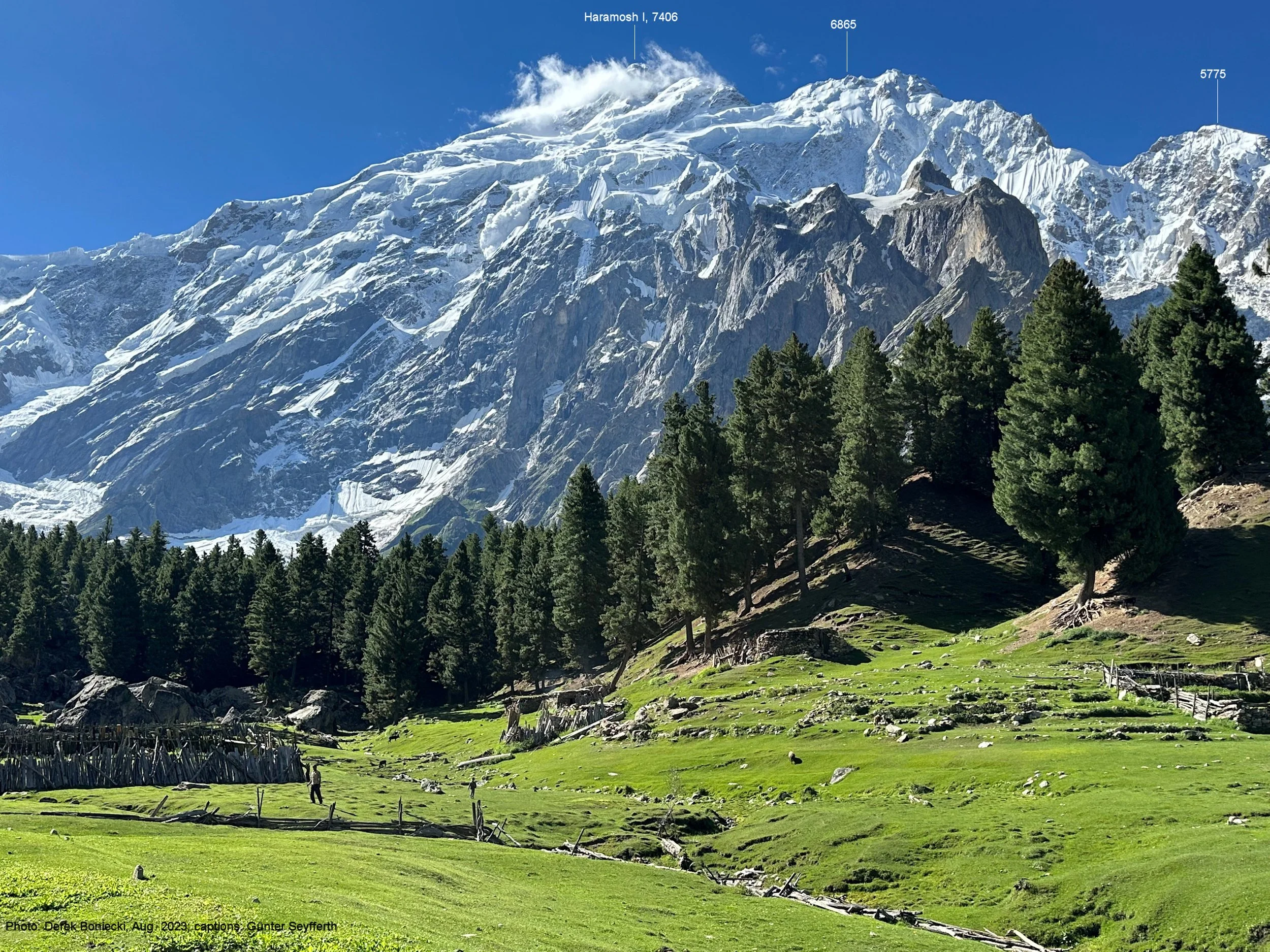
Sunrise on Haramosh 1 7406m.
Laila Peak icefall with Laila Peak 6986m above.
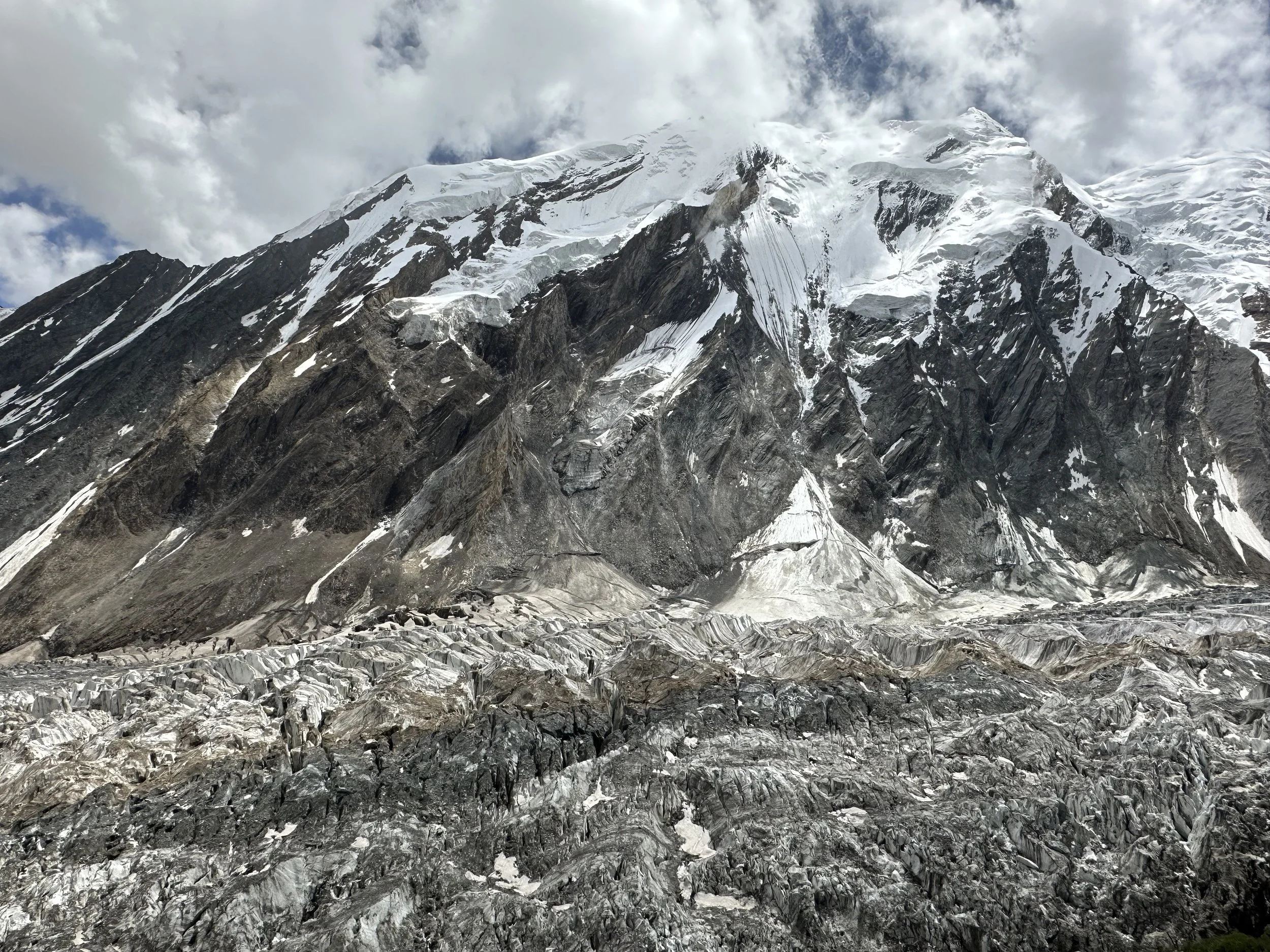
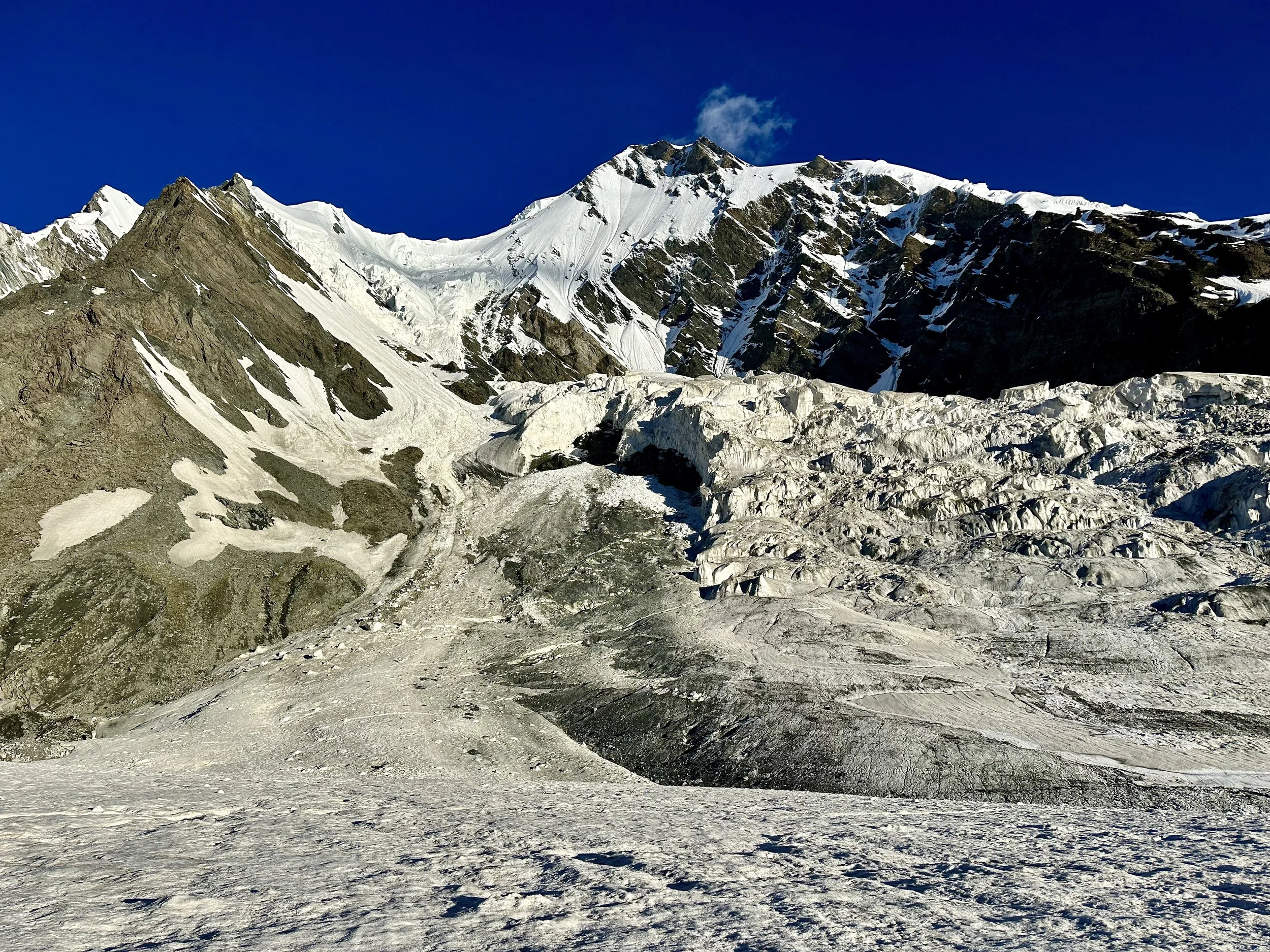
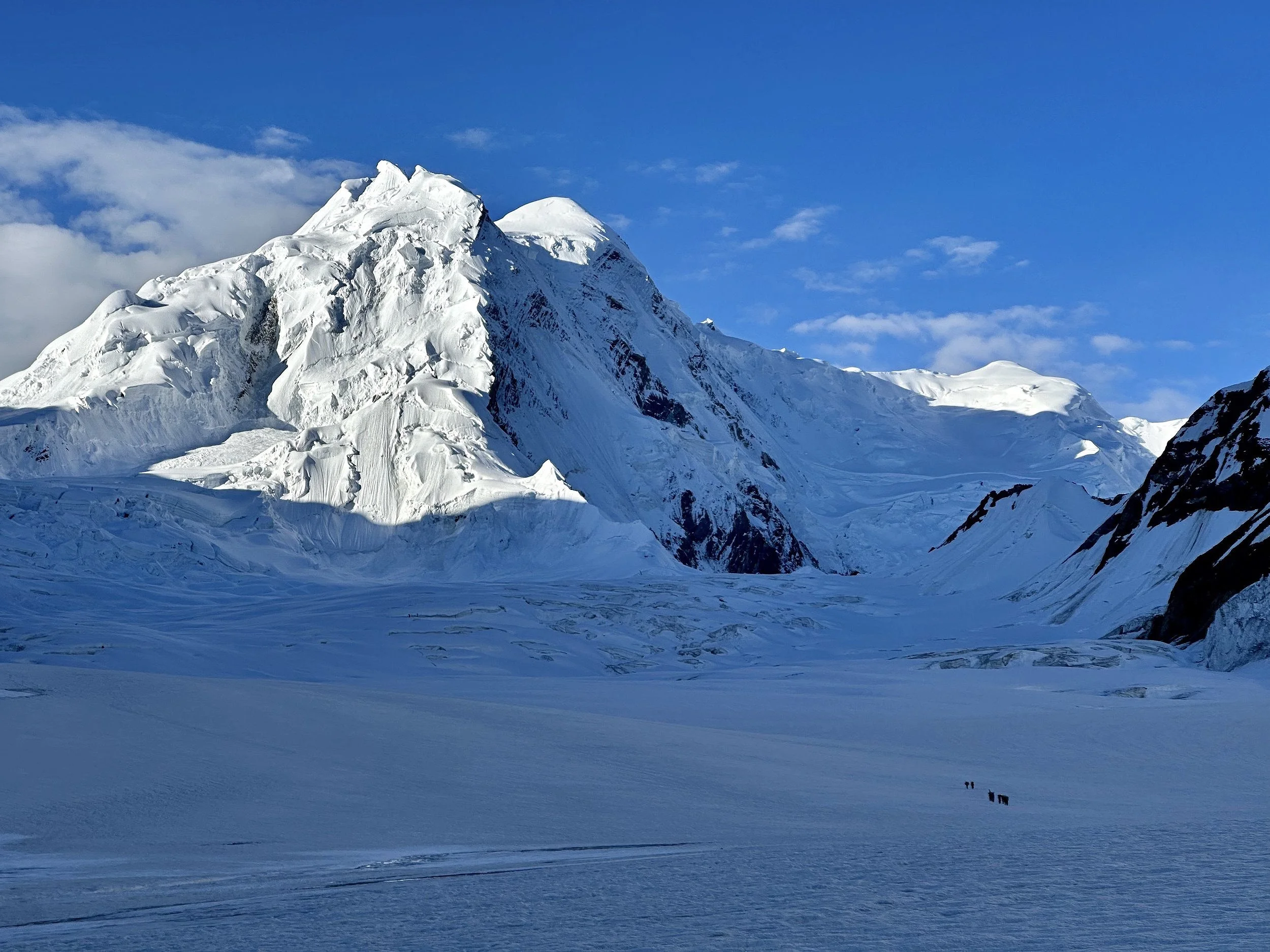
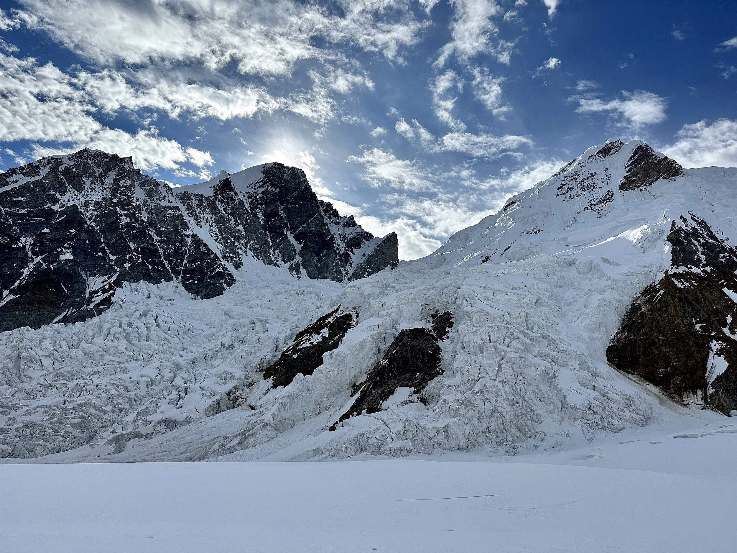
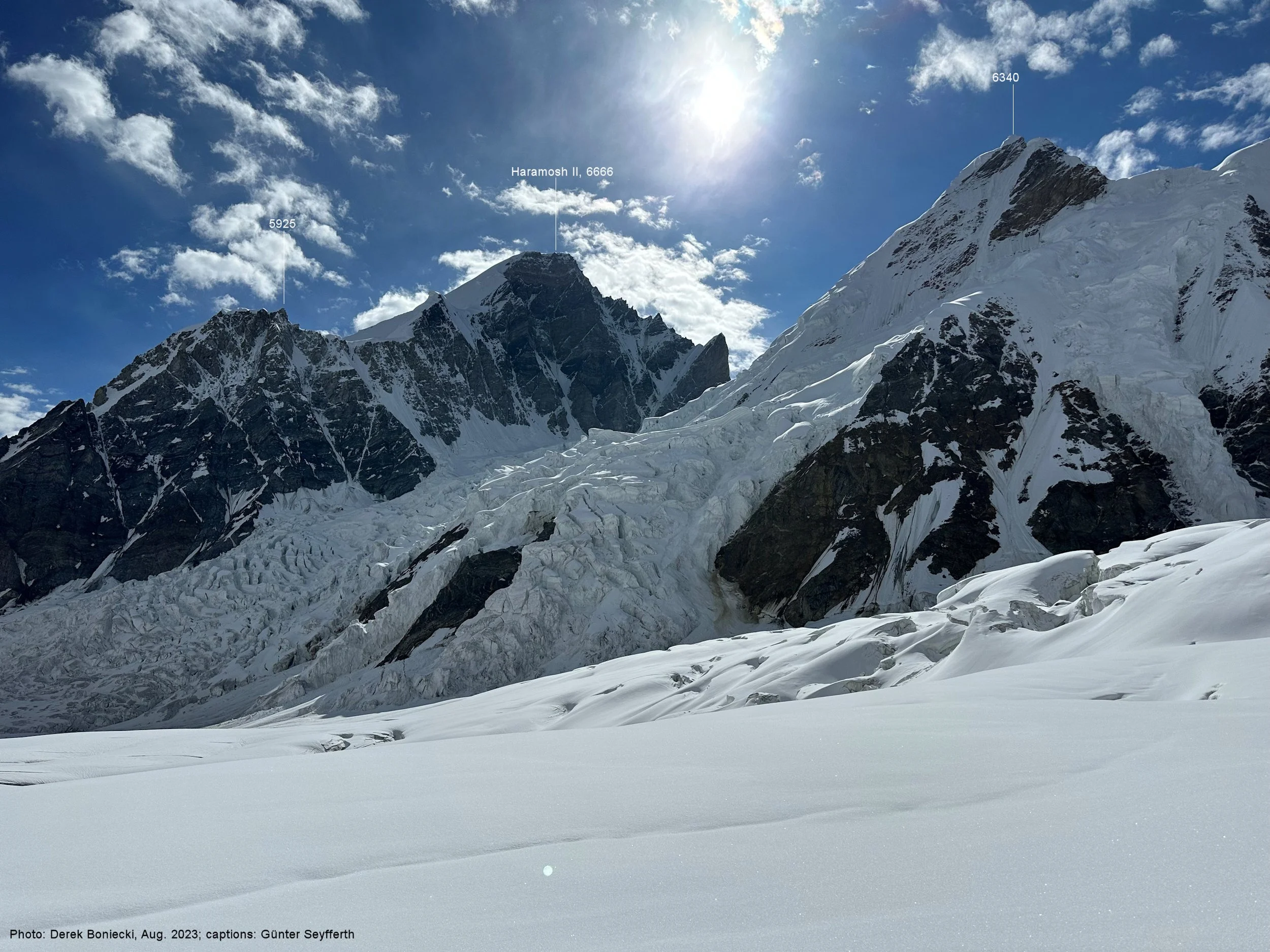
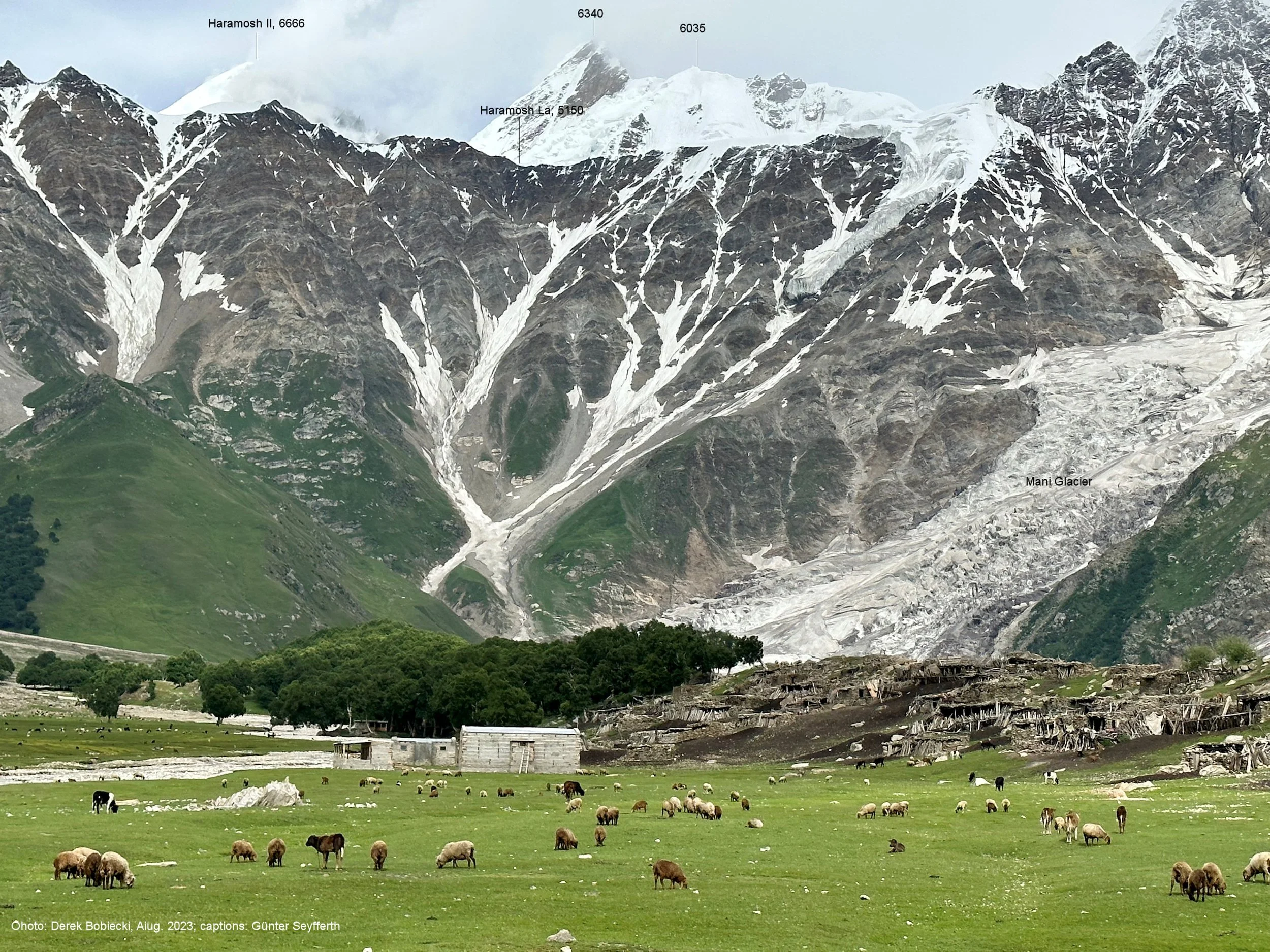
Haramosh 2 6666m.
Haramosh 2
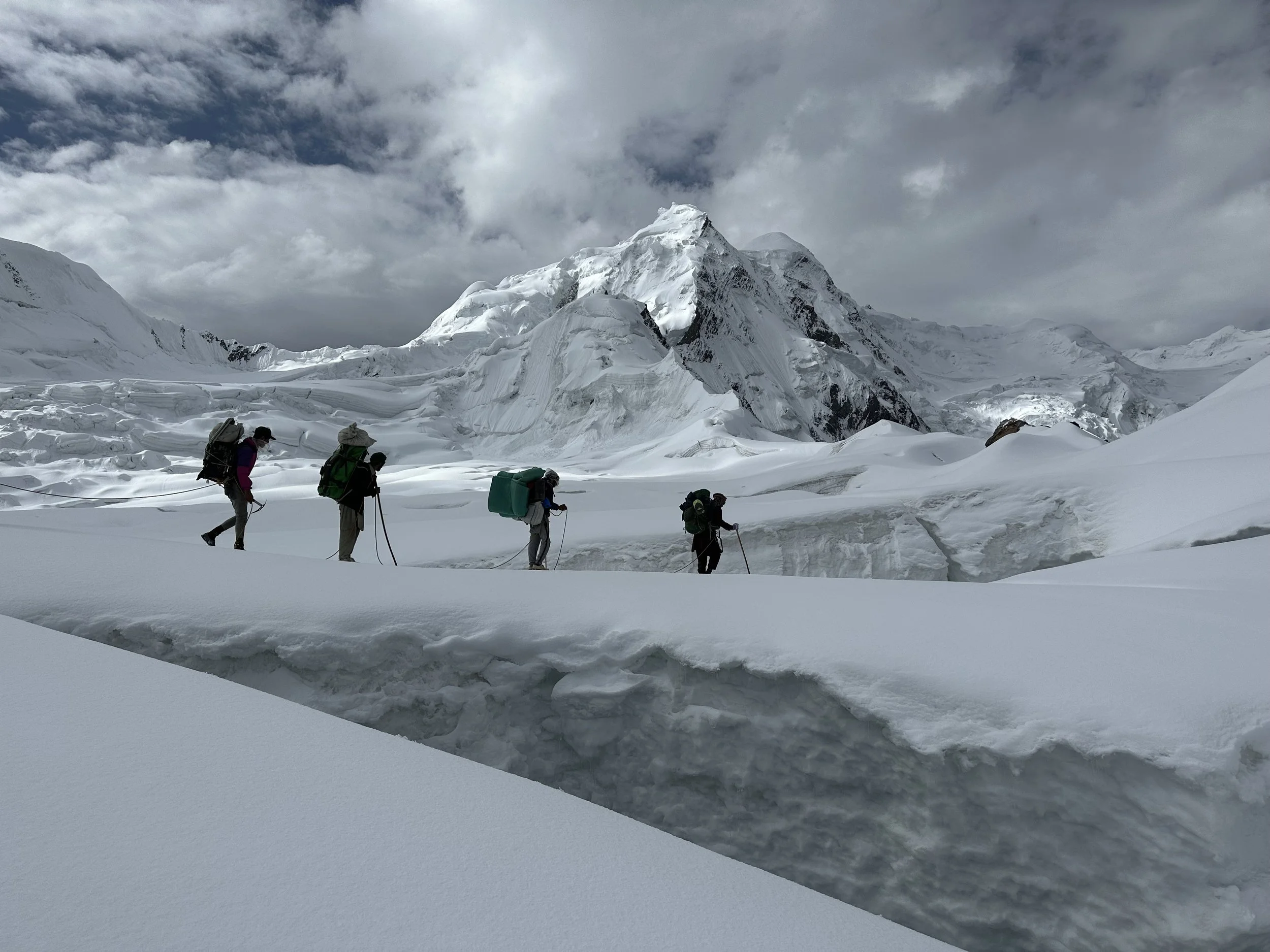
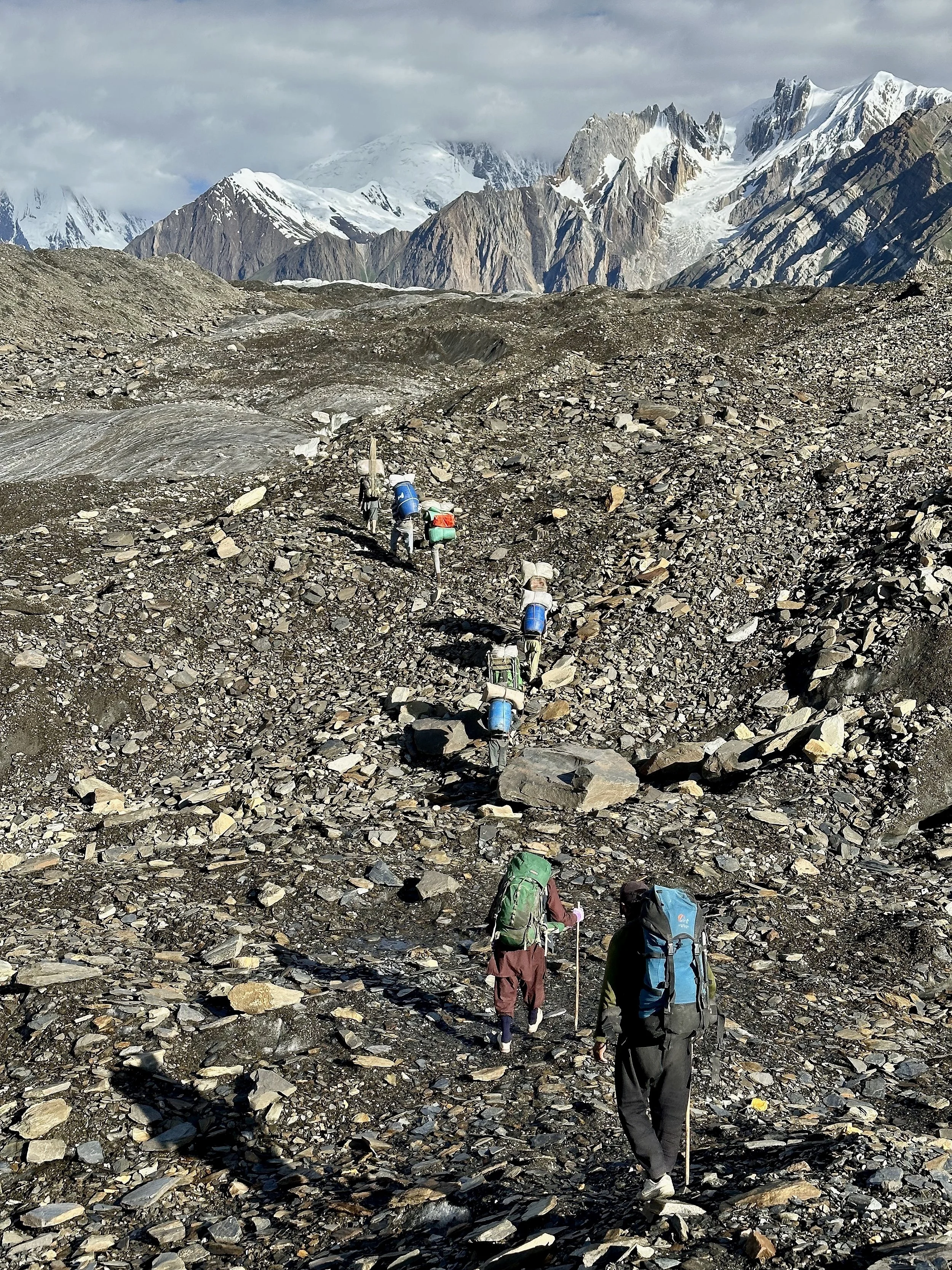
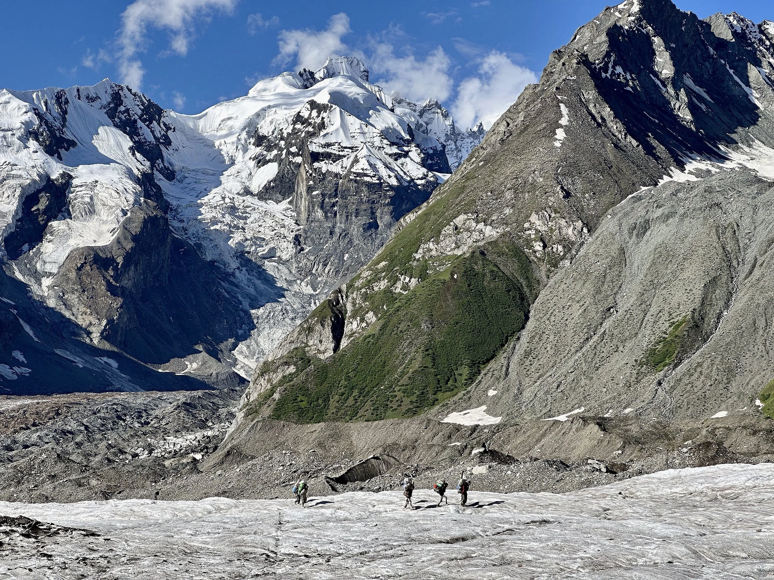
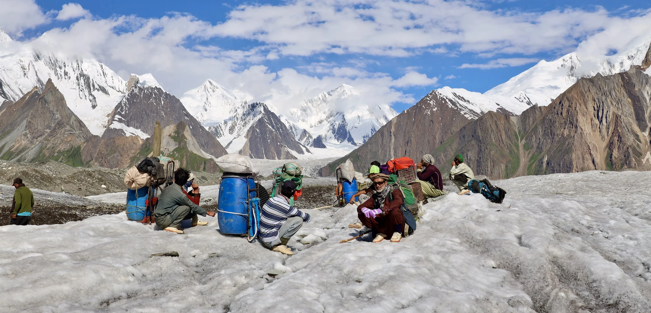
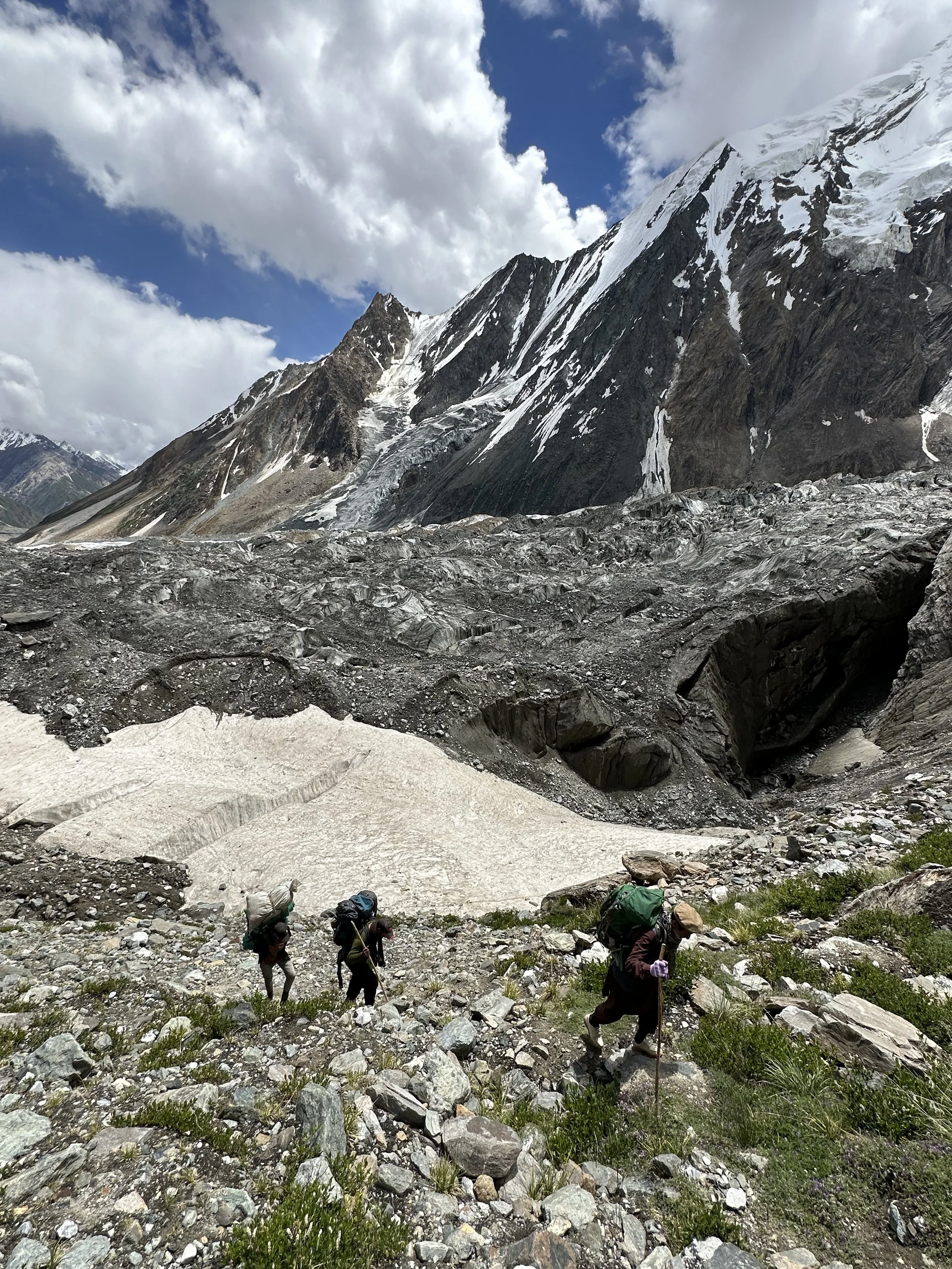
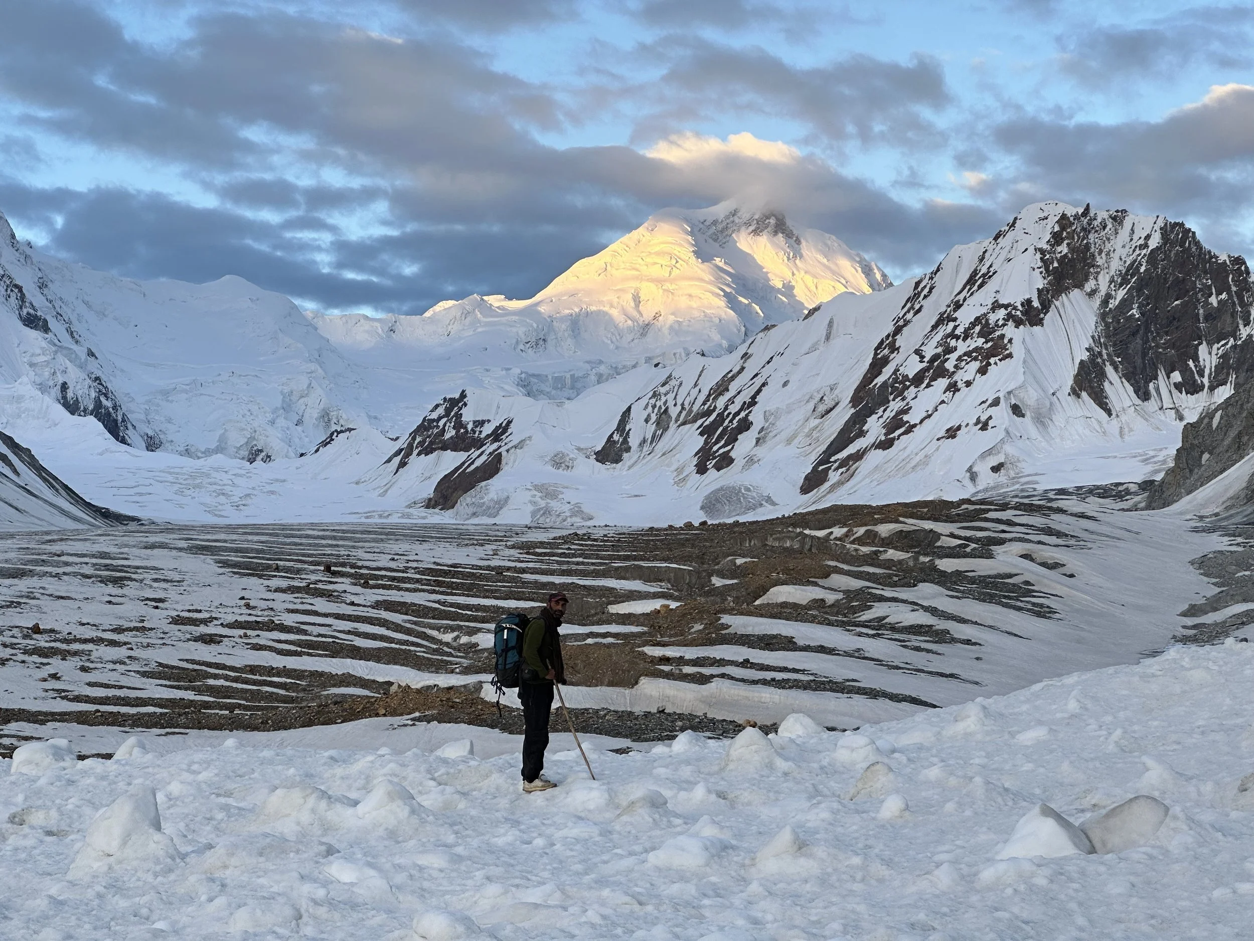
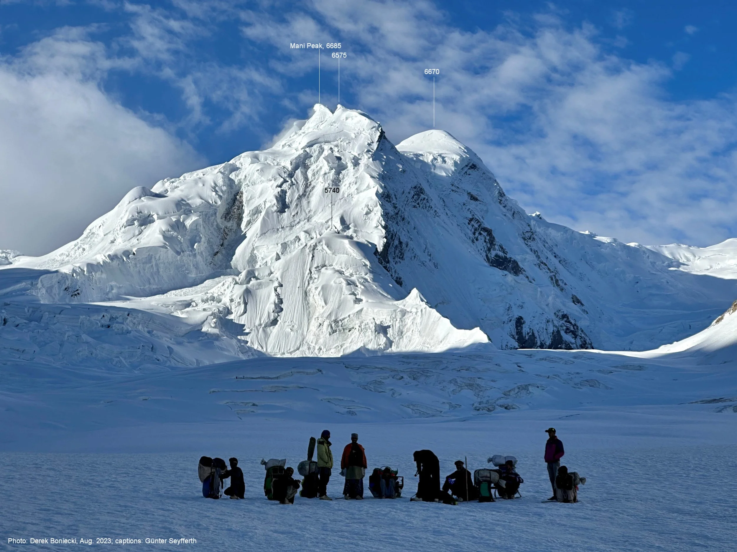
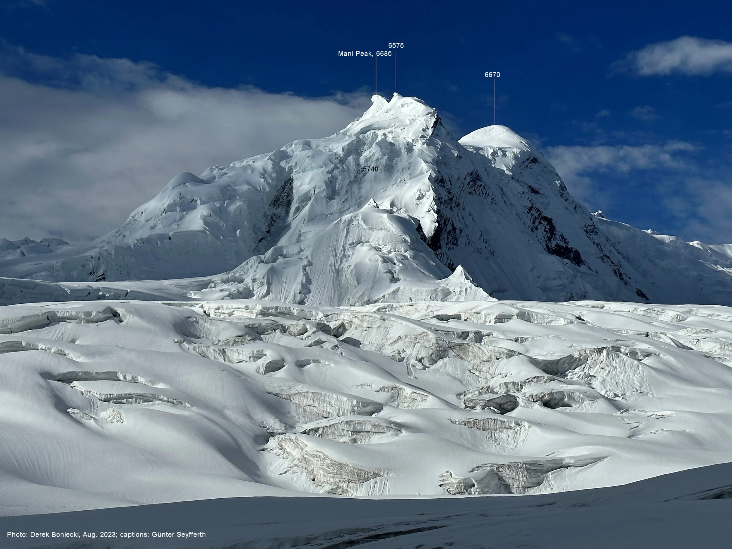
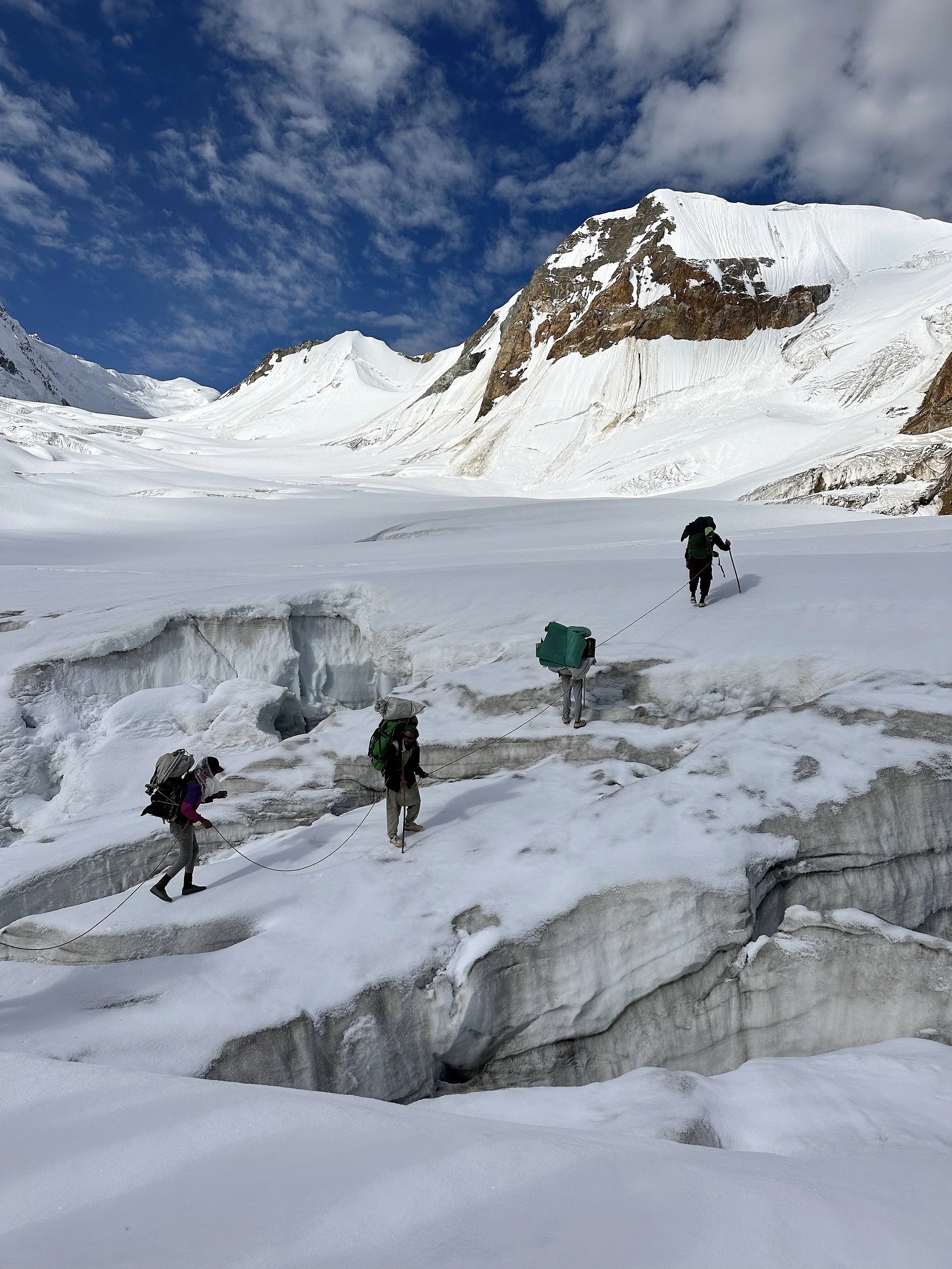
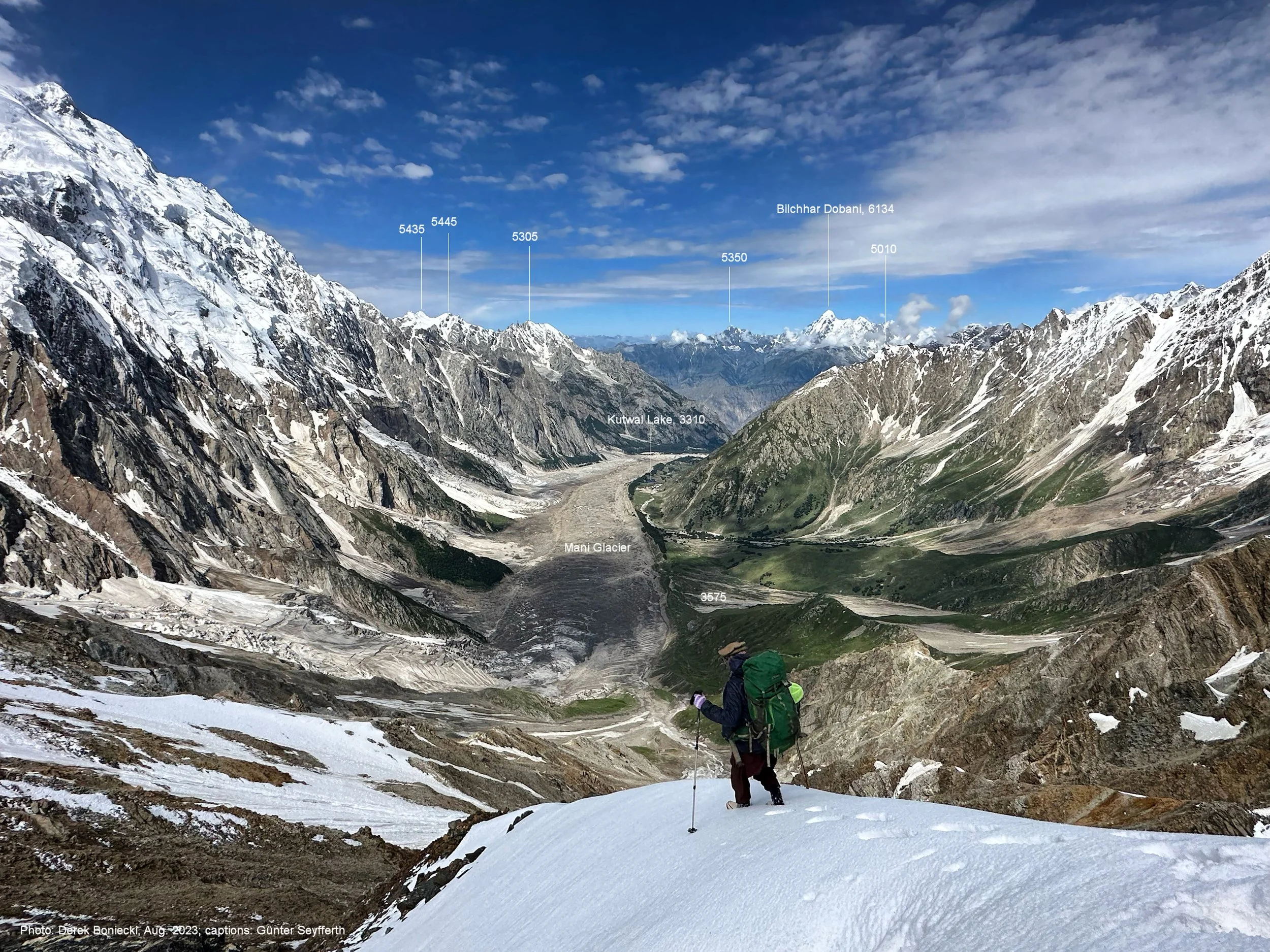
Mani Pk and Haramosh La. See the porters for scale.
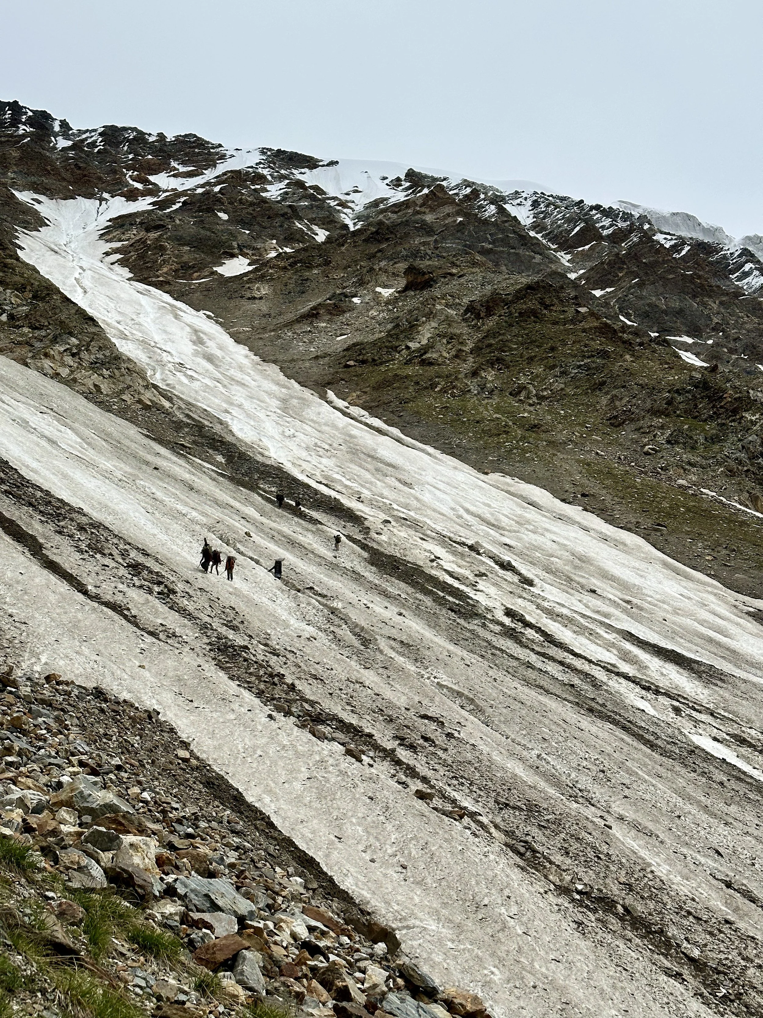
Taking a break before roping up on the Haramosh Glacier.
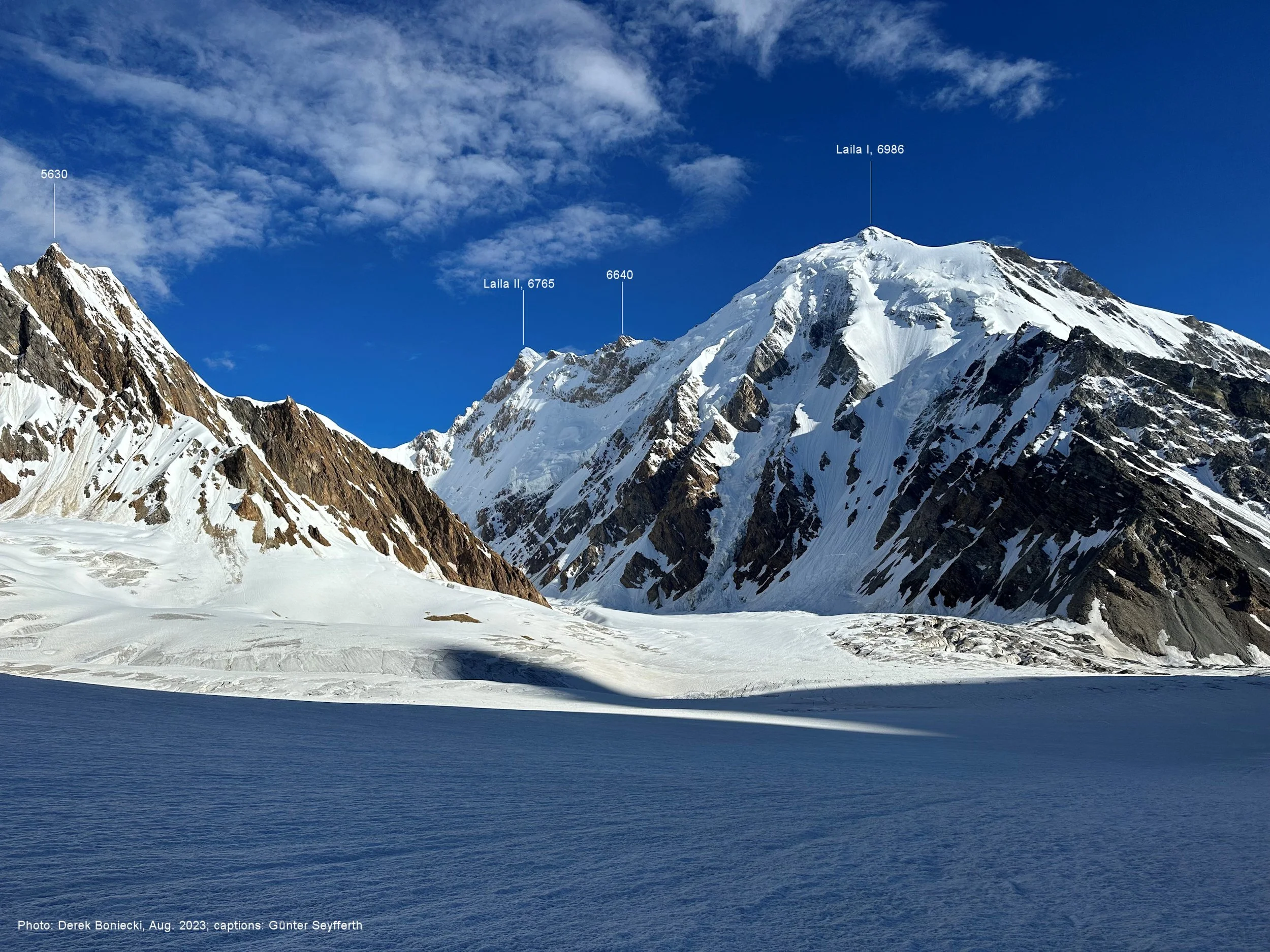
Laila 1 Peak 6985m
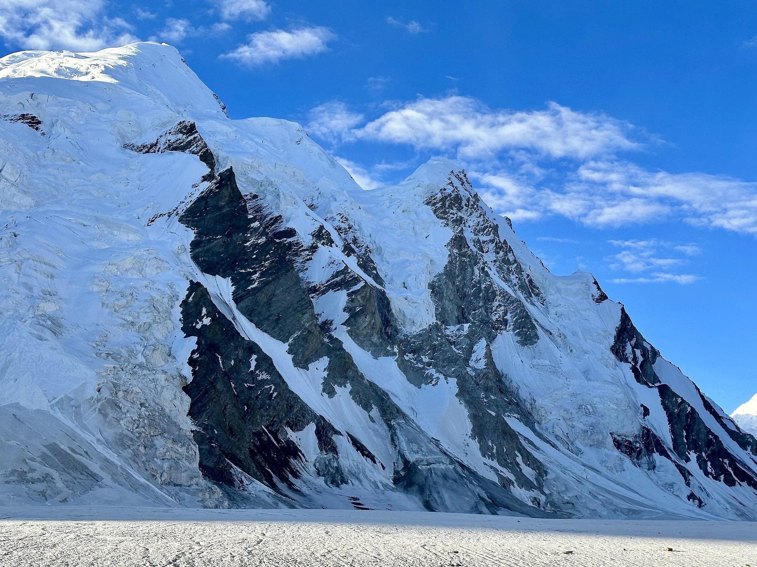
Unnamed Peak along the upper Haramosh Glacier.
Sun halo on Haramosh 2
Looking down the Haramosh Glacier. Laila Pk on the left and Haramosh 2 on the right.
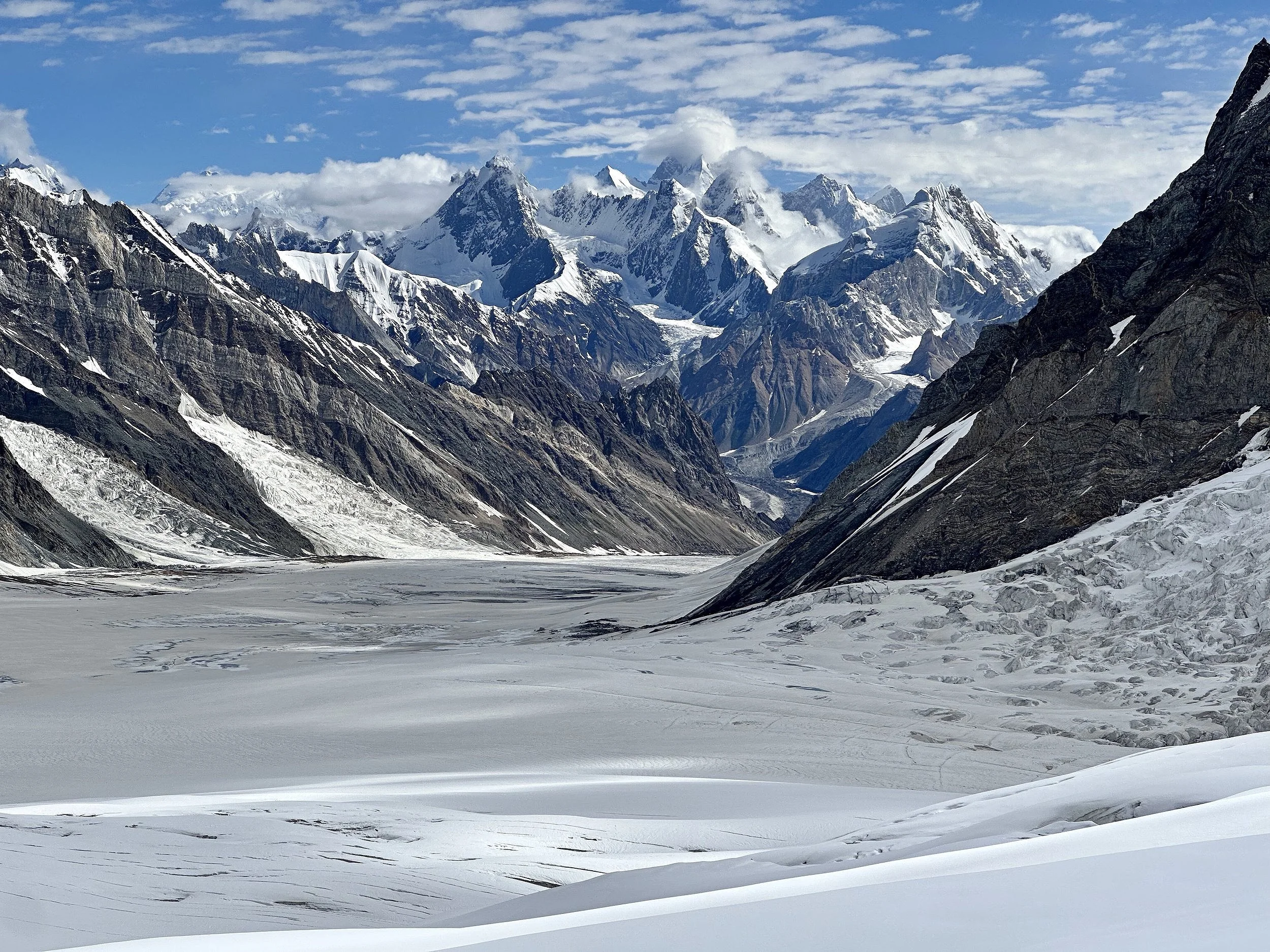
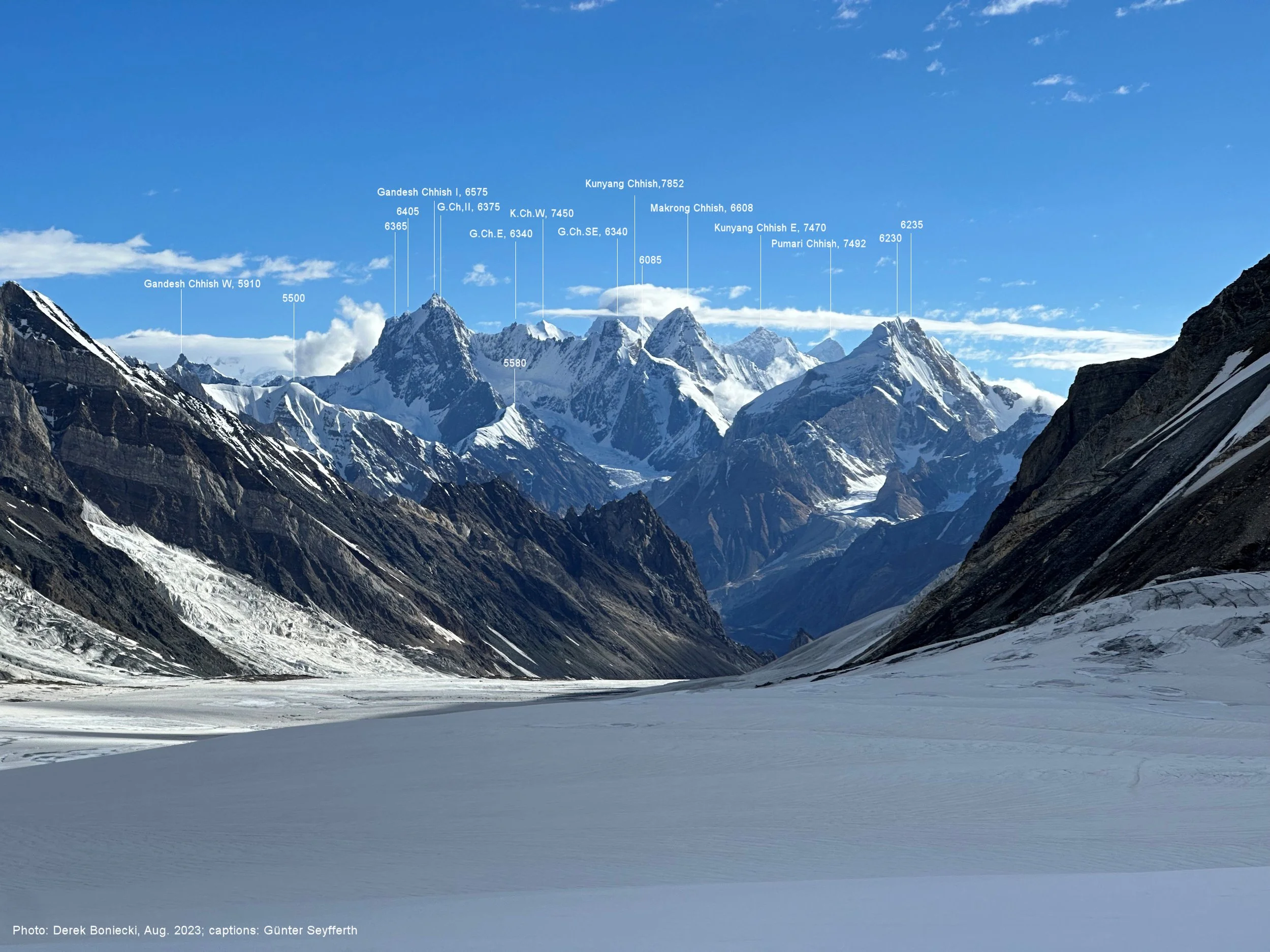
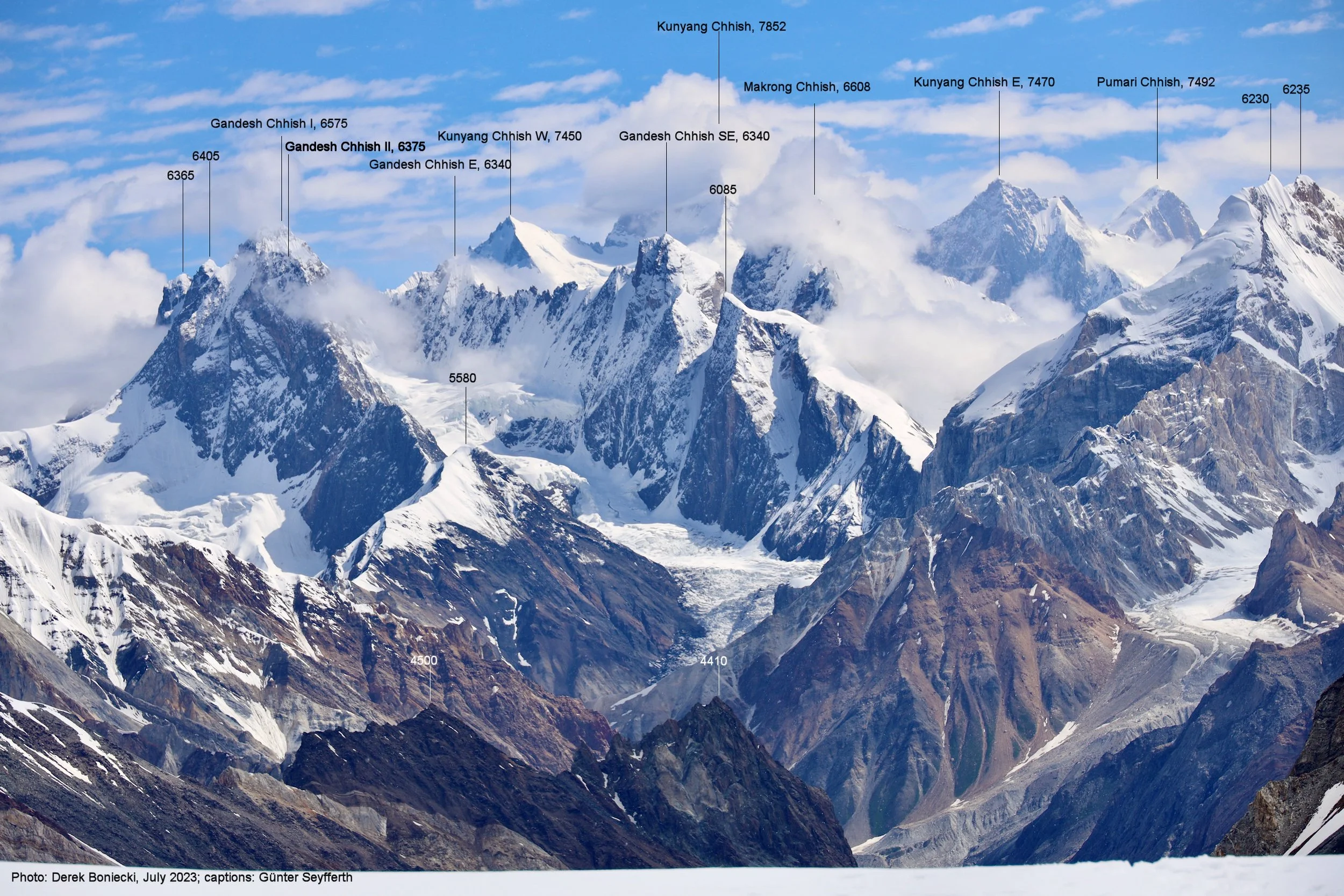
Mountains of the Hispar Glacier area above the Chgolugma Glacier
Haramosh 2 from Haramosh La
Haramosh La. Haramosh 1 is on the right.
Hassan has balls of steel - no rope or ice axe, in plastic shoes with steep drop-offs on both sides. I was watching this and slowly realizing that I was next to follow him.
Haramosh 1 Mountain 7409m half way down from the pass.
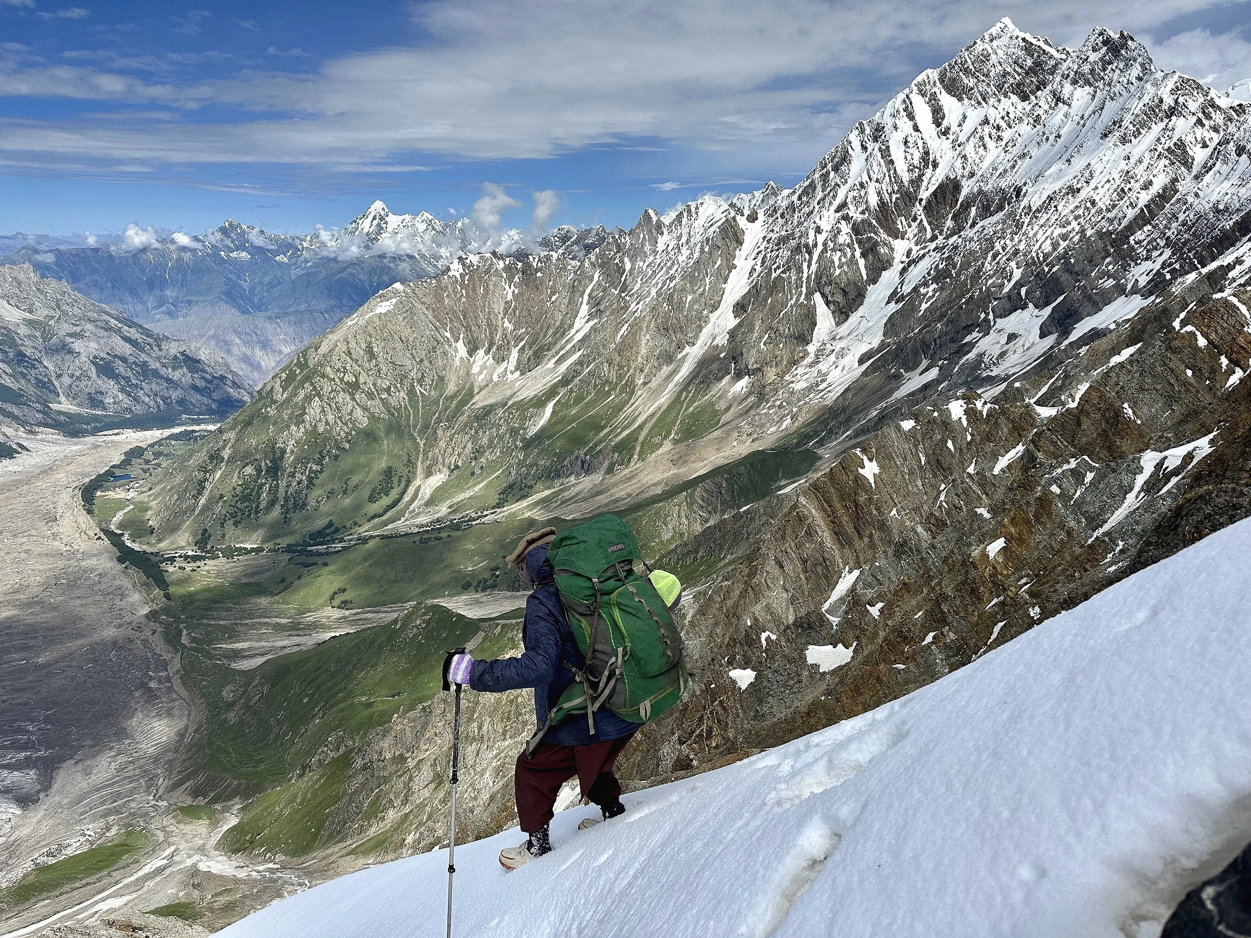
Lower section of the descent slope. We descended from the top of the pass diagonally to avoid rockfall. The slope was very loose and we sent rocks flying many times. Crossing the snow gullies in plastic shoes was quite challenging for the porters but no rope was used at any point.
Mani Pk and Haramosh from the descent of the Haramosh La
Mani Pk and the Haramosh La from the bottom of our descend route.
Haramosh 1 Mountain and the head of the Kutwal Valley.
Haramosh La 5150m and our descent route.
Haramosh 1 Mt 7409m
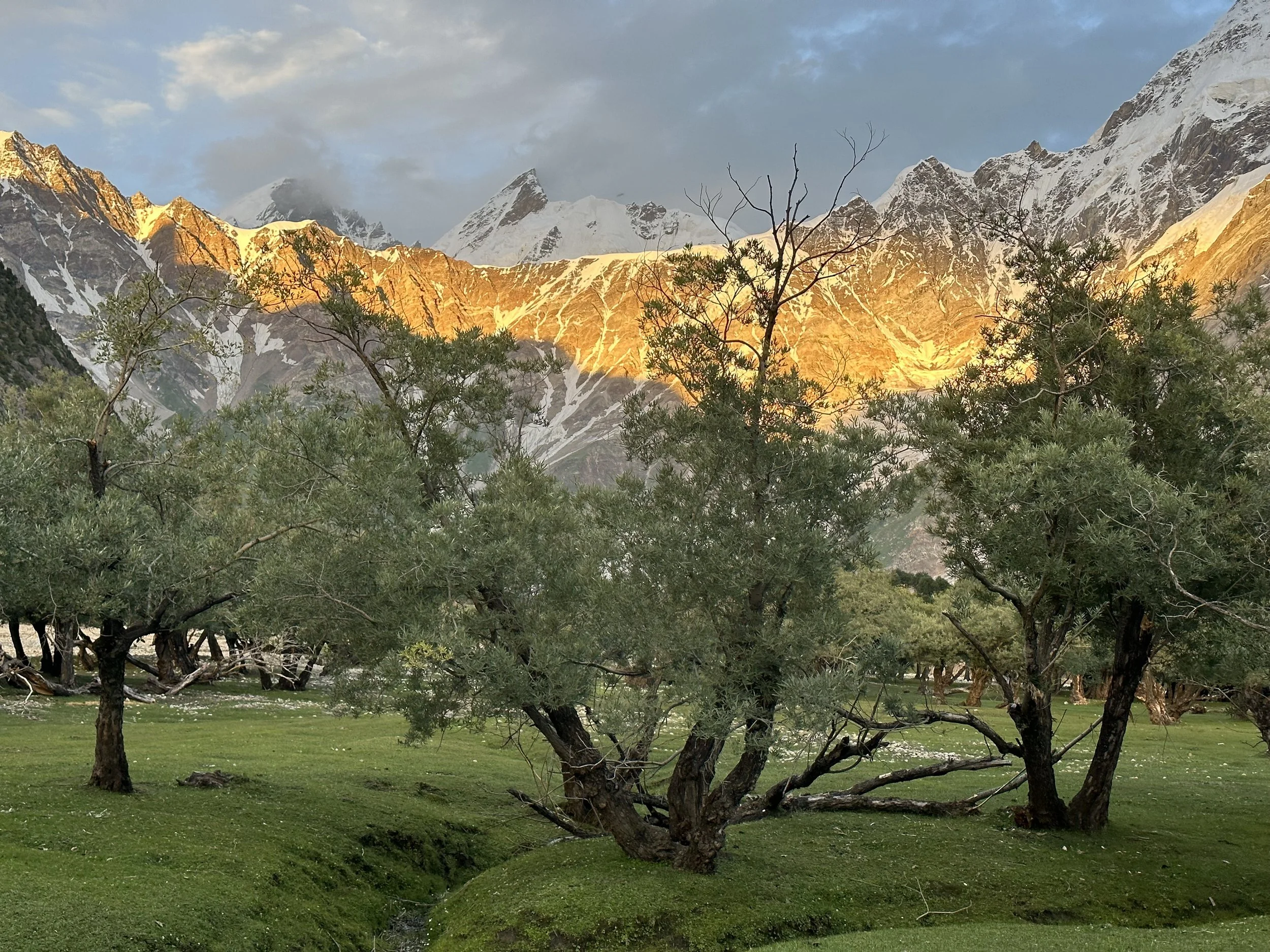
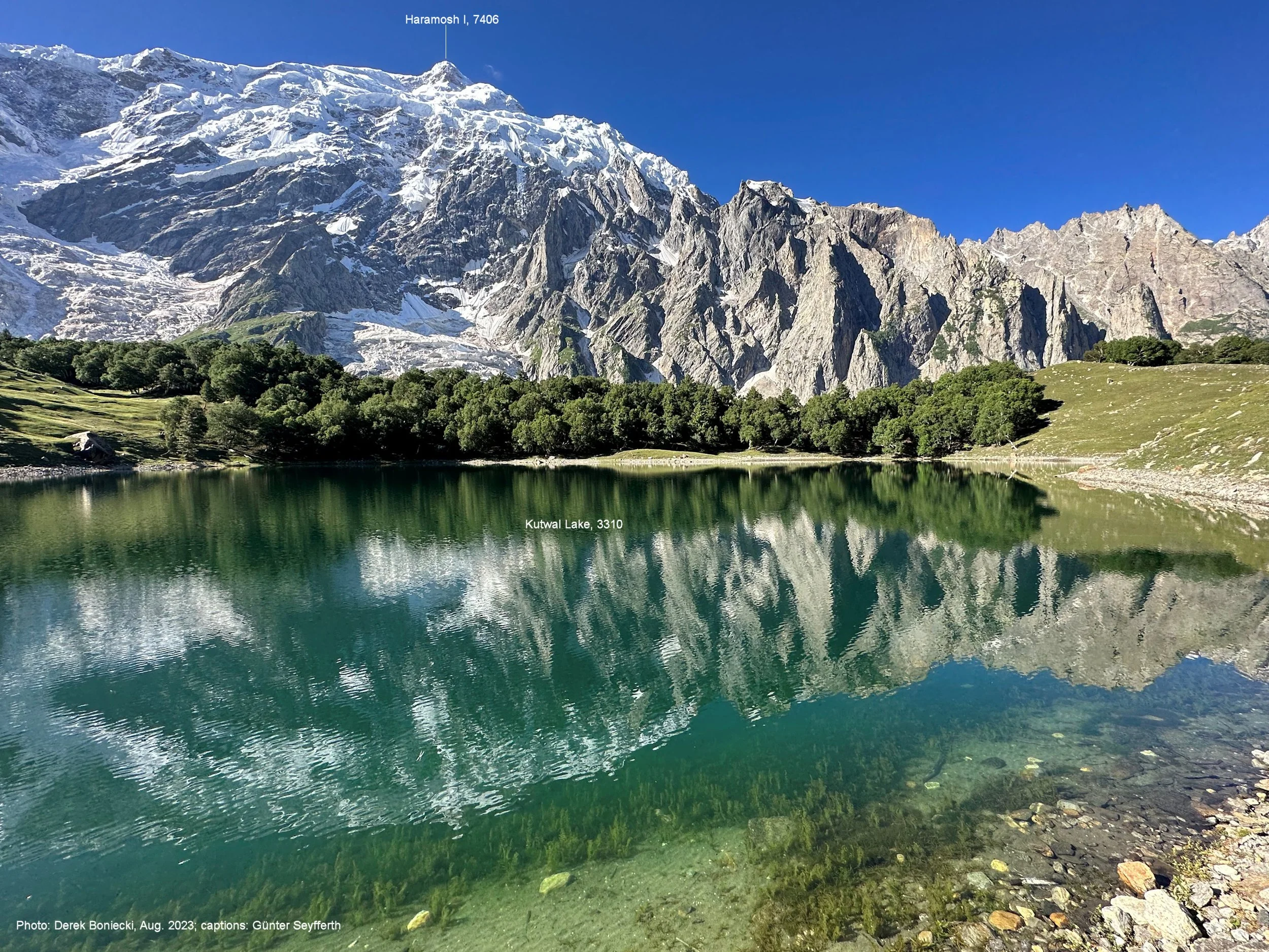
Beautiful sunset on the Haramosh La from our camp at the Kutwal Lake.
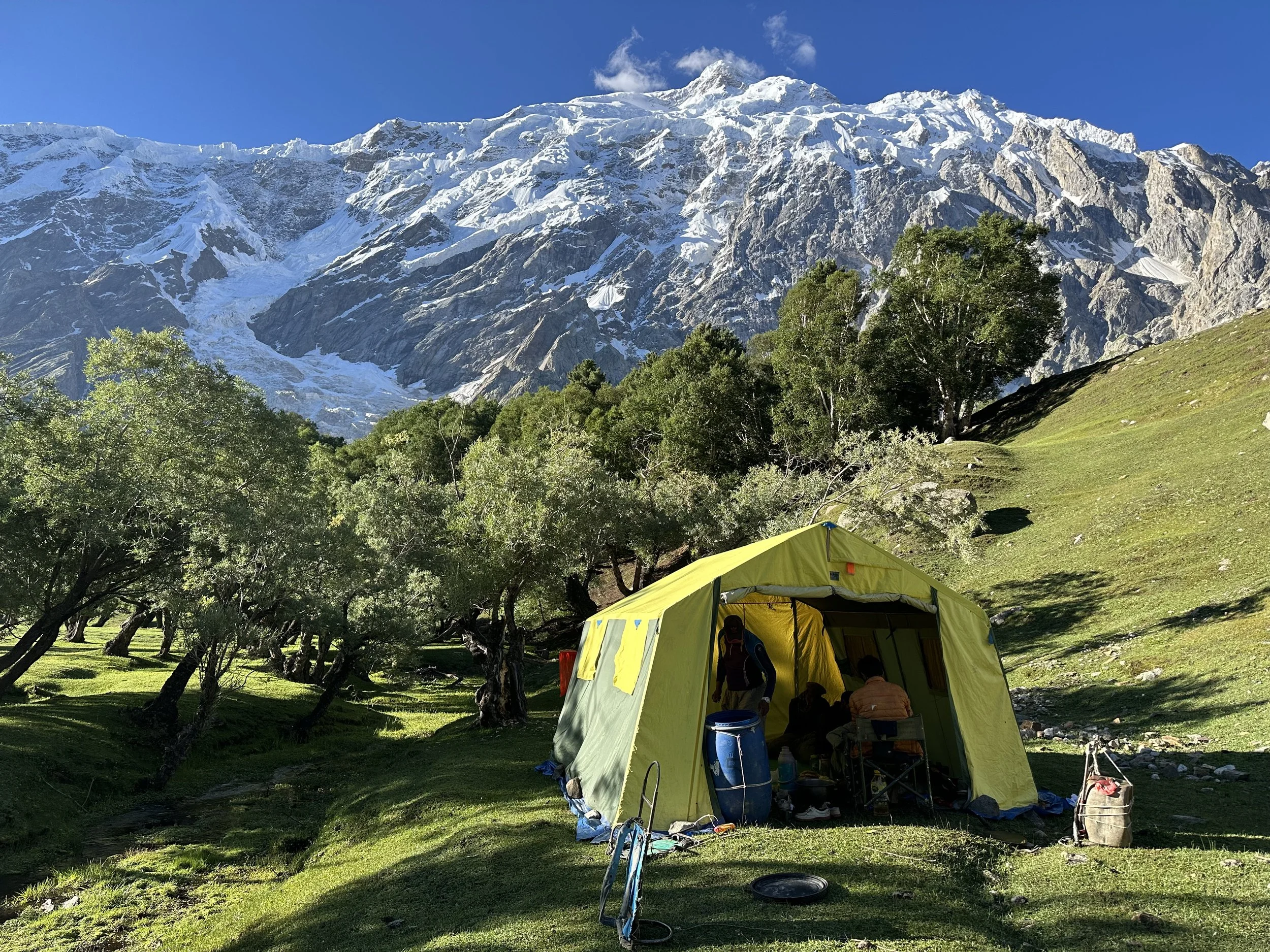
The camp at the Kutwal Lake with Haramosh 1 towering above.
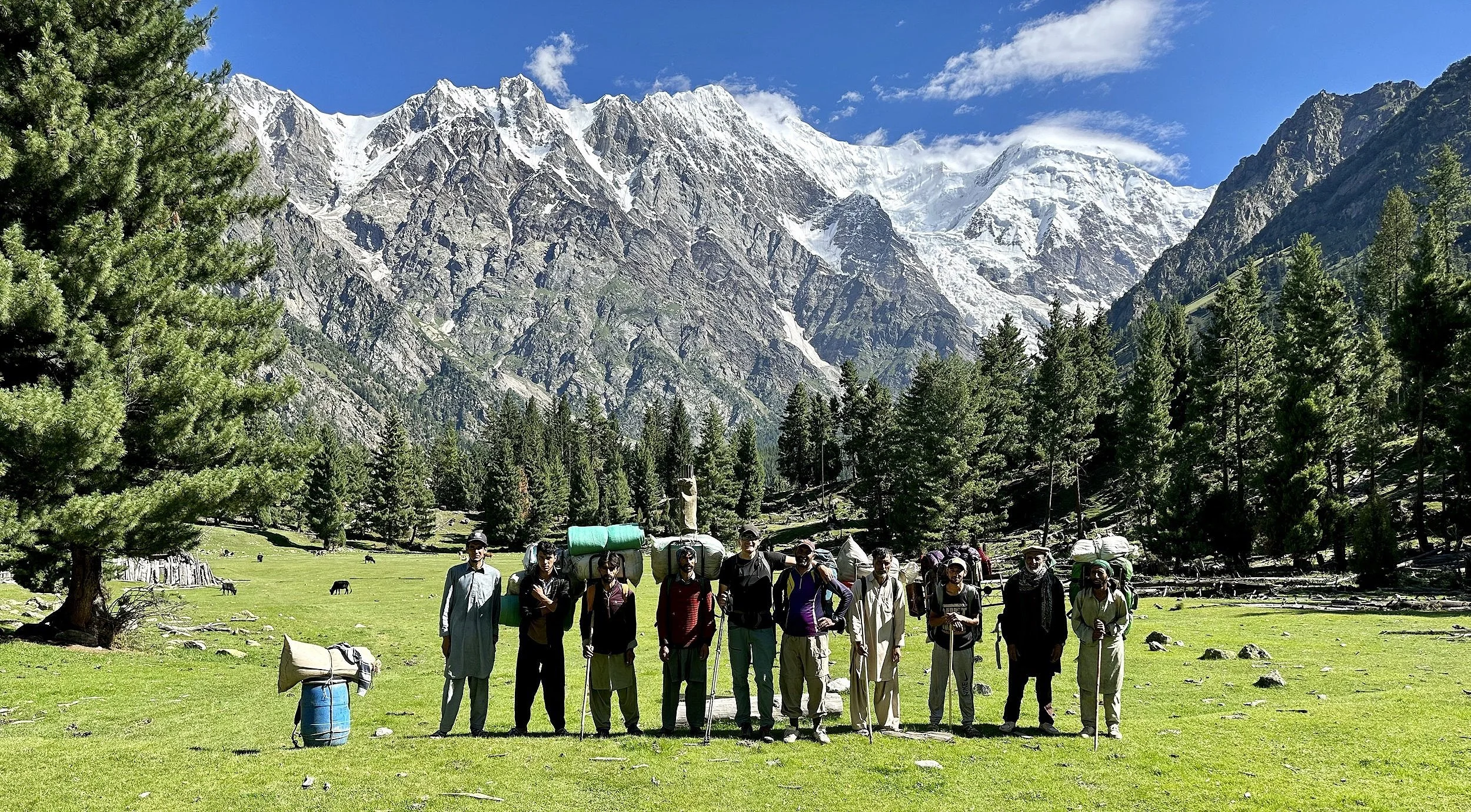
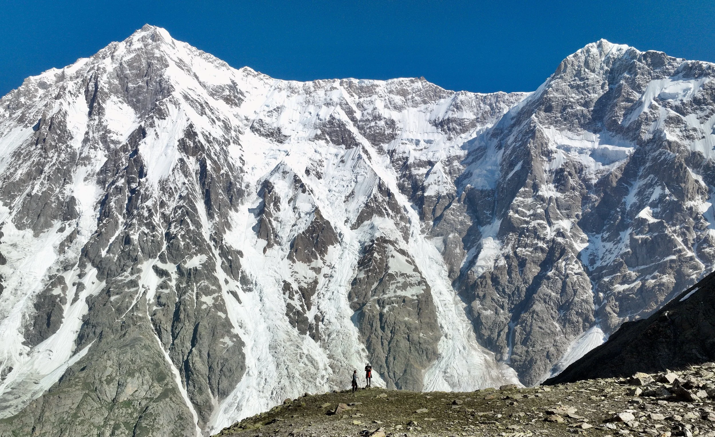
Our Haramosh La team with Malubiting 7453m behind.
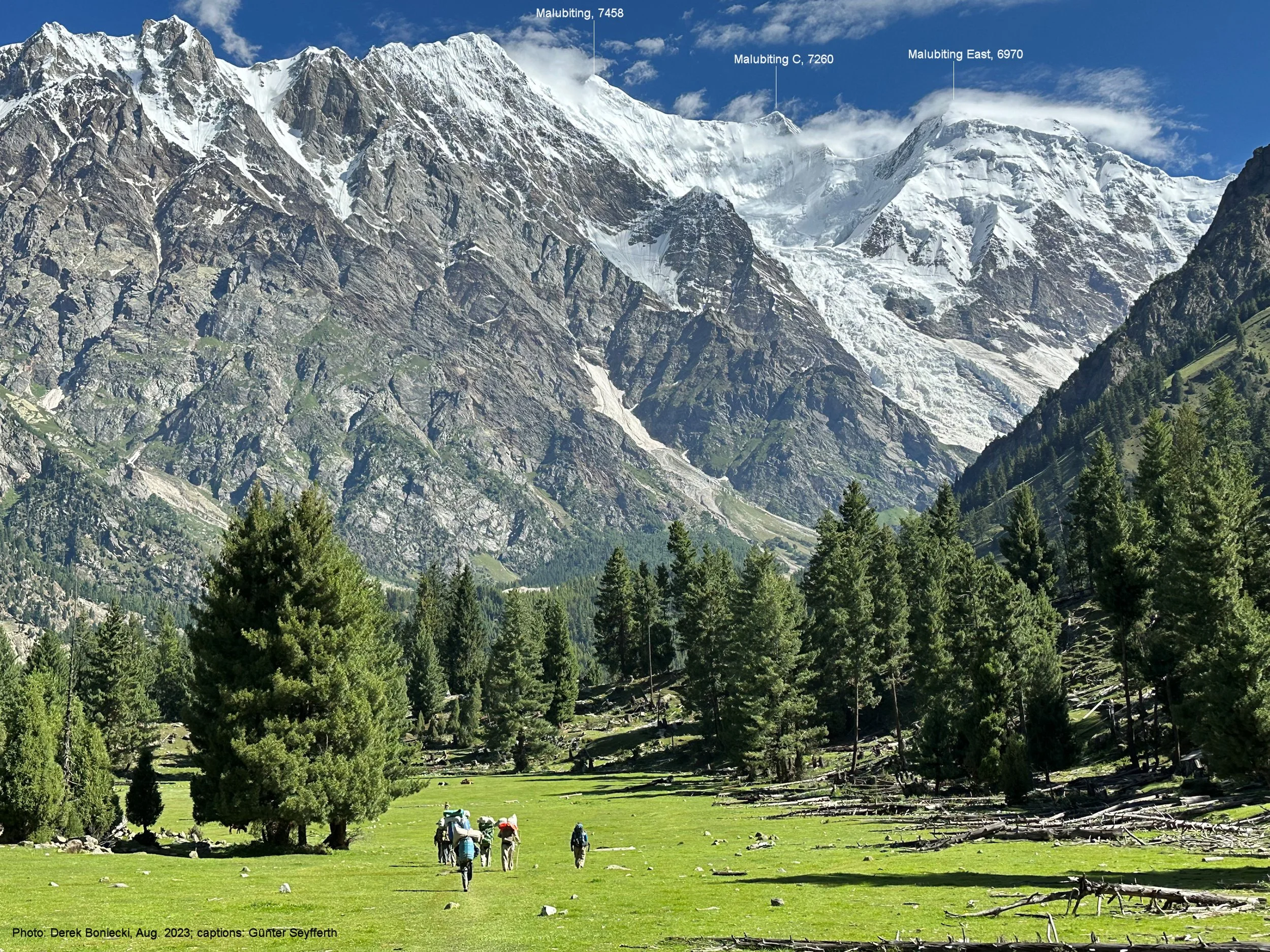
The incredible scenery of the Kutwal Valley. Malubiting West 7458m (centre), Malubiting Centre and East 6970m (right). The glacier flowing from Malubiting is Baskal Glacier. What an incredible place!
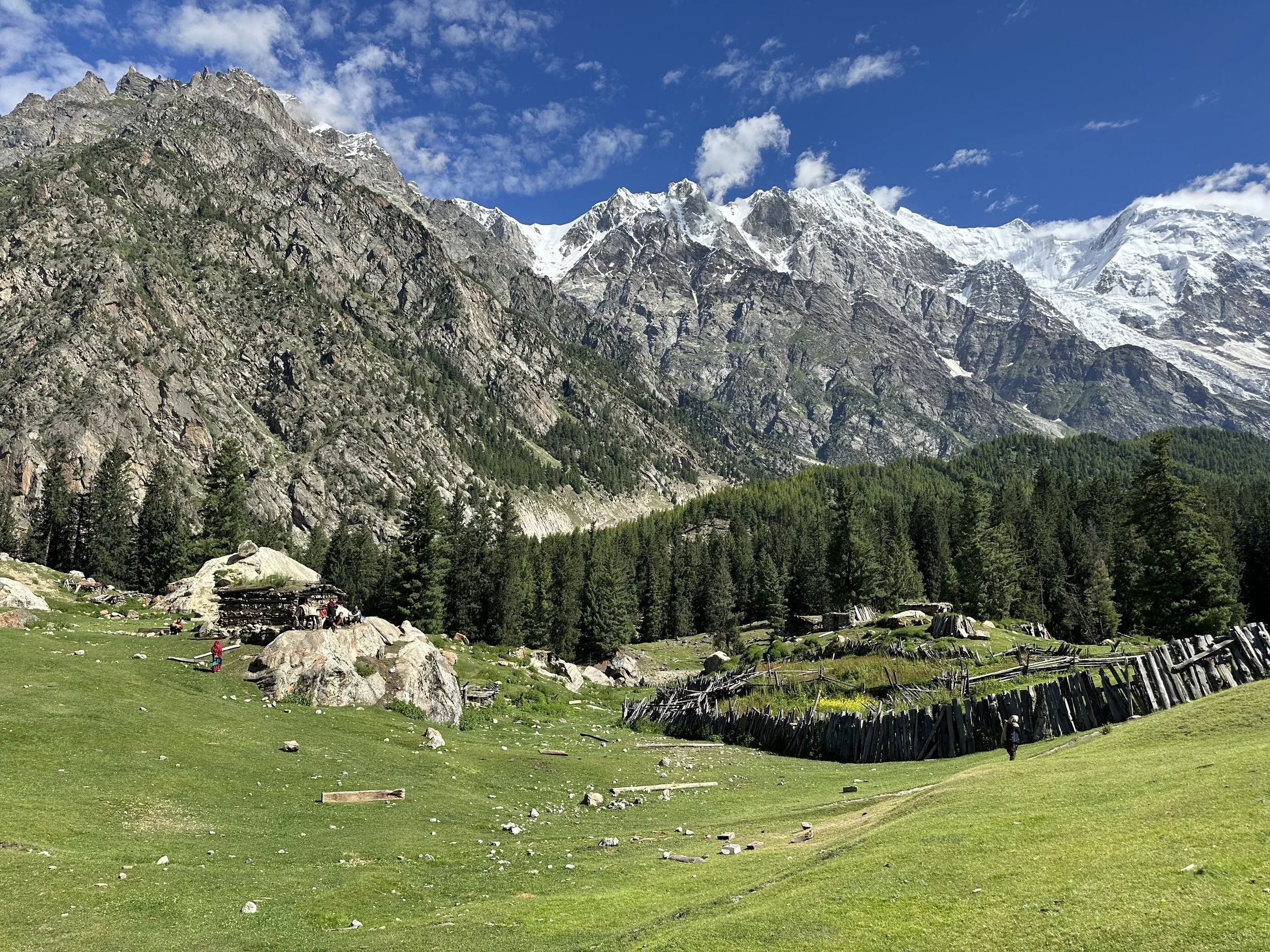
Pastures of the upper Kutwal Valley
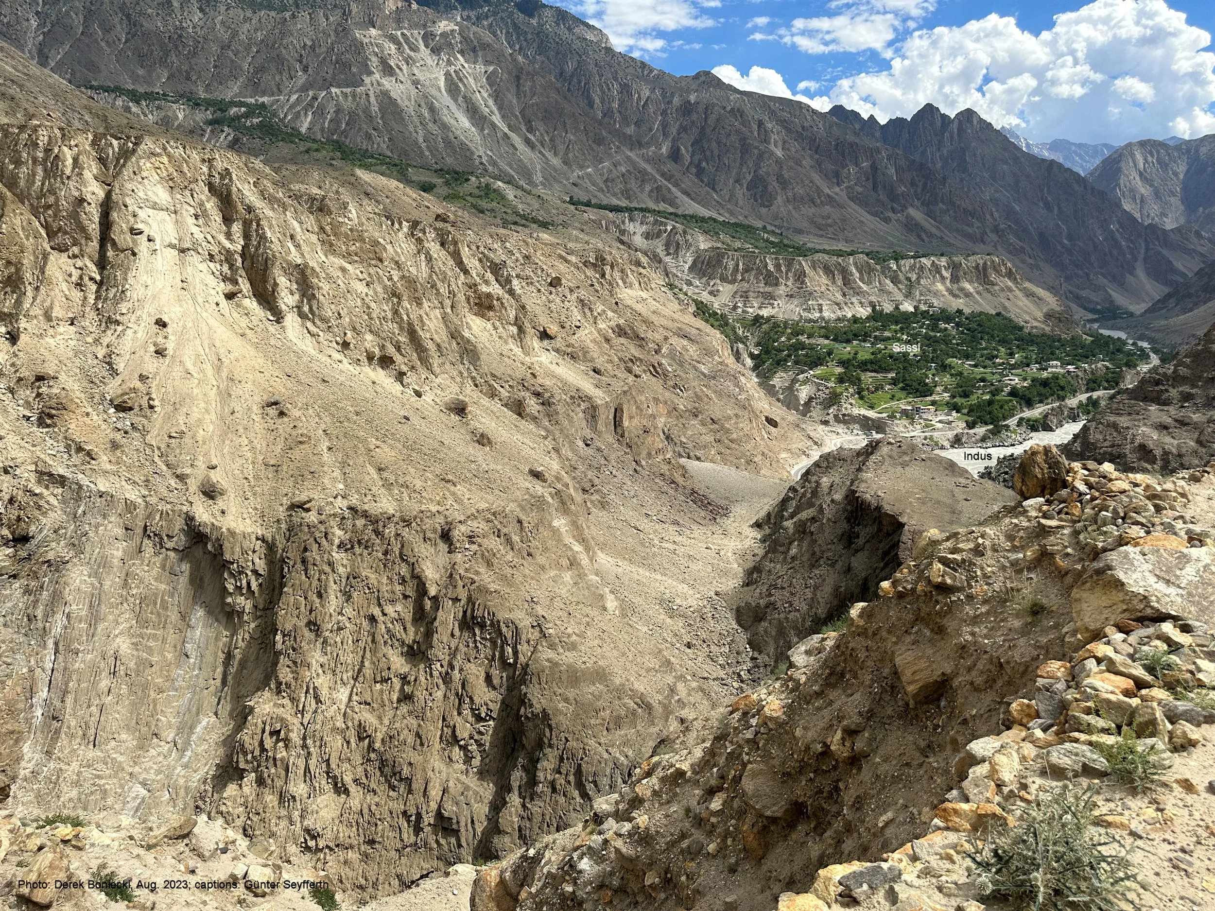
The crazy road to the KKH!
Miar 2 6,790m and 3 Mt 6,635m and the crazy road to Sassi and the KKH.
Sasso and the KKH can be seen below. KKH follows the Indus River Valley
Join the discussion
Share thoughts, tips, or questions about this trip.
Please keep it kind and relevant.
All Trips and Adventures by Year
A chronological archive of trip reports, photo essays, and route notes across decades.
2026
2025
2024
- Mon - Bhutan
- Bhutan - Snowman Trek Part 1
- Bhutan - Snowman Trek Part 2
- Bhutan - Snowman Trek Part 3
- North of 60º - Polar Adventures
- East Greenland 66º North
- On the Trail of Teutonic Order Castles in Northern Poland
- Wolfsschanze Hitler's HQ, Ketrzyn Poland and Peenemunde WW2 V1/V2 Research Centre in North Germany
- Central Mexico - Mexico City, Puebla and Teotihuacan
- Venezuela - Orinoco River Delta
- Venezuela - Mount Roraima Trek 2810m
- Venezuela - Angel Falls
2023
2022
- Nepal Solukhumbu - Sumna Pass and Lobuche East trip summary
- Nepal Khumbu and Kangchendzonga from the Air
- Nepal Solukhumbu Sundar Peak 5000m and Sumna Pass 5400m
- Nepal Solukhumbu Chola Pass 5450m Lobuche East Ridge 6090m
- Renjola La 5360m Gokyo Ri 5450m, and Cho Oyu BC Photos
- Iceland - Hellismannaleid, Laugavegur and Fimmvorduhals Trails
- The Yukon and the Alaska Highway
- Mount Robson
- Yellowstone National Park
- Grand Teton and Glacier National Parks
2021
- The Rockies of Alberta, Western BC and the Yukon
- Columbia Icefield from the Air
- Waterton Lakes National Park
- Colombia
- Los Nevados National Park Colombia
- Colombia Tayrona National Park
- Colombia Teyuna - Ciudad Perdida Trek (The Lost City)
- Mexico Pico de Orizaba 5,630m
- Mexico - Sierra Negra 4,650m and Izaccihuatl 5,350m
- Chitwan National Park Nepal
2020
2019
- The Grand Mustang Circuit - Part 1: Chame to Kagbeni via Thorong La Pass
- The Grand Mustang Circuit - Part 2: Kagbeni to Lo Mantang
- The Grand Mustang Circuit - Part 3: Lo Mantang to TeriLa Pass
- The Grand Mustang Circuit - Part 4: Terila Pass to Chame via Naar and Kangla Pass
- Kamchatka Trip Report
- Камча́тка, Russia - The Mutnowski and Gorely Volcanoes
- Камча́тка, Russia - The Tolbachik Volcano Circuit and Volcano Bezimienny
- Russia Far East - Sakhalin, Vladivostok, Petropawlowsk-Kamchatsky
- Taiwan
- Ancohuma 6,427M Bolivia
- Huayna Potosi 6,088m Bolivia
- Ausangate Trek Peru
- Yellowstone National Park in Winter 2019
2018
- Calgary Mountain Film Festival
- Langtang, Tilman Pass and Ganjala Trip Report
- Langtang Trek - Tilman Pass
- Langtang Trek - Ganjala Pass
- Paria River Wilderness - USA, Utah
- Slot Canyons - USA, Arizona
- Bryce National Park - USA, Utah
- Zion National Park and Cedar Breaks - USA, Utah
- Norway
- Poland - The Slav and Viking Festival in Wolin
- Iceland
- Bolivia Cordillera Real and Sajama National Park
- Bolivia - Tiwanaku and La Paz
- Togo and Benin
- Benin - Egungun Masquerade
- Benin - Voodoo Festival
- Ghana - The Gold Coast and the Land of the Ashanti
2017
- Annapurna Basecamp and Annapurna Sanctuary Photos
- Annapurna Sanctuary Trip Summary
- Dhaulagiri Basecamp Trek, Dhampus Pass - Trip Summary
- Dhaulagiri Circuit Photos - Nepal
- Peru Central - Huaraz, Cordillera Blanca and Chavin de Hauntar
- Peru South, Sacred Valley - the Land of the Incas, Rainbow Mountain and Lima
- Mt. Brazeau and Maligne Lake in Jasper National Park in Alberta, Canada
- China Shanghai Beijing Wuhan
- Papua New Guinea
2016
- China Far West - Kashgar and Shiphton Arch
- China Far West - Pamir and The Tajik Games
- K2 Basecamp North, Shaksgam Valley Trip Summary
- Chinese K2 (BC North), Shaksgam Valley - Chinese Karakoram
- North Peru Chachapoyas Trip Report
- Peru North - Kuelap, Chachapoyas and Royal Tombs of Sipan
- Wapta Icefiled Area, Alberta, Canada
- The Caribbean and the Panama Canal
- China Far West - Ancient Silk Road Trip Summary
- China Far West - Ancient Silk Road
2015
2014
2013
2012
2011
2010
2009
2008
2007
2006
2004
2002
2001
1996
Get new trip reports when they land
One email when a new story is published. No noise. Just the trail.